Category:Silton
Vai alla navigazione
Vai alla ricerca
English: Silton is a village in north Dorset, England, situated in the Blackmore Vale four miles north west of Gillingham. The village has a population of 134 .
village and civil parish in Dorset, United Kingdom  | |||||
| Carica un file multimediale | |||||
| Istanza di | |||||
|---|---|---|---|---|---|
| Luogo | Dorset, Sud Ovest dell'Inghilterra, Inghilterra | ||||
 | |||||
Sottocategorie
Questa categoria contiene le 2 sottocategorie indicate di seguito, su un totale di 2.
S
W
- Wyndham's Oak (6 F)
File nella categoria "Silton"
Questa categoria contiene 37 file, indicati di seguito, su un totale di 37.
-
 A303 curving left round Zeals - geograph.org.uk - 3673522.jpg 1 738 × 1 080; 935 KB
-
 A303 entering Wiltshire - geograph.org.uk - 4780136.jpg 640 × 324; 36 KB
-
 A303 heading west - geograph.org.uk - 6260544.jpg 1 024 × 684; 150 KB
-
 A303 heading west - geograph.org.uk - 6260549.jpg 1 024 × 684; 186 KB
-
 A303 near Bourton - geograph.org.uk - 3028468.jpg 640 × 430; 42 KB
-
 A303 parking area south of Bourton - geograph.org.uk - 3673515.jpg 1 864 × 1 165; 1,08 MB
-
 A303 south of Zeals - geograph.org.uk - 3828851.jpg 3 648 × 2 736; 1,19 MB
-
 A303, westbound - geograph.org.uk - 5297450.jpg 640 × 458; 51 KB
-
 Bench Mark, Fitz Farm - geograph.org.uk - 2302039.jpg 480 × 640; 105 KB
-
 Card's Farm Ford - geograph.org.uk - 4872817.jpg 1 600 × 1 067; 2,09 MB
-
 Cows in field - geograph.org.uk - 2606038.jpg 3 072 × 2 304; 2,56 MB
-
 Dairy farm buildings - geograph.org.uk - 2606035.jpg 3 072 × 2 304; 2 MB
-
 Eastward on A303 near Bourton and Zeals, 1984 - geograph.org.uk - 4157454.jpg 2 394 × 1 371; 3,22 MB
-
 Footpath to Silton Church - geograph.org.uk - 2176171.jpg 640 × 480; 66 KB
-
 Lay-by on A303 eastbound south-east of Bourton - geograph.org.uk - 4117128.jpg 1 600 × 1 200; 1,21 MB
-
 Layby, A303 - geograph.org.uk - 5297453.jpg 640 × 432; 63 KB
-
 Mill wheel, Waterloo Mill - geograph.org.uk - 2176113.jpg 640 × 480; 90 KB
-
 Minor road, Fitz Farm - geograph.org.uk - 2302035.jpg 640 × 480; 86 KB
-
 Mounting block, Silton - geograph.org.uk - 2176208.jpg 640 × 480; 106 KB
-

-
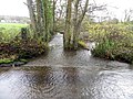 River Stour, Silton - geograph.org.uk - 2176302.jpg 640 × 480; 86 KB
-
 River Stour, Silton - geograph.org.uk - 2176307.jpg 640 × 480; 90 KB
-
 Silton Ford - geograph.org.uk - 4872826.jpg 1 600 × 1 067; 1,88 MB
-
 Silton, postbox in the hedge - geograph.org.uk - 2128708.jpg 640 × 480; 143 KB
-
 Silton, postbox № SP8 112 - geograph.org.uk - 2128711.jpg 480 × 640; 155 KB
-
 Silton, postbox № SP8 113 - geograph.org.uk - 2133948.jpg 640 × 480; 74 KB
-
 Silton, village hall and phone box - geograph.org.uk - 3349427.jpg 640 × 480; 56 KB
-
 Stile, Silton - geograph.org.uk - 2176197.jpg 480 × 640; 95 KB
-
 The B3081 near Cucklington - geograph.org.uk - 3056669.jpg 640 × 480; 107 KB
-
 The Old Mill Waterwheel - geograph.org.uk - 3784047.jpg 1 600 × 1 200; 504 KB
-
 The River Stour, Silton - geograph.org.uk - 2176123.jpg 640 × 481; 110 KB
-
 Waterloo Mill - geograph.org.uk - 2176139.jpg 640 × 480; 73 KB
-
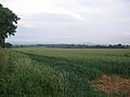 Farmland near Woodhouse Cross - geograph.org.uk - 466481.jpg 640 × 480; 70 KB
-
 Footpath to West Bourton. - geograph.org.uk - 466478.jpg 640 × 480; 82 KB
-
 Stocking Bridge - geograph.org.uk - 466479.jpg 640 × 480; 84 KB
-
 Whistley Farm - geograph.org.uk - 169985.jpg 640 × 480; 72 KB
-
 Woodhouse Cross - geograph.org.uk - 466272.jpg 640 × 480; 50 KB


