Category:Silverton, Devon
Aller à la navigation
Aller à la recherche
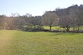
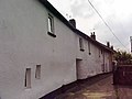
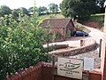
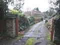
English: Silverton is a large village, about . In the year 2001, its population was 1,905. It has three pubs: The Lamb, The Three Tuns and the Silverton Inn.
village britannique  | |||||
| Téléverser des médias | |||||
| Nature de l’élément | |||||
|---|---|---|---|---|---|
| Lieu | Mid Devon, Devon, Angleterre du Sud-Ouest, Angleterre | ||||
| Population |
| ||||
 | |||||
Sous-catégories
Cette catégorie comprend 10 sous-catégories, dont les 10 ci-dessous.
E
- Ellerhayes (7 F)
- Ellerhayes Bridge (4 F)
H
- Hayne House, Devon (4 F)
L
- Lower Hayne (3 F)
S
- Silverton Park (9 F)
- Silverton railway station (2 F)
- Singleton Park, Devon (5 F)
T
- The Ruffwell Inn, Silverton (5 F)
Média dans la catégorie « Silverton, Devon »
Cette catégorie comprend 718 fichiers, dont les 200 ci-dessous.
(page précédente) (page suivante)-
 40 Fore Street Silverton (geograph 3181753).jpg 640 × 484 ; 108 kio
-
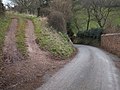
 A Devon country lane toward Killerton Park (NT) - geograph.org.uk - 4526302.jpg 4 608 × 3 456 ; 3,46 Mio
-
 A396 and bus stop opposite Ruffwell Inn - geograph.org.uk - 4734668.jpg 640 × 369 ; 168 kio
-
 A396 passing Keywise Cars - geograph.org.uk - 4734674.jpg 640 × 441 ; 148 kio
-
 Access to two fields near Billingsmoor - geograph.org.uk - 2773011.jpg 800 × 600 ; 411 kio
-
 Aish Barton - geograph.org.uk - 2815070.jpg 800 × 600 ; 388 kio
-
 Alley off Fore Street, Silverton (geograph 6142067).jpg 1 200 × 1 600 ; 515 kio
-
 Approaching Penstone - geograph.org.uk - 1720274.jpg 1 024 × 768 ; 236 kio
-
 Arable landscape - geograph.org.uk - 5678408.jpg 640 × 426 ; 42 kio
-
 Ash Farm (Aish Barton) - geograph.org.uk - 2815033.jpg 800 × 600 ; 398 kio
-
 Ash Farm - geograph.org.uk - 5136350.jpg 640 × 480 ; 103 kio
-
 At the entrance to Lower Dorweeke Farms - geograph.org.uk - 2524721.jpg 800 × 600 ; 545 kio
-
 Autumnal colours - geograph.org.uk - 4842329.jpg 640 × 426 ; 66 kio
-
 Barn at Christ Cross - geograph.org.uk - 2815022.jpg 800 × 600 ; 489 kio
-
 Barn at Great Dorweeke - geograph.org.uk - 2524670.jpg 800 × 600 ; 442 kio
-
 Barn conversion, Silverton Park Farm - geograph.org.uk - 2479233.jpg 640 × 480 ; 71 kio
-
 Barn near Little Dorweeke - geograph.org.uk - 1584416.jpg 640 × 480 ; 100 kio
-
 Barn on the edge of Silverton (geograph 2814948).jpg 800 × 600 ; 366 kio
-
 Barn, Yarde Farm - geograph.org.uk - 4535622.jpg 640 × 426 ; 47 kio
-
 Barns and wind turbine near Ash Farm - geograph.org.uk - 2815061.jpg 800 × 600 ; 355 kio
-
 Barns at Great Dorweeke - geograph.org.uk - 1584401.jpg 640 × 480 ; 168 kio
-
 Barns at Yarde Farm - geograph.org.uk - 2314282.jpg 800 × 600 ; 465 kio
-
 Bend in minor road and track to Dyers - geograph.org.uk - 2759241.jpg 800 × 600 ; 446 kio
-
 Bickleigh, Burn River near Burn Farm - geograph.org.uk - 105507.jpg 640 × 427 ; 134 kio
-
 Bickleigh, lane in the Burn valley - geograph.org.uk - 105490.jpg 640 × 427 ; 185 kio
-
 Boundary walls of Silverton Park - geograph.org.uk - 2314211.jpg 800 × 600 ; 442 kio
-
 Boundary walls of Silverton Park - geograph.org.uk - 2314264.jpg 800 × 600 ; 490 kio
-
 Bridge over Burn River at Burnhayes - geograph.org.uk - 2524705.jpg 800 × 600 ; 519 kio
-
 Bridge over stream near Silverton Park Farm - geograph.org.uk - 2314144.jpg 800 × 600 ; 458 kio
-
 Bridge over the Burn River at Burnhayes Farm - geograph.org.uk - 5176455.jpg 480 × 640 ; 151 kio
-
 Bridleway, to Greenslinch - geograph.org.uk - 1124976.jpg 480 × 640 ; 129 kio
-
 Brimclose Copse and valley of Burn River - geograph.org.uk - 2524730.jpg 640 × 480 ; 82 kio
-
 Bungalows on Coach Road - geograph.org.uk - 2814968.jpg 800 × 600 ; 306 kio
-
 Burdock near Heal-eye Stream - geograph.org.uk - 1982256.jpg 640 × 488 ; 60 kio
-
 Burn River - geograph.org.uk - 1766795.jpg 640 × 480 ; 153 kio
-
 Burn River - geograph.org.uk - 1825022.jpg 640 × 480 ; 139 kio
-
 Burn River surrounded by trees at Underleigh - geograph.org.uk - 5500846.jpg 1 600 × 1 200 ; 724 kio
-
 Caseberry Lane - geograph.org.uk - 1982500.jpg 640 × 480 ; 111 kio
-
 Cattle byre, at Silverton Park Farm - geograph.org.uk - 1719377.jpg 1 600 × 1 200 ; 589 kio
-
 Cattle resting - geograph.org.uk - 5618580.jpg 640 × 426 ; 52 kio
-
 Cattle shed, Yarde Farm - geograph.org.uk - 4535623.jpg 640 × 426 ; 46 kio
-
 Centre of Silverton - geograph.org.uk - 1070465.jpg 640 × 480 ; 165 kio
-
 Christ Cross - geograph.org.uk - 2129394.jpg 640 × 480 ; 146 kio
-
 Christ Cross - geograph.org.uk - 3300122.jpg 2 592 × 1 944 ; 1,65 Mio
-
 Christ Cross and road to Butterleigh - geograph.org.uk - 2815028.jpg 800 × 600 ; 523 kio
-
 Christ Cross Lane - geograph.org.uk - 2129421.jpg 640 × 418 ; 81 kio
-

-
 Coblands Farm - geograph.org.uk - 2128983.jpg 548 × 640 ; 113 kio
-
 Combe, Chitterley - geograph.org.uk - 2128894.jpg 640 × 480 ; 78 kio
-
 Coombe valley - geograph.org.uk - 2129043.jpg 640 × 469 ; 65 kio
-
 Cot Lane from Stockwell Cross to Ford - geograph.org.uk - 2314249.jpg 800 × 600 ; 527 kio
-
 Cottages by the roadside near Penstone - geograph.org.uk - 1734932.jpg 640 × 427 ; 70 kio
-
 Cottages, on the narrow lane, from Ellerhayes bridge - geograph.org.uk - 1720269.jpg 1 024 × 768 ; 198 kio
-
 Countryside near Hele - geograph.org.uk - 2129955.jpg 640 × 375 ; 49 kio
-
 Culm Valley - geograph.org.uk - 4914693.jpg 640 × 426 ; 57 kio
-
 Culm Valley - geograph.org.uk - 5094194.jpg 640 × 426 ; 54 kio
-
 Culm Valley - geograph.org.uk - 5094196.jpg 640 × 426 ; 57 kio
-
 Culm Valley - geograph.org.uk - 5094198.jpg 640 × 426 ; 62 kio
-
 Culm Valley - geograph.org.uk - 5299097.jpg 640 × 426 ; 44 kio
-
 Culm Valley - geograph.org.uk - 5299101.jpg 640 × 426 ; 40 kio
-
 Culm Valley and Park Wood - geograph.org.uk - 5987541.jpg 1 024 × 681 ; 165 kio
-
 Culm valley countryside - geograph.org.uk - 4842314.jpg 640 × 426 ; 53 kio
-
 Culm Valley near Killerton Park - geograph.org.uk - 4535593.jpg 640 × 426 ; 63 kio
-
 Dead tree near Worth - geograph.org.uk - 6233910.jpg 2 921 × 1 170 ; 378 kio
-
 Derelict buildings, Coombe - geograph.org.uk - 2128994.jpg 640 × 459 ; 122 kio
-
 Devon cob building - geograph.org.uk - 5508.jpg 640 × 480 ; 37 kio
-
 Devon Names - geograph.org.uk - 2725624.jpg 530 × 640 ; 74 kio
-

-

-
 Ditch flowing to the River Culm - geograph.org.uk - 4535597.jpg 640 × 426 ; 62 kio
-
 Dorweeke Cross - geograph.org.uk - 2773027.jpg 800 × 600 ; 494 kio
-
 Dorweeke Cross, the road north to Figtree Farm - geograph.org.uk - 2524581.jpg 800 × 600 ; 525 kio
-

-
 Dorweeke Cross, the road west - geograph.org.uk - 2524578.jpg 800 × 600 ; 536 kio
-
 Double gates into fields - geograph.org.uk - 1582897.jpg 640 × 480 ; 165 kio
-
 Dunsmore - geograph.org.uk - 1070469.jpg 640 × 480 ; 166 kio
-
 Ellerhayes , Country Road - geograph.org.uk - 3665590.jpg 4 268 × 2 816 ; 7,52 Mio
-
 Ellerhayes - geograph.org.uk - 5299123.jpg 640 × 308 ; 44 kio
-
 Ellerhayes - geograph.org.uk - 5901518.jpg 1 024 × 681 ; 151 kio
-
 Entrance to Ash Farm - geograph.org.uk - 2534766.jpg 640 × 480 ; 122 kio
-
 Entrance to Butterleigh on Bickleigh Road - geograph.org.uk - 2772919.jpg 800 × 600 ; 416 kio
-
 Entrance to Combensatchfield - geograph.org.uk - 1125048.jpg 640 × 480 ; 97 kio
-
 Entrance to Ellerhayes - geograph.org.uk - 4302769.jpg 640 × 461 ; 60 kio
-
 Entrance to Land Farm and Exe Valley Brewery - geograph.org.uk - 2815006.jpg 800 × 600 ; 414 kio
-
 Entrance to Silverton - geograph.org.uk - 4265585.jpg 640 × 480 ; 65 kio
-
 Entrance to Silverton - geograph.org.uk - 4302784.jpg 640 × 422 ; 76 kio
-
 Farm access road and shed at Overleigh - geograph.org.uk - 2759239.jpg 800 × 600 ; 393 kio
-
 Farm access road to Backswood Farm - geograph.org.uk - 2759237.jpg 600 × 800 ; 401 kio
-
 Farm buildings at Underleigh Farm - geograph.org.uk - 5500831.jpg 1 600 × 1 200 ; 837 kio
-
 Farm road to Moorland Farm - geograph.org.uk - 2742421.jpg 600 × 800 ; 468 kio
-
 Farm track, to the west of the M5 motorway - geograph.org.uk - 1720313.jpg 1 600 × 1 200 ; 575 kio
-
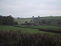
 Farmland - geograph.org.uk - 4842323.jpg 640 × 426 ; 57 kio
-
 Farmland at Heazille Barton - geograph.org.uk - 2519753.jpg 640 × 404 ; 150 kio
-
 Farmland in the Culm Valley - geograph.org.uk - 4545038.jpg 640 × 426 ; 57 kio
-
 Farmland in the Culm Valley - geograph.org.uk - 4842312.jpg 640 × 426 ; 44 kio
-
 Farmland near Ellerhayes - geograph.org.uk - 4346114.jpg 640 × 405 ; 32 kio
-
 Farmland near Worth - geograph.org.uk - 4349567.jpg 640 × 382 ; 46 kio
-
 Farmland, Culm Valley - geograph.org.uk - 4535583.jpg 640 × 426 ; 49 kio
-
 Farmland, Culm Valley - geograph.org.uk - 4842304.jpg 640 × 426 ; 50 kio
-
 Field above Burn Mill - geograph.org.uk - 2128867.jpg 640 × 437 ; 95 kio
-
 Field above Chitterley - geograph.org.uk - 2128972.jpg 640 × 393 ; 56 kio
-
 Field access and wall of Ash Farm - geograph.org.uk - 2815065.jpg 800 × 600 ; 419 kio
-

-

-
 Field at Ellerhayes - geograph.org.uk - 3191019.jpg 640 × 480 ; 77 kio
-
 Field at Silverton Park Farm - geograph.org.uk - 3181700.jpg 640 × 480 ; 83 kio
-
 Field boundary near New Park Farm - geograph.org.uk - 1982439.jpg 640 × 473 ; 104 kio
-
 Field Edge view from Christ Cross Triangulation Pillar - geograph.org.uk - 4721496.jpg 4 000 × 3 000 ; 3,86 Mio
-
 Field near Flock Mill - geograph.org.uk - 4349569.jpg 640 × 470 ; 38 kio
-
 Field near Livingshayes - geograph.org.uk - 3183796.jpg 640 × 480 ; 75 kio
-
 Field of stubble, near Christ Cross - geograph.org.uk - 1124941.jpg 640 × 480 ; 105 kio
-
 Field, Culm Valley - geograph.org.uk - 5299106.jpg 640 × 426 ; 43 kio
-
 Field, Ellerhayes - geograph.org.uk - 6235895.jpg 3 722 × 1 342 ; 601 kio
-
 Fields and house at Ford - geograph.org.uk - 1582894.jpg 640 × 480 ; 133 kio
-
 Fields at Great Dorweeke - geograph.org.uk - 5176456.jpg 640 × 480 ; 71 kio
-
 Fields below Great Pit Farm - geograph.org.uk - 3183847.jpg 640 × 480 ; 68 kio
-
 Fields near Bradninch - geograph.org.uk - 1034691.jpg 640 × 480 ; 48 kio
-
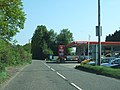 Filling station and service station near Forches - geograph.org.uk - 2380290.jpg 800 × 600 ; 419 kio
-
 Finger post on the turning to Worth - geograph.org.uk - 1734915.jpg 640 × 427 ; 54 kio
-
 Flock Mill - geograph.org.uk - 1719263.jpg 1 024 × 768 ; 248 kio
-
 Flock Mill junction - geograph.org.uk - 6387129.jpg 1 024 × 768 ; 355 kio
-
 Flooded lane, near Hayne House - geograph.org.uk - 1719360.jpg 1 024 × 768 ; 335 kio
-
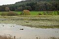
 Flooding, River Culm, January 2016 - geograph.org.uk - 4971994.jpg 640 × 426 ; 54 kio
-
 Flooding, River Culm, January 2016 - geograph.org.uk - 4971996.jpg 640 × 320 ; 24 kio
-
 Flooding, River Culm, January 2016 - geograph.org.uk - 4971997.jpg 640 × 332 ; 26 kio
-
 Flooding, River Culm, January 2016 - geograph.org.uk - 4972001.jpg 640 × 322 ; 32 kio
-
 Flooding, River Culm, January 2016 - geograph.org.uk - 4972002.jpg 640 × 367 ; 38 kio
-
 Flooding, River Culm, January 2016 - geograph.org.uk - 4972005.jpg 640 × 426 ; 61 kio
-
 Flooding, River Culm, January 2016 - geograph.org.uk - 4972008.jpg 640 × 426 ; 61 kio
-
 Flooding, River Culm, January 2016 - geograph.org.uk - 4972010.jpg 640 × 426 ; 57 kio
-
 Flooding, River Culm, January 2016 - geograph.org.uk - 4972011.jpg 640 × 426 ; 58 kio
-
 Flooding, River Culm, January 2016 - geograph.org.uk - 4972013.jpg 640 × 329 ; 44 kio
-
 Flooding, River Culm, January 2016 - geograph.org.uk - 4972018.jpg 640 × 308 ; 38 kio
-
 Footbridge near Underleigh Farm - geograph.org.uk - 5500827.jpg 1 200 × 1 600 ; 802 kio
-
 Footpath above Lower Roach - geograph.org.uk - 2129379.jpg 640 × 480 ; 98 kio
-
 Footpath by Roach Lane - geograph.org.uk - 2814991.jpg 600 × 800 ; 475 kio
-
 Footpath on the hill north of Silverton - geograph.org.uk - 2814993.jpg 800 × 600 ; 384 kio
-
 Fore Street Silverton (geograph 3181722).jpg 640 × 480 ; 56 kio
-
 Fore Street, Silverton (geograph 5136347).jpg 1 024 × 785 ; 127 kio
-
 Fore Street, Silverton (geograph 5722032).jpg 640 × 427 ; 74 kio
-
 Fore Street, Silverton (geograph 6141422).jpg 1 600 × 1 200 ; 456 kio
-
 Fore Street, Silverton (geograph 6141431).jpg 1 600 × 1 200 ; 379 kio
-
 Fore Street, Silverton - geograph.org.uk - 1125329.jpg 640 × 480 ; 71 kio
-
 Free-range poultry farm, on Hayne Lane - geograph.org.uk - 1719390.jpg 1 024 × 768 ; 201 kio
-
 Freshly mown grass at Great Dorweeke - geograph.org.uk - 2524622.jpg 800 × 600 ; 403 kio
-
 Gate and field, Ravenscott - geograph.org.uk - 2128873.jpg 640 × 444 ; 89 kio
-
 Gate and fields above Chitterley - geograph.org.uk - 1584511.jpg 640 × 480 ; 143 kio
-
 Gate and muddy entrance to a field - geograph.org.uk - 1582889.jpg 640 × 480 ; 142 kio
-
 Gates, a field and Dunsmore beyond - geograph.org.uk - 2314061.jpg 800 × 600 ; 415 kio
-
 Gateway into a field above the Burn valley - geograph.org.uk - 1584469.jpg 640 × 480 ; 210 kio
-
 Going through the woods near Southcoombe - geograph.org.uk - 1584430.jpg 640 × 480 ; 211 kio
-
 Grassland, Culm Valley - geograph.org.uk - 5299111.jpg 640 × 426 ; 53 kio
-
 Grazing and woodland, Culm Valley - geograph.org.uk - 4535590.jpg 640 × 426 ; 55 kio
-
 Grazing near Old Heazille - geograph.org.uk - 4346133.jpg 640 × 430 ; 32 kio
-
 Grazing sheep - geograph.org.uk - 4535627.jpg 640 × 426 ; 49 kio
-
 Great Dorweeke - geograph.org.uk - 5136324.jpg 1 024 × 835 ; 294 kio
-
 Hayne Lane - geograph.org.uk - 1766771.jpg 640 × 443 ; 109 kio
-
 Hayne Lane - geograph.org.uk - 1982234.jpg 506 × 640 ; 115 kio
-
 Hayne Lane - geograph.org.uk - 2773019.jpg 800 × 600 ; 490 kio
-
 Hayne Lane - geograph.org.uk - 5061600.jpg 1 024 × 768 ; 299 kio
-
 Hayne Lane and field gateway - geograph.org.uk - 5500675.jpg 1 600 × 1 200 ; 788 kio
-
 Hazelhurst - geograph.org.uk - 5433020.jpg 640 × 426 ; 40 kio
-
 Heal-eye valley - geograph.org.uk - 2181574.jpg 640 × 424 ; 80 kio
-
 Hedgerow tree, on the lane near Singleton Park - geograph.org.uk - 1719285.jpg 768 × 1 024 ; 315 kio
-
 Hele , Construction - geograph.org.uk - 3914502.jpg 4 288 × 2 848 ; 6,04 Mio
-
 Hill above Silverton - geograph.org.uk - 5773763.jpg 1 600 × 1 036 ; 498 kio
-
 Hill north west of Ravenshayes - geograph.org.uk - 1584488.jpg 640 × 480 ; 113 kio
-
 Hillside below Land Farm - geograph.org.uk - 2129088.jpg 640 × 480 ; 79 kio
-
 Hillside near Singleton Park - geograph.org.uk - 5661167.jpg 3 566 × 1 733 ; 619 kio
-
 Hillside, Coblands Farm - geograph.org.uk - 2129020.jpg 640 × 474 ; 125 kio
-
 Horses in the valley of Heal-Eye Stream - geograph.org.uk - 2814958.jpg 800 × 600 ; 492 kio
-

-
 House at Underleigh - geograph.org.uk - 1766740.jpg 640 × 479 ; 124 kio
-
 House on Old Butterleigh Road - geograph.org.uk - 5136736.jpg 1 024 × 832 ; 187 kio
-
 Houses on Fore Street, Silverton (geograph 4549349).jpg 5 184 × 3 888 ; 7,03 Mio
-
 Houses on the High Street, Silverton - geograph.org.uk - 2129242.jpg 640 × 480 ; 86 kio
-
 In a cutting near Penstone - geograph.org.uk - 4535609.jpg 640 × 540 ; 126 kio
-
 In a cutting near Penstone - geograph.org.uk - 4535612.jpg 640 × 475 ; 107 kio
-
 In the Culm Valley - geograph.org.uk - 4535581.jpg 640 × 426 ; 46 kio
-
 Isolated barn above Lower Dorweeke - geograph.org.uk - 5136339.jpg 1 024 × 833 ; 165 kio
-
 Isolated oak tree, on the road between Penstone and Hele - geograph.org.uk - 1720280.jpg 1 024 × 768 ; 239 kio
-
 Isolated tree - geograph.org.uk - 4842306.jpg 640 × 426 ; 54 kio
-
 Junction near Figtree Farm - geograph.org.uk - 1824364.jpg 640 × 480 ; 135 kio
-
 Junction with Caseberry Lane - geograph.org.uk - 5719562.jpg 1 024 × 859 ; 187 kio
-
 Kenson Hill - geograph.org.uk - 1982153.jpg 640 × 468 ; 116 kio
-
 Kink in the lane to Greenslinch - geograph.org.uk - 1582903.jpg 640 × 480 ; 168 kio
-
 Land Farm and Exe Valley Brewery - geograph.org.uk - 2815008.jpg 800 × 600 ; 429 kio
-
 LandArms.png 810 × 933 ; 42 kio
-
 Lane above Red Cross - geograph.org.uk - 1982424.jpg 480 × 640 ; 141 kio
-
 Lane and house at Great Dorweeke - geograph.org.uk - 1584388.jpg 640 × 480 ; 150 kio
-
 Lane and ruin at Greenslinch - geograph.org.uk - 1582923.jpg 640 × 480 ; 136 kio
-
 Lane at Silverton Park Farm - geograph.org.uk - 1982418.jpg 480 × 640 ; 130 kio
-
 Lane from Greenslinch towards Ford - geograph.org.uk - 1582932.jpg 640 × 480 ; 168 kio
-
 Lane heading away from Dunsmore - geograph.org.uk - 1070474.jpg 640 × 480 ; 182 kio
-
 Lane heading north - geograph.org.uk - 2534772.jpg 640 × 480 ; 125 kio
-
 Lane heading south from Great Dorweeke - geograph.org.uk - 1584404.jpg 640 × 480 ; 155 kio
-
 Lane heading south near Little Dorweeke - geograph.org.uk - 1584425.jpg 640 × 480 ; 132 kio
-
 Lane passing Hayne House - geograph.org.uk - 1582876.jpg 640 × 480 ; 213 kio
-

-
 Lane to Backswood Farm - geograph.org.uk - 4374747.jpg 1 024 × 768 ; 190 kio
.jpg)
_-_geograph.org.uk_-_4526302.jpg)


.jpg)


_-_geograph.org.uk_-_2815033.jpg)


.jpg)


.jpg)
.jpg)
.jpg)
.jpg)
.jpg)


.jpg)


