Category:Sixpenny Handley
Vai alla navigazione
Vai alla ricerca
English: Sixpenny Handley is a village in north east Dorset, England, situated on Cranborne Chase ten miles north east of Blandford Forum. The parish had a population of 1,233 in 2011.
village in Dorset, United Kingdom  | |||||
| Carica un file multimediale | |||||
| Istanza di | |||||
|---|---|---|---|---|---|
| Luogo | Sixpenny Handley and Pentridge, Dorset, Sud Ovest dell'Inghilterra, Inghilterra | ||||
 | |||||
Sottocategorie
Questa categoria contiene le 4 sottocategorie indicate di seguito, su un totale di 4.
File nella categoria "Sixpenny Handley"
Questa categoria contiene 200 file, indicati di seguito, su un totale di 206.
(pagina precedente) (pagina successiva)-
 1st Woodcutt Scout HQ - geograph.org.uk - 448799.jpg 640 × 480; 85 KB
-
 1st Woodcutts Scout Hut - geograph.org.uk - 246864.jpg 640 × 480; 77 KB
-
 Alpacas grazing - geograph.org.uk - 261474.jpg 640 × 480; 78 KB
-
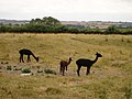 Alpacas with young - geograph.org.uk - 261478.jpg 640 × 480; 81 KB
-
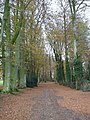 Avenue of trees behind Middle Chase Farm - geograph.org.uk - 281478.jpg 480 × 640; 149 KB
-
 Beech trees in Stonedown Wood - geograph.org.uk - 281178.jpg 480 × 640; 164 KB
-
 Bridleway to Woodcutts - geograph.org.uk - 260560.jpg 480 × 640; 96 KB
-
 Bridleway to Woodcutts Common - geograph.org.uk - 260553.jpg 480 × 640; 84 KB
-
 Bus shelter, Sixpenny Handley - geograph.org.uk - 1635129.jpg 480 × 640; 125 KB
-
 Byway near Shermel Gate - geograph.org.uk - 1219972.jpg 640 × 480; 218 KB
-
 Common Road, Sixpenny Handley - geograph.org.uk - 3057611.jpg 640 × 480; 83 KB
-
 Dean Lane, Sixpenny Handley - geograph.org.uk - 496705.jpg 640 × 480; 98 KB
-

-
 Deanland, a Dorset backwater - geograph.org.uk - 505151.jpg 429 × 640; 76 KB
-

-
 Deer in Garston Wood - geograph.org.uk - 304556.jpg 640 × 462; 164 KB
-
 Drive to Sixpenny Handley Village Hall - geograph.org.uk - 448765.jpg 640 × 431; 126 KB
-
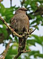 Dunnock, Sixpenny Handley, Dorset - geograph.org.uk - 416383.jpg 470 × 640; 94 KB
-

-
 Finger post, Sixpenny Handley - geograph.org.uk - 1717818.jpg 480 × 640; 201 KB
-
 Footpath crosses road - geograph.org.uk - 1052704.jpg 640 × 436; 127 KB
-
 Footpath near Shermel Gate - geograph.org.uk - 848581.jpg 640 × 480; 145 KB
-
 Fort, Mistleberry Wood - geograph.org.uk - 848556.jpg 640 × 480; 153 KB
-
 Fort, Mistleberry Wood - geograph.org.uk - 848563.jpg 640 × 480; 121 KB
-
 Fungus on Log in Garston Wood - geograph.org.uk - 313089.jpg 640 × 409; 114 KB
-
 Garston Wood Dorset - geograph.org.uk - 270496.jpg 640 × 480; 258 KB
-
 George VI Postbox, Sixpenny Handley - geograph.org.uk - 902303.jpg 480 × 640; 106 KB
-
 George VI Postbox, Sixpenny Handley - geograph.org.uk - 906218.jpg 640 × 491; 130 KB
-
 Hare field - geograph.org.uk - 416320.jpg 640 × 419; 111 KB
-
 Hazel deer fence, Garston Wood - geograph.org.uk - 304547.jpg 427 × 640; 173 KB
-
 Helleborus orientalis - geograph.org.uk - 376862.jpg 640 × 543; 88 KB
-
 High Street, Sixpenny Handley - geograph.org.uk - 5299696.jpg 640 × 480; 108 KB
-
 Houses Sixpenny Handley Dorset - geograph.org.uk - 130026.jpg 640 × 480; 146 KB
-
 Hurdle Fencing at Garston Wood - geograph.org.uk - 313086.jpg 640 × 410; 178 KB
-
 Llama of Sixpenny Handley - geograph.org.uk - 370066.jpg 640 × 427; 121 KB
-
 Male Chaffinch (Fringilla coelebs) - geograph.org.uk - 428148.jpg 640 × 417; 102 KB
-
 Milestone, Sixpenny Handley - geograph.org.uk - 1717999.jpg 480 × 640; 164 KB
-
 Minchington Farm - geograph.org.uk - 1459604.jpg 640 × 480; 79 KB
-
 Oakley Lane, Sixpenny Handley - geograph.org.uk - 496711.jpg 640 × 480; 135 KB
-
 Ox-eye Daisy - geograph.org.uk - 496778.jpg 640 × 480; 59 KB
-
 Pieris napi - geograph.org.uk - 419111.jpg 640 × 427; 99 KB
-
 Pieris napi - geograph.org.uk - 419115.jpg 640 × 427; 100 KB
-
 Ploughing Match in Woodcutts - geograph.org.uk - 301161.jpg 640 × 480; 67 KB
-
 Primrose and Bluebells in Garston Wood - geograph.org.uk - 408708.jpg 427 × 640; 156 KB
-
 Rainbow over Oakley Farm - geograph.org.uk - 437201.jpg 640 × 505; 77 KB
-
 Ramsons and Bluebells in Garston Wood - geograph.org.uk - 408715.jpg 640 × 427; 168 KB
-
-
 Sessions Gate - geograph.org.uk - 1052717.jpg 640 × 480; 123 KB
-

-
 Sheep preparing to attack - geograph.org.uk - 310702.jpg 640 × 480; 93 KB
-
 Shermel Gate - geograph.org.uk - 848591.jpg 640 × 461; 99 KB
-
 Signage old and new, Sixpenny Handley - geograph.org.uk - 1717984.jpg 640 × 481; 153 KB
-
 Sixpenny Handley (that's 6 old pence) - geograph.org.uk - 456576.jpg 640 × 445; 98 KB
-
 Sixpenny Handley - geograph.org.uk - 320303.jpg 640 × 480; 84 KB
-

-
 Sixpenny Handley First School - geograph.org.uk - 1934141.jpg 1 024 × 768; 210 KB
-
 Sixpenny Handley First School - geograph.org.uk - 339830.jpg 640 × 427; 93 KB
-
 Sixpenny Handley High Street - geograph.org.uk - 1934416.jpg 1 024 × 768; 179 KB
-
 Sixpenny Handley Post Office - geograph.org.uk - 320294.jpg 640 × 480; 110 KB
-
 Sixpenny Handley roadsign - geograph.org.uk - 24105.jpg 640 × 480; 113 KB
-
 Sixpenny Handley School - geograph.org.uk - 2139691.jpg 640 × 425; 117 KB
-
 Sixpenny Handley Village Hall - geograph.org.uk - 448756.jpg 640 × 400; 50 KB
-

-
-

-
 Sixpenny Handley, brewery - geograph.org.uk - 1934011.jpg 1 024 × 776; 107 KB
-
 Sixpenny Handley, butcher's shop - geograph.org.uk - 1934124.jpg 1 024 × 768; 163 KB
-
 Sixpenny Handley, country road - geograph.org.uk - 2394907.jpg 1 024 × 768; 352 KB
-
 Sixpenny Handley, Dean Lane - geograph.org.uk - 2394663.jpg 1 024 × 768; 245 KB
-

-
 Sixpenny Handley, farm buildings - geograph.org.uk - 1933998.jpg 1 024 × 768; 121 KB
-
 Sixpenny Handley, field on Wyke Down - geograph.org.uk - 4340442.jpg 640 × 480; 42 KB
-

-
 Sixpenny Handley, fingerpost - geograph.org.uk - 1934037.jpg 1 024 × 768; 172 KB
-
 Sixpenny Handley, fingerpost - geograph.org.uk - 1934059.jpg 1 024 × 768; 166 KB
-
 Sixpenny Handley, former chapel - geograph.org.uk - 1934433.jpg 1 024 × 783; 158 KB
-
 Sixpenny Handley, mounting block - geograph.org.uk - 1934106.jpg 1 024 × 768; 245 KB
-

-

-

-

-

-

-

-
 Sixpenny Handley, signpost at Dean Lane - geograph.org.uk - 3501510.jpg 480 × 640; 112 KB
-

-
 Sixpenny Handley, the post office - geograph.org.uk - 953661.jpg 480 × 640; 60 KB
-

-
 Sixpenny Handley, village store - geograph.org.uk - 1934195.jpg 1 024 × 768; 173 KB
-

-

-
 Small white (Pieris rapae) on nettle - geograph.org.uk - 416814.jpg 539 × 640; 119 KB
-
 Steps over Deer fence, Garston Wood - geograph.org.uk - 991664.jpg 640 × 480; 191 KB
-
 The Ackling Dyke - geograph.org.uk - 24079.jpg 640 × 480; 145 KB
-
 Track in Pribdean wood - geograph.org.uk - 991685.jpg 640 × 480; 176 KB
-

-
 Tree stump, Garston Wood - geograph.org.uk - 1635152.jpg 640 × 480; 194 KB
-
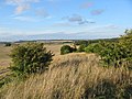
 View across Handley Down - geograph.org.uk - 496769.jpg 640 × 480; 102 KB
-
 Walking the dogs in Dean Lane - geograph.org.uk - 496783.jpg 640 × 480; 98 KB
-
 Wheat Field - geograph.org.uk - 496754.jpg 640 × 480; 83 KB
-
 Winter cereals beside Garston Wood Dorset - geograph.org.uk - 270493.jpg 640 × 480; 211 KB
-
 Wooded Avenue in Greatstone Coppice - geograph.org.uk - 299871.jpg 640 × 480; 108 KB
-

-

-
 Apple blossom - geograph.org.uk - 416440.jpg 463 × 640; 105 KB
-
 B3081 past Squirrel's Corner - geograph.org.uk - 294525.jpg 480 × 640; 117 KB
-

-

-
 Barn on Stilts - geograph.org.uk - 448814.jpg 640 × 480; 140 KB
-
 Barn on Town Farm - geograph.org.uk - 284232.jpg 640 × 480; 75 KB
-
 Bottlebush Down - geograph.org.uk - 294011.jpg 640 × 480; 97 KB
-
 Bottlebush Down west of B3081 - geograph.org.uk - 294393.jpg 640 × 480; 82 KB
-

-
 Bridleway Junction - geograph.org.uk - 496761.jpg 640 × 480; 111 KB
-
 Bridleway near Sixpenny Handley - geograph.org.uk - 1432339.jpg 481 × 640; 134 KB
-
 Brimstone (Gonepteryx rhamni) - geograph.org.uk - 416373.jpg 534 × 640; 101 KB
-
 BT Premises, Sixpenny Handley - geograph.org.uk - 320299.jpg 640 × 480; 88 KB
-
 Buildings on Middle Chase Farm - geograph.org.uk - 281483.jpg 640 × 480; 138 KB
-

-
 Cows on Market Road Farm - geograph.org.uk - 277351.jpg 640 × 480; 80 KB
-
 Ditch of Ancient Fort in Mistleberry Wood - geograph.org.uk - 281193.jpg 480 × 640; 175 KB
-
 Down south of Blackbush Plantation - geograph.org.uk - 303312.jpg 640 × 480; 81 KB
-
 Downland north of Monkton Up Wimborne - geograph.org.uk - 303181.jpg 640 × 480; 75 KB
-
 Drive into Sixpenny Handley - geograph.org.uk - 428137.jpg 640 × 427; 116 KB
-
 Early morning mist Bottlebush Down - geograph.org.uk - 294007.jpg 640 × 427; 89 KB
-
 Farm buildings on Upwood Farm - geograph.org.uk - 281135.jpg 640 × 480; 85 KB
-

-

-
 Farmland near Woodcutts - geograph.org.uk - 246345.jpg 400 × 273; 32 KB
-

-
 Field side Bridleway - geograph.org.uk - 496745.jpg 640 × 480; 106 KB
-
 Field side Footpath - geograph.org.uk - 496729.jpg 640 × 480; 93 KB
-
 First growth of cereal crop - geograph.org.uk - 370112.jpg 640 × 427; 95 KB
-

-
 Footbridge by Bowldish Pond - geograph.org.uk - 303307.jpg 640 × 480; 139 KB
-
 Footpath from Deanland to Upwood - geograph.org.uk - 281131.jpg 480 × 640; 152 KB
-
 Footpath in Stonedown Wood - geograph.org.uk - 281185.jpg 480 × 640; 147 KB
-
 Footpath to Oakley Down - geograph.org.uk - 437204.jpg 427 × 640; 110 KB
-
 Frogmore Farmhouse, 6d Handley - geograph.org.uk - 284846.jpg 640 × 480; 93 KB
-

-
 Hawthorn in bloom. - geograph.org.uk - 428151.jpg 640 × 427; 83 KB
-
 Hedgerow before hail storm - geograph.org.uk - 370021.jpg 427 × 640; 110 KB
-
 Henge monument on Wyke Down - geograph.org.uk - 336990.jpg 640 × 480; 104 KB
-
 Hens in Handley - Christmas Day 2006 - geograph.org.uk - 298297.jpg 640 × 480; 83 KB
-
 Hollyhocks - geograph.org.uk - 496779.jpg 480 × 640; 65 KB
-

-

-
 House in Handley - Christmas Day 2006 - geograph.org.uk - 298290.jpg 480 × 640; 81 KB
-
 Humby's Farm - geograph.org.uk - 277349.jpg 640 × 480; 82 KB
-
 Junction to Dean at Woodcutts - B3081 - geograph.org.uk - 299865.jpg 640 × 480; 98 KB
-

-
 Littlefield Lane, Sixpenny Handley - geograph.org.uk - 320305.jpg 640 × 480; 118 KB
-
 Lone tree and wheat, Handley Down. - geograph.org.uk - 437174.jpg 640 × 427; 59 KB
-
 Looking south from Bowerchalke - geograph.org.uk - 310696.jpg 640 × 480; 61 KB
-
 Manor Farm jumps, 6d Handley - geograph.org.uk - 284851.jpg 640 × 480; 81 KB
-
 Manor Farm, Sixpenny Handley - geograph.org.uk - 284833.jpg 640 × 480; 91 KB
-
 Middle Chase Farmhouse - geograph.org.uk - 281155.jpg 640 × 480; 73 KB
-
 New Barn, outskirts of Sixpenny Handley - geograph.org.uk - 277348.jpg 640 × 480; 128 KB
-
 Nine Yews - geograph.org.uk - 305438.jpg 640 × 427; 63 KB
-
 Northern end of The Drive Plantation - geograph.org.uk - 303021.jpg 640 × 480; 88 KB
-

-

-

-
 Rain storm at Upward Estate - geograph.org.uk - 437168.jpg 640 × 427; 68 KB
-
 Ramsons and Bluebells in Garston Wood - geograph.org.uk - 408700.jpg 427 × 640; 133 KB
-
 Road side marker - geograph.org.uk - 342283.jpg 480 × 640; 177 KB
-
 Roman Milestone on the Achling Dyke - geograph.org.uk - 367678.jpg 640 × 480; 131 KB
-
 Round Barrows beside the Ackling Dyke - geograph.org.uk - 367685.jpg 640 × 480; 109 KB
-

-
 Roundabout Rookery,Handley Cross, Dorset. - geograph.org.uk - 412315.jpg 640 × 480; 104 KB
-
 Sessions Gate, Mistleberry Wood - geograph.org.uk - 281190.jpg 640 × 480; 144 KB
-
 Sheep grazing on Middle Chase Farm - geograph.org.uk - 281494.jpg 640 × 480; 61 KB
-
 Sheep on Middle Chase Farm - geograph.org.uk - 281202.jpg 640 × 480; 86 KB
-
 Shermel Gate - geograph.org.uk - 273670.jpg 640 × 480; 82 KB
-
 Sign in Sixpenny Handley Dorset - geograph.org.uk - 130030.jpg 640 × 480; 120 KB
-
 Spring Flora in Garston Wood - geograph.org.uk - 408725.jpg 427 × 640; 165 KB
-
 Squirrel's Corner - geograph.org.uk - 294012.jpg 480 × 640; 164 KB
-

-

-
 Storm moving toward Handley Down - geograph.org.uk - 370041.jpg 640 × 427; 100 KB
-
 Storm moving toward Handley Down 2 - geograph.org.uk - 370059.jpg 640 × 427; 100 KB
-
 Sun light tracking across downland - geograph.org.uk - 322721.jpg 640 × 427; 54 KB
-
 Sunset on Garston Down - geograph.org.uk - 408721.jpg 640 × 427; 72 KB
-

-

-
-
 The Ackling Dyke near Sixpenny Handley - geograph.org.uk - 367738.jpg 640 × 480; 144 KB
-
 The Ford by Bowldish Pond - geograph.org.uk - 303305.jpg 480 × 640; 127 KB
-
 The River Crane at Bowldish Pond - geograph.org.uk - 303310.jpg 480 × 640; 106 KB
-
 The Roebuck Inn, Sixpenny Handley - geograph.org.uk - 320298.jpg 640 × 480; 103 KB
-
 Town Farm BandB - geograph.org.uk - 284238.jpg 640 × 480; 62 KB
-
 Track and Pheasant feeding strip - geograph.org.uk - 303316.jpg 480 × 640; 84 KB
-
 Track behind New Town - geograph.org.uk - 273663.jpg 480 × 640; 106 KB
-
 Upwood Estate and barley - geograph.org.uk - 437166.jpg 640 × 427; 85 KB
-
 Upwood farmhouse - geograph.org.uk - 281121.jpg 640 × 480; 72 KB
-
 View across Garston Down - geograph.org.uk - 302248.jpg 640 × 196; 58 KB
-

-
 View of Middle Chase Farm - geograph.org.uk - 281490.jpg 640 × 480; 64 KB
-

-


_-_geograph.org.uk_-_428148.jpg)


_-_geograph.org.uk_-_456576.jpg)


_on_nettle_-_geograph.org.uk_-_416814.jpg)


,_Sixpenny_Handley_-_geograph.org.uk_-_1862896.jpg)


_-_geograph.org.uk_-_416373.jpg)


_-_geograph.org.uk_-_304562.jpg)