Category:Skeffington
Aller à la navigation
Aller à la recherche
English: Skeffington is a village and civil parish in the Harborough district of Leicestershire, England. It is situated east of Leicester on the A47 Leicester to Uppingham road, between the parishes of Billesdon and Tugby and Keythorpe.
localité britannique du comté anglais de Leicestershire  | |||||
| Téléverser des médias | |||||
| Nature de l’élément | |||||
|---|---|---|---|---|---|
| Lieu | Harborough, Leicestershire, Midlands de l'Est, Angleterre | ||||
| Population |
| ||||
| Superficie |
| ||||
 | |||||
Sous-catégories
Cette catégorie comprend 2 sous-catégories, dont les 2 ci-dessous.
H
- Skeffington Hall (1 F)
Média dans la catégorie « Skeffington »
Cette catégorie comprend 236 fichiers, dont les 200 ci-dessous.
(page précédente) (page suivante)-
 A47 at Skeffington - geograph.org.uk - 5935505.jpg 640 × 441 ; 47 kio
-
 A47 at Skeffington crossroads - geograph.org.uk - 3587815.jpg 640 × 480 ; 66 kio
-
 A47 at Skeffington Gap, Leicestershire - geograph.org.uk - 213071.jpg 640 × 427 ; 101 kio
-
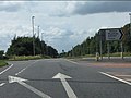 A47 at the B6047 crossroads - geograph.org.uk - 3587895.jpg 640 × 480 ; 62 kio
-

-
 A47 entering Skeffington - geograph.org.uk - 4700900.jpg 640 × 426 ; 47 kio
-
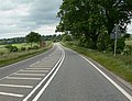
 A47 heading east, Skeffington - geograph.org.uk - 4005653.jpg 640 × 480 ; 77 kio
-
 A47 leaving Skeffington - geograph.org.uk - 4005654.jpg 640 × 480 ; 89 kio
-
 A47 near Skeffington Gap - geograph.org.uk - 3587813.jpg 640 × 480 ; 90 kio
-
 A47 Uppingham Road at Skeffington Gap Farm - geograph.org.uk - 885773.jpg 640 × 398 ; 85 kio
-
 A47 Uppingham Road towards Skeffington - geograph.org.uk - 885740.jpg 640 × 489 ; 89 kio
-
 A47, westbound - geograph.org.uk - 4701048.jpg 640 × 547 ; 83 kio
-
 Away from junction with A47 - geograph.org.uk - 5453281.jpg 640 × 482 ; 57 kio
-
 Bales along the former A47 Uppingham Road - geograph.org.uk - 3415228.jpg 4 000 × 3 000 ; 3,6 Mio
-
 Base of mast in west radio mast compound - geograph.org.uk - 6229102.jpg 640 × 446 ; 72 kio
-
 Benchmark on porch buttress of St Thomas a Becket Church - geograph.org.uk - 4627837.jpg 683 × 1 024 ; 305 kio
-
 Benchmark on Skeffington triangulation pillar - geograph.org.uk - 4628022.jpg 683 × 1 024 ; 209 kio
-
 Bridleway bridge over the Eye Brook - geograph.org.uk - 3990954.jpg 800 × 600 ; 251 kio
-
 Buildings at Welsh Myers Farm - geograph.org.uk - 5935519.jpg 640 × 435 ; 63 kio
-
 Bus shelter along the A47 in Skeffington - geograph.org.uk - 4327868.jpg 1 600 × 1 218 ; 489 kio
-
 Church of St Thomas a Becket, Skeffington - geograph.org.uk - 6384136.jpg 3 776 × 2 520 ; 3,05 Mio
-
 Circular bench on a green - geograph.org.uk - 3415451.jpg 3 295 × 2 604 ; 2,52 Mio
-
 Cottages at Skeffington (geograph 7009238).jpg 1 024 × 768 ; 277 kio
-
 Crop field off Rolleston Road - geograph.org.uk - 4005628.jpg 640 × 480 ; 62 kio
-
 Crop field off Skeffington Glebe Road - geograph.org.uk - 4005644.jpg 640 × 480 ; 65 kio
-
 Crop field off the A47 - geograph.org.uk - 4005657.jpg 640 × 480 ; 59 kio
-
 Crop field, Skeffington - geograph.org.uk - 4005647.jpg 640 × 480 ; 64 kio
-
 Crossroads on the A47 - geograph.org.uk - 3587823.jpg 640 × 480 ; 61 kio
-
 Derelict barns at Glebe Farm - geograph.org.uk - 6229103.jpg 640 × 398 ; 47 kio
-
 Descending Skeffington Wood Road - geograph.org.uk - 885643.jpg 640 × 532 ; 102 kio
-
 Driveway to Billesdon Lodge - geograph.org.uk - 751832.jpg 640 × 404 ; 96 kio
-

-

-

-

-
 Entrance to west radio mast compound - geograph.org.uk - 6229107.jpg 640 × 465 ; 84 kio
-
 Equipment at base of west radio mast - geograph.org.uk - 6229108.jpg 640 × 435 ; 61 kio
-
 Equipment building by west radio mast - geograph.org.uk - 6229109.jpg 640 × 427 ; 74 kio
-
 Equipment cabinet in west radio mast compound - geograph.org.uk - 6229110.jpg 640 × 468 ; 106 kio
-
 Equipment cabinets by west radio mast 0001 - geograph.org.uk - 6229114.jpg 640 × 480 ; 56 kio
-
 Equipment cabinets by west radio mast 0002 - geograph.org.uk - 6229113.jpg 640 × 480 ; 71 kio
-
 Equipment cabinets by west radio mast 0003 - geograph.org.uk - 6229112.jpg 640 × 588 ; 109 kio
-
 Ewes and lambs - geograph.org.uk - 3415232.jpg 3 581 × 2 541 ; 2,75 Mio
-
 Farm gate along Rolleston Road - geograph.org.uk - 3415754.jpg 3 382 × 2 397 ; 2,45 Mio
-
 Farm gates along Rolleston Road - geograph.org.uk - 3415777.jpg 3 761 × 2 425 ; 2,64 Mio
-
 Farm track, Little Skeffington - geograph.org.uk - 4005641.jpg 640 × 480 ; 91 kio
-
 Farmland near Skeffington Vale - geograph.org.uk - 3415767.jpg 2 796 × 2 187 ; 1,64 Mio
-
 Felled trees in Skeffington Wood - geograph.org.uk - 885584.jpg 640 × 478 ; 133 kio
-
 Field east of Skeffington Wood Road - geograph.org.uk - 5935521.jpg 640 × 485 ; 99 kio
-
 Field edge by Rolleston Road - geograph.org.uk - 6225754.jpg 640 × 480 ; 78 kio
-
 Field entrance off Skeffington Road - geograph.org.uk - 4005619.jpg 640 × 480 ; 87 kio
-

-

-
 Fields east of Rolleston Road - geograph.org.uk - 6225755.jpg 640 × 481 ; 83 kio
-
 Fields north of Skeffington Wood Road - geograph.org.uk - 5935522.jpg 640 × 471 ; 81 kio
-
 Fields south of Skeffington Wood Road - geograph.org.uk - 5935523.jpg 640 × 466 ; 93 kio
-
 Footpath from Rolleston to Skeffington - geograph.org.uk - 6384161.jpg 3 776 × 2 520 ; 3,22 Mio
-
 Footpath to Park Farm - geograph.org.uk - 4005638.jpg 640 × 480 ; 86 kio
-
 Ford at Skeffington - geograph.org.uk - 2997999.jpg 3 264 × 2 448 ; 3,73 Mio
-
 Ford at Skeffington - geograph.org.uk - 2998008.jpg 3 264 × 2 448 ; 3,54 Mio
-
 Former A47 Uppingham Road - geograph.org.uk - 3415211.jpg 3 546 × 2 595 ; 2,8 Mio
-
 Former stables-cattle sheds at Glebe Farm - geograph.org.uk - 6229115.jpg 640 × 404 ; 48 kio
-
 Gate and bales blocking the former A47 Uppingham Road - geograph.org.uk - 4327890.jpg 1 600 × 1 054 ; 566 kio
-

-
 Gate on Skeffington Wood Road - geograph.org.uk - 5935513.jpg 640 × 464 ; 78 kio
-

-
 Gates to the graveyard - geograph.org.uk - 3415436.jpg 3 664 × 2 603 ; 3,41 Mio
-
 Gateway off Melton Road - geograph.org.uk - 2796694.jpg 640 × 472 ; 82 kio
-
 Gateway off the A47, Skeffington - geograph.org.uk - 4005650.jpg 640 × 480 ; 89 kio
-
 Gateway south of Skeffington Wood Road - geograph.org.uk - 5935524.jpg 640 × 487 ; 111 kio
-
 Glebe Farm on Skeffington Glebe Road - geograph.org.uk - 6421169.jpg 3 776 × 2 520 ; 2,96 Mio
-
 Grassy Track - geograph.org.uk - 238799.jpg 640 × 480 ; 146 kio
-
 Grazing Little Skeffington - geograph.org.uk - 4005640.jpg 640 × 480 ; 49 kio
-
 Hedgerow and crop field - geograph.org.uk - 4005626.jpg 640 × 480 ; 67 kio
-
 Hills in east Leicestershire - geograph.org.uk - 3296337.jpg 3 760 × 2 777 ; 1,64 Mio
-
 Houses along the Main Street in Skeffington - geograph.org.uk - 4327864.jpg 1 600 × 1 293 ; 493 kio
-
 Lay-by on the westbound A47 - geograph.org.uk - 3587830.jpg 640 × 480 ; 68 kio
-
 Looking east along the Main Street in Skeffington - geograph.org.uk - 3415421.jpg 2 138 × 1 645 ; 946 kio
-
 Looking north along the B6047 Melton Road - geograph.org.uk - 3296338.jpg 4 000 × 3 000 ; 4,81 Mio
-
 Main Street in Little Skeffington - geograph.org.uk - 3415441.jpg 2 831 × 2 100 ; 1,91 Mio
-
 Main Street in Skeffington - geograph.org.uk - 753077.jpg 640 × 409 ; 102 kio
-
 Main Street-A47 junction at Skeffington - geograph.org.uk - 5935507.jpg 640 × 423 ; 60 kio
-
 Melton Road passes by Rushfield House - geograph.org.uk - 2796695.jpg 640 × 478 ; 84 kio
-
 New build property - geograph.org.uk - 3990972.jpg 800 × 600 ; 318 kio
-
 North towards Skeffington - geograph.org.uk - 753140.jpg 640 × 479 ; 85 kio
-
 Ordnance Survey Trig Pillar S4866 - geograph.org.uk - 3292968.jpg 4 000 × 3 000 ; 4,03 Mio
-
 Out for a walk on Rolleston Road - geograph.org.uk - 6225756.jpg 640 × 450 ; 94 kio
-
 Park Farm House - geograph.org.uk - 6225750.jpg 640 × 452 ; 71 kio
-
 Park Farm House near Skeffington - geograph.org.uk - 3415469.jpg 2 716 × 2 356 ; 2,15 Mio
-
 Public footpath to Billesdon - geograph.org.uk - 3415795.jpg 2 787 × 2 309 ; 2,04 Mio
-
 Pylons and farmland near Skeffington - geograph.org.uk - 885676.jpg 640 × 562 ; 90 kio
-
 Pylons north of Skeffington Wood Road - geograph.org.uk - 5935514.jpg 640 × 481 ; 70 kio
-
 Radio mast to east of Skeffington Glebe Road - geograph.org.uk - 6229116.jpg 640 × 480 ; 49 kio
-
 Radio masts by Skeffington Glebe Road - geograph.org.uk - 6229117.jpg 640 × 463 ; 65 kio
-

-
 Radio masts north of Skeffington - geograph.org.uk - 751823.jpg 640 × 442 ; 60 kio
-
 Remains of a large fire - geograph.org.uk - 3415221.jpg 3 899 × 2 789 ; 3,3 Mio
-
 Rolleston Road - geograph.org.uk - 4005622.jpg 640 × 480 ; 75 kio
-
 Rolleston Road entering Skeffington - geograph.org.uk - 6384146.jpg 3 776 × 2 520 ; 3,18 Mio
-
 Rolleston Road in Skeffington - geograph.org.uk - 6304432.jpg 800 × 576 ; 264 kio
-
 Rolleston Road running south from Skeffington - geograph.org.uk - 6384157.jpg 3 776 × 2 520 ; 3,13 Mio
-
 Route of the former A47 Uppingham Road - geograph.org.uk - 3415216.jpg 4 000 × 3 000 ; 3,48 Mio
-
 Sign at the entrance to the Park Farm Business Units - geograph.org.uk - 4327913.jpg 1 600 × 1 140 ; 620 kio
-

-
 Signs at east radio mast compound 0001 - geograph.org.uk - 6229600.jpg 640 × 498 ; 78 kio
-
 Signs at east radio mast compound 0002 - geograph.org.uk - 6229601.jpg 640 × 450 ; 58 kio
-
 Signs at east radio mast compound 0003 - geograph.org.uk - 6229602.jpg 640 × 614 ; 74 kio
-
 Signs at east radio mast compound 0004 - geograph.org.uk - 6229603.jpg 640 × 620 ; 75 kio
-
 Signs at east radio mast compound 0005 - geograph.org.uk - 6229604.jpg 480 × 640 ; 85 kio
-
 Signs at east radio mast compound 0006 - geograph.org.uk - 6229605.jpg 640 × 486 ; 65 kio
-

-

-

-

-

-

-

-

-

-

-

-

-

-

-

-

-

-

-

-

-
 Milestone along the A47 Uppingham Road - geograph.org.uk - 885717.jpg 640 × 614 ; 181 kio
-
 Skeffington Glebe Road - geograph.org.uk - 4005645.jpg 640 × 480 ; 59 kio
-
 Skeffington Glebe Road - geograph.org.uk - 752903.jpg 640 × 578 ; 96 kio
-
 Skeffington Glebe Road - geograph.org.uk - 752987.jpg 640 × 507 ; 76 kio
-
 Skeffington Glebe Road crossing Eye Brook - geograph.org.uk - 6384726.jpg 2 962 × 1 977 ; 1,66 Mio
-
 Skeffington Glebe Road crossing Eye Brook - geograph.org.uk - 6421197.jpg 3 776 × 2 520 ; 3,22 Mio
-

-

-
 Skeffington Glebe Road north of the A47 - geograph.org.uk - 6421156.jpg 2 877 × 1 808 ; 1,52 Mio
-

-

-

-

-

-

-
 Skeffington Glebe Road towards Skeffington - geograph.org.uk - 6225752.jpg 640 × 475 ; 60 kio
-

-
 Skeffington Glebe Road towards Tilton - geograph.org.uk - 6225753.jpg 640 × 479 ; 61 kio
-
 Skeffington Road - geograph.org.uk - 4005617.jpg 640 × 480 ; 90 kio
-
 Skeffington Road into the woods sign on gate - geograph.org.uk - 6225747.jpg 640 × 525 ; 83 kio
-
 Skeffington Road into the woods with gate closed - geograph.org.uk - 6229100.jpg 640 × 451 ; 107 kio
-
 Skeffington Road into the woods with gate open - geograph.org.uk - 6229101.jpg 640 × 451 ; 110 kio
-
 Skeffington Road towards Skeffington - geograph.org.uk - 6225749.jpg 640 × 486 ; 95 kio
-
 Skeffington trig point - geograph.org.uk - 4628074.jpg 683 × 1 024 ; 332 kio
-
 Skeffington Vale Farm - geograph.org.uk - 753222.jpg 640 × 465 ; 97 kio
-
 Skeffington Vale farmhouse - geograph.org.uk - 753228.jpg 640 × 504 ; 135 kio
-
 Skeffington village in Leicestershire - geograph.org.uk - 753147.jpg 640 × 488 ; 83 kio
-
 Skeffington Wood - geograph.org.uk - 5935525.jpg 640 × 477 ; 122 kio
-
 Skeffington Wood Road - geograph.org.uk - 5935508.jpg 640 × 465 ; 59 kio
-
 Skeffington Wood Road - geograph.org.uk - 5935699.jpg 640 × 474 ; 75 kio
-
 Skeffington Wood Road - geograph.org.uk - 885541.jpg 640 × 448 ; 104 kio
-
 Skeffington Wood Road along a field edge - geograph.org.uk - 5935515.jpg 640 × 491 ; 87 kio
-
 Skeffington Wood Road away from the A47 - geograph.org.uk - 5935509.jpg 640 × 390 ; 58 kio
-
 Skeffington Wood Road eastwards - geograph.org.uk - 5935700.jpg 640 × 477 ; 83 kio
-
 Skeffington Wood Road enters the woods - geograph.org.uk - 5935526.jpg 640 × 478 ; 112 kio
-
 Skeffington Wood Road heading towards Skeffington - geograph.org.uk - 6384723.jpg 3 776 × 2 520 ; 3,06 Mio
-
 Skeffington Wood Road joins the A47 - geograph.org.uk - 5935510.jpg 640 × 427 ; 70 kio
-
 Skeffington Wood Road leaves the woods - geograph.org.uk - 5935527.jpg 640 × 502 ; 107 kio
-
 Skeffington Wood Road northwards - geograph.org.uk - 5935528.jpg 640 × 470 ; 106 kio
-
 Skeffington Wood Road towards Skeffington - geograph.org.uk - 5935516.jpg 640 × 487 ; 112 kio
-
 Skeffington Wood Road towards Skeffington - geograph.org.uk - 5935529.jpg 640 × 490 ; 120 kio
-
 Skeffington Wood Road towards Skeffington - geograph.org.uk - 885661.jpg 519 × 640 ; 105 kio
-
 Skeffington Wood Road towards the woods - geograph.org.uk - 5935702.jpg 640 × 470 ; 82 kio
-
 Skeffington Wood Road westwards - geograph.org.uk - 5935517.jpg 640 × 413 ; 64 kio
-
 Solar at Skeffington Lodge Farm - geograph.org.uk - 3991629.jpg 800 × 600 ; 362 kio
-
 St Thomas a Becket Church - geograph.org.uk - 4627911.jpg 1 024 × 683 ; 223 kio
-
 Stile - geograph.org.uk - 181082.jpg 480 × 640 ; 90 kio
-
 The former A47 near Skeffington - geograph.org.uk - 3415200.jpg 3 445 × 2 992 ; 3,05 Mio
-
 The Main Street in Skeffington - geograph.org.uk - 3415416.jpg 4 000 × 3 000 ; 4,61 Mio
-
 The Main Street of Skeffington - geograph.org.uk - 3415429.jpg 3 258 × 2 407 ; 2,47 Mio
-
 The Midshires Way about to cross a tributary to Eye Brook - geograph.org.uk - 6384715.jpg 3 776 × 2 520 ; 3,02 Mio
-
 The Midshires Way approaching Lodge Farm Cottages - geograph.org.uk - 6384602.jpg 3 776 × 2 520 ; 3,27 Mio
-
 The Midshires Way crosses the River Eyebrook - geograph.org.uk - 5609461.jpg 640 × 480 ; 60 kio
-
 The Midshires Way crossing High Leicestershire - geograph.org.uk - 6384719.jpg 3 776 × 2 520 ; 3,16 Mio
-
 The Midshires Way leaving the A47 for Tilton on the Hill - geograph.org.uk - 6384594.jpg 3 776 × 2 520 ; 3,13 Mio
-
 The Midshires Way north of Welsh Meyers Farm - geograph.org.uk - 6384709.jpg 3 776 × 2 520 ; 3,33 Mio
-
 The Skeffington family coat of arms.jpg 150 × 166 ; 29 kio
-
 The west end of Main Street, Skeffington - geograph.org.uk - 6384142.jpg 3 776 × 2 520 ; 3,23 Mio
-
 Towards junction with A47 - geograph.org.uk - 5453282.jpg 640 × 473 ; 71 kio
-
 Towards Melton Road-Uppingham Road junction - geograph.org.uk - 2796696.jpg 640 × 508 ; 80 kio
-
 Towards Park Farm House from Rolleston Road - geograph.org.uk - 6225751.jpg 640 × 442 ; 48 kio
-
 Track along northern edge of Skeffington Wood - geograph.org.uk - 5935703.jpg 640 × 472 ; 121 kio
-

-
 Track off the B6047 Melton Road - geograph.org.uk - 3296336.jpg 2 571 × 2 106 ; 1,68 Mio
-
 Tracks - geograph.org.uk - 238778.jpg 640 × 480 ; 126 kio
-
 Traffic on the A47 heading towards Tugby - geograph.org.uk - 4327859.jpg 1 600 × 973 ; 478 kio
-
 Uppingham Road (A47) - geograph.org.uk - 4005659.jpg 640 × 480 ; 69 kio
-
 Vale Cottages along Rolleston Road - geograph.org.uk - 3415720.jpg 2 828 × 2 168 ; 1,92 Mio
-
 Wall at Skeffington (geograph 7012379).jpg 768 × 1 024 ; 319 kio
-
 Welsh Myers Farm - geograph.org.uk - 5935520.jpg 640 × 462 ; 70 kio


.jpg)


_-_geograph.org.uk_-_4005659.jpg)

.jpg)
