Category:Slapton, Devon
Zur Navigation springen
Zur Suche springen
English: Slapton is a coastal village in Devon, England. It is located on the A379 road between Kingsbridge and Dartmouth, and lies within the South Devon Area of Outstanding Natural Beauty (AONB).
Français : Slapton est un village dans le Devon, en Angleterre, situé entre Kingsbridge et Dartmouth
village and civil parish in the South Hams district of Devon, England, UK  | |||||
| Medium hochladen | |||||
| Ist ein(e) | |||||
|---|---|---|---|---|---|
| Ort | South Hams, Devon, Südwestengland, England | ||||
 | |||||
Unterkategorien
Es werden 6 von insgesamt 6 Unterkategorien in dieser Kategorie angezeigt:
In Klammern die Anzahl der enthaltenen Kategorien (K), Seiten (S), Dateien (D)
Medien in der Kategorie „Slapton, Devon“
Folgende 200 Dateien sind in dieser Kategorie, von 926 insgesamt.
(vorherige Seite) (nächste Seite)-
 1 - 2, Sands Rd - geograph.org.uk - 3037697.jpg 640 × 430; 71 KB
-
 1 - 2, Sands Rd - geograph.org.uk - 3037700.jpg 640 × 430; 69 KB
-
 1 ^ 2, Sands Rd - geograph.org.uk - 5340979.jpg 640 × 426; 75 KB
-
 1, Sands Rd - geograph.org.uk - 3094930.jpg 640 × 430; 54 KB
-
 A Devon lane - geograph.org.uk - 3016909.jpg 640 × 430; 73 KB
-
 A Devon Lane - geograph.org.uk - 3115785.jpg 640 × 430; 97 KB
-
 A field of Barley - geograph.org.uk - 3021092.jpg 640 × 430; 70 KB
-
 A narrow Devon lane - geograph.org.uk - 3258797.jpg 640 × 430; 57 KB
-
 A narrow Devon lane - geograph.org.uk - 3258825.jpg 640 × 430; 119 KB
-
 A narrow lane - geograph.org.uk - 3025132.jpg 640 × 430; 128 KB
-
 A place to hide - geograph.org.uk - 3028785.jpg 640 × 430; 59 KB
-
 A quiet Devon lane - geograph.org.uk - 3115788.jpg 640 × 430; 84 KB
-
 A sea of barley - geograph.org.uk - 3022965.jpg 640 × 430; 57 KB
-
 A379 - geograph.org.uk - 3306155.jpg 640 × 397; 56 KB
-
 A379 - geograph.org.uk - 5299791.jpg 640 × 426; 48 KB
-
 A379 - geograph.org.uk - 5299793.jpg 640 × 426; 46 KB
-
 A379 southsoutheast of Broadstone Point - geograph.org.uk - 3889002.jpg 3.995 × 2.398; 1,18 MB
-
 A379, Slapton Sands - geograph.org.uk - 3265467.jpg 640 × 430; 51 KB
-
 A379, Slapton Sands - geograph.org.uk - 5299872.jpg 640 × 462; 55 KB
-
 Across the reedbeds at Slapton - May 2015 - panoramio.jpg 4.000 × 3.000; 2,02 MB
-
 Alleyway to the church - geograph.org.uk - 5335166.jpg 640 × 426; 65 KB
-
 Along the coast towards Dartmouth - evening June 2012 - panoramio.jpg 4.000 × 3.000; 3,76 MB
-
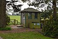
 Anglers Hut, slapton - geograph.org.uk - 5348783.jpg 640 × 426; 121 KB
-
 Anglers hut, Slapton Ley - geograph.org.uk - 5299781.jpg 640 × 426; 119 KB
-
 Approaching Alston - geograph.org.uk - 4131616.jpg 4.000 × 3.000; 3,63 MB
-
 Approaching Deerbridge Mill - geograph.org.uk - 5326213.jpg 640 × 426; 83 KB
-
 Approaching Higher Green Cross - geograph.org.uk - 3119457.jpg 640 × 430; 56 KB
-
 Approaching Newton Cross - geograph.org.uk - 3025167.jpg 640 × 430; 106 KB
-
 Approaching Whitestone Cross - geograph.org.uk - 3115797.jpg 640 × 430; 67 KB
-
 Arable fields north of Higher Green Cross - geograph.org.uk - 3998589.jpg 3.648 × 2.736; 1,93 MB
-
 Autumn colours, Slapton Wood - geograph.org.uk - 5296208.jpg 426 × 640; 149 KB
-
 Banks of Slapton Ley - geograph.org.uk - 3269316.jpg 640 × 430; 148 KB
-
 Barley - geograph.org.uk - 3022964.jpg 640 × 430; 47 KB
-
 Barley - geograph.org.uk - 3022967.jpg 640 × 430; 51 KB
-
 Barley field - geograph.org.uk - 3021091.jpg 640 × 430; 61 KB
-
 Barn at Molton - geograph.org.uk - 3016921.jpg 640 × 430; 95 KB
-
 Barn at Newton - geograph.org.uk - 3025154.jpg 640 × 430; 81 KB
-
 Barn in Start - geograph.org.uk - 5326209.jpg 640 × 426; 89 KB
-
 Barn near Torr Farm - geograph.org.uk - 5956030.jpg 3.210 × 2.249; 943 KB
-
 Barn southeast of Dittiscombe Cross - geograph.org.uk - 6025530.jpg 4.282 × 2.329; 982 KB
-
 Barn, Brook St - geograph.org.uk - 3040216.jpg 640 × 430; 92 KB
-
 Barn, Brook Street - geograph.org.uk - 5340913.jpg 640 × 426; 80 KB
-
 Barn, Buckland Court - geograph.org.uk - 3023001.jpg 640 × 430; 73 KB
-
 Barn, Lower Coltscombe - geograph.org.uk - 5321305.jpg 640 × 426; 92 KB
-
 Barn, Middlegrounds Farm - geograph.org.uk - 5296062.jpg 640 × 426; 104 KB
-
 Barn, Thorn Farm - geograph.org.uk - 3023018.jpg 640 × 430; 74 KB
-
 Barns, Buckland - geograph.org.uk - 3111476.jpg 640 × 430; 102 KB
-
 Barns, Pollardscombe Farm - geograph.org.uk - 3021069.jpg 640 × 430; 65 KB
-
 Beach, Slapton Sands - geograph.org.uk - 3244654.jpg 640 × 430; 56 KB
-
 Beach, Slapton Sands - geograph.org.uk - 3244658.jpg 640 × 430; 49 KB
-
 Beginning of bridleway, Slapton - geograph.org.uk - 824193.jpg 640 × 430; 133 KB
-
 Beginning of bridleway, Slapton - geograph.org.uk - 824223.jpg 640 × 430; 88 KB
-
 Bench by Sands Rd - geograph.org.uk - 3244679.jpg 640 × 430; 97 KB
-
 Bench, Sands Rd - geograph.org.uk - 3176860.jpg 640 × 430; 51 KB
-
 Bench, Sands Rd - geograph.org.uk - 3255819.jpg 640 × 430; 51 KB
-
 Bench, Sands Rd - geograph.org.uk - 3265384.jpg 640 × 430; 64 KB
-
 Between high hedges - geograph.org.uk - 3258827.jpg 640 × 430; 125 KB
-
 Blackpool Sands from Slapton Sands (9951).jpg 4.288 × 2.848; 4,31 MB
-
 Boadwalk around Slapton Ley - geograph.org.uk - 3874491.jpg 640 × 425; 136 KB
-
 Board walk - geograph.org.uk - 3874466.jpg 640 × 425; 136 KB
-
 Boardwalk across the marsh near Slapton Ley - geograph.org.uk - 2899075.jpg 3.000 × 4.000; 3,77 MB
-
 Boardwalk, Slapton Ley - geograph.org.uk - 3271635.jpg 640 × 430; 123 KB
-
 Boardwalk, Slapton Ley - geograph.org.uk - 3271638.jpg 640 × 430; 139 KB
-
 Boardwalk, Slapton Nature Reserve - geograph.org.uk - 5321090.jpg 640 × 426; 127 KB
-
 Boardwalk, Slapton Nature Reserve - geograph.org.uk - 5321091.jpg 640 × 426; 129 KB
-
 Bridge at Higher North Mill - geograph.org.uk - 3261171.jpg 640 × 430; 96 KB
-
 Bridge near Slapton in the rain - geograph.org.uk - 824301.jpg 640 × 430; 108 KB
-
 Bridge near Stokenham - geograph.org.uk - 62742.jpg 640 × 480; 200 KB
-
 Bridleway to Higher Coltscombe - geograph.org.uk - 5321312.jpg 640 × 426; 115 KB
-
 Bridleways diverge - geograph.org.uk - 5321310.jpg 640 × 426; 90 KB
-
 Brook Cottage - geograph.org.uk - 3040212.jpg 640 × 410; 79 KB
-
 Brook Cottage - geograph.org.uk - 5340905.jpg 640 × 425; 57 KB
-
 Brook entering the marsh at Slapton - May 2015 - panoramio.jpg 4.000 × 3.000; 2,35 MB
-
 Brook St - geograph.org.uk - 5335077.jpg 640 × 426; 98 KB
-
 Brook Street - geograph.org.uk - 5340907.jpg 640 × 426; 87 KB
-
 Brook Street - geograph.org.uk - 5340926.jpg 640 × 426; 89 KB
-
 Brook Street - geograph.org.uk - 5340969.jpg 640 × 426; 106 KB
-
 Brook Street Corner - geograph.org.uk - 3040206.jpg 640 × 430; 105 KB
-
 Brook Street junction, Slapton - geograph.org.uk - 824184.jpg 430 × 640; 84 KB
-
 Brook Street, Slapton - geograph.org.uk - 3094905.jpg 640 × 430; 113 KB
-
 Buckland Court - geograph.org.uk - 2210426.jpg 640 × 426; 77 KB
-
 Buckland Court - geograph.org.uk - 3023004.jpg 640 × 430; 67 KB
-
 Buckland Court - geograph.org.uk - 3111468.jpg 640 × 430; 106 KB
-
 Buckland Court, Lower Courtyard - geograph.org.uk - 2210444.jpg 640 × 426; 70 KB
-
 Buckland Court, Upper Courtyard - geograph.org.uk - 2210439.jpg 640 × 426; 74 KB
-
 Buckland Cross - geograph.org.uk - 3115792.jpg 640 × 430; 56 KB
-
 Buckland Cross - geograph.org.uk - 3998580.jpg 3.500 × 2.511; 1,57 MB
-
 Buckland Cross - geograph.org.uk - 5953511.jpg 4.288 × 2.848; 1,7 MB
-
 Buckland Cross - geograph.org.uk - 6025446.jpg 4.288 × 2.848; 1,77 MB
-
 Buckland House - geograph.org.uk - 2210371.jpg 640 × 487; 109 KB
-
 Buckland House - geograph.org.uk - 3111465.jpg 640 × 430; 110 KB
-
 Bushes by the South West Coast Path - geograph.org.uk - 3306152.jpg 640 × 430; 68 KB
-
 By the Ley - geograph.org.uk - 3269319.jpg 640 × 430; 140 KB
-
 Byway to Battle Ford - geograph.org.uk - 5326207.jpg 640 × 426; 108 KB
-
 Car Park - Slapton Sands - geograph.org.uk - 2439938.jpg 4.000 × 3.000; 3,95 MB
-
 Car park on Slapton Sands - geograph.org.uk - 2457778.jpg 1.024 × 768; 233 KB
-
 Car park, Slapton Sands - geograph.org.uk - 3265465.jpg 640 × 430; 43 KB
-
 Car park, Slapton Sands - geograph.org.uk - 4161969.jpg 1.920 × 1.231; 582 KB
-
 Carlane Cottage - Slapton - geograph.org.uk - 2898857.jpg 3.000 × 4.000; 4,13 MB
-
 Carr Lane - geograph.org.uk - 3016273.jpg 640 × 430; 109 KB
-
 Carr Lane, Slapton - geograph.org.uk - 1363309.jpg 640 × 491; 96 KB
-
 Carr Lane, Slapton - geograph.org.uk - 2505741.jpg 3.872 × 2.592; 5,68 MB
-
 Carr Lane, Slapton - geograph.org.uk - 3346616.jpg 768 × 1.024; 131 KB
-
 Carr Lane, Slapton - geograph.org.uk - 4884569.jpg 640 × 427; 102 KB
-
 Cattle at Slapton - geograph.org.uk - 1361984.jpg 640 × 450; 79 KB
-
 Cattle feeder - geograph.org.uk - 3244678.jpg 640 × 430; 52 KB
-
 Cattle feeder by Sands Rd - geograph.org.uk - 3306167.jpg 640 × 430; 62 KB
-
 Cattle grazing - geograph.org.uk - 3016916.jpg 640 × 430; 85 KB
-
 Cattle on a hillside - geograph.org.uk - 3023036.jpg 640 × 430; 77 KB
-
 Chantry Tower - geograph.org.uk - 2210155.jpg 425 × 640; 78 KB
-
 Chest Tombs - geograph.org.uk - 5340683.jpg 640 × 426; 97 KB
-
 Church Hill - geograph.org.uk - 5335152.jpg 640 × 426; 73 KB
-
 Church Lane, Slapton (2) - geograph.org.uk - 1363206.jpg 480 × 640; 98 KB
-
 Church Lane, Slapton - geograph.org.uk - 1363186.jpg 640 × 382; 67 KB
-
 Church of St James - altar - geograph.org.uk - 5340689.jpg 640 × 426; 52 KB
-
 Church of St James - font - geograph.org.uk - 5340691.jpg 426 × 640; 54 KB
-
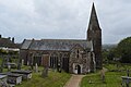
 Church of St James - geograph.org.uk - 3094912.jpg 640 × 430; 64 KB
-
 Church of St James - geograph.org.uk - 3094951.jpg 640 × 430; 46 KB
-
 Church of St James - geograph.org.uk - 3889332.jpg 3.522 × 2.819; 1,82 MB
-
 Church of St James - geograph.org.uk - 5335192.jpg 640 × 426; 59 KB
-
 Church of St James - geograph.org.uk - 5335197.jpg 640 × 426; 81 KB
-
 Church of St James - geograph.org.uk - 5335203.jpg 386 × 640; 50 KB
-
 Church of St James - geograph.org.uk - 5335312.jpg 640 × 426; 43 KB
-
 Church of St James - geograph.org.uk - 5335328.jpg 640 × 426; 59 KB
-
 Church of St James - geograph.org.uk - 5335337.jpg 640 × 426; 55 KB
-
 Church of St James - geograph.org.uk - 5335355.jpg 640 × 426; 56 KB
-
 Church of St James - geograph.org.uk - 5340685.jpg 426 × 640; 62 KB
-
 Church of St James - geograph.org.uk - 5340960.jpg 426 × 640; 56 KB
-
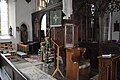 Church of St James - pulpit - geograph.org.uk - 5340687.jpg 640 × 426; 74 KB
-
 Church Road - geograph.org.uk - 1582954.jpg 640 × 480; 64 KB
-
 Climbing out of The Gara Valley - geograph.org.uk - 3107337.jpg 640 × 430; 63 KB
-
 Climbing out of The Gara Valley - geograph.org.uk - 3111433.jpg 640 × 430; 78 KB
-
 Coastal erosion, Slapton Sands - geograph.org.uk - 5299789.jpg 426 × 640; 95 KB
-
 Coltscombe - geograph.org.uk - 235839.jpg 640 × 480; 108 KB
-
 Composting toilet, Field Study Centre - geograph.org.uk - 5321076.jpg 640 × 426; 104 KB
-
 Conservation area, Slapton Sands - geograph.org.uk - 5299804.jpg 640 × 426; 85 KB
-
 Conversion at Merrifield - geograph.org.uk - 3258806.jpg 640 × 430; 74 KB
-
 Converted Farm Buildings - geograph.org.uk - 1449549.jpg 640 × 426; 73 KB
-
 Cottage at Newton - geograph.org.uk - 3025145.jpg 640 × 430; 50 KB
-
 Cottage in Slapton - geograph.org.uk - 5335281.jpg 640 × 426; 46 KB
-
 Cottage in Slapton - geograph.org.uk - 5340890.jpg 640 × 426; 51 KB
-
 Cottage, Brook St - geograph.org.uk - 3040207.jpg 640 × 430; 56 KB
-
 Cottage, Hansel - geograph.org.uk - 3261152.jpg 640 × 430; 84 KB
-
 Cottage, Start - geograph.org.uk - 5321300.jpg 640 × 426; 97 KB
-
 Cottage, Towns End Cross - geograph.org.uk - 3016288.jpg 640 × 430; 65 KB
-
 Cottage, Towns End Cross - geograph.org.uk - 3016289.jpg 640 × 430; 62 KB
-
 Cottages by the church at Slapton - geograph.org.uk - 4884555.jpg 640 × 427; 95 KB
-
 Cottages in Slapton (2) - geograph.org.uk - 1363144.jpg 480 × 640; 73 KB
-
 Cottages in Slapton - geograph.org.uk - 1363076.jpg 502 × 640; 75 KB
-
 Cottages, Prospect Hill - geograph.org.uk - 3094919.jpg 640 × 430; 85 KB
-
 Cottages, Slapton - geograph.org.uk - 5335101.jpg 640 × 426; 57 KB
-
 Countryside near Slapton - geograph.org.uk - 3271654.jpg 640 × 430; 91 KB
-
 Countryside near Thorn Farm - geograph.org.uk - 3023014.jpg 640 × 430; 60 KB
-
 Cows above Slapton Ley - geograph.org.uk - 2504494.jpg 3.872 × 2.592; 4,81 MB
-
 Crop, Heathfield - geograph.org.uk - 5953532.jpg 4.271 × 2.647; 2,06 MB
-
 Crossroads at Watergate Langford - geograph.org.uk - 3874624.jpg 640 × 425; 122 KB
-
 Deer Bridge - geograph.org.uk - 1582968.jpg 640 × 480; 105 KB
-
 Deer Bridge - geograph.org.uk - 3874574.jpg 640 × 425; 109 KB
-
 Deer Bridge - geograph.org.uk - 3889975.jpg 3.420 × 2.505; 2,4 MB
-
 Deer Bridge - geograph.org.uk - 5321149.jpg 640 × 426; 91 KB
-
 Deerbridge Mill - geograph.org.uk - 5326214.jpg 640 × 425; 81 KB
-
 Deerbridge Mill House - geograph.org.uk - 5321291.jpg 640 × 426; 77 KB
-
-

-
 Dense woodland, Slapton Ley - geograph.org.uk - 3271637.jpg 640 × 430; 145 KB
-
 Derelict barn - geograph.org.uk - 235165.jpg 480 × 640; 119 KB
-
 Derelict barn - geograph.org.uk - 5296353.jpg 640 × 426; 44 KB
-
 Descending into Slapton - geograph.org.uk - 5340954.jpg 640 × 426; 104 KB
-
 Descending into the Gara Valley - geograph.org.uk - 3261163.jpg 640 × 430; 109 KB
-
 Descending to Hansel - geograph.org.uk - 3261146.jpg 640 × 430; 106 KB
-
 Descending to Molton - geograph.org.uk - 3016919.jpg 640 × 430; 104 KB
-
 Devon bank, Heathfield - geograph.org.uk - 6025534.jpg 4.276 × 2.611; 978 KB
-
 Devon country lane - geograph.org.uk - 3023029.jpg 640 × 430; 102 KB
-
 Devon Countryside - geograph.org.uk - 3016304.jpg 640 × 430; 74 KB
-
 Devon countryside through a farm gate - geograph.org.uk - 3025140.jpg 640 × 430; 119 KB
-
 Devon lane - geograph.org.uk - 3016803.jpg 640 × 430; 69 KB
-
 Devon pasture near Start - geograph.org.uk - 5326206.jpg 640 × 426; 63 KB
-
 Disappearing car park at Slapton - geograph.org.uk - 4884590.jpg 640 × 427; 103 KB
-
 Dittiscombe Cross - geograph.org.uk - 235668.jpg 640 × 480; 86 KB
-
 Dittiscombe from above Alston Wash - geograph.org.uk - 236069.jpg 640 × 480; 91 KB
-
 Drive to Scarswell - geograph.org.uk - 5956044.jpg 3.459 × 2.528; 1,84 MB
-
 Ducks on The Ley - geograph.org.uk - 5348007.jpg 640 × 426; 51 KB
-
 Eastergrounds Farm - geograph.org.uk - 3258787.jpg 640 × 430; 50 KB
-
 Edenhurst - geograph.org.uk - 5335159.jpg 640 × 426; 57 KB
-
 Entering Slapton - geograph.org.uk - 3037661.jpg 640 × 430; 100 KB
-
 Entering Slapton - geograph.org.uk - 3094867.jpg 640 × 454; 137 KB
-
 Entering Slapton - geograph.org.uk - 3094891.jpg 640 × 430; 83 KB
-
 Entering Slapton - geograph.org.uk - 3119469.jpg 640 × 430; 97 KB
-
 Entering Slapton - geograph.org.uk - 3119522.jpg 640 × 430; 96 KB
-
 Entering Slapton - geograph.org.uk - 5299814.jpg 640 × 426; 114 KB
-
 Entering Slapton - geograph.org.uk - 5335074.jpg 640 × 426; 110 KB
-
 Entering Slapton Ley National Nature Reserve - geograph.org.uk - 2502855.jpg 3.872 × 2.592; 6,4 MB
-
 Entering Start - geograph.org.uk - 3875783.jpg 640 × 425; 100 KB
-
 Entrance drive, Clovelly - geograph.org.uk - 5434527.jpg 1.989 × 2.683; 1,47 MB
-
 Entrance to Buckland House - geograph.org.uk - 3111462.jpg 640 × 430; 138 KB
-
 Entrance to Fairweather - geograph.org.uk - 3875763.jpg 640 × 425; 86 KB
-
 Entrance to the Slapton Ley NNR - geograph.org.uk - 3874359.jpg 640 × 425; 122 KB
-
 Entrance to Torr Farm - geograph.org.uk - 3024979.jpg 640 × 430; 113 KB
-
 Entrance to Torr Farm - geograph.org.uk - 6025276.jpg 4.288 × 2.848; 2,7 MB
-


.jpg)


_-_geograph.org.uk_-_1363206.jpg)


_-_geograph.org.uk_-_1363144.jpg)


