Category:Snailwell
Aller à la navigation
Aller à la recherche
localité britannique du comté anglais de Cambridgeshire  | |||||
| Téléverser des médias | |||||
| Nature de l’élément | |||||
|---|---|---|---|---|---|
| Lieu | East Cambridgeshire, Cambridgeshire, Angleterre de l'Est, Angleterre | ||||
 | |||||
Sous-catégories
Cette catégorie comprend 3 sous-catégories, dont les 3 ci-dessous.
Média dans la catégorie « Snailwell »
Cette catégorie comprend 181 fichiers, dont les 181 ci-dessous.
-
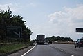
 GBRF 66 710 approaching A142 bridge Snailwell 4E33 Felixstowe-Doncaster Railport intermodal.jpg 1 988 × 2 847 ; 954 kio
-
 GBRF 66 710 passing Snailwell 4E33 Felixstowe-Doncaster Railport intermodal.jpg 2 336 × 3 504 ; 873 kio
-
 A dot on the horizon - geograph.org.uk - 2668193.jpg 4 320 × 3 240 ; 5,75 Mio
-
 A11 joins the A14 - geograph.org.uk - 1960637.jpg 640 × 309 ; 61 kio
-
 A11 joins the A14 - geograph.org.uk - 2589257.jpg 640 × 367 ; 57 kio
-
 A1304 towards Thetford - geograph.org.uk - 4871952.jpg 640 × 480 ; 55 kio
-
 A14 - geograph.org.uk - 5769858.jpg 640 × 401 ; 53 kio
-
 A14 - geograph.org.uk - 5769861.jpg 640 × 426 ; 40 kio
-
 A14 Newmarket bypass approaching junction 37 - geograph.org.uk - 1960682.jpg 640 × 430 ; 127 kio
-
 A14 Newmarket Road, Snailwell - geograph.org.uk - 4808649.jpg 1 456 × 1 718 ; 817 kio
-
 A14, footbridge - geograph.org.uk - 3345810.jpg 640 × 430 ; 41 kio
-
 A14, Newmarket bypass - geograph.org.uk - 3774620.jpg 640 × 430 ; 45 kio
-
 A14, Newmarket bypass - geograph.org.uk - 3774621.jpg 640 × 394 ; 44 kio
-
 A14, Newmarket Bypass - geograph.org.uk - 4131192.jpg 640 × 392 ; 39 kio
-
 A14, westbound - geograph.org.uk - 4131188.jpg 640 × 430 ; 46 kio
-
 Bridge on Snailwell Road - geograph.org.uk - 6295794.jpg 4 000 × 3 000 ; 3,49 Mio
-
 Bridleway to Snailwell - geograph.org.uk - 2574656.jpg 1 600 × 1 200 ; 720 kio
-
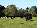 Cattle in Snailwell, Newmarket - geograph.org.uk - 2655600.jpg 4 320 × 3 240 ; 5,74 Mio
-
 Chamossaire's Statue, 1987 - geograph.org.uk - 5011202.jpg 898 × 625 ; 109 kio
-
 Chippenham Junction - geograph.org.uk - 1111794.jpg 640 × 480 ; 102 kio
-
 Chippenham Junction near Newmarket - geograph.org.uk - 2668302.jpg 4 320 × 3 240 ; 5,88 Mio
-
 Chippenham Junction Signal Box - geograph.org.uk - 5180082.jpg 620 × 640 ; 88 kio
-
 Chippenham Road - geograph.org.uk - 4854597.jpg 640 × 480 ; 91 kio
-
 Chippenham Road - geograph.org.uk - 5111543.jpg 1 600 × 1 200 ; 1,07 Mio
-
 Chippenham Road heading to Snailwell near Newmarket - geograph.org.uk - 2655605.jpg 4 320 × 3 240 ; 5,37 Mio
-
 Church Farm, Snailwell - geograph.org.uk - 1067282.jpg 640 × 427 ; 111 kio
-
 Church Farmhouse and Tithe Barn, Snailwell - geograph.org.uk - 3099971.jpg 4 320 × 3 240 ; 5,67 Mio
-
 Church Lane, Snailwell - geograph.org.uk - 6295948.jpg 4 608 × 3 456 ; 3,94 Mio
-
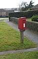
 Close up, Elizabeth II postbox on The Green, Snailwell - geograph.org.uk - 4855315.jpg 1 077 × 2 015 ; 592 kio
-
 Cottage in The Street, Snailwell - geograph.org.uk - 5962689.jpg 1 200 × 900 ; 282 kio
-
 Defibrillator at George ^ Dragon Public House - geograph.org.uk - 6295892.jpg 3 723 × 2 793 ; 2,9 Mio
-
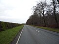
 Eastbound A14 near Snailwell - geograph.org.uk - 3843590.jpg 640 × 427 ; 247 kio
-
 Eastbound A14, Layby near Snailwell - geograph.org.uk - 3843582.jpg 640 × 427 ; 297 kio
-
 Elizabeth II postbox on The Green, Snailwell - geograph.org.uk - 4855311.jpg 1 000 × 1 560 ; 427 kio
-
 Entering Cambridgeshire - geograph.org.uk - 4871949.jpg 640 × 385 ; 43 kio
-
 Entering Snailwell - geograph.org.uk - 4854593.jpg 640 × 480 ; 83 kio
-
 Entering Snailwell - geograph.org.uk - 5598291.jpg 1 024 × 768 ; 1,02 Mio
-
 Entering Snailwell on Fordham Road - geograph.org.uk - 6295841.jpg 4 608 × 3 456 ; 3,75 Mio
-
 Entering Suffolk - geograph.org.uk - 4871953.jpg 640 × 480 ; 67 kio
-
 Entrance to the Jockey Club Estates - geograph.org.uk - 4871951.jpg 640 × 480 ; 67 kio
-
 Exercise track at Railway Field - geograph.org.uk - 1931563.jpg 427 × 640 ; 73 kio
-
 Exercise track north-east of Newmarket - geograph.org.uk - 1931581.jpg 640 × 427 ; 49 kio
-
 Exercise track, The Limekilns - geograph.org.uk - 4871961.jpg 640 × 480 ; 66 kio
-
 Farm track near Snailwell - geograph.org.uk - 1192844.jpg 427 × 640 ; 113 kio
-
 Farm track off Fordham Road - geograph.org.uk - 4854590.jpg 640 × 480 ; 76 kio
-
 Farmland by the A14 - geograph.org.uk - 3345813.jpg 640 × 430 ; 28 kio
-
 Farmland by the Newmarket Bypass - geograph.org.uk - 3774623.jpg 640 × 358 ; 25 kio
-
 Fibre-sand gallops over The Railway Field - geograph.org.uk - 2668273.jpg 4 320 × 3 240 ; 5,91 Mio
-
 Field by the railway - geograph.org.uk - 5111540.jpg 1 600 × 1 200 ; 1 002 kio
-
 Field entrance off Fordham Road - geograph.org.uk - 4854588.jpg 640 × 480 ; 95 kio
-
 Field margin near the A14 - geograph.org.uk - 1934587.jpg 427 × 640 ; 77 kio
-
 Footbridge over A14 - geograph.org.uk - 5978131.jpg 1 600 × 1 066 ; 605 kio
-
 Footbridge over the A14 - geograph.org.uk - 1932931.jpg 640 × 427 ; 71 kio
-
 Footbridge over the A14 - geograph.org.uk - 2718255.jpg 640 × 226 ; 34 kio
-
 Footbridge over the A14 - geograph.org.uk - 3819152.jpg 640 × 430 ; 47 kio
-
 Footbridge over the A14 near Snailworth - geograph.org.uk - 2589249.jpg 640 × 386 ; 52 kio
-
 Footbridge, A14 - geograph.org.uk - 3774622.jpg 640 × 430 ; 45 kio
-
 Footpath to Chippenham - geograph.org.uk - 1914097.jpg 427 × 640 ; 157 kio
-
 Footpath to Snailwell Church - geograph.org.uk - 1067274.jpg 427 × 640 ; 133 kio
-
 Footpath to Snailwell Church - geograph.org.uk - 1067277.jpg 427 × 640 ; 141 kio
-
 Fordham Road - geograph.org.uk - 4854589.jpg 640 × 480 ; 89 kio
-
 Fordham Road sign - geograph.org.uk - 6296157.jpg 3 897 × 2 923 ; 5,74 Mio
-
 Former airfield at Snailwell - geograph.org.uk - 1932949.jpg 640 × 427 ; 82 kio
-
 Former driveway to Chippenham Park - geograph.org.uk - 1934591.jpg 427 × 640 ; 99 kio
-
 Former runway at RAF Snailwell - geograph.org.uk - 1932953.jpg 640 × 427 ; 73 kio
-
 Gallops near Chippenham Junction - geograph.org.uk - 1931573.jpg 427 × 640 ; 66 kio
-
 George ^ Dragon Public House car park - geograph.org.uk - 6296166.jpg 4 608 × 3 456 ; 3,78 Mio
-
 George ^ Dragon Public House, Snailwell - geograph.org.uk - 6295872.jpg 4 608 × 3 456 ; 4,09 Mio
-
 Grazing off Chippenham Road - geograph.org.uk - 4854596.jpg 640 × 480 ; 41 kio
-
 Heading north east on Well Bottom (B1506) - geograph.org.uk - 4871960.jpg 640 × 480 ; 59 kio
-
 Hedge on the edge - geograph.org.uk - 2668184.jpg 4 320 × 3 240 ; 5,95 Mio
-
 House on The Street, Snailwell - geograph.org.uk - 4854594.jpg 640 × 480 ; 60 kio
-
 Icknield Way near Newmarket - geograph.org.uk - 1932934.jpg 427 × 640 ; 113 kio
-
 Icknield Way, near Snailwell - geograph.org.uk - 1934321.jpg 427 × 640 ; 97 kio
-
 In the tree belt near The Lodge, Newmarket - geograph.org.uk - 2668246.jpg 4 320 × 3 240 ; 5,84 Mio
-
 Industry in rural Cambridgeshire - 1981 - geograph.org.uk - 254850.jpg 640 × 431 ; 100 kio
-
 Infrared HDR St Peter's church Snailwell Cambridgeshire (2918585999).jpg 1 600 × 1 022 ; 291 kio
-
 Infrared HDR St Peter's church Snailwell Cambridgeshire (2920316570).jpg 3 905 × 2 601 ; 7,62 Mio
-
 Inside The Lodge gates, Newmarket - geograph.org.uk - 2668423.jpg 4 320 × 3 240 ; 5,85 Mio
-
 Joining the A14 - geograph.org.uk - 2716360.jpg 640 × 430 ; 56 kio
-
 Joining the Newmarket bypass - geograph.org.uk - 3819151.jpg 640 × 430 ; 40 kio
-
 Layby, A14 - geograph.org.uk - 3345809.jpg 640 × 430 ; 60 kio
-
 Line at Chippenham Junction - geograph.org.uk - 5769857.jpg 640 × 426 ; 82 kio
-
 Lower Yard Cottages, Newmarket Road - geograph.org.uk - 5598165.jpg 1 024 × 768 ; 984 kio
-
 Meadow and willows near Snailwell, Newmarket - geograph.org.uk - 4693923.jpg 4 320 × 3 240 ; 5,69 Mio
-
 Meadow by the River Snail - geograph.org.uk - 1913657.jpg 640 × 427 ; 73 kio
-
 Near Chippenham Junction - geograph.org.uk - 5769855.jpg 640 × 426 ; 42 kio
-
 Old Milepost - geograph.org.uk - 2807441.jpg 1 024 × 768 ; 226 kio
-
 Old Milestone - geograph.org.uk - 2807435.jpg 768 × 1 024 ; 311 kio
-
 Ordnance Survey Cut Mark - geograph.org.uk - 4275551.jpg 4 000 × 3 000 ; 4,41 Mio
-
 Ordnance Survey Flush Bracket 1368 - geograph.org.uk - 4275529.jpg 4 000 × 3 000 ; 3,88 Mio
-
 Paddocks near Snailwell - geograph.org.uk - 1934323.jpg 640 × 427 ; 82 kio
-
 Path off Well Bottom (B1506) - geograph.org.uk - 4871958.jpg 640 × 480 ; 109 kio
-
 Racehorses crossing please give way - geograph.org.uk - 2668214.jpg 4 320 × 3 240 ; 5,81 Mio
-
 Railway to Bury St Edmunds - geograph.org.uk - 2627669.jpg 1 600 × 1 200 ; 721 kio
-
 Red Admiral on The Icknield Way - geograph.org.uk - 3100458.jpg 2 880 × 2 296 ; 2,05 Mio
-
 Sheep grazing - geograph.org.uk - 5766180.jpg 640 × 426 ; 38 kio
-
 Sign for the George and Dragon, Snailwell - geograph.org.uk - 4854592.jpg 1 031 × 1 542 ; 414 kio
-
 Site of Chamossaire's statue - geograph.org.uk - 5011168.jpg 3 264 × 2 448 ; 2,46 Mio
-
 Snailwell Church reflected - geograph.org.uk - 5598268.jpg 768 × 1 024 ; 1,25 Mio
-
 Snailwell Gallops from the higher ground - geograph.org.uk - 3100441.jpg 4 320 × 3 240 ; 5,31 Mio
-
 Snailwell gallops near Newmarket - (1 of 3) - geograph.org.uk - 2674263.jpg 4 320 × 3 240 ; 5,74 Mio
-
 Snailwell gallops near Newmarket - (2 of 3) - geograph.org.uk - 2674271.jpg 4 320 × 3 240 ; 5,44 Mio
-
 Snailwell gallops near Newmarket - (3 of 3) - geograph.org.uk - 2674287.jpg 4 320 × 3 240 ; 5,34 Mio
-
 Snailwell gallops, Newmarket Road - geograph.org.uk - 2655611.jpg 4 320 × 3 240 ; 5,53 Mio
-
 Snailwell in autumn - geograph.org.uk - 5598277.jpg 1 024 × 768 ; 1,27 Mio
-
 Snailwell St. Peter's church - geograph.org.uk - 5461132.jpg 3 456 × 2 592 ; 3,83 Mio
-
 Snailwell Village Name sign on Fordham Road - geograph.org.uk - 6295846.jpg 4 000 × 3 000 ; 4,28 Mio
-
 Snailwell Village Sign - geograph.org.uk - 5962703.jpg 1 200 × 900 ; 325 kio
-
 Snailwell War Memorial - geograph.org.uk - 5461142.jpg 2 520 × 3 315 ; 2,28 Mio
-
 Snailwell, Church Lane - geograph.org.uk - 5598259.jpg 1 024 × 768 ; 1,15 Mio
-
 Snailwell, St Peter - geograph.org.uk - 5598195.jpg 1 024 × 732 ; 942 kio
-
 Snailwell, The Green - geograph.org.uk - 5598284.jpg 1 024 × 768 ; 1,28 Mio
-
 Snailwell, The Street - geograph.org.uk - 5598172.jpg 1 024 × 819 ; 921 kio
-
 Snailwell, Tithe Barn - geograph.org.uk - 5598178.jpg 1 024 × 1 024 ; 1,01 Mio
-
 St Peter, Snailwell - Benefactions board - geograph.org.uk - 4374137.jpg 692 × 1 000 ; 238 kio
-
 St Peter, Snailwell - Chancel - geograph.org.uk - 4374054.jpg 1 000 × 667 ; 236 kio
-
 St Peter, Snailwell - Corbel - geograph.org.uk - 4374134.jpg 1 000 × 667 ; 206 kio
-
 St Peter, Snailwell - Corbel - geograph.org.uk - 4374135.jpg 1 000 × 667 ; 257 kio
-
 St Peter, Snailwell - East end - geograph.org.uk - 4374047.jpg 1 000 × 685 ; 238 kio
-
 St Peter, Snailwell - Font - geograph.org.uk - 4374126.jpg 653 × 1 000 ; 217 kio
-
 St Peter, Snailwell - geograph.org.uk - 4374044.jpg 1 000 × 666 ; 257 kio
-
 St Peter, Snailwell - geograph.org.uk - 4374045.jpg 1 000 × 562 ; 262 kio
-
 St Peter, Snailwell - Label head - geograph.org.uk - 4374121.jpg 573 × 1 000 ; 122 kio
-
 St Peter, Snailwell - Label head - geograph.org.uk - 4374125.jpg 667 × 1 000 ; 126 kio
-
 St Peter, Snailwell - North arcade - geograph.org.uk - 4374051.jpg 1 000 × 667 ; 221 kio
-
 St Peter, Snailwell - Organ - geograph.org.uk - 4374055.jpg 567 × 1 000 ; 187 kio
-
 St Peter, Snailwell - Pews - geograph.org.uk - 4374123.jpg 1 000 × 779 ; 254 kio
-
 St Peter, Snailwell - Pulpit - geograph.org.uk - 4374052.jpg 1 000 × 685 ; 262 kio
-
 St Peter, Snailwell - Sanctuary - geograph.org.uk - 4374058.jpg 1 000 × 660 ; 229 kio
-
 St Peter, Snailwell - Stained glass window - geograph.org.uk - 4374059.jpg 773 × 1 000 ; 429 kio
-
 St Peter, Snailwell - Stained glass window - geograph.org.uk - 4374062.jpg 819 × 1 000 ; 470 kio
-
 St Peter, Snailwell - Stained glass window - geograph.org.uk - 4374063.jpg 646 × 1 000 ; 434 kio
-
 St Peter, Snailwell - Stained glass window - geograph.org.uk - 4374065.jpg 624 × 1 000 ; 407 kio
-
 St Peter, Snailwell - Stained glass window - geograph.org.uk - 4374070.jpg 599 × 1 000 ; 384 kio
-
 St Peter, Snailwell - Stained glass window - geograph.org.uk - 4374076.jpg 637 × 1 000 ; 433 kio
-
 St Peter, Snailwell - Stained glass window - geograph.org.uk - 4374077.jpg 527 × 1 000 ; 384 kio
-
 St Peter, Snailwell - Wall monument - geograph.org.uk - 4374129.jpg 623 × 1 000 ; 203 kio
-
 St Peter, Snailwell - Wall monument - geograph.org.uk - 4374131.jpg 563 × 1 000 ; 173 kio
-
 St. Peter's Church Notice Board - geograph.org.uk - 6295931.jpg 3 456 × 4 608 ; 3,67 Mio
-
 St. Peter's Church, Snailwell - geograph.org.uk - 6295904.jpg 4 608 × 3 456 ; 3,89 Mio
-
 St. Peter's Church, Snailwell - geograph.org.uk - 6295914.jpg 4 608 × 3 456 ; 3,86 Mio
-
 Stable Managers' Houses at HFL - geograph.org.uk - 637979.jpg 1 963 × 1 472 ; 1 019 kio
-
 Stud field off Chippenham Road - geograph.org.uk - 5111542.jpg 1 600 × 1 200 ; 920 kio
-
 The A14 - geograph.org.uk - 2718263.jpg 640 × 430 ; 54 kio
-
 The A14 - geograph.org.uk - 3345807.jpg 640 × 430 ; 48 kio
-
 The Church of St Peter at Snailwell - geograph.org.uk - 4207054.jpg 4 000 × 3 000 ; 2,51 Mio
-
 The George and Dragon, Snailwell - geograph.org.uk - 4854591.jpg 640 × 480 ; 65 kio
-
 The Green - geograph.org.uk - 2065476.jpg 1 024 × 768 ; 246 kio
-
 The Limekilns training ground - geograph.org.uk - 1931523.jpg 640 × 427 ; 67 kio
-
 The Limekilns training ground - geograph.org.uk - 4871957.jpg 640 × 480 ; 50 kio
-

-
 The Old Rectory in Snailwell Geograph-3099924-by-Richard-Humphrey.jpg 4 320 × 3 240 ; 5,59 Mio
-
 The Railway Field - geograph.org.uk - 5987174.jpg 4 032 × 3 024 ; 2,92 Mio
-
 The Street sign - geograph.org.uk - 6296159.jpg 3 948 × 2 961 ; 4,45 Mio
-
 The Street, Snailwell - geograph.org.uk - 6295952.jpg 4 000 × 2 972 ; 3,97 Mio
-
 The Street, Snailwell - geograph.org.uk - 6295955.jpg 4 608 × 3 456 ; 4,06 Mio
-
 Towards Snailwell - geograph.org.uk - 5598305.jpg 1 024 × 768 ; 1,4 Mio
-
 Track beside the A1304 - geograph.org.uk - 4871950.jpg 640 × 480 ; 63 kio
-
 Track leading to Chippenham Park - geograph.org.uk - 1934334.jpg 640 × 427 ; 77 kio
-
 Training gallops near Snailwell - geograph.org.uk - 1932918.jpg 640 × 427 ; 75 kio
-
 Training gallops near Snailwell - geograph.org.uk - 1932925.jpg 640 × 427 ; 63 kio
-
 Training gallops near Snailwell - geograph.org.uk - 1934327.jpg 427 × 640 ; 61 kio
-
 Trees beside gallops, The Limekilns - geograph.org.uk - 5180087.jpg 640 × 387 ; 50 kio
-
 Trees lining railway - geograph.org.uk - 1273934.jpg 640 × 427 ; 76 kio
-
 Variable Message Sign, Eastbound A14 - geograph.org.uk - 3843585.jpg 640 × 480 ; 255 kio
-

-
 Well Bottom (B1506) - geograph.org.uk - 4871955.jpg 640 × 480 ; 55 kio
-
 Westbound A14 - geograph.org.uk - 5798251.jpg 1 024 × 684 ; 192 kio
-
 Westbound A14 - geograph.org.uk - 5798254.jpg 1 024 × 684 ; 199 kio
-
 Westbound A14 at Waterhall Junction - geograph.org.uk - 3874535.jpg 640 × 480 ; 238 kio
-
 What a Works - geograph.org.uk - 71462.jpg 640 × 480 ; 117 kio
-
 Woodland beside Well Bottom (B1506) - geograph.org.uk - 4871954.jpg 640 × 480 ; 94 kio
-
 Gallop Into the Sunset - geograph.org.uk - 61687.jpg 640 × 480 ; 70 kio
-
 Highway Boundary - geograph.org.uk - 61714.jpg 640 × 480 ; 120 kio
-
 Reflections on a field - geograph.org.uk - 62878.jpg 640 × 480 ; 97 kio
-
 River Snail - geograph.org.uk - 62888.jpg 640 × 480 ; 112 kio
-
 Snailwell Junction - geograph.org.uk - 71452.jpg 640 × 480 ; 83 kio
-
 Stud Country - geograph.org.uk - 71457.jpg 640 × 480 ; 70 kio
-
 Studland Prairie - geograph.org.uk - 71459.jpg 640 × 480 ; 84 kio
-
 Terrific Tractors - geograph.org.uk - 71465.jpg 640 × 480 ; 67 kio


_-_geograph.org.uk_-_4871960.jpg)


.jpg)
.jpg)


_-_geograph.org.uk_-_4871958.jpg)


_-_geograph.org.uk_-_2674263.jpg)
_-_geograph.org.uk_-_2674271.jpg)
_-_geograph.org.uk_-_2674287.jpg)


_-_geograph.org.uk_-_4871955.jpg)


_-_geograph.org.uk_-_4871954.jpg)


