Category:Snaith
Vai alla navigazione
Vai alla ricerca
town in Yorkshire, England  Eglwys Sant Lawrens, Snaith | |||||
| Carica un file multimediale | |||||
| Istanza di | |||||
|---|---|---|---|---|---|
| Luogo | Snaith and Cowick, East Riding of Yorkshire, Yorkshire e Humber, Inghilterra | ||||
 | |||||
English: Snaith is a town in the East Riding of Yorkshire local government area of England. It is situated approximately 6 miles (9.7 km) west of Goole on the A1041 road at its junction with the A645 road. It lies 1 mile (1.6 km) to the north of the M62 motorway and just south of the River Aire.
Sottocategorie
Questa categoria contiene le 4 sottocategorie indicate di seguito, su un totale di 4.
File nella categoria "Snaith"
Questa categoria contiene 54 file, indicati di seguito, su un totale di 54.
-

-

-
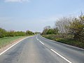 A645 towards Snaith - geograph.org.uk - 1265994.jpg 640 × 480; 56 KB
-
 A645, Snaith, heading south west - geograph.org.uk - 2275765.jpg 1 600 × 1 200; 457 KB
-
 Beast Fair, Snaith - geograph.org.uk - 2063791.jpg 1 024 × 768; 209 KB
-
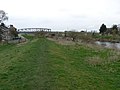 Bridges Old and New - geograph.org.uk - 1198439.jpg 640 × 480; 68 KB
-
 Butter Market, Snaith - geograph.org.uk - 2052346.jpg 1 024 × 768; 207 KB
-
 Carr Lane - geograph.org.uk - 370417.jpg 640 × 433; 99 KB
-
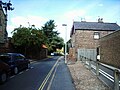
 Church Lane, Snaith - geograph.org.uk - 2048518.jpg 1 024 × 768; 229 KB
-
 Church Lane, Snaith - geograph.org.uk - 2048541.jpg 1 024 × 768; 153 KB
-
 Dorr Lane Level Crossing - geograph.org.uk - 1427363.jpg 640 × 480; 107 KB
-
 Ferry Lane - geograph.org.uk - 664015.jpg 640 × 480; 295 KB
-
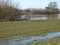
 Flow of Aire - geograph.org.uk - 663704.jpg 640 × 480; 262 KB
-
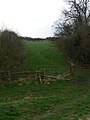 Footpath to Snaith - geograph.org.uk - 1199751.jpg 480 × 640; 74 KB
-
 Gowdall to Snaith railway - geograph.org.uk - 317998.jpg 640 × 480; 97 KB
-

-
 High Street, Snaith - geograph.org.uk - 2048495.jpg 1 024 × 768; 227 KB
-
 High Street, Snaith - geograph.org.uk - 2048510.jpg 1 024 × 768; 212 KB
-
 High Street, Snaith - geograph.org.uk - 2048552.jpg 1 024 × 768; 210 KB
-
 High Street, Snaith - geograph.org.uk - 2063862.jpg 1 024 × 768; 181 KB
-
 Methodist Church Snaith.jpg 432 × 298; 18 KB
-
 Mill Lane, Snaith - geograph.org.uk - 2052457.jpg 1 024 × 768; 165 KB
-
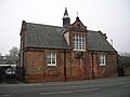 Old School. Snaith - geograph.org.uk - 2275762.jpg 1 600 × 1 200; 297 KB
-
 Pedestrian barrier alongside the A645 Snaith - geograph.org.uk - 4231072.jpg 768 × 1 024; 281 KB
-
 Piers of an earlier Bridge - geograph.org.uk - 1198405.jpg 640 × 480; 70 KB
-
 Plough Inn, Snaith - geograph.org.uk - 4567995.jpg 3 072 × 1 728; 1,3 MB
-

-
 Pumping Station and Sluice - geograph.org.uk - 1199715.jpg 480 × 640; 98 KB
-

-
 River Aire and Embankment - geograph.org.uk - 1199697.jpg 640 × 480; 73 KB
-
 River Aire, Carlton Marsh - geograph.org.uk - 1735643.jpg 640 × 480; 101 KB
-
 Selby Road, Snaith - geograph.org.uk - 2052468.jpg 1 024 × 768; 161 KB
-
 Snaith - fire station - geograph.org.uk - 4028306.jpg 640 × 480; 64 KB
-
 Snaith Brewery - geograph.org.uk - 242929.jpg 640 × 480; 139 KB
-
 Snaith fire station - geograph.org.uk - 1394108.jpg 640 × 427; 194 KB
-
 Snaith Grammar School - geograph.org.uk - 2048598.jpg 1 024 × 768; 223 KB
-
 Snaith Grammar School - geograph.org.uk - 4551809.jpg 800 × 533; 113 KB
-
 Snaith Hall, Pontefract Road - geograph.org.uk - 2052578.jpg 1 024 × 768; 225 KB
-
 Snaith Methodist Church - geograph.org.uk - 2395021.jpg 800 × 600; 296 KB
-
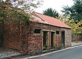
 Snaith Town Lock-Up - geograph.org.uk - 134615.jpg 640 × 427; 138 KB
-
 Snaith Town Lock-up - geograph.org.uk - 584583.jpg 640 × 466; 133 KB
-
 Snaith, Old Grammar School - geograph.org.uk - 242953.jpg 640 × 480; 122 KB
-

-
 Snaith, South Parkway - geograph.org.uk - 189704.jpg 640 × 480; 130 KB
-
 Snaiths Four Piers - geograph.org.uk - 1198420.jpg 480 × 640; 84 KB
-
 Specials board.jpg 4 118 × 3 347; 3,25 MB
-
 Storage yard at Snaith - geograph.org.uk - 1427374.jpg 640 × 480; 68 KB
-
 The Black Lion, Selby Road, Snaith - geograph.org.uk - 2052514.jpg 1 024 × 768; 178 KB
-
 The Black Lion, Selby Road, Snaith - geograph.org.uk - 2063885.jpg 1 024 × 768; 159 KB
-
 The Brewers Arms, Pontefract Road, Snaith - geograph.org.uk - 2052611.jpg 1 024 × 768; 218 KB
-
 The Fire Station, Snaith - geograph.org.uk - 2726235.jpg 1 024 × 768; 124 KB
-
 The River Aire at the former toll bridge Snaith - geograph.org.uk - 4258445.jpg 1 024 × 768; 158 KB
-
 The Snaith School (geograph 4231567).jpg 1 024 × 768; 159 KB
-
 The south side of Snaith High Street - geograph.org.uk - 2726221.jpg 1 024 × 768; 132 KB
.jpg)


.jpg)

_Edited_by_E._G._Ravenstein_..._Illustrated,_etc%27_(11188114994).jpg)