Category:Snake Pass
Zur Navigation springen
Zur Suche springen

Gebirgspass im Vereinigten Königreich  | |||||
| Medium hochladen | |||||
| Ist ein(e) | |||||
|---|---|---|---|---|---|
| Ort | Derbyshire, East Midlands, England | ||||
| Überführt | |||||
| Gebirgszug | |||||
| Höhe über dem Meeresspiegel |
| ||||
| Verschieden von | |||||
 | |||||
Unterkategorien
Diese Kategorie enthält folgende Unterkategorie:
In Klammern die Anzahl der enthaltenen Kategorien (K), Seiten (S), Dateien (D)
L
- Lady Clough (15 D)
Medien in der Kategorie „Snake Pass“
Folgende 59 Dateien sind in dieser Kategorie, von 59 insgesamt.
-
 "The Snake Pass Inn" February 2012 - geograph.org.uk - 2789590.jpg 2.608 × 1.952; 1,32 MB
-
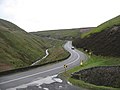
 A57 - A dangerous road - geograph.org.uk - 616076.jpg 640 × 415; 53 KB
-
 A57 Snake Road - geograph.org.uk - 959297.jpg 640 × 480; 135 KB
-

-
 Aqueduct near Rowlee Bridge - geograph.org.uk - 1047809.jpg 640 × 480; 118 KB
-
 Ashop Valley - geograph.org.uk - 217995.jpg 640 × 480; 146 KB
-
 Bar of Snake Pass Inn - geograph.org.uk - 3576943.jpg 640 × 480; 82 KB
-
 Blackden Moor - geograph.org.uk - 67442.jpg 640 × 441; 60 KB
-
 Blackley Hey - geograph.org.uk - 67434.jpg 640 × 480; 60 KB
-
 Dean Hill from Blackden Edge - geograph.org.uk - 218064.jpg 640 × 480; 153 KB
-
 Fairbrook Naze - geograph.org.uk - 80978.jpg 640 × 480; 129 KB
-
 Featherbed Moss from Holden Clough - geograph.org.uk - 698719.jpg 640 × 480; 42 KB
-

-
 GlossopSnakePass6273.JPG 2.048 × 1.536; 757 KB
-
 GlossopSnakePass6275.JPG 2.048 × 1.536; 733 KB
-
 Holden Clough and the Snake Road - geograph.org.uk - 214874.jpg 640 × 480; 117 KB
-
-
 Lordship Hill - geograph.org.uk - 67840.jpg 640 × 480; 47 KB
-
 Mist over Kinder - geograph.org.uk - 323577.jpg 640 × 480; 95 KB
-
 On The Pennine Way - geograph.org.uk - 4887932.jpg 4.608 × 3.072; 3,18 MB
-
 Oops too late! - geograph.org.uk - 559754.jpg 640 × 428; 108 KB
-
 Packhorse trail - geograph.org.uk - 451336.jpg 480 × 640; 104 KB
-
 Peak District 9955.jpeg 2.048 × 1.536; 889 KB
-
 Peat moorland, England (9214).jpg 4.841 × 3.080; 11,67 MB
-
 Pennine Way at A57 Snake Pass summit - geograph.org.uk - 22692.jpg 640 × 480; 86 KB
-
 Pennine Way at Snake Pass - geograph.org.uk - 4042745.jpg 2.048 × 1.536; 1,56 MB
-
 Pennine Way at the Snake Pass - geograph.org.uk - 2525950.jpg 427 × 640; 255 KB
-
 Pennine Way near Snake Pass - geograph.org.uk - 3856250.jpg 4.000 × 3.000; 2,88 MB
-
 Remains of Elmin Pits Farm - geograph.org.uk - 474289.jpg 640 × 480; 144 KB
-
 Rough Bank - geograph.org.uk - 393367.jpg 640 × 427; 114 KB
-
 Seal Edge - geograph.org.uk - 198248.jpg 640 × 480; 118 KB
-
 Shooting Cabin on Oyster Clough - geograph.org.uk - 197443.jpg 640 × 480; 118 KB
-
 Snake Pass - Derbyshire - geograph.org.uk - 189185.jpg 640 × 403; 65 KB
-
 Snake Pass - geograph.org.uk - 431557.jpg 640 × 480; 70 KB
-
 Snake Pass - panoramio.jpg 2.048 × 1.536; 1,79 MB
-
 Snake Pass Inn - geograph.org.uk - 5577.jpg 640 × 420; 71 KB
-
 Snake Pass retaining wall repairs.JPG 3.840 × 2.160; 5,24 MB
-
 Snake Pass Summit - geograph.org.uk - 2511566.jpg 1.024 × 768; 129 KB
-
 Snake Pass Summit - geograph.org.uk - 997351.jpg 640 × 480; 64 KB
-
 Snake Pass, chevron on a tight bend - geograph.org.uk - 2393654.jpg 480 × 640; 98 KB
-

-
 Snake Pass, Ramsley Clough - geograph.org.uk - 2393636.jpg 640 × 480; 87 KB
-

-

-
 Snake Road, Derbyshire - geograph.org.uk - 33798.jpg 640 × 460; 99 KB
-
 Snake-Pass-accident-blackspots-red 01.jpg 3.224 × 2.421; 3,37 MB
-
 Snake-Pass-accident-blackspots-red 02.png 3.224 × 2.421; 9,37 MB
-
 Snake-Pass-accident-blackspots.jpg 3.413 × 2.421; 3,54 MB
-
 Snake-Pass-accident-blackspots.png 1.501 × 1.065; 3,32 MB
-
 SnakePass6276.JPG 2.048 × 1.536; 743 KB
-
 SnakePass6277.JPG 2.048 × 1.536; 744 KB
-
 SnakePass6279.JPG 2.048 × 1.536; 749 KB
-
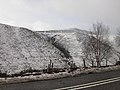 Snow on Wood Moor - geograph.org.uk - 323555.jpg 640 × 480; 127 KB
-
 The Pennine Way approaching the Snake Pass - geograph.org.uk - 1750007.jpg 2.272 × 1.712; 911 KB
-
 The Pennine Way at the Snake Summit - geograph.org.uk - 481664.jpg 640 × 480; 95 KB
-
 The snake pass at twilight - geograph.org.uk - 613550.jpg 478 × 640; 107 KB
-
 The woods alongside the A57 Snake Pass - geograph.org.uk - 1558393.jpg 640 × 480; 134 KB
-
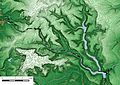
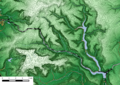
 Winding river in valley between Bleaklow and Snake Pass, 180 pano - panoramio.jpg 16.843 × 3.462; 13,41 MB
-
 Pennine Way at A57 Summit - geograph.org.uk - 445721.jpg 640 × 480; 80 KB


.jpg)


