Category:Snape, North Yorkshire
Aller à la navigation
Aller à la recherche
village britannique  | |||||
| Téléverser des médias | |||||
| Nature de l’élément | |||||
|---|---|---|---|---|---|
| Lieu | Snape with Thorp, Hambleton, Yorkshire du Nord, Yorkshire-et-Humber, Angleterre | ||||
 | |||||
English: Snape is a large village in the Hambleton district of North Yorkshire, England, located about 3 miles (5 km) south of Bedale and 3 miles west of the A1, it has a population of 350. Nearby is Thorp Perrow Arboretum.
Sous-catégories
Cette catégorie comprend 2 sous-catégories, dont les 2 ci-dessous.
S
- Snape Castle (13 F)
Média dans la catégorie « Snape, North Yorkshire »
Cette catégorie comprend 30 fichiers, dont les 30 ci-dessous.
-
 "The Belt", Snape, Yorkshire - geograph.org.uk - 274520.jpg 640 × 480 ; 74 kio
-
 Autumn morning, Snape - geograph.org.uk - 3225516.jpg 640 × 452 ; 178 kio
-
 Barn at Snape - geograph.org.uk - 892738.jpg 640 × 380 ; 84 kio
-
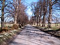
 Country Lane near Snape - geograph.org.uk - 1734764.jpg 2 448 × 3 264 ; 2,53 Mio
-
 Cross and Castle at Snape - geograph.org.uk - 330997.jpg 640 × 480 ; 76 kio
-
 Farmland near Snape - geograph.org.uk - 1734747.jpg 3 162 × 1 632 ; 1,12 Mio
-
 Ings Lane, Snape - geograph.org.uk - 2394435.jpg 2 188 × 2 177 ; 1,11 Mio
-
 Lime avenue, Snape - geograph.org.uk - 1734778.jpg 3 264 × 2 448 ; 3,5 Mio
-
 Memorial to Lady Augusta Milbank in Snape - geograph.org.uk - 4088001.jpg 3 456 × 4 608 ; 3,27 Mio
-
 Mires Lane east of Snape - geograph.org.uk - 3510174.jpg 1 632 × 1 224 ; 479 kio
-
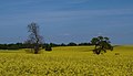 Rapeseed crop, Snape - geograph.org.uk - 2396126.jpg 2 845 × 1 632 ; 1,03 Mio
-
 Salmon Lane entering Snape - geograph.org.uk - 3510175.jpg 1 632 × 1 224 ; 748 kio
-
 Snape Dovcote - geograph.org.uk - 892168.jpg 640 × 427 ; 100 kio
-
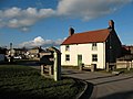
 Snape Millennium Stone (detail) - geograph.org.uk - 3225518.jpg 640 × 425 ; 225 kio
-
 Snape Millennium Stone - geograph.org.uk - 3225512.jpg 640 × 425 ; 235 kio
-
 Snape sheep - geograph.org.uk - 2308625.jpg 1 024 × 768 ; 107 kio
-
 Snape village green - geograph.org.uk - 3223279.jpg 640 × 429 ; 193 kio
-
 Snape Village Institute - geograph.org.uk - 3223276.jpg 640 × 445 ; 208 kio
-

-
 The Avenue, Snape - geograph.org.uk - 2308621.jpg 1 024 × 768 ; 179 kio
-
 Well Lane, Snape - geograph.org.uk - 2396132.jpg 3 264 × 2 448 ; 1,76 Mio
-
 Winter afternoon, Snape - geograph.org.uk - 330993.jpg 480 × 640 ; 96 kio
-
 Castle Arms, Snape - geograph.org.uk - 249619.jpg 640 × 480 ; 108 kio
-
 Country Lane near Snape - geograph.org.uk - 249427.jpg 640 × 480 ; 90 kio
-
 Mosaic Bridge, Snape. - geograph.org.uk - 330995.jpg 480 × 640 ; 138 kio
-
 Old pump, Snape village. - geograph.org.uk - 330992.jpg 640 × 480 ; 74 kio
-
 Salmon Lane near Snape - geograph.org.uk - 330991.jpg 480 × 640 ; 130 kio
-
 Snape Mires from Salmon Lane - geograph.org.uk - 330990.jpg 640 × 480 ; 65 kio
-
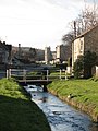
 The Beck, Snape - geograph.org.uk - 125000.jpg 392 × 554 ; 48 kio
-
 Track near Thorp Perrow - geograph.org.uk - 250180.jpg 640 × 480 ; 91 kio


_-_geograph.org.uk_-_3225518.jpg)


