Category:Solukhumbu District
Zur Navigation springen
Zur Suche springen
Distrikt in Nepal   | |||||
| Medium hochladen | |||||
| Aussprache (Audiodatei) | |||||
|---|---|---|---|---|---|
| Ist ein(e) | |||||
| Ort | Provinz Koshi, Nepal | ||||
| Höchster Punkt | |||||
| Einwohnerzahl |
| ||||
| Fläche |
| ||||
| offizielle Website | |||||
 | |||||
Unterkategorien
Es werden 37 von insgesamt 37 Unterkategorien in dieser Kategorie angezeigt:
In Klammern die Anzahl der enthaltenen Kategorien (K), Seiten (S), Dateien (D)
*
- Maps of Solukhumbu District (8 D)
B
- Bupsa, Nepal (8 D)
C
- Cho La pass (55 D)
- Cho La Tsho (12 D)
D
G
I
- Imja Khola (17 D)
- Imja Tsho (7 D)
J
- Junbesi (3 D)
K
M
- Malanphulan (8 D)
- Mera Pass (6 D)
- Mera Peak (1 S, 210 D)
N
P
- Phaplu Airport (11 D)
R
- Renjo La (6 D)
S
- Shartse (9 D)
T
- Taksindu (20 D)
- Tapting (1 D)
- Thule Karka (2 D)
Medien in der Kategorie „Solukhumbu District“
Folgende 200 Dateien sind in dieser Kategorie, von 243 insgesamt.
(vorherige Seite) (nächste Seite)-
 Divisions of Solukhumbu.png 2.151 × 2.560; 827 KB
-
 Solukhumbu District in Nepal 2015.svg 1.100 × 721; 812 KB
-
 Solukhumbu district locator map.png 661 × 650; 143 KB
-
Solukhumbu.ogg 1,6 s; 87 KB
-
 12th Day. The last view of the Sibuje. November 2013. - panoramio.jpg 1.936 × 1.296; 858 KB
-
 13th Day of the hike. Taksindu Sherpa Buddhist Monastery. - panoramio.jpg 1.936 × 1.296; 1,25 MB
-
 14th Day of the hike. So looks Junbesi in the morning. - panoramio.jpg 1.936 × 1.296; 1,07 MB
-
 22SR DS19 Nepal.jpg 4.032 × 3.024; 2,27 MB
-

-
 A view to the pass Lamjura La from the valley Junbesi. - panoramio.jpg 1.936 × 1.296; 1,19 MB
-
 Amazing Nepal.jpg 5.472 × 3.648; 7,96 MB
-
 Amphu Lapsta pass, Everest-Lhotse-Cho Polu-Baruntse - panoramio.jpg 1.800 × 1.196; 843 KB
-
 Amphu Lapsta pass-Mt.Barunse-West Col-Mt.Chamlang - panoramio.jpg 1.800 × 1.196; 547 KB
-
 Baruntse-Makalu - panoramio.jpg 1.800 × 1.196; 640 KB
-
 Beautiful Ama Dablam Himal.jpg 2.304 × 1.536; 1,79 MB
-
 Bhote Koshi Valley, Trail, Nepal.jpg 4.032 × 2.688; 9,76 MB
-
 Bhote Koshi.JPG 3.872 × 2.592; 3,94 MB
-

-

-
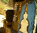
 Buddhist mantras carved into stones on the trail to Khumbu Nepal - panoramio.jpg 1.536 × 1.024; 801 KB
-
 Buddhist mantras painted on stones on the trail to Khumbu Nepal - panoramio (1).jpg 1.024 × 1.536; 516 KB
-
 Buddhist mantras painted on stones on the trail to Khumbu Nepal - panoramio (2).jpg 1.024 × 1.078; 606 KB
-
 Buddhist mantras painted on stones on the trail to Khumbu Nepal - panoramio (3).jpg 1.140 × 1.024; 522 KB
-
 Buddhist mantras painted on stones on the trail to Khumbu Nepal - panoramio (4).jpg 1.176 × 1.024; 687 KB
-
 Buddhist mantras painted on stones on the trail to Khumbu Nepal - panoramio (5).jpg 1.536 × 1.024; 586 KB
-
 Buddhist Monastry at Kerung, Solukhumbu.jpg 1.080 × 565; 135 KB
-
 Chhanga (Nepal).jpg 763 × 613; 79 KB
-
 Chhimbu Primary School supported by Himalayan Project Denmark. - panoramio.jpg 1.936 × 1.296; 1.015 KB
-
 CHUTANG - 3530m. GPS. - panoramio.jpg 1.936 × 1.296; 995 KB
-
 Coniferous forest on the southern slope of the valley. - panoramio.jpg 1.936 × 1.296; 998 KB
-
 Cross (235270319).jpeg 2.048 × 1.365; 783 KB
-
 Desert Mountains (Unsplash).jpg 5.472 × 3.648; 5,72 MB
-
 DudhKosi2WoodenBridge.jpg 2.065 × 1.160; 805 KB
-
 DudhKosiSuspensionBridge1.jpg 1.585 × 1.738; 1,11 MB
-
 DudhKosiSuspensionBridge2.jpg 1.600 × 1.881; 852 KB
-
 Dudhkund Lake.jpg 2.400 × 1.600; 1,8 MB
-
 Dudhkund Mountain.jpg 2.400 × 1.600; 2,65 MB
-
 End of the 12th Day. Nunthala. Overnight in the Loggia. - panoramio.jpg 1.936 × 1.296; 1,28 MB
-
 Everest Trek Pic.jpg 4.032 × 3.024; 3,73 MB
-
 Fields above 3500m (16697352552).jpg 2.000 × 1.250; 2,94 MB
-
 Flying from Lukla to Kathmandu - Everest view - panoramio (2).jpg 1.536 × 1.024; 409 KB
-
 Forest (1).JPG 3.264 × 2.448; 4,09 MB
-
 Forest (2).JPG 3.264 × 2.448; 4,16 MB
-
 Forest (3).JPG 3.264 × 2.448; 2,51 MB
-
 Forest (4).JPG 3.264 × 2.448; 2,48 MB
-
 Glacier lakes in front of Mt. Cholatse.jpg 2.805 × 2.336; 5,69 MB
-
 Gokyo Lake1.jpg 4.000 × 2.667; 4,54 MB
-
 Helicopter trying to land on solukhumbu airport.jpg 332 × 720; 42 KB
-
 Hills in Solu.JPG 4.000 × 3.000; 3,15 MB
-
 Hills near Khunde, Solukhumbu District, Nepal.jpg 2.916 × 1.944; 795 KB
-
 Himalayan Wilderness.jpg 6.016 × 4.016; 15,24 MB
-
 House in the Rural Nepal.jpg 3.264 × 2.448; 2,5 MB
-
 Hunku Nup - panoramio.jpg 1.800 × 1.154; 618 KB
-
 Hydraena (s.str.) sharmai Skale & Jäch, 2008 male (4050091029).jpg 3.029 × 2.061; 792 KB
-
 Khumbu Valley, Mountains of Nepal.jpg 4.032 × 2.688; 7,27 MB
-
 Kongma La Panorama (25523196038).jpg 14.533 × 2.606; 6,83 MB
-
 Lamjura La pass (3530 m). - panoramio.jpg 1.936 × 1.296; 1,27 MB
-
 Lamjura Pass looking towards Junbesi - November 2013. - panoramio.jpg 1.936 × 1.296; 1,14 MB
-
 Layers of hills seen from Pikey peak, lower solukhumbu.jpg 6.000 × 4.000; 10,37 MB
-
 Life on half of the dollar a day. - panoramio.jpg 1.936 × 1.296; 1.007 KB
-
 Lobuche.jpg 3.000 × 1.999; 1,89 MB
-
 Local Lizard lying egg 01.jpg 3.024 × 2.431; 2,6 MB
-
 Local Lizard lying egg 02.jpg 3.024 × 4.032; 3,67 MB
-
 Lodge in Phaplu.jpg 2.592 × 1.944; 1,86 MB
-
 Mani Prayer stones with Buddhist mantras - Everest trail to Khumbu - panoramio.jpg 1.536 × 1.024; 751 KB
-
 Mani Stone near Milinggo.jpg 3.648 × 2.736; 4,89 MB
-
 Mani Stones (7476663024).jpg 3.033 × 1.843; 1,87 MB
-
 Manjo1.jpg 1.700 × 1.121; 2,41 MB
-
 Mong La, after snowfall.jpg 4.928 × 3.264; 7,2 MB
-
 Morning and beginning of the11th day of the trip. GPS exact coordinates. - panoramio.jpg 1.936 × 1.296; 1,05 MB
-
 Morning of the 12th day. GPS exact coordinates. - panoramio.jpg 1.936 × 1.296; 944 KB
-
 Mountain pass, Nepal.jpg 4.032 × 2.688; 8,05 MB
-
 Mountains covered with clouds.JPG 4.000 × 3.000; 2,98 MB
-
 Mountains near when the sun rises. - panoramio.jpg 1.936 × 1.291; 994 KB
-
 Mountains of the east.jpg 4.898 × 3.265; 7,4 MB
-
 Mrika and Arianit Nikci1.jpg 4.032 × 3.024; 4,51 MB
-
 Mrika base camp.jpg 4.032 × 3.024; 5,28 MB
-
 Mt Everest (Unsplash).jpg 2.304 × 1.536; 1,07 MB
-
 Mt. Choyu.jpg 2.000 × 1.295; 2,05 MB
-
 Mt. PK Seen from Kerung, Solukhumbu.jpg 3.757 × 1.737; 4,63 MB
-
 Mt.Ama DablamIMG 8365.jpg 2.000 × 1.333; 1,39 MB
-
 Mt.Everest.jpg 2.100 × 1.361; 1,81 MB
-
 Near Paiya.jpg 3.648 × 2.736; 4,65 MB
-
 Nepal - Sagamartha Trek - 016 - waiting for yaks.jpg 1.944 × 2.592; 2,19 MB
-
 Nepal 2018-03-25 (27817172888).jpg 5.400 × 3.528; 1,54 MB
-
 Nepal 2018-03-25 (27817173148).jpg 5.292 × 3.000; 1,02 MB
-
 Nepal 2018-03-25 (27817173258).jpg 6.000 × 2.496; 948 KB
-
 Nepal 2018-03-25 (27817173548).jpg 6.000 × 3.480; 1,97 MB
-
 Nepal 2018-03-31 (28237132868).jpg 5.178 × 3.471; 3,02 MB
-
 Nepal 2018-03-31 (41208973005).jpg 3.448 × 5.344; 2,47 MB
-
 Nepal 2018-03-31 (41208973525).jpg 4.848 × 3.917; 4,31 MB
-
 Nepal 2018-03-31 (41208974175).jpg 6.000 × 2.454; 3,01 MB
-
 Nepal 2018-03-31 (42064218812).jpg 3.832 × 5.480; 3,61 MB
-
 November is the time of flowering cherries. - panoramio.jpg 1.936 × 1.296; 1,01 MB
-
 Nuptse Ridge ,Everest,Lhotse and Lhotse Shar peaks.jpg 1.800 × 934; 288 KB
-
 Old Rai Kirati Grandmother in traditional attire.jpg 768 × 531; 87 KB
-
 OldSherpaWoman in SoluKhumbu region NepalIMG 4668.jpg 1.032 × 1.200; 327 KB
-
 Paiya View.jpg 2.668 × 1.347; 4,37 MB
-
 Paiya.jpg 3.648 × 2.736; 4,78 MB
-
 Phaplu bus booking counter.jpg 2.592 × 1.944; 1,86 MB
-
 Phortse 1.jpg 1.900 × 1.267; 2,47 MB
-
 Phortshe.jpg 5.184 × 3.456; 3,52 MB
-
 Porter Waiting to Cross Bridge (7476663456).jpg 2.926 × 1.934; 1,91 MB
-
 Porters Climbing the Trail to Namche Bazaar (7476665272).jpg 3.591 × 2.048; 2,4 MB
-

-
 Renjola Pass Lake.jpg 4.608 × 3.456; 13,68 MB
-
 RINGMU. - panoramio.jpg 1.936 × 1.291; 1,04 MB
-
 Rising sun (Unsplash).jpg 5.760 × 3.840; 7,6 MB
-
 River View Hotel (7476660608).jpg 3.403 × 1.940; 1,94 MB
-
 Rocks and soil, Mountains of Nepal.jpg 4.032 × 2.688; 9,5 MB
-
 Salyan Solukhumbu.jpg 2.560 × 1.536; 1,45 MB
-
 Sibuje, Top view to the loggia. - panoramio.jpg 1.936 × 1.296; 843 KB
-
 Solu Salyan.jpg 2.560 × 1.440; 1,9 MB
-
 Solu Thade Khola.jpg 2.560 × 1.440; 1,48 MB
-
 Solukhumbu District-WLV 001.jpg 9.312 × 6.976; 12,44 MB
-
 Solukhumbu District-WLV 002.jpg 3.264 × 2.448; 2,01 MB
-
 Solukhumbu District-WLV 003.jpg 9.312 × 6.976; 11,21 MB
-
 Solukhumbu District-WLV 004.jpg 3.264 × 2.448; 2,05 MB
-
 Solukhumbu District-WLV 005.jpg 3.264 × 2.448; 1,85 MB
-
 Solukhumbu District-WLV 006.jpg 3.264 × 2.448; 1,72 MB
-
 Solukhumbu District-WLV 007.jpg 3.264 × 2.448; 1,96 MB
-
 Solukhumbu District-WLV 008.jpg 3.264 × 2.448; 1,55 MB
-
 Solukhumbu District-WLV 009.jpg 3.264 × 2.448; 3,23 MB
-
 Solukhumbu District-WLV 01.jpg 3.264 × 2.448; 1,54 MB
-
 Solukhumbu District-WLV 010.jpg 9.312 × 6.976; 11,55 MB
-
 Solukhumbu District-WLV 011.jpg 1.280 × 720; 566 KB
-
 Solukhumbu District-WLV 012.jpg 3.264 × 2.448; 1,87 MB
-
 Solukhumbu District-WLV 013.jpg 3.264 × 2.448; 2,12 MB
-
 Solukhumbu District-WLV 014.jpg 9.312 × 6.976; 10,04 MB
-
 Solukhumbu District-WLV 015.jpg 3.264 × 2.448; 1,35 MB
-
 Solukhumbu District-WLV 016.jpg 3.264 × 2.448; 1,46 MB
-
 Solukhumbu District-WLV 017.jpg 3.264 × 2.448; 2,62 MB
-
 Solukhumbu District-WLV 018.jpg 3.264 × 2.448; 2,43 MB
-
 Solukhumbu District-WLV 019.jpg 3.264 × 2.448; 2,65 MB
-
 Solukhumbu District-WLV 02.jpg 3.264 × 2.448; 1,53 MB
-
 Solukhumbu District-WLV 020.jpg 3.264 × 2.448; 2,15 MB
-
 Solukhumbu District-WLV 021.jpg 3.264 × 2.448; 2,62 MB
-
 Solukhumbu District-WLV 022.jpg 3.264 × 2.448; 2,34 MB
-
 Solukhumbu District-WLV 023.jpg 3.264 × 2.448; 3,35 MB
-
 Solukhumbu District-WLV 024.jpg 3.264 × 2.448; 3,06 MB
-
 Solukhumbu District-WLV 025.jpg 3.264 × 2.448; 3,09 MB
-
 Solukhumbu District-WLV 026.jpg 3.264 × 2.448; 2,35 MB
-
 Solukhumbu District-WLV 027.jpg 3.264 × 2.448; 3,24 MB
-
 Solukhumbu District-WLV 028.jpg 3.264 × 2.448; 1,65 MB
-
 Solukhumbu District-WLV 029.jpg 3.264 × 2.448; 2,43 MB
-
 Solukhumbu District-WLV 03.jpg 3.264 × 2.448; 1,4 MB
-
 Solukhumbu District-WLV 030.jpg 3.264 × 2.448; 3,88 MB
-
 Solukhumbu District-WLV 031.jpg 3.264 × 2.448; 3,55 MB
-
 Solukhumbu District-WLV 032.jpg 3.264 × 2.448; 2,13 MB
-
 Solukhumbu District-WLV 033.jpg 3.264 × 2.448; 2,19 MB
-
 Solukhumbu District-WLV 034.jpg 3.264 × 2.448; 2,29 MB
-
 Solukhumbu District-WLV 035.jpg 3.264 × 2.448; 2,02 MB
-
 Solukhumbu District-WLV 036.jpg 3.264 × 2.448; 1,98 MB
-
 Solukhumbu District-WLV 037.jpg 3.264 × 2.448; 3,28 MB
-
 Solukhumbu District-WLV 038.jpg 3.264 × 2.448; 2,33 MB
-
 Solukhumbu District-WLV 039.jpg 3.264 × 2.448; 2,41 MB
-
 Solukhumbu District-WLV 04.jpg 3.264 × 2.448; 1,41 MB
-
 Solukhumbu District-WLV 040.jpg 9.312 × 6.976; 12,56 MB
-
 Solukhumbu District-WLV 041.jpg 1.392 × 1.776; 1,62 MB
-
 Solukhumbu District-WLV 042.jpg 2.384 × 1.728; 3,01 MB
-
 Solukhumbu District-WLV 043.jpg 9.312 × 6.976; 13,13 MB
-
 Solukhumbu District-WLV 044.jpg 3.264 × 2.448; 3,5 MB
-
 Solukhumbu District-WLV 045.jpg 3.264 × 2.448; 3,24 MB
-
 Solukhumbu District-WLV 05.jpg 3.264 × 2.448; 1,37 MB
-
 Solukhumbu District-WLV 06.jpg 3.264 × 2.448; 1,46 MB
-
 Solukhumbu District-WLV 07.jpg 3.264 × 2.448; 1,46 MB
-
 Solukhumbu District-WLV 08.jpg 3.264 × 2.448; 1,28 MB
-
 Solukhumbu District-WLV 09.jpg 3.264 × 2.448; 2,66 MB
-
 Solukhumbu, Nepal - panoramio (1).jpg 1.936 × 1.296; 1.016 KB
-
 Solukhumbu, Nepal - panoramio (2).jpg 1.800 × 1.196; 506 KB
-
 Solukhumbu, Nepal - panoramio (3).jpg 1.800 × 1.196; 858 KB
-
 Solukhumbu, Nepal - panoramio (4).jpg 1.800 × 1.181; 605 KB
-
 Solukhumbu, Nepal - panoramio (5).jpg 1.800 × 1.165; 604 KB
-
 Solukhumbu, Nepal - panoramio (6).jpg 1.800 × 1.196; 634 KB
-
 Solukhumbu, Nepal - panoramio.jpg 1.936 × 1.291; 949 KB
-
 Solukhumbu.jpg 778 × 465; 87 KB
-
 Solukhumbu0.JPG 1.181 × 886; 153 KB
-
 Solukhumbu1.JPG 880 × 1.181; 196 KB
-
 Solukhumbu2.JPG 1.181 × 886; 227 KB
-
 Solukhumbu4.JPG 1.181 × 886; 105 KB
-
 Solukhumbu5.JPG 1.181 × 886; 92 KB
-
 Solukhumbu6.JPG 1.181 × 886; 133 KB
-
 Solukhumbu7.JPG 1.181 × 886; 285 KB
-
 Solukhumbu8.JPG 1.181 × 886; 202 KB
-
 Solukhumbu9.JPG 1.181 × 886; 186 KB
-
 Solukhumbuɜ.JPG 1.181 × 886; 295 KB
-
 Stonework on the way to Namche Bazar.jpg 720 × 720; 76 KB
-
 Stupa and prayer wheels on the trail to Khumbu and Everest - panoramio (1).jpg 1.263 × 1.024; 502 KB
-
 Stupa in Junbesi. - panoramio.jpg 1.936 × 1.291; 1,07 MB
-
 Stupa on the trail to Khumbu and Everest - panoramio.jpg 1.205 × 1.024; 637 KB
-
 Sunrise in the mountains. - panoramio.jpg 1.936 × 1.296; 1.020 KB
-
 Sunrise view from Pike Peak.jpg 4.128 × 3.096; 3,38 MB
-
 Suspension Bridges Above the Dudh Kosi River (7476662388).jpg 3.591 × 2.048; 2,43 MB
-
 Syangboche1.jpg 2.000 × 1.333; 1,72 MB
-
 Tea House - panoramio (1).jpg 1.936 × 1.296; 917 KB
-
 Tengboche Monastery, Khumjung, Nepal (Unsplash wRvqoP2QWVg).jpg 5.472 × 3.648; 5,18 MB
-

-
 THAKDING is two and a half hours walk from Lukla. - panoramio.jpg 1.936 × 1.296; 1,15 MB
-
 The descent from the pass Lamjura towards Kenja. - panoramio.jpg 1.936 × 1.296; 1,06 MB
-
 The land of the Paradise Solukhumbu.jpg 4.608 × 3.456; 12,21 MB


.jpg)


.jpg)
.jpg)
.jpg)
.jpg)
.jpg)

.jpg)


.jpeg)
.jpg)


.jpg)
.jpg)
.JPG)
.JPG)
.JPG)
.JPG)


_sharmai_Skale_%26_J%C3%A4ch,_2008_male_(4050091029).jpg)

._-_panoramio.jpg)


.jpg)


.jpg)


.jpg)
.jpg)
.jpg)
.jpg)
.jpg)
.jpg)
.jpg)
.jpg)


.jpg)
.jpg)


.jpg)
.jpg)


.jpg)
.jpg)
.jpg)
.jpg)
.jpg)
.jpg)


.jpg)


.jpg)

.jpg)
.jpg)


.jpg)
.jpg)