Category:Somersby, Lincolnshire
Aller à la navigation
Aller à la recherche
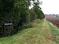
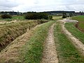
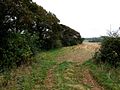
English: Somersby is both a village and a parish in the Lincolnshire Wolds, 6 miles northwest of Spilsby and 7 miles eastnortheast of Horncastle. The parish covers about 600 acres.
Português: Somersby é uma pequena vila e uma paróquia em Lincolnshire Wolds, no condado de Lincolnshire, Inglaterra, a cerca de 10 km (6 milhas) a noroeste de Spilsby e a cerca de 11 km a leste-nordeste de Horncastle. A paróquia cobre cerca de 600 acres. Alfred Tennyson, o Poeta laureado, nasceu e cresceu lá.

village britannique  | |||||
| Téléverser des médias | |||||
| Nature de l’élément |
| ||||
|---|---|---|---|---|---|
| Lieu | Greetham with Somersby, East Lindsey, Lincolnshire, Midlands de l'Est, Angleterre | ||||
 | |||||
Sous-catégories
Cette catégorie comprend 3 sous-catégories, dont les 3 ci-dessous.
M
- Manor House, Somersby (6 F)
S
Média dans la catégorie « Somersby, Lincolnshire »
Cette catégorie comprend 67 fichiers, dont les 67 ci-dessous.
-
 A Literary Pilgrim in England - OLD SOMERSBY RECTORY.png 1 522 × 2 169 ; 1,96 Mio
-
 Approaching Somersby - geograph.org.uk - 1939239.jpg 640 × 480 ; 100 kio
-
 Approaching Somersby - geograph.org.uk - 2919444.jpg 1 280 × 853 ; 487 kio
-
 Bridleway to Black Hill - geograph.org.uk - 530080.jpg 640 × 428 ; 77 kio
-
 Country lane to Stainsby - geograph.org.uk - 577401.jpg 640 × 480 ; 71 kio
-
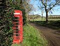 Decommissioned phone kiosk in Somersby - geograph.org.uk - 4831702.jpg 4 913 × 3 760 ; 5,63 Mio
-
 Entering Somersby on Tetford Road - geograph.org.uk - 4831709.jpg 5 184 × 3 888 ; 5,8 Mio
-
 Farm near Somersby - geograph.org.uk - 4044940.jpg 640 × 427 ; 68 kio
-
 Farm track near Somersby - geograph.org.uk - 1299263.jpg 640 × 480 ; 74 kio
-
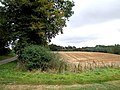 Farmland near Somersby - geograph.org.uk - 577316.jpg 640 × 480 ; 101 kio
-
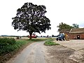 Farmyard, Somersby - geograph.org.uk - 577321.jpg 640 × 480 ; 83 kio
-
 Footbridge on the footpath to Bag Enderby - geograph.org.uk - 577654.jpg 640 × 480 ; 143 kio
-
 Footpath by The Moor - geograph.org.uk - 576968.jpg 640 × 480 ; 100 kio
-
 Footpath by The Moor - geograph.org.uk - 576988.jpg 640 × 480 ; 69 kio
-
 Footpath near Little London - geograph.org.uk - 576500.jpg 640 × 480 ; 101 kio
-
 Footpath near Little London - geograph.org.uk - 576508.jpg 640 × 480 ; 107 kio
-
 Footpath near Little London - geograph.org.uk - 576637.jpg 640 × 480 ; 91 kio
-
 Footpath near Little London - geograph.org.uk - 576912.jpg 480 × 640 ; 109 kio
-
 General view of Somersby - geograph.org.uk - 4831728.jpg 4 555 × 2 602 ; 3,2 Mio
-
 Hall farmhouse - geograph.org.uk - 517628.jpg 640 × 427 ; 96 kio
-
 Memories of the Tennysons (1912) (14594036317).jpg 2 064 × 1 508 ; 588 kio
-
 Memories of the Tennysons (1912) (14800404433).jpg 2 064 × 1 452 ; 525 kio
-
 Old track west of Brinkhill - geograph.org.uk - 482702.jpg 640 × 482 ; 102 kio
-
 Path to Brinkhill - geograph.org.uk - 112366.jpg 427 × 640 ; 126 kio
-
 Road junction west of Somersby - geograph.org.uk - 4831486.jpg 5 121 × 3 799 ; 6,02 Mio
-
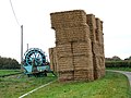
 Silage - geograph.org.uk - 511826.jpg 640 × 427 ; 76 kio
-
 Somerby Grange, Somerby - geograph.org.uk - 4150024.jpg 1 600 × 1 200 ; 473 kio
-
 Somersby rectory.JPG 604 × 524 ; 72 kio
-
 Somersby Rocks Picnic Area - geograph.org.uk - 1939259.jpg 640 × 480 ; 74 kio
-
 Somersby, on the menu in Bug's Parlour - geograph.org.uk - 4044934.jpg 640 × 427 ; 51 kio
-
 Somersby, The Rectory, Birthplace of Lord Alfred Tennyson - geograph.org.uk - 5153303.jpg 4 631 × 2 898 ; 7,75 Mio
-
 The River Lymn, Somersby - geograph.org.uk - 577394.jpg 640 × 480 ; 147 kio
-

-

-
 W.E.F. Britten - The Early Poems of Alfred, Lord Tennyson - The Garden at Somersby Rectory.png 5 373 × 7 312 ; 54,91 Mio
-
 A bridge by the footpath to Bag Enderby - geograph.org.uk - 577680.jpg 640 × 480 ; 116 kio
-
 Anderson Hill - geograph.org.uk - 112358.jpg 640 × 427 ; 101 kio
-
 Attractive approach to Harrington Hill - geograph.org.uk - 482709.jpg 640 × 482 ; 157 kio
-
 Bag Enderby - geograph.org.uk - 112365.jpg 640 × 427 ; 145 kio
-
 Bales at Harden's Gap - geograph.org.uk - 803758.jpg 640 × 428 ; 95 kio
-
 Barns and Beeches - geograph.org.uk - 803687.jpg 640 × 428 ; 139 kio
-
 Brook at Somersby - geograph.org.uk - 577382.jpg 480 × 640 ; 117 kio
-
 Brook at Somersby - geograph.org.uk - 577387.jpg 640 × 480 ; 137 kio
-
 Bug's Parlour - geograph.org.uk - 112362.jpg 640 × 427 ; 105 kio
-
 Country lane near Somersby - geograph.org.uk - 577298.jpg 640 × 480 ; 86 kio
-
 Countryside view at Stainsby - geograph.org.uk - 578094.jpg 640 × 480 ; 117 kio
-
 Double Dyke near Little London - geograph.org.uk - 576513.jpg 640 × 480 ; 102 kio
-
 Farm at Stainsby - geograph.org.uk - 577404.jpg 640 × 480 ; 59 kio
-
 Farm at Stainsby - geograph.org.uk - 577405.jpg 640 × 480 ; 69 kio
-
 Farm buildings near Hall Farm - geograph.org.uk - 511813.jpg 640 × 427 ; 84 kio
-
 Farmland at Little London - geograph.org.uk - 576389.jpg 640 × 480 ; 112 kio
-
 Farmland at Little London - geograph.org.uk - 576420.jpg 640 × 480 ; 101 kio
-
 Farmland at Little London - geograph.org.uk - 576484.jpg 640 × 480 ; 73 kio
-
 Field boundary, Little London - geograph.org.uk - 576378.jpg 640 × 480 ; 100 kio
-
 Footpath back to Stainsby - geograph.org.uk - 577754.jpg 640 × 480 ; 134 kio
-
 Footpath back to Stainsby - geograph.org.uk - 577758.jpg 640 × 480 ; 123 kio
-
 Footpath back to Stainsby - geograph.org.uk - 577806.jpg 640 × 480 ; 119 kio
-
 Footpath back to Stainsby - geograph.org.uk - 577813.jpg 640 × 480 ; 104 kio
-
 Footpath near Little London - geograph.org.uk - 576618.jpg 640 × 480 ; 100 kio
-
 Footpath near Little London - geograph.org.uk - 576923.jpg 640 × 480 ; 147 kio
-
 Footpath near Little London - geograph.org.uk - 577020.jpg 640 × 480 ; 101 kio
-
 Footpath near Little London - geograph.org.uk - 577046.jpg 640 × 480 ; 94 kio
-
 House at Somersby - geograph.org.uk - 578401.jpg 640 × 480 ; 77 kio
-
 Lane junction to Brinkfield - geograph.org.uk - 482810.jpg 640 × 482 ; 83 kio
-
 Mud and Gates - geograph.org.uk - 235594.jpg 640 × 480 ; 110 kio
-
 Road bridge, Somersby - geograph.org.uk - 577373.jpg 640 × 480 ; 115 kio
-
 The River Lymn, Somersby - geograph.org.uk - 577389.jpg 640 × 480 ; 129 kio


_(14594036317).jpg)
_(14800404433).jpg)


.jpg)


