Category:South Barrow
Vai alla navigazione
Vai alla ricerca
English: South Barrow is a village and civil parish approximately north-east of Ilchester in the South Somerset district of Somerset, England.
Insediamento umano in Inghilterra  | |||||
| Carica un file multimediale | |||||
| Istanza di | |||||
|---|---|---|---|---|---|
| Luogo | South Somerset, Somerset, Sud Ovest dell'Inghilterra, Inghilterra | ||||
 | |||||
Sottocategorie
Questa categoria contiene un'unica sottocategoria, indicata di seguito.
P
File nella categoria "South Barrow"
Questa categoria contiene 21 file, indicati di seguito, su un totale di 21.
-
 Churchyard, South Barrow - geograph.org.uk - 4452970.jpg 800 × 533; 266 KB
-
 Countryside near South Barrow. - geograph.org.uk - 5646132.jpg 640 × 427; 195 KB
-
 For Sale - geograph.org.uk - 4452954.jpg 800 × 533; 216 KB
-
 Junction on Sparkford Road - geograph.org.uk - 5695414.jpg 1 024 × 823; 251 KB
-
 Musmoor Lane - geograph.org.uk - 5646128.jpg 640 × 427; 195 KB
-
 Nightingale Lane - geograph.org.uk - 5695403.jpg 1 024 × 788; 318 KB
-
 Parsonage Farm - geograph.org.uk - 5646123.jpg 640 × 427; 182 KB
-
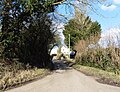
 Road between North and South Barrow - geograph.org.uk - 4452959.jpg 800 × 533; 154 KB
-
 South Barrow - geograph.org.uk - 4452967.jpg 800 × 533; 192 KB
-
 St Peter, South Barrow - geograph.org.uk - 4452973.jpg 800 × 533; 207 KB
-

-
 Bridleway-footpath-by-way junction - geograph.org.uk - 543503.jpg 640 × 480; 140 KB
-
 Craddock's Farm - geograph.org.uk - 543649.jpg 640 × 480; 90 KB
-
 Field view west of Newland's Lane - geograph.org.uk - 543490.jpg 640 × 480; 92 KB
-
 Fortyacres Farmhouse - geograph.org.uk - 543095.jpg 640 × 480; 108 KB
-
 Manor Farm Farmhouse - South Barrow - geograph.org.uk - 424438.jpg 640 × 480; 141 KB
-
 Musmoor Lane - geograph.org.uk - 544178.jpg 640 × 480; 94 KB
-
 Parsonage Farm House - geograph.org.uk - 544171.jpg 640 × 480; 141 KB
-

-
 Pyle Well Lane - geograph.org.uk - 543651.jpg 640 × 480; 129 KB
-
 Road between South Barrow and Sparkford - geograph.org.uk - 709086.jpg 640 × 480; 138 KB


