Category:South Derbyshire District
Zur Navigation springen
Zur Suche springen
local government district in Derbyshire, England  | |||||
| Medium hochladen | |||||
| Ist ein(e) | |||||
|---|---|---|---|---|---|
| Ort | Derbyshire, East Midlands, England | ||||
| Hauptstadt | |||||
| Gesetzgebende Körperschaft |
| ||||
| Datum der Gründung, Erstellung, Entstehung, Erbauung |
| ||||
| Einwohnerzahl |
| ||||
| Fläche |
| ||||
| offizielle Website | |||||
 | |||||
Unterkategorien
Es werden 53 von insgesamt 53 Unterkategorien in dieser Kategorie angezeigt:
In Klammern die Anzahl der enthaltenen Kategorien (K), Seiten (S), Dateien (D)
A
B
- Barton Blount (56 D)
- Bearwardcote (24 D)
C
- Castle Gresley (46 D)
- Cauldwell (38 D)
D
E
F
H
- Hoon, Derbyshire (28 D)
I
L
M
N
O
S
- Stenson Fields (54 D)
T
W
Medien in der Kategorie „South Derbyshire District“
Folgende 110 Dateien sind in dieser Kategorie, von 110 insgesamt.
-
 Coat of Arms of South Derbyshire District.svg 508 × 550; 779 KB
-
 Marianne Bamkin Green Party 01.jpg 640 × 384; 70 KB
-
 Marianne Bamkin Green Party 02.jpg 384 × 640; 80 KB
-
 Marianne Bamkin Green Party portrait.jpg 640 × 384; 79 KB
-
 Michael John Firbank of Swadluncote.jpg 2.464 × 3.280; 2,38 MB
-
 South Derbyshire District Council 2021.svg 360 × 185; 3 KB
-
 South Derbyshire green party candidate.jpg 3.280 × 2.464; 2,46 MB
-
 South Derbyshire labour candidate.jpg 3.280 × 2.464; 1,35 MB
-
 South Derbyshire Tory and labour candidates 2.jpg 541 × 542; 70 KB
-
 South Derbyshire UK ward map 2023.svg 712 × 688; 356 KB
-
 Stile and sign - geograph.org.uk - 393904.jpg 640 × 480; 271 KB
-
-
 Storage field - geograph.org.uk - 377386.jpg 640 × 480; 72 KB
-
 Storm clouds over the A50 - geograph.org.uk - 314296.jpg 640 × 480; 117 KB
-
 Strawberry field and sheep - geograph.org.uk - 393878.jpg 640 × 480; 304 KB
-
 Sub-station Entrance - geograph.org.uk - 258567.jpg 640 × 426; 123 KB
-
 Sunset on the River Derwent - geograph.org.uk - 586046.jpg 640 × 482; 71 KB
-
 Sutton Brook - geograph.org.uk - 316590.jpg 640 × 480; 113 KB
-
 Sutton Lane Ends Chapel - geograph.org.uk - 317705.jpg 640 × 480; 66 KB
-
 Sutton Lane House - geograph.org.uk - 316702.jpg 640 × 480; 123 KB
-
 Sutton on the Hill - geograph.org.uk - 317041.jpg 640 × 480; 101 KB
-
 Swarkestone Bridge - geograph.org.uk - 375226.jpg 640 × 480; 85 KB
-
 Sycamore Farmhouse - geograph.org.uk - 387695.jpg 640 × 480; 103 KB
-
 Taylors Cottage - geograph.org.uk - 314922.jpg 640 × 480; 112 KB
-
 Thatched Cottages - geograph.org.uk - 273609.jpg 640 × 426; 89 KB
-
 The A50 - geograph.org.uk - 707759.jpg 427 × 640; 187 KB
-
 The A50 at dawn - geograph.org.uk - 709469.jpg 640 × 441; 56 KB
-
 The dam wall - geograph.org.uk - 387621.jpg 640 × 480; 75 KB
-
 The Elms - geograph.org.uk - 386698.jpg 640 × 480; 109 KB
-
 The flood plain of the Dove - geograph.org.uk - 632664.jpg 640 × 480; 75 KB
-
 The footpath from Ingleby - geograph.org.uk - 386723.jpg 640 × 480; 99 KB
-
 The Grange - geograph.org.uk - 313362.jpg 640 × 480; 117 KB
-
 The Hall - geograph.org.uk - 317046.jpg 640 × 480; 105 KB
-
 The Kiln - geograph.org.uk - 377186.jpg 480 × 640; 63 KB
-
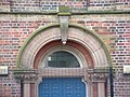 The Memorial Hall Doorway - geograph.org.uk - 376480.jpg 640 × 480; 121 KB
-
 The Millway - geograph.org.uk - 313393.jpg 640 × 480; 117 KB
-
 The New Weston School - geograph.org.uk - 418414.jpg 640 × 480; 89 KB
-
 The Old Hall - geograph.org.uk - 313370.jpg 640 × 480; 115 KB
-
 The Old Lodge Nursing Home - geograph.org.uk - 312489.jpg 640 × 480; 113 KB
-
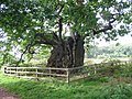 The Old Man of Calke - geograph.org.uk - 251044.jpg 640 × 480; 155 KB
-
 The old Tip - geograph.org.uk - 376485.jpg 640 × 480; 55 KB
-
 The Old Village School - geograph.org.uk - 418377.jpg 640 × 480; 80 KB
-
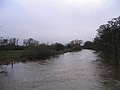 The River Dove - geograph.org.uk - 632646.jpg 640 × 480; 47 KB
-
 The road into Scropton - geograph.org.uk - 445590.jpg 640 × 379; 50 KB
-
 The Stables - geograph.org.uk - 398096.jpg 640 × 481; 107 KB
-
 The Trent in Flood at Swarkestone - geograph.org.uk - 478950.jpg 640 × 480; 59 KB
-
 The visitor centre - geograph.org.uk - 387605.jpg 640 × 480; 101 KB
-
 The White House - geograph.org.uk - 317759.jpg 640 × 480; 91 KB
-
 The Windle - geograph.org.uk - 318629.jpg 640 × 480; 67 KB
-
 Three levels, five directions - geograph.org.uk - 707831.jpg 640 × 427; 166 KB
-
 Thurvaston Farm - geograph.org.uk - 318103.jpg 640 × 480; 118 KB
-
 Thurvaston Moat - geograph.org.uk - 318096.jpg 640 × 480; 119 KB
-
 Ticknall Quarries SSSI - geograph.org.uk - 429890.jpg 640 × 480; 191 KB
-
 Ticknall Quarries SSSI - geograph.org.uk - 429893.jpg 640 × 480; 170 KB
-
 Ticknall to Stanton-by-Bridge Road - geograph.org.uk - 251019.jpg 640 × 480; 73 KB
-
 Top Farm - geograph.org.uk - 314906.jpg 640 × 480; 113 KB
-
 Toplane at Burntheath - geograph.org.uk - 316695.jpg 640 × 480; 98 KB
-
 Towards Coton wood - geograph.org.uk - 372949.jpg 480 × 640; 129 KB
-
 Towards Newton Mount - geograph.org.uk - 398050.jpg 640 × 481; 57 KB
-
 Towards Seal Brook - geograph.org.uk - 392227.jpg 640 × 481; 80 KB
-
 Towards the A511 - geograph.org.uk - 396862.jpg 640 × 481; 91 KB
-
 Towards West Brook - geograph.org.uk - 392663.jpg 640 × 481; 78 KB
-
 Track across the fields - geograph.org.uk - 673928.jpg 447 × 640; 69 KB
-
 Track and ditch - geograph.org.uk - 312692.jpg 640 × 480; 114 KB
-
 Track Entrance - geograph.org.uk - 316600.jpg 640 × 480; 121 KB
-
 Track Leading to Cave Cottage - geograph.org.uk - 458805.jpg 640 × 480; 37 KB
-
 Track off Bakeacre Lane - geograph.org.uk - 323364.jpg 640 × 428; 109 KB
-
 Track to Bendall's Farm - geograph.org.uk - 286615.jpg 426 × 640; 116 KB
-
 Track to Grove Farm - geograph.org.uk - 417251.jpg 640 × 480; 56 KB
-
 Track towards Daniel Hayes - geograph.org.uk - 615623.jpg 640 × 429; 119 KB
-
 Trackbed of the Ticknall tramway - geograph.org.uk - 387479.jpg 640 × 480; 76 KB
-
 Tree and a Post - geograph.org.uk - 368610.jpg 640 × 480; 84 KB
-
 Tree beside Wood End Lane - geograph.org.uk - 674367.jpg 489 × 640; 108 KB
-
 Tree lined pool west of Hartshorne - geograph.org.uk - 615617.jpg 640 × 429; 115 KB
-
 Tree-lined track above Tadsor Farm - geograph.org.uk - 615771.jpg 640 × 429; 143 KB
-
 Trees lining Rosliston Road - geograph.org.uk - 417186.jpg 640 × 480; 77 KB
-

-
 Trig Point - geograph.org.uk - 257094.jpg 426 × 640; 170 KB
-
 Trusley Brook - geograph.org.uk - 316641.jpg 640 × 480; 111 KB
-
 Trusley Brook Farm - geograph.org.uk - 315058.jpg 640 × 480; 114 KB
-
 Trusley Brook Farm - geograph.org.uk - 316653.jpg 640 × 480; 111 KB
-
 Trusley Brook Farmyard - geograph.org.uk - 316664.jpg 640 × 480; 109 KB
-
 Trusley Coppice - geograph.org.uk - 316042.jpg 640 × 480; 95 KB
-
 Two woods and a gap - geograph.org.uk - 397570.jpg 640 × 481; 99 KB
-
 Unloved house - geograph.org.uk - 396605.jpg 640 × 481; 103 KB
-
 Viewing Platform - geograph.org.uk - 252271.jpg 640 × 426; 123 KB
-
 Walton Hall - geograph.org.uk - 417454.jpg 640 × 480; 146 KB
-
 Walton Lane Farm - geograph.org.uk - 426023.jpg 640 × 480; 76 KB
-
 Water Booster Plant - geograph.org.uk - 688235.jpg 640 × 480; 90 KB
-
 Way back to Coton in the Elms - geograph.org.uk - 391594.jpg 640 × 481; 104 KB
-
 Well Lane, Repton - geograph.org.uk - 680774.jpg 479 × 640; 112 KB
-
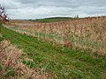
 Wet field - geograph.org.uk - 312681.jpg 640 × 480; 116 KB
-
 What Reservoir - geograph.org.uk - 364387.jpg 640 × 480; 144 KB
-
 What's over the hedge - geograph.org.uk - 397678.jpg 640 × 481; 73 KB
-
 Which Way ^ - geograph.org.uk - 391587.jpg 640 × 481; 82 KB
-
 Willington Co-Op - geograph.org.uk - 280493.jpg 640 × 498; 132 KB
-
 Willington Gravel Pits - geograph.org.uk - 252261.jpg 640 × 426; 113 KB
-
 Willington Old School - geograph.org.uk - 280495.jpg 640 × 438; 103 KB
-
 Willington Quarry - geograph.org.uk - 287077.jpg 640 × 426; 107 KB
-
 Willington Quarry Entrance - geograph.org.uk - 287078.jpg 640 × 426; 83 KB
-
 Winding footpath - geograph.org.uk - 377226.jpg 640 × 480; 114 KB
-
 Windlehill Farm - geograph.org.uk - 318436.jpg 640 × 480; 49 KB
-
 Windlehill Pond - geograph.org.uk - 316039.jpg 640 × 480; 97 KB
-
 Wood End Lane - geograph.org.uk - 674335.jpg 640 × 483; 76 KB
-
 Woodend Cottage - geograph.org.uk - 673954.jpg 640 × 448; 45 KB
-
 Woodland and stream at Drakelow - geograph.org.uk - 402992.jpg 480 × 640; 241 KB
-
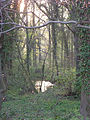
 Woodland Pond - geograph.org.uk - 312616.jpg 640 × 480; 116 KB
-
 Woodville Island - geograph.org.uk - 377199.jpg 640 × 480; 57 KB
-
 Wrekin weight - geograph.org.uk - 401894.jpg 480 × 640; 98 KB
-
 Young saplings - geograph.org.uk - 387612.jpg 640 × 480; 104 KB


