Category:South Downs
Przejdź do nawigacji
Przejdź do wyszukiwania
Podkategorie
Poniżej wyświetlono 32 spośród wszystkich 32 podkategorii tej kategorii.
B
- Beacon Hill, Warnford (27 plików)
- Blackcap, East Sussex (30 plików)
- Bostal Hill, Alciston (7 plików)
- Bowl barrow 200m west of Chanctonbury Ring (11 plików)
C
- Cissbury Ring (60 plików)
- Coney Hill, Patcham (10 plików)
D
- Devil's Humps (14 plików)
- Devil's Jumps, Treyford (45 plików)
F
H
- Harrow Hill, West Sussex (17 plików)
- Harting Beacon (9 plików)
- Harting Downs (7 plików)
K
L
- Lewes Downs (5 plików)
M
- Malling Down (22 pliki)
O
- Old Winchester Hill (95 plików)
- Oxteddle Bottom (6 plików)
Q
R
- Ranscombe Camp (8 plików)
S
W
- Waterhall, Brighton (12 plików)
- Wolstonbury Camp (45 plików)
Pliki w kategorii „South Downs”
Poniżej wyświetlono 200 spośród wszystkich 379 plików w tej kategorii.
(poprzednia strona) (następna strona)-
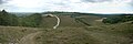
 A horse carved on the mountain - panoramio.jpg 2400 × 1800; 735 KB
-
 A solitary tree at Parham Park, West Sussex, England.jpg 3000 × 2000; 4,33 MB
-
 Beacon Hill fort 1.jpg 2816 × 2112; 1,47 MB
-
 Beacon Hill trig point, South Harting 01.JPG 2816 × 2112; 3,45 MB
-
 Beacon Hill trig point, South Harting 02.JPG 2816 × 2112; 3,42 MB
-
 Bepton Down Barrow.jpg 5152 × 3864; 4,5 MB
-

-
 Bowl barrow on Edburton Hill 01.jpg 4000 × 3000; 5,31 MB
-
 Bowl barrow on Edburton Hill 02.jpg 4000 × 3000; 3,21 MB
-
 Bowl barrow on Edburton Hill 03.jpg 4000 × 3000; 4,56 MB
-
 Bowl Barrow on Springhead Hill, Parham, West Sussex 01.jpg 5152 × 3864; 4,34 MB
-
 Bowl Barrow on Springhead Hill, Parham, West Sussex 02.jpg 5152 × 3864; 4,4 MB
-
 Bowl Barrow on Springhead Hill, Parham, West Sussex 03.jpg 5152 × 3864; 4,48 MB
-
 Bowl Barrow on Springhead Hill, Parham, West Sussex 04.jpg 5152 × 3864; 4,38 MB
-
 Bowl Barrow on Springhead Hill, Parham, West Sussex 05.jpg 5152 × 3864; 4,39 MB
-
 Bowl Barrow on Springhead Hill, Parham, West Sussex 06.jpg 5152 × 3864; 4,41 MB
-
 Bowl Barrow on Springhead Hill, Parham, West Sussex 07.jpg 5152 × 3864; 4,34 MB
-
 Bowl Barrow on Springhead Hill, Parham, West Sussex 08.jpg 5152 × 3864; 4,43 MB
-
 Bowl Barrow on Springhead Hill, Parham, West Sussex 09.jpg 5152 × 3864; 4,34 MB
-
 Bowl Barrow on Springhead Hill, Parham, West Sussex 10.jpg 5152 × 3864; 4,46 MB
-
 Bridleway, Charlton Forest - geograph.org.uk - 225517.jpg 479 × 640; 207 KB
-
 Brighton Dorset Gardens glass 3.jpg 2578 × 4501; 1,56 MB
-
 Broadham House - geograph.org.uk - 225509.jpg 640 × 479; 110 KB
-
 Caravan near the Dongas, Twyford Down - geograph.org.uk - 449491.jpg 640 × 480; 118 KB
-
 Castle Hill National Nature Reserve, near Balsdean, Brighton (August 2019) (1).JPG 3000 × 2000; 2,59 MB
-
 Castle Hill National Nature Reserve, near Balsdean, Brighton (August 2019) (2).JPG 3000 × 2000; 2,47 MB
-
 Chalkpit Lane, East Lavant 01.jpg 4000 × 3000; 4,39 MB
-
 Chalkpit Lane, East Lavant 02.jpg 4000 × 3000; 5,37 MB
-
 Chalkpit Lane, East Lavant 03.jpg 4000 × 3000; 3,23 MB
-
 Chalkpit Lane, East Lavant 04.jpg 4000 × 3000; 6,96 MB
-
 Chalkpit Lane, East Lavant 05.jpg 4000 × 3000; 4,67 MB
-
 Chalkpit Lane, East Lavant 06.jpg 4000 × 3000; 3,7 MB
-
 Chalkpit Lane, East Lavant 07.jpg 4000 × 3000; 4,25 MB
-
 Chalkpit Lane, East Lavant 08.jpg 4000 × 3000; 4,04 MB
-
 Chalkpit Lane, East Lavant 09.jpg 4000 × 3000; 3,73 MB
-
 Chalkpit Lane, East Lavant 10.jpg 4000 × 3000; 2,91 MB
-
 Chalkpit Lane, East Lavant 11.jpg 4000 × 3000; 3,46 MB
-
 Chanctonbury Dew Pond - geograph.org.uk - 440194.jpg 640 × 480; 76 KB
-
 Chantry Hill South Downs Way.jpg 2048 × 1509; 2,93 MB
-
 Church of the Transfiguration, Pyecombe 78.jpg 3000 × 4000; 3,08 MB
-
 Churchill MK2 Tank South Downs.jpg 2048 × 1501; 3,7 MB
-

-
 Cliff face - geograph.org.uk - 424327.jpg 640 × 480; 210 KB
-
 Cross dyke southeast of Wolstonbury Camp 01.jpg 4000 × 3000; 4,01 MB
-
 Cross dyke southeast of Wolstonbury Camp 02.jpg 4000 × 3000; 4,36 MB
-
 Cross dyke southeast of Wolstonbury Camp 03.jpg 4000 × 3000; 3,15 MB
-
 Cross dyke southeast of Wolstonbury Camp 04.jpg 4000 × 3000; 2,62 MB
-
 Cross dyke southeast of Wolstonbury Camp 05.jpg 3615 × 3000; 8,04 MB
-
 Devil's Dyke with storm clouds and rainbow.JPG 4608 × 3456; 4,41 MB
-
 Ditchling Beacon Panorama 1.jpg 9345 × 1200; 3,64 MB
-
 Ditchling Beacon Panorama 2.jpg 8731 × 1200; 1,96 MB
-
 Ditchling Beacon Panorama 3.jpg 9216 × 1200; 2,4 MB
-
 Downland, Beachy Head - geograph.org.uk - 948029.jpg 640 × 480; 118 KB
-
 DSCN1513 Pen Hill cross dykes.JPG 2816 × 2112; 1,47 MB
-
 Eastward view towards Lewes from The Drove, Falmer (August 2019) (1).JPG 3000 × 2000; 1,94 MB
-
 Eastward view towards Lewes from The Drove, Falmer (August 2019) (2).JPG 2400 × 1200; 1,09 MB
-
 Eastward view towards Lewes from The Drove, Falmer (August 2019) (3).JPG 2600 × 1200; 935 KB
-
 Electricity Substation, Whiteley - geograph.org.uk - 454749.jpg 640 × 427; 175 KB
-
 Elsted and Treyford - Treyford Manor Farmhouse - 20230805142958.jpg 4000 × 3000; 3,88 MB
-
 Farm Buildings at west end of Drove Road, Woodingdean (May 2020) (1).JPG 3000 × 1600; 2,02 MB
-
 Farm Buildings at west end of Drove Road, Woodingdean (May 2020) (2).JPG 3000 × 1600; 1,72 MB
-
 Farm Buildings at west end of Drove Road, Woodingdean (May 2020) (3).JPG 2400 × 1400; 1,49 MB
-
 Farm Buildings at west end of Drove Road, Woodingdean (May 2020) (4).JPG 3000 × 2000; 2,72 MB
-

-
-
 Field near Idsworth - geograph.org.uk - 416427.jpg 480 × 640; 111 KB
-
 Flint layer - geograph.org.uk - 424332.jpg 640 × 480; 167 KB
-
 Flint layer - geograph.org.uk - 424334.jpg 640 × 480; 185 KB
-
 Forum Four, Solent Business Park - geograph.org.uk - 453282.jpg 640 × 427; 154 KB
-
 Frosty (8314587521).jpg 3872 × 2592; 7,52 MB
-
 Garden shed in Meonstoke - geograph.org.uk - 426988.jpg 640 × 381; 156 KB
-
 General view from Cattle Hill, Ovingdean (February 2011) (1).JPG 2400 × 1400; 807 KB
-
 General view from Cattle Hill, Ovingdean (February 2011) (2).JPG 2592 × 1500; 938 KB
-
 General view of Hangleton from the South Downs (March 2008).JPG 640 × 480; 128 KB
-
 George and Falcon - geograph.org.uk - 431991.jpg 640 × 480; 108 KB
-
 Grazing land on South Downs - geograph.org.uk - 712685.jpg 640 × 480; 70 KB
-
 Green Lane, Woodingdean (May 2020).JPG 3000 × 2000; 2,16 MB
-
 Ha-ha at Parham House, West Sussex, England.jpg 3000 × 2000; 5,04 MB
-
 Harrow Lane ,Steep - geograph.org.uk - 463208.jpg 640 × 480; 147 KB
-
 Hillside - geograph.org.uk - 400776.jpg 640 × 480; 135 KB
-
 Horseshoe Woods cross dyke 01.jpg 4000 × 3000; 5,82 MB
-
 Horseshoe Woods cross dyke 02.jpg 4000 × 3000; 5,45 MB
-
-

-

-
 Kingly Vale and Devil's Humps.jpg 2816 × 2112; 3,29 MB
-
 Lane from St Andrew's Church, Chilcomb - geograph.org.uk - 436316.jpg 427 × 640; 191 KB
-
 Lewes St. Michael's Church from castle.JPG 3264 × 2448; 2,21 MB
-
 Snow in Sussex (3).jpg 1944 × 2592; 1,78 MB
-
 Linseed field, South Downs Way 1.jpg 2816 × 2112; 1,6 MB
-
 Linseed field, South Downs Way 2.jpg 2816 × 2112; 1,69 MB
-
 Lock's Farm Chalkpit - geograph.org.uk - 443267.jpg 640 × 480; 106 KB
-

-

-
 Memorial to Upham Drag Hounds - geograph.org.uk - 439387.jpg 640 × 420; 161 KB
-
 National Trust sign at Fulking Escarpment.jpg 3000 × 4000; 3,89 MB
-
 Northeastward view along Drove Road, Woodingdean (May 2020).JPG 3000 × 1600; 2,11 MB
-
 Northward view from end of Warren Avenue, Woodingdean (May 2020).JPG 2600 × 1800; 1,64 MB
-
 Northward view towards Plumpton College from South Downs (April 2021) (1).JPG 3000 × 1600; 1,71 MB
-
 Northward view towards Plumpton College from South Downs (April 2021) (2).JPG 3000 × 2000; 2,75 MB
-

-

-

-

-

-

-
 NT Harting Down sign.jpg 2112 × 2816; 1,46 MB
-
 Open Fields north of Saltdean (August 2014) (1).JPG 2000 × 1400; 498 KB
-
 Open Fields north of Saltdean (August 2014) (2).JPG 2000 × 1400; 478 KB
-
 Open Fields north of Saltdean (August 2014) (3).JPG 2000 × 1400; 538 KB
-
 Open Fields north of Saltdean (August 2014) (4).JPG 2000 × 1400; 521 KB
-
 Open Fields north of Saltdean (August 2014) (5).JPG 2400 × 1800; 733 KB
-
 Open Land at Balsdean, Brighton (August 2019) (1).JPG 3000 × 2000; 2,39 MB
-
 Open Land at Balsdean, Brighton (August 2019) (2).JPG 3000 × 2000; 2,19 MB
-
 Open Land at Balsdean, Brighton (August 2019) (3).JPG 3000 × 2000; 2,28 MB
-
 Open Land at Balsdean, Brighton (August 2019) (4).JPG 2000 × 3000; 2,36 MB
-
 Open Land at Balsdean, Brighton (August 2019) (5).JPG 3000 × 2000; 2,27 MB
-
 Open Land at Greenways, Ovingdean (December 2016) (1).JPG 3200 × 2400; 1,48 MB
-
 Open Land at Greenways, Ovingdean (December 2016) (2).JPG 3200 × 2200; 1,62 MB
-
 Open Land at Greenways, Ovingdean (December 2016) (3).JPG 3200 × 2400; 1,67 MB
-
 Open Land at Hollingbury Hill, Brighton (July 2015) (1).JPG 4600 × 3400; 3,93 MB
-
 Open Land at Hollingbury Hill, Brighton (July 2015) (2).JPG 4600 × 3400; 3,09 MB
-

-

-

-

-
-
 Open Land near Brighton Racecourse (September 2018) (1).JPG 3000 × 2000; 2,38 MB
-
 Open Land near Brighton Racecourse (September 2018) (2).JPG 3000 × 2000; 2,22 MB
-
 Open Land near Brighton Racecourse (September 2018) (3).JPG 3000 × 2000; 2,72 MB
-
 Open Land near Brighton Racecourse (September 2018) (4).JPG 3000 × 1600; 1,93 MB
-
 Open Land near Brighton Racecourse (September 2018) (5).JPG 3000 × 1600; 1,78 MB
-
 Open Land near Brighton Racecourse (September 2018) (6).JPG 3000 × 2000; 2,46 MB
-
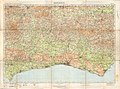 Ordnance Survey Half-inch Sheet 39 Brighton, Published 1928.jpg 11 820 × 8763; 12,83 MB
-
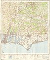
 Ordnance Survey One-Inch Sheet 133 Chichester & Worthing, Published 1920.jpg 11 878 × 8925; 9,74 MB
-
 Ordnance Survey One-Inch Sheet 181 Chichester, Published 1945.jpg 8193 × 9555; 11,25 MB
-
 Ordnance Survey One-Inch Sheet 181 Chichester, Published 1960.jpg 8327 × 9971; 11,47 MB
-
 Ordnance Survey One-Inch Sheet 181 Chichester, Published 1970.jpg 11 080 × 13 189; 59,51 MB
-
 Ordnance Survey One-Inch Sheet 182 Brighton & Worthing, Published 1940.jpg 8191 × 9533; 12,01 MB
-
 Ordnance Survey One-Inch Sheet 182 Brighton & Worthing, Published 1960.jpg 8278 × 9963; 12,59 MB
-
 Ordnance Survey One-Inch Sheet 182 Brighton & Worthing, Published 1970.jpg 11 089 × 13 154; 60,98 MB
-
 Ordnance Survey One-Inch Tourist Map of Brighton and the South Downs, Published 1922.jpg 16 010 × 12 092; 24,56 MB
-
 Ordnance Survey One-Inch Tourist Map of Chichester Published 1922.jpg 9601 × 6643; 7,9 MB
-
 Ornithological miscellany (Plate) (5982047174).jpg 1660 × 1178; 379 KB
-
 Page 66, inset illustration. Folk-Lore, vol. 20.png 1037 × 142; 22 KB
-

-

-
 Part of S Downs near Devils Dyke.JPG 1632 × 1224; 926 KB
-
 Pen Hill cross dykes 01.jpg 3264 × 2448; 2,19 MB
-
 Pen Hill cross dykes 02.jpg 3264 × 2448; 2,38 MB
-
 Pen Hill cross dykes 03.jpg 5152 × 3864; 4,35 MB
-
 Pen Hill Cross Dykes.jpg 6409 × 2110; 8,07 MB
-

-
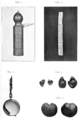 Plate 01. Folk-Lore, vol. 20.png 1638 × 2469; 1,36 MB
-
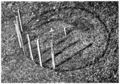 Plate 02, fig 6. Folk-Lore, vol. 20.png 1607 × 1119; 1,28 MB
-
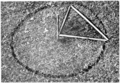 Plate 02, fig 7. Folk-Lore, vol. 20.png 1606 × 1114; 1,31 MB
-
 Ponies Grazing on South Downs (8393499928).jpg 5184 × 3456; 5,01 MB
-
 Power lines, near Ropley Dean, Hants - geograph.org.uk - 419801.jpg 640 × 480; 45 KB
-
 Robert Thorne-Waite - South Downs picnic - Thorne-Waite-98428.jpg 2250 × 1562; 610 KB
-
 Romano-British farmstead, field system and trackway on Wolstonbury Hill.jpg 4000 × 3000; 3,82 MB
-

-

-

-
-
-
 Sheep Pen, Beddingham Hill - geograph.org.uk - 760709.jpg 479 × 640; 112 KB
-
 Singleton Oil Field - geograph.org.uk - 225526.jpg 640 × 479; 130 KB
-
 South Downs 20181104 1.jpg 4160 × 2340; 2,95 MB
-
 South Downs 20181104 2.jpg 4160 × 2340; 3,04 MB
-
 South Downs 20181104 3.jpg 4160 × 2340; 2,81 MB
-
 South Downs 20181104 4.jpg 4160 × 2340; 2,46 MB
-
 South Downs around the Bevendean Estate, Brighton (December 2013).JPG 2400 × 1600; 695 KB
-
 South Downs around the Bevendean Estate, Brighton (September 2018) (1).JPG 3000 × 2000; 2,13 MB
-
 South Downs around the Bevendean Estate, Brighton (September 2018) (2).JPG 3000 × 2000; 2,7 MB
-
 South Downs National Park map.svg 1425 × 884; 1,98 MB
-

-
 South Downs near West Hove Golf Club, Northwest of Hangleton (February 2019) (1).JPG 3600 × 2600; 1,69 MB
-

-
 South Downs near West Hove Golf Club, Northwest of Hangleton (February 2019) (3).JPG 3600 × 2600; 1,73 MB
-
 South Downs near West Hove Golf Club, Northwest of Hangleton (February 2019) (4).JPG 3600 × 2600; 1,55 MB
-
 South Downs picnic - circa 1900 - Robert Thorne Waite - 6323-2048x1422.jpg 2048 × 1422; 549 KB
-
 South Downs Way, Cuckmere Valley, England - May 2009.jpg 6884 × 1740; 5,87 MB
-
 South downs.jpg 2998 × 1051; 577 KB
-
 Southeastward view across Brighton from Truleigh Hill at dusk (July 2014).JPG 2500 × 1500; 764 KB
-
 Southward view from Beacon Hill, Ovingdean (January 2010) (1).JPG 2592 × 1944; 1,4 MB
-
 Southward view from Beacon Hill, Ovingdean (January 2010) (2).JPG 2592 × 1944; 1,43 MB
-
 Southward view from Warren Road, Woodingdean (March 2009).JPG 2000 × 1400; 841 KB
-
 Southwestward view along Ladies Mile, Patcham (February 2014).JPG 3600 × 2600; 1,77 MB
-
 Spring - panoramio (36).jpg 3777 × 2655; 2,63 MB
-
 Steyningfromabove.jpg 3264 × 2448; 1,4 MB
-
 The 'South Downs' from nr. Seaford. - panoramio.jpg 4416 × 2105; 5,93 MB
-
 The South Downs at Beachy Head - geograph.org.uk - 1297433.jpg 640 × 389; 53 KB
-
 Tillington vineyard.jpg 2816 × 2112; 1,46 MB
-
 Tower Hill, South Harting banner.jpg 5152 × 736; 1,19 MB
-
 Tristan Gooley Bignor Hill.jpg 1280 × 960; 150 KB
-
 View across South Downs from Drove Road, Woodingdean (May 2020) (1).JPG 2600 × 1600; 1,61 MB
-
 View across South Downs from Drove Road, Woodingdean (May 2020) (10).JPG 3000 × 2000; 2,36 MB
-
 View across South Downs from Drove Road, Woodingdean (May 2020) (11).JPG 2600 × 1400; 1,17 MB
-
 View across South Downs from Drove Road, Woodingdean (May 2020) (12).JPG 3000 × 2000; 2,25 MB
-
 View across South Downs from Drove Road, Woodingdean (May 2020) (2).JPG 2600 × 1600; 1,6 MB


.jpg)


_(1).JPG)
_(2).JPG)


_(1).JPG)
_(2).JPG)
_(3).JPG)


_(1).JPG)
_(2).JPG)
_(3).JPG)
_(4).JPG)
_(1).JPG)
_(2).JPG)


.jpg)

_(1).JPG)
_(2).JPG)
.JPG)


.JPG)


_(1).JPG)
_(2).JPG)
_(3).JPG)


.jpg)


.JPG)
.JPG)
_(1).JPG)
_(2).JPG)
_(1).JPG)
_(2).JPG)
_(1).JPG)
_(2).JPG)
_(1).JPG)
_(2).JPG)

_(1).JPG)
_(2).JPG)
_(3).JPG)
_(4).JPG)
_(5).JPG)
_(1).JPG)
_(2).JPG)
_(3).JPG)
_(4).JPG)
_(5).JPG)
_(1).JPG)
_(2).JPG)
_(3).JPG)
_(1).JPG)
_(2).JPG)
_(1).JPG)
_(2).JPG)
_(3).JPG)
_(4).JPG)
_(5).JPG)
_(1).JPG)
_(2).JPG)
_(3).JPG)
_(4).JPG)
_(5).JPG)
_(6).JPG)


_(5982047174).jpg)
_(August_2022)_(1).JPG)
_(August_2022)_(2).JPG)


.jpg)


.JPG)
_(1).JPG)
_(2).JPG)


_(1).JPG)
_(2).JPG)
_(3).JPG)
_(4).JPG)

.JPG)
.JPG)
.JPG)
.jpg)


_(1).JPG)
_(10).JPG)
_(11).JPG)
_(12).JPG)
_(2).JPG)
_(1).JPG)
_(2).JPG)