Category:South Kilworth
Aller à la navigation
Aller à la recherche
Cebuano: South Kilworth maoy parokya sa Hiniusang Gingharian. Ang South Kilworth nahimutang sa kondado sa Leicestershire ug apil sa nasod sa Inglatera, sa habagatang bahin sa nasod, ka molupyo. (→South Kilworth)
English: South Kilworth is a village and civil parish in the southern part of Leicestershire, England, south of North Kilworth. The parish has a population of 430, according to the 2001 Census, and is part of the district of Harborough. (→South Kilworth)
Nederlands: South Kilworth is een plaats en civil parish in het bestuurlijke gebied Harborough, in het Engelse graafschap Leicestershire met 430 inwoners. (→South Kilworth)
Polski: South Kilworth – wieś w Anglii, w hrabstwie Leicestershire, w dystrykcie Harborough. Leży 23 km na południe od miasta Leicester i 123 km na północny zachód od Londynu. W 2001 miejscowość liczyła 430 mieszkańców. (→South Kilworth)
Svenska: South Kilworth är en parish i Storbritannien. Den ligger i grevskapet Leicestershire och riksdelen England, i den södra delen av landet. (→South Kilworth)

localité britannique du comté anglais de Leicestershire | |||||
| Téléverser des médias | |||||
| Nature de l’élément | |||||
|---|---|---|---|---|---|
| Lieu | Harborough, Leicestershire, Midlands de l'Est, Angleterre | ||||
| Population |
| ||||
| Superficie |
| ||||
 | |||||
Sous-catégories
Cette catégorie comprend 2 sous-catégories, dont les 2 ci-dessous.
S
- Stanford Reservoir (10 F)
Média dans la catégorie « South Kilworth »
Cette catégorie comprend 93 fichiers, dont les 93 ci-dessous.
-
 Barns near Top Barn Farm - geograph.org.uk - 2804393.jpg 800 × 600 ; 91 kio
-
 Book Swap Kiosk - geograph.org.uk - 2999112.jpg 1 024 × 768 ; 200 kio
-
 Cattle grazing - geograph.org.uk - 3613906.jpg 1 024 × 680 ; 210 kio
-
 Cottages, South Kilworth - geograph.org.uk - 5440935.jpg 640 × 428 ; 108 kio
-
 Cut through - South Kilworth - geograph.org.uk - 4714363.jpg 480 × 640 ; 79 kio
-
 Cut through - South Kilworth - geograph.org.uk - 4714364.jpg 480 × 640 ; 120 kio
-
 Cut through - South Kilworth - geograph.org.uk - 4714367.jpg 480 × 640 ; 95 kio
-
 Entering South Kilworth - geograph.org.uk - 3909556.jpg 640 × 480 ; 71 kio
-
 Entrance to South Kilworth - geograph.org.uk - 3820222.jpg 640 × 480 ; 136 kio
-
 Farmland at South Kilworth - geograph.org.uk - 3613892.jpg 1 024 × 680 ; 227 kio
-
 Grazing near Botney Lodge - geograph.org.uk - 3909529.jpg 640 × 480 ; 57 kio
-
 Grazing off Walcote Road - geograph.org.uk - 3909550.jpg 640 × 480 ; 90 kio
-
 Grazing, South Kilworth Lodge - geograph.org.uk - 3909535.jpg 640 × 480 ; 74 kio
-
 Houses in South Kilworth - geograph.org.uk - 5826795.jpg 1 600 × 900 ; 315 kio
-
 Large House - South Kilworth - geograph.org.uk - 4714368.jpg 480 × 640 ; 77 kio
-
 North Road, South Kilworth - geograph.org.uk - 5440938.jpg 640 × 428 ; 166 kio
-
 Old Milepost - geograph.org.uk - 2999041.jpg 768 × 1 024 ; 290 kio
-
 Old Milepost - geograph.org.uk - 2999052.jpg 1 024 × 768 ; 180 kio
-
-
-
 Rugby Road - geograph.org.uk - 5440897.jpg 640 × 428 ; 155 kio
-
 Rugby Road, South Kilworth - geograph.org.uk - 2804399.jpg 800 × 600 ; 104 kio
-
 Rugby Road, South Kilworth - geograph.org.uk - 3909567.jpg 640 × 480 ; 54 kio
-
 South Kilworth - geograph.org.uk - 112712.jpg 480 × 640 ; 102 kio
-
 South Kilworth church - geograph.org.uk - 3613874.jpg 680 × 1 024 ; 248 kio
-
 South Kilworth Cottages - geograph.org.uk - 1439407.jpg 640 × 480 ; 80 kio
-
 South Kilworth Farmland - geograph.org.uk - 1451933.jpg 640 × 480 ; 111 kio
-
 South Kilworth Hall - geograph.org.uk - 5826793.jpg 1 600 × 900 ; 246 kio
-
 South Kilworth Old Chapel - geograph.org.uk - 4350139.jpg 1 600 × 1 200 ; 363 kio
-
 South Kilworth Old Post Office and Bus Shelter - geograph.org.uk - 4350100.jpg 1 600 × 1 200 ; 510 kio
-
 South Kilworth Playing Field - geograph.org.uk - 1370617.jpg 640 × 480 ; 94 kio
-
 South Kilworth Post Box - geograph.org.uk - 4350092.jpg 1 200 × 1 600 ; 536 kio
-
 South Kilworth Road - geograph.org.uk - 3909525.jpg 640 × 480 ; 81 kio
-
 South Kilworth School - geograph.org.uk - 3613898.jpg 1 024 × 680 ; 206 kio
-
 South Kilworth Village Green - geograph.org.uk - 4350080.jpg 1 600 × 1 200 ; 438 kio
-
 South Kilworth Village Green - geograph.org.uk - 4350144.jpg 1 600 × 1 233 ; 446 kio
-
 South Kilworth Village School. - geograph.org.uk - 417061.jpg 640 × 480 ; 119 kio
-
 South Kilworth-Rugby Road - geograph.org.uk - 4350126.jpg 1 600 × 1 200 ; 507 kio
-
 South Kilworth-The White Hart - geograph.org.uk - 2126472.jpg 640 × 480 ; 63 kio
-
 South Kilworth-Welford Road - geograph.org.uk - 4350116.jpg 1 600 × 1 358 ; 497 kio
-
 St Nicholas Church, South Kilworth - geograph.org.uk - 3820236.jpg 640 × 480 ; 75 kio
-
 St Nicholas, South Kilworth - Benefactions board - geograph.org.uk - 3423136.jpg 1 000 × 968 ; 255 kio
-
 St Nicholas, South Kilworth - Chancel - geograph.org.uk - 3423105.jpg 1 000 × 693 ; 178 kio
-
 St Nicholas, South Kilworth - East end - geograph.org.uk - 3423101.jpg 1 000 × 638 ; 170 kio
-
 St Nicholas, South Kilworth - East end - geograph.org.uk - 3423104.jpg 1 000 × 634 ; 190 kio
-
 St Nicholas, South Kilworth - Font - geograph.org.uk - 3423130.jpg 1 000 × 667 ; 154 kio
-
 St Nicholas, South Kilworth - geograph.org.uk - 3423093.jpg 1 000 × 612 ; 257 kio
-
 St Nicholas, South Kilworth - geograph.org.uk - 3423094.jpg 1 000 × 722 ; 223 kio
-
 St Nicholas, South Kilworth - geograph.org.uk - 3423097.jpg 1 000 × 711 ; 235 kio
-
 St Nicholas, South Kilworth - Organ - geograph.org.uk - 3423125.jpg 687 × 1 000 ; 173 kio
-
 St Nicholas, South Kilworth - Path to porch - geograph.org.uk - 3423089.jpg 723 × 1 000 ; 352 kio
-
 St Nicholas, South Kilworth - Porch - geograph.org.uk - 3423099.jpg 688 × 1 000 ; 154 kio
-
 St Nicholas, South Kilworth - Royal Arms - geograph.org.uk - 3423133.jpg 1 000 × 878 ; 219 kio
-
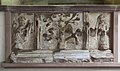
 St Nicholas, South Kilworth - Sculpture - geograph.org.uk - 3423128.jpg 1 000 × 573 ; 177 kio
-
 St Nicholas, South Kilworth - South aisle - geograph.org.uk - 3423106.jpg 1 000 × 659 ; 170 kio
-
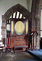
 St Nicholas, South Kilworth - Stained glass window - geograph.org.uk - 3423111.jpg 587 × 1 000 ; 284 kio
-
 St Nicholas, South Kilworth - Stained glass window - geograph.org.uk - 3423115.jpg 573 × 1 000 ; 246 kio
-
 St Nicholas, South Kilworth - Stained glass window - geograph.org.uk - 3423118.jpg 599 × 1 000 ; 316 kio
-
 St Nicholas, South Kilworth - Stonework - geograph.org.uk - 3423121.jpg 1 000 × 590 ; 173 kio
-
 St Nicholas, South Kilworth - Stonework - geograph.org.uk - 3423123.jpg 997 × 1 000 ; 242 kio
-
 St Nicholas, South Kilworth - War Memorial - geograph.org.uk - 3423138.jpg 880 × 1 000 ; 179 kio
-
 Stanford Reservoir - geograph.org.uk - 1831807.jpg 640 × 241 ; 29 kio
-
 Swans and ducks on Stanford Reservoir - geograph.org.uk - 4605778.jpg 800 × 600 ; 113 kio
-
 Thatched cottage, South Kilworth - geograph.org.uk - 3909570.jpg 640 × 480 ; 56 kio
-
 The White Hart, South Kilworth - geograph.org.uk - 3820230.jpg 640 × 480 ; 58 kio
-
 The White Hart, South Kilworth - geograph.org.uk - 3909559.jpg 640 × 480 ; 54 kio
-
 The White Hart,South Kilworth - geograph.org.uk - 2804405.jpg 800 × 600 ; 80 kio
-
 The White Hart,South Kilworth - geograph.org.uk - 2804410.jpg 600 × 800 ; 112 kio
-
 The White Hart. - geograph.org.uk - 417069.jpg 640 × 480 ; 92 kio
-
 Towards Fish Ponds - geograph.org.uk - 4714369.jpg 480 × 640 ; 71 kio
-
 Track to Botney Lodge - geograph.org.uk - 3909531.jpg 640 × 480 ; 59 kio
-
 Track to South Kilworth Lodge - geograph.org.uk - 3909539.jpg 640 × 480 ; 81 kio
-
 View from North Road - geograph.org.uk - 597367.jpg 640 × 448 ; 90 kio
-
 View from Rugby Road - geograph.org.uk - 592902.jpg 640 × 458 ; 128 kio
-
 View north of Rugby Road - geograph.org.uk - 597354.jpg 640 × 498 ; 134 kio
-
 View to Stanford Reservoir - geograph.org.uk - 3614162.jpg 1 024 × 680 ; 189 kio
-
 Walcote Road - geograph.org.uk - 3909540.jpg 640 × 480 ; 71 kio
-
 Walcote Road - geograph.org.uk - 3909554.jpg 640 × 480 ; 79 kio
-
 Welford Road, South Kilworth - geograph.org.uk - 592897.jpg 640 × 480 ; 133 kio
-
 William pearson green plaque south kilworth.jpg 800 × 800 ; 191 kio
-
 Wind turbines near South Kilworth - geograph.org.uk - 3613905.jpg 1 024 × 680 ; 160 kio
-
 Approaching South Kilworth - geograph.org.uk - 592895.jpg 640 × 457 ; 143 kio
-
 North Road near South Kilworth - geograph.org.uk - 597371.jpg 640 × 480 ; 115 kio
-
 North Road, South Kilworth - geograph.org.uk - 597361.jpg 640 × 443 ; 76 kio
-
 River Avon, South Kilworth - geograph.org.uk - 164596.jpg 640 × 480 ; 115 kio
-
 Rugby Road, Leicestershire - geograph.org.uk - 592904.jpg 640 × 420 ; 104 kio
-
 South Kilworth - geograph.org.uk - 112707.jpg 640 × 480 ; 137 kio
-
 South Kilworth - geograph.org.uk - 150361.jpg 640 × 480 ; 94 kio
-
 South Kilworth - geograph.org.uk - 150363.jpg 640 × 480 ; 60 kio
-
 South Kilworth - geograph.org.uk - 167645.jpg 640 × 480 ; 121 kio
-
 South Kilworth - Walcote Rd - geograph.org.uk - 150359.jpg 640 × 480 ; 75 kio
-
 Stanford on Avon - geograph.org.uk - 60547.jpg 640 × 480 ; 93 kio
-
 The Belt, South Kilworth - geograph.org.uk - 164600.jpg 640 × 480 ; 143 kio


