Category:South Stack
Zur Navigation springen
Zur Suche springen
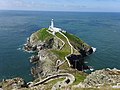
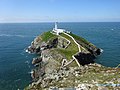
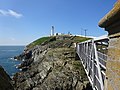
English: South Stack is an island in the community of Trearddur, in the principal area of the Isle of Anglesey, Wales.
Insel im Vereinigten Königreich  | |||||
| Medium hochladen | |||||
| Ist ein(e) | |||||
|---|---|---|---|---|---|
| Ort | Isle of Anglesey, Wales | ||||
| Liegt am oder im Gewässer | |||||
| Breite |
| ||||
| Länge |
| ||||
| Höhe |
| ||||
| Einwohnerzahl |
| ||||
| Fläche |
| ||||
 | |||||
Unterkategorien
Es werden 2 von insgesamt 2 Unterkategorien in dieser Kategorie angezeigt:
In Klammern die Anzahl der enthaltenen Kategorien (K), Seiten (S), Dateien (D)
A
- South Stack in art (14 D)
S
- South Stack Lighthouse (218 D)
Medien in der Kategorie „South Stack“
Folgende 87 Dateien sind in dieser Kategorie, von 87 insgesamt.
-
 Admiralty Chart No 368 Wales Barmouth to South Stack, Published 1896.jpg 9.517 × 12.093; 16,97 MB
-
 Anglsey and South Stack Lighthouse (8722129219).jpg 3.872 × 2.592; 4,59 MB
-
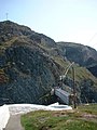
 Bridge across to South Stack - geograph.org.uk - 4426350.jpg 2.112 × 2.816; 1,15 MB
-
 Bridge and stepped path to South Stack Lighthouse - geograph.org.uk - 2738088.jpg 1.500 × 1.125; 1,89 MB
-
 Coast near South Stack - geograph.org.uk - 1898505.jpg 640 × 394; 199 KB
-
 Ellens Tower, South Stack, Holy Island (507277) (33114243175).jpg 5.324 × 2.995; 4,02 MB
-
 Ellens Tower, South Stack, Holy Island (507278) (32731784220).jpg 3.955 × 2.225; 3,62 MB
-
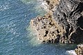
 Folded Rocks in Cliff at South Stack on Anglesey in Wales.jpg 640 × 427; 280 KB
-

-
-

-

-
-

-

-
-

-

-

-

-
-

-

-

-

-
 Guillemots at South Stack (48203384186).jpg 2.048 × 1.536; 1,47 MB
-
 Guillemots at South Stack (48203428492).jpg 2.048 × 1.536; 1,47 MB
-
 Guillemots at South Stack (48203434852).jpg 1.536 × 2.048; 1.001 KB
-
 Guillemots RSPB Southstack - Anglesey (20199596766).jpg 3.500 × 2.333; 13,78 MB
-
 Gull's Nest - geograph.org.uk - 1898458.jpg 427 × 640; 315 KB
-
 Gwylanod yn nyth yn Ynys Lawd Seagulls nesting at South Stack, Wales 01.tif 2.481 × 2.127; 9,59 MB
-
 Gwylanod yn nyth yn Ynys Lawd Seagulls nesting at South Stack, Wales 02.jpg 4.272 × 2.848; 7,05 MB
-
 Larus argentatus argenteus01.jpg 2.848 × 1.758; 3,41 MB
-
 South Stack (48203430927).jpg 2.048 × 1.368; 1,1 MB
-
 South Stack - 1982 - geograph.org.uk - 2776813.jpg 1.520 × 2.272; 562 KB
-
 South Stack - 1982 - geograph.org.uk - 2776974.jpg 2.272 × 1.520; 325 KB
-
 South Stack - geograph.org.uk - 2591365.jpg 640 × 427; 92 KB
-
 South Stack - geograph.org.uk - 6292618.jpg 1.600 × 1.102; 417 KB
-
 South Stack and yachts - geograph.org.uk - 2401349.jpg 3.648 × 2.736; 5,8 MB
-
 South Stack Bridge - geograph.org.uk - 1898515.jpg 640 × 427; 230 KB
-
 South Stack Bridge - geograph.org.uk - 240399.jpg 480 × 640; 76 KB
-
 South Stack coastline - geograph.org.uk - 1159389.jpg 640 × 428; 87 KB
-
 South Stack Rocks, Holyhead, Wales LOC 3752429748.jpg 1.024 × 763; 238 KB
-
 South Stack the long way up - geograph.org.uk - 702831.jpg 456 × 640; 107 KB
-
 South Stack, a gull and a view - geograph.org.uk - 3652749.jpg 640 × 480; 80 KB
-
 South Stack, Anglesey - geograph.org.uk - 3134762.jpg 1.840 × 3.264; 673 KB
-
 South Stack, Anglesey, N Wales - geograph.org.uk - 3134786.jpg 3.264 × 1.840; 968 KB
-
 South Stack, approaching the bridge - geograph.org.uk - 3652694.jpg 480 × 640; 91 KB
-

-

-
 South Stack, part of the path - geograph.org.uk - 3652795.jpg 480 × 640; 102 KB
-

-
 South Stack, some spectacular cliffs - geograph.org.uk - 3652792.jpg 640 × 480; 120 KB
-
 South Stack, the suspension bridge - geograph.org.uk - 3652710.jpg 480 × 640; 98 KB
-

-
 South Stack3.JPG 2.816 × 2.112; 2,58 MB
-

-
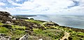
 The coast near South Stack - geograph.org.uk - 4159354.jpg 2.592 × 1.944; 1,45 MB
-
 The View from South Stack - geograph.org.uk - 1898447.jpg 427 × 640; 276 KB
-

-

-

-
 Tinwen y garn - Oenanthe oenanthe - Northern wheatear on South Stack, Ynys Mon, Wales 04.jpg 4.272 × 2.848; 6,06 MB
-
 Twr Elin.jpg 4.032 × 2.272; 4,02 MB
-
 Tŵr Elin (Elin's Tower), Ynys Lawd, Ynys Mon, Wales 01.jpg 4.896 × 3.672; 4,14 MB
-
 Tŵr Elin (Elin's Tower), Ynys Lawd, Ynys Mon, Wales 02.jpg 7.751 × 3.697; 6,39 MB
-
 Tŵr Elin (Elin's Tower), Ynys Lawd, Ynys Mon, Wales 03.jpg 4.896 × 3.672; 7,55 MB
-
 Tŵr Elin (Elin's Tower), Ynys Lawd, Ynys Mon, Wales 04.jpg 5.255 × 3.541; 3,92 MB
-
 Tŵr Elin (Elin's Tower), Ynys Lawd, Ynys Mon, Wales 05.jpg 4.896 × 3.672; 4,67 MB
-
 Tŵr Elin (Elin's Tower), Ynys Lawd, Ynys Mon, Wales 06.jpg 6.790 × 3.462; 5,15 MB
-
 Walls on South Stack - geograph.org.uk - 1898429.jpg 534 × 640; 365 KB
-

-
 Ynys Lawd - South Stack RSPB Ynys Mon, Wales 01.jpg 6.852 × 3.198; 2,78 MB
-
 Ynys Lawd - South Stack RSPB Ynys Mon, Wales 02.jpg 4.107 × 2.738; 2,14 MB
-
 Ynys Lawd - South Stack RSPB Ynys Mon, Wales 03.jpg 4.019 × 2.679; 2,67 MB
-
 Ynys Lawd - South Stack RSPB Ynys Mon, Wales 04.jpg 4.272 × 2.848; 6,12 MB
-
 Ynys Lawd - South Stack RSPB Ynys Mon, Wales 05.jpg 4.272 × 2.848; 3,17 MB
-
 Ynys Lawd - South Stack RSPB Ynys Mon, Wales 06.jpg 4.896 × 3.672; 6,48 MB
-
 Ynys Lawd - South Stack RSPB Ynys Mon, Wales 07.jpg 4.699 × 3.524; 4,04 MB
-
 Ynys Lawd - South Stack RSPB Ynys Mon, Wales 08.jpg 4.896 × 3.672; 6,08 MB
-
 Ynys Lawd - South Stack RSPB Ynys Mon, Wales 09.jpg 7.954 × 4.138; 26,88 MB
-
 Ynys Lawd - South Stack RSPB Ynys Mon, Wales 10.jpg 4.896 × 3.672; 6,1 MB
-
 Ynys Lawd - South Stack RSPB Ynys Mon, Wales 11.jpg 4.896 × 3.672; 7,05 MB
-
 Ynys Lawd - South Stack RSPB Ynys Mon, Wales 12.jpg 5.848 × 4.564; 17,81 MB
-
 Ynys Lawd - South Stack RSPB Ynys Mon, Wales 13.jpg 4.896 × 3.672; 5,99 MB
-
 Ynys Lawd Caniadau Buddug.jpg 1.344 × 992; 534 KB
-
 Ynys Lawd-South Stack on the port side - geograph.org.uk - 3899905.jpg 1.024 × 768; 112 KB

.jpg)


_(33114243175).jpg)
_(32731784220).jpg)

,_Ynys_Mon,_Wales_May_2021_01.jpg)
,_Ynys_Mon,_Wales_May_2021_02.jpg)
,_Ynys_Mon,_Wales_May_2021_03.jpg)
,_Ynys_Mon,_Wales_May_2021_04.jpg)
,_Ynys_Mon,_Wales_May_2021_05.jpg)
,_Ynys_Mon,_Wales_May_2021_06.jpg)
,_Ynys_Mon,_Wales_May_2021_07.jpg)
,_Ynys_Mon,_Wales_May_2021_08.jpg)
,_Ynys_Mon,_Wales_May_2021_09.jpg)
,_Ynys_Mon,_Wales_May_2021_10.jpg)
,_Ynys_Mon,_Wales_May_2021_11.jpg)
,_Ynys_Mon,_Wales_May_2021_12.jpg)
,_Ynys_Mon,_Wales_May_2021_13.jpg)
,_Ynys_Mon,_Wales_May_2021_14.jpg)
,_Ynys_Mon,_Wales_May_2021_15.jpg)
,_Ynys_Mon,_Wales_May_2021_16.jpg)
,_Ynys_Mon,_Wales_May_2021_17.jpg)
.jpg)
.jpg)
.jpg)
.jpg)


.jpg)


,_Ynys_Lawd,_Ynys_Mon,_Wales_01.jpg)
,_Ynys_Lawd,_Ynys_Mon,_Wales_02.jpg)
,_Ynys_Lawd,_Ynys_Mon,_Wales_03.jpg)
,_Ynys_Lawd,_Ynys_Mon,_Wales_04.jpg)
,_Ynys_Lawd,_Ynys_Mon,_Wales_05.jpg)
,_Ynys_Lawd,_Ynys_Mon,_Wales_06.jpg)

_from_Ellin%27s_Tower_-_geograph.org.uk_-_1899932.jpg)


