Category:South Stoke, West Sussex
Naar navigatie springen
Naar zoeken springen
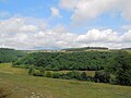
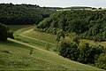
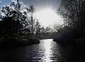
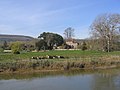
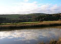
English: South Stoke is a village and civil parish in the Arun District of West Sussex, England. It is located two miles (3 km) to the north of Arundel, and is situated on the west bank of the River Arun on the edge of Arundel Park. It is reached by road from Arundel. A footpath leads to North Stoke on the east bank. The civil parish, which includes the hamlet of Offham, covers an area of and has a population of 44 persons (2001 census). The parish church, Saxon in origin, is dedicated to St Leonard. There is one public house, the Black Rabbit at Offham.

West Sussex  | |||||
| Media uploaden | |||||
| Is een | |||||
|---|---|---|---|---|---|
| Locatie | Arun, West Sussex, South East England, Engeland | ||||
| Inwonertal |
| ||||
| Oppervlakte |
| ||||
 | |||||
Ondercategorieën
Deze categorie bevat de volgende 2 subcategorieën, van de 2 in totaal.
O
Media in categorie "South Stoke, West Sussex"
Deze categorie bevat de volgende 200 bestanden, van in totaal 342.
(vorige pagina) (volgende pagina)-
 "From up here, ewe can see the whole world" - geograph.org.uk - 5090442.jpg 4.000 × 2.666; 6,94 MB
-
 40, South Stoke - geograph.org.uk - 3619050.jpg 640 × 480; 53 kB
-
 A charm of goldfinches (Carduelis carduelis) - geograph.org.uk - 5587487.jpg 1.000 × 1.008; 851 kB
-
-
 A very low Swanbourne Lake - geograph.org.uk - 1557387.jpg 640 × 480; 96 kB
-
 An old course of the River Arun - geograph.org.uk - 2604544.jpg 640 × 430; 50 kB
-
 And you are^ - geograph.org.uk - 4346237.jpg 640 × 480; 63 kB
-
 Approach to the house at Foxes Oven - geograph.org.uk - 2523864.jpg 1.024 × 768; 302 kB
-
 Arun journey - geograph.org.uk - 803092.jpg 634 × 417; 60 kB
-
 Arun journey - geograph.org.uk - 803112.jpg 637 × 425; 88 kB
-
 Arun journey - geograph.org.uk - 803117.jpg 637 × 425; 48 kB
-
 Arun journey - geograph.org.uk - 803131.jpg 637 × 425; 79 kB
-
 Arun Valley - geograph.org.uk - 3618643.jpg 640 × 480; 64 kB
-
 Arun Valley - geograph.org.uk - 5090411.jpg 3.985 × 2.656; 6,93 MB
-
 Arun Valley - geograph.org.uk - 5090417.jpg 3.986 × 2.657; 7,39 MB
-
 Arun Valley - geograph.org.uk - 5090424.jpg 3.986 × 2.657; 7,22 MB
-
 Arun Valley - geograph.org.uk - 644169.jpg 479 × 640; 77 kB
-
 Arun Valley Railway - geograph.org.uk - 3612439.jpg 640 × 480; 86 kB
-
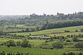
 Arundel Castle from Wetland Centre - geograph.org.uk - 5586522.jpg 1.000 × 1.005; 743 kB
-
 Arundel Park - geograph.org.uk - 3036247.jpg 640 × 430; 68 kB
-
 Arundel Park - geograph.org.uk - 3039435.jpg 640 × 430; 52 kB
-
 Arundel Park - geograph.org.uk - 3039472.jpg 640 × 430; 44 kB
-
 Arundel Park - geograph.org.uk - 3039537.jpg 640 × 430; 45 kB
-
 Arundel Park - geograph.org.uk - 3039542.jpg 640 × 430; 51 kB
-
 Arundel Park - geograph.org.uk - 3039549.jpg 640 × 430; 48 kB
-
 Arundel Park - geograph.org.uk - 3039556.jpg 640 × 430; 37 kB
-
 Arundel Park - geograph.org.uk - 4042874.jpg 4.000 × 3.000; 3,95 MB
-
 Arundel Park - geograph.org.uk - 4110782.jpg 2.048 × 1.536; 536 kB
-
 Arundel Park - geograph.org.uk - 4570805.jpg 1.600 × 1.200; 353 kB
-
 Arundel Park - geograph.org.uk - 4570856.jpg 1.600 × 1.200; 341 kB
-
 Arundel Park - geograph.org.uk - 4570873.jpg 1.600 × 1.200; 374 kB
-
 Arundel Park - geograph.org.uk - 5090123.jpg 3.973 × 2.648; 7,9 MB
-
 Arundel Park - geograph.org.uk - 5090435.jpg 4.000 × 2.666; 7,33 MB
-
 Arundel Park - geograph.org.uk - 5090468.jpg 4.000 × 2.666; 7,98 MB
-
 Arundel Park - geograph.org.uk - 5090477.jpg 4.000 × 2.666; 7,06 MB
-
 Arundel Park - geograph.org.uk - 5092184.jpg 5.792 × 3.861; 5,63 MB
-
 Arundel Park - geograph.org.uk - 5092186.jpg 4.000 × 2.666; 6,76 MB
-
 Arundel Park - geograph.org.uk - 5092192.jpg 4.000 × 2.666; 7,56 MB
-
 Arundel Park - geograph.org.uk - 5092196.jpg 4.000 × 2.666; 6,44 MB
-
 Arundel Park - geograph.org.uk - 5092201.jpg 4.000 × 2.666; 7,04 MB
-
 Arundel Park - geograph.org.uk - 5092204.jpg 4.000 × 2.666; 7,52 MB
-
 Arundel Park - geograph.org.uk - 5092211.jpg 4.000 × 2.666; 7,23 MB
-
 Arundel Park by Swanbourne Lake - geograph.org.uk - 4571335.jpg 1.600 × 1.200; 403 kB
-
 Arundel Park trig point - geograph.org.uk - 5571108.jpg 3.840 × 2.160; 4,11 MB
-
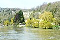
 Arundel Pool - geograph.org.uk - 2547984.jpg 800 × 600; 223 kB
-
 Arundel Wetland Centre - geograph.org.uk - 4056708.jpg 800 × 531; 180 kB
-
 Arundel Wetland Centre - geograph.org.uk - 4359187.jpg 640 × 428; 102 kB
-
 Arundel Wetland Centre - geograph.org.uk - 4359195.jpg 640 × 479; 123 kB
-
 Arundel Wetland Centre - geograph.org.uk - 5316227.jpg 4.647 × 2.074; 5,73 MB
-
 Arundel Wetland Centre - View from the boat - geograph.org.uk - 5585407.jpg 1.364 × 1.000; 1,12 MB
-
 Arundel Wetlands Centre - geograph.org.uk - 4357908.jpg 640 × 428; 45 kB
-
 Arundel Wetlands Centre - geograph.org.uk - 6655458.jpg 3.648 × 2.736; 3,78 MB
-
 Arundel Wetlands Centre - geograph.org.uk - 6655463.jpg 3.648 × 2.736; 3,32 MB
-
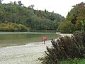
 Arundel WWT - Boat safari - geograph.org.uk - 2985496.jpg 1.600 × 1.200; 474 kB
-
 Arundel WWT - geograph.org.uk - 2986118.jpg 1.600 × 1.200; 641 kB
-
 Arundel, Swanbourne Lake - geograph.org.uk - 1508797.jpg 640 × 480; 75 kB
-
 Autumn at South Stoke - geograph.org.uk - 1558762.jpg 640 × 480; 96 kB
-
 Barn, South Stoke, Arundel 01.jpg 2.816 × 2.112; 1,46 MB
-
 Barn, South Stoke, Arundel 02.jpg 2.816 × 2.112; 1,5 MB
-
 Bend in the River Arun near Foxes Oven - geograph.org.uk - 2523909.jpg 1.024 × 768; 236 kB
-
 Bend on the Arun near Offham - geograph.org.uk - 2523861.jpg 1.024 × 768; 278 kB
-
 Black Necked Swans - Arundel WWT - geograph.org.uk - 2986130.jpg 1.600 × 1.200; 553 kB
-
 Black Poplar Memorial Grove at Arundel Wetland Centre - geograph.org.uk - 5316230.jpg 2.650 × 4.553; 7,15 MB
-
 Black Rabbit Pub, Arundel - geograph.org.uk - 4572080.jpg 1.600 × 1.200; 400 kB
-
 Boardwalk at Arundel Wetlands Centre - geograph.org.uk - 5316225.jpg 1.730 × 2.967; 3,57 MB
-
 Boat Safari - Arundel WWT - geograph.org.uk - 2985483.jpg 1.600 × 1.190; 480 kB
-
 Boundary Wall, Arundel Park - geograph.org.uk - 3041906.jpg 640 × 430; 106 kB
-
 Box Copse - geograph.org.uk - 3036238.jpg 640 × 430; 64 kB
-
 Box Copse - geograph.org.uk - 3036246.jpg 640 × 430; 54 kB
-
 Bridge Across the River Arun - geograph.org.uk - 1305300.jpg 640 × 424; 77 kB
-
 Bridge carrying Mill Road - geograph.org.uk - 1557484.jpg 640 × 480; 108 kB
-
 Bridge over the River Arun - geograph.org.uk - 4764623.jpg 640 × 426; 39 kB
-
 Bridge over the River Arun - geograph.org.uk - 6634886.jpg 1.024 × 684; 147 kB
-
 Bridge, Arun Valley Railway - geograph.org.uk - 3586266.jpg 640 × 480; 74 kB
-
 Bridleway corner near South Stoke Farm - geograph.org.uk - 2523954.jpg 1.024 × 768; 268 kB
-
 Bridleway reaches road at Offham - geograph.org.uk - 2523867.jpg 1.024 × 768; 315 kB
-
 Bridleway towards Peppering High Barn - geograph.org.uk - 4681617.jpg 1.024 × 760; 166 kB
-
 Broken Gate - geograph.org.uk - 3679989.jpg 4.000 × 3.000; 4,66 MB
-
 Buildings at Home Farm, Arundel, Sussex - geograph.org.uk - 2237563.jpg 3.214 × 2.139; 7,6 MB
-
 Burpham church tower seen from Arun footpath - geograph.org.uk - 2523899.jpg 1.024 × 768; 238 kB
-
 Burpham Loop, River Arun - geograph.org.uk - 3618905.jpg 640 × 480; 49 kB
-
 Burpham, Sussex - geograph.org.uk - 2237549.jpg 4.592 × 2.196; 4,88 MB
-
 Canoeist, River Arun - geograph.org.uk - 3618959.jpg 640 × 332; 91 kB
-
 Castle Park Gate - geograph.org.uk - 2459560.jpg 800 × 600; 115 kB
-
 Cattle by the River Arun south of South Stoke - geograph.org.uk - 2523913.jpg 1.024 × 768; 239 kB
-
 Chalk dry valley - geograph.org.uk - 3036243.jpg 640 × 430; 74 kB
-
 Chapel Barn, South Stoke - geograph.org.uk - 1895342.jpg 640 × 428; 140 kB
-
 Clump of trees, Arundel Park - geograph.org.uk - 3039544.jpg 640 × 430; 47 kB
-
 Cock pheasant, Arundel Wetland Centre - geograph.org.uk - 4440124.jpg 1.000 × 1.333; 1,26 MB
-
 Collecting the bales at South Stoke - geograph.org.uk - 2490249.jpg 800 × 600; 125 kB
-
 Cottages near Black Rabbit Pub, Arundel - geograph.org.uk - 4572060.jpg 1.600 × 1.200; 449 kB
-
 Descending on The Monarch's Way - geograph.org.uk - 3041853.jpg 640 × 430; 78 kB
-
 Drainage Ditch Junction - geograph.org.uk - 644007.jpg 479 × 640; 122 kB
-
 Dry Lodge Plantation - geograph.org.uk - 3039548.jpg 640 × 430; 64 kB
-
 Dry Lodge Plantation - geograph.org.uk - 3039552.jpg 640 × 430; 62 kB
-
 Dry Lodge Plantation - geograph.org.uk - 3041836.jpg 640 × 430; 57 kB
-
 Dry valley - geograph.org.uk - 3036251.jpg 640 × 430; 59 kB
-
 Dry valley, Arundel Park - geograph.org.uk - 3036232.jpg 640 × 430; 51 kB
-
 Dryad's Saddle (Polyporus squamosus) (1) - geograph.org.uk - 3620007.jpg 480 × 640; 131 kB
-

-
 Duckling, Arundel Wetland Centre - geograph.org.uk - 4440130.jpg 1.415 × 1.000; 930 kB
-
 Duke's Plantation - geograph.org.uk - 3039475.jpg 640 × 430; 40 kB
-
 Entrance to Arundel Park - geograph.org.uk - 3843663.jpg 4.000 × 2.666; 6,29 MB
-
 Entrance to Arundel Wetland Centre - geograph.org.uk - 5316241.jpg 4.000 × 3.000; 2,47 MB
-
 Farm track bridge over the Arun - geograph.org.uk - 1558678.jpg 640 × 480; 83 kB
-
 Farmhouse, South Stoke Farm - geograph.org.uk - 1895353.jpg 640 × 428; 107 kB
-

-
 Field edge near South Stoke Farm - geograph.org.uk - 2523951.jpg 1.024 × 768; 211 kB
-
 Flooding in the Arun Valley - geograph.org.uk - 3837350.jpg 4.000 × 2.666; 6,47 MB
-
 Flooding in the Arun Valley - geograph.org.uk - 3840872.jpg 4.000 × 2.666; 7,35 MB
-
 Flooding in the Arun Valley - geograph.org.uk - 3840893.jpg 4.000 × 2.666; 6,83 MB
-
 Flooding in the Arun Valley - geograph.org.uk - 3840909.jpg 4.000 × 2.666; 6,79 MB
-
 Flooding in the Arun Valley - geograph.org.uk - 3840962.jpg 4.000 × 2.666; 7,77 MB
-
 Flooding in the Arun Valley - geograph.org.uk - 3840970.jpg 4.000 × 2.666; 7,37 MB
-
 Flooding in the Arun Valley - geograph.org.uk - 3840979.jpg 4.000 × 2.666; 7,36 MB
-
 Flooding in the Arun Valley - geograph.org.uk - 3841129.jpg 4.000 × 2.666; 7,19 MB
-
 Follow the Leader - geograph.org.uk - 2986088.jpg 1.600 × 1.079; 710 kB
-
 Footbridge at South Stoke - geograph.org.uk - 1558779.jpg 640 × 480; 87 kB
-

-
 Footbridge over the River Arun - geograph.org.uk - 2604553.jpg 640 × 430; 54 kB
-

-
 Footpath along the west bank of the Arun - geograph.org.uk - 3526746.jpg 640 × 427; 112 kB
-
 Footpath and Farm Access at South Stoke - geograph.org.uk - 6122627.jpg 2.560 × 1.920; 2,05 MB
-
 Footpath between River Arun and Wetlands Centre - geograph.org.uk - 4668535.jpg 1.600 × 1.200; 807 kB
-
 Footpath by the Arun - geograph.org.uk - 2523890.jpg 1.024 × 768; 253 kB
-
 Footpath from South Stoke - geograph.org.uk - 4668623.jpg 1.600 × 1.200; 1,17 MB
-
 Footpath on west bank of River Arun - geograph.org.uk - 4668610.jpg 1.600 × 1.200; 1,02 MB
-
 Footpath sign on the River Arun - geograph.org.uk - 2522048.jpg 1.024 × 768; 209 kB
-
 Footpath sign, Arundel Park - geograph.org.uk - 3039427.jpg 640 × 430; 74 kB
-
 Former Rectory, South Stoke - geograph.org.uk - 393550.jpg 640 × 480; 54 kB
-
 Former Rectory, South Stoke - geograph.org.uk - 644076.jpg 479 × 640; 69 kB
-
 Foxes Oven - geograph.org.uk - 3618950.jpg 640 × 480; 55 kB
-
 Foxes Oven - geograph.org.uk - 644110.jpg 640 × 463; 66 kB
-
 Gate on footpath over sluice on the Arun - geograph.org.uk - 2547360.jpg 1.024 × 731; 288 kB
-
 Gateway on the Monarch's Way - geograph.org.uk - 2523845.jpg 1.024 × 768; 299 kB
-
-
 Geese by Swanbourne Lake - geograph.org.uk - 4571332.jpg 1.600 × 1.200; 636 kB
-
 Goslings at Swanbourne Lake - geograph.org.uk - 2272110.jpg 3.264 × 2.448; 2,78 MB
-
 Grassland, Arundel Park - geograph.org.uk - 3039460.jpg 640 × 430; 41 kB
-
 Gurkha Suspension Bridge - geograph.org.uk - 3620017.jpg 480 × 640; 115 kB
-
 Gurkha Suspension Bridge - geograph.org.uk - 4936877.jpg 640 × 635; 112 kB
-
 Hidden lake - geograph.org.uk - 3036230.jpg 640 × 430; 91 kB
-
 Hide at Arundel Wetland Centre - geograph.org.uk - 2523859.jpg 1.024 × 768; 299 kB
-

-
 In Arundel Park - geograph.org.uk - 4042878.jpg 4.000 × 3.000; 3,97 MB
-
 Into the valley - geograph.org.uk - 1999107.jpg 3.648 × 2.736; 3,78 MB
-
 Lake at Arundel WWT - geograph.org.uk - 2986066.jpg 1.600 × 1.200; 603 kB
-
 Lake at Arundel WWT - geograph.org.uk - 2986123.jpg 1.600 × 1.200; 852 kB
-
 Lane leading to South Stoke - geograph.org.uk - 6122622.jpg 2.560 × 1.920; 2,18 MB
-
 Local flooding, Arun Valley - geograph.org.uk - 4764625.jpg 640 × 292; 26 kB
-
 Lodge at the entrance to Arundel Park - geograph.org.uk - 4041941.jpg 4.000 × 3.000; 4,08 MB
-
 Log pile, Arundel Park - geograph.org.uk - 4110784.jpg 2.048 × 1.536; 688 kB
-
 Looking across the head of Swanbourne Lake - geograph.org.uk - 4042887.jpg 4.000 × 3.000; 4,25 MB
-

-
 Looking over the bridge at South Stoke - geograph.org.uk - 2490257.jpg 800 × 600; 118 kB
-
-
 Looking to Lonebeech Plantation - geograph.org.uk - 3041834.jpg 640 × 430; 35 kB
-
 Looking towards Swanbourne Lake - geograph.org.uk - 5030201.jpg 7.198 × 4.743; 4,19 MB
-
 Meadows - Arundel WWT - geograph.org.uk - 2985434.jpg 1.600 × 1.200; 736 kB
-
 Mill Road Bridge - geograph.org.uk - 2547990.jpg 600 × 800; 126 kB
-
 Mill Road by Arundel Wetland Centre - geograph.org.uk - 2523871.jpg 1.024 × 768; 244 kB
-
 Mind your head - geograph.org.uk - 3680807.jpg 4.000 × 3.000; 4,93 MB
-
 Monarch's Way - geograph.org.uk - 3036236.jpg 640 × 430; 66 kB
-
 Monarch's Way - geograph.org.uk - 3036237.jpg 640 × 430; 132 kB
-
 Monarch's Way - geograph.org.uk - 3036240.jpg 640 × 430; 104 kB
-
 Monarch's Way - geograph.org.uk - 3036248.jpg 640 × 430; 83 kB
-
 Monarch's Way - geograph.org.uk - 3039457.jpg 640 × 430; 39 kB
-
 Monarch's Way - geograph.org.uk - 3039462.jpg 640 × 430; 36 kB
-
 Monarch's Way - geograph.org.uk - 3041837.jpg 640 × 430; 39 kB
-
 Monarch's Way - geograph.org.uk - 3041896.jpg 640 × 430; 114 kB
-
 Monarch's Way - geograph.org.uk - 3041905.jpg 640 × 430; 101 kB
-
-

-

-
 Monarch's Way goes left - geograph.org.uk - 3041888.jpg 640 × 430; 68 kB
-
 Monarch's Way in South Wood - geograph.org.uk - 3041879.jpg 640 × 430; 117 kB
-
 Monarch's Way in South Wood - geograph.org.uk - 3041887.jpg 640 × 430; 89 kB
-
 Monarch's Way, Arundel Park - geograph.org.uk - 3039535.jpg 640 × 430; 41 kB
-
 Monarch's Way, Arundel Park - geograph.org.uk - 3039561.jpg 640 × 430; 64 kB
-
 Mother duck taking the kids for a walk - geograph.org.uk - 4440106.jpg 1.070 × 1.000; 919 kB
-
 Mute Swan - geograph.org.uk - 4304070.jpg 6.000 × 4.000; 6,05 MB
-
 Navigating the River Arun - geograph.org.uk - 1895066.jpg 640 × 428; 125 kB
-
 New Year, new Mallards - geograph.org.uk - 4301840.jpg 4.000 × 2.667; 7,93 MB
-
 Offham - geograph.org.uk - 3612412.jpg 640 × 282; 37 kB
-
 Offham Farm Bridge - geograph.org.uk - 643999.jpg 640 × 479; 127 kB
-

-
 One limb left, South Stoke - geograph.org.uk - 1894929.jpg 640 × 428; 98 kB
-
 Outlook In Building, Arundel WWT - geograph.org.uk - 2985396.jpg 1.600 × 1.200; 602 kB
-
 Outlook In Buildings, Arundel WWT - geograph.org.uk - 2985541.jpg 1.595 × 1.600; 737 kB
-
 Overgrown track - geograph.org.uk - 3680740.jpg 4.000 × 3.000; 4,67 MB
-
 Path by the River Arun - geograph.org.uk - 4041485.jpg 4.000 × 3.000; 4,04 MB
-
 Path through Arundel Park - geograph.org.uk - 4570895.jpg 1.600 × 1.200; 580 kB
-
 Path to Arundel Wetlands Centre - geograph.org.uk - 2985314.jpg 1.600 × 1.200; 762 kB
-

-
 Post Box, South Stoke - geograph.org.uk - 6087228.jpg 683 × 1.024; 307 kB
-
 Postbox in South Stoke, West Sussex - geograph.org.uk - 2462444.jpg 1.600 × 1.200; 463 kB
-

-
 Railway tunnel, North Stoke - geograph.org.uk - 1894911.jpg 640 × 428; 99 kB
-
 Reed Beds - Arundel WWT - geograph.org.uk - 2985500.jpg 1.600 × 1.200; 595 kB
-
 Reed Beds - Arundel WWT - geograph.org.uk - 2985557.jpg 1.600 × 1.200; 445 kB


_-_geograph.org.uk_-_5587487.jpg)


_(1)_-_geograph.org.uk_-_3620007.jpg)
_(2)_-_geograph.org.uk_-_3620010.jpg)


_-_geograph.org.uk_-_2490114.jpg)


