Category:Southern California
Saltar para a navegação
Saltar para a pesquisa
English: Southern California — a major region of California, from the deserts and mountains to the Pacific coast and beaches.
American geographic and cultural region   | |||||
| Carregar ficheiro | |||||
| Instância de | |||||
|---|---|---|---|---|---|
| Localização | Califórnia, Pacific States | ||||
| Composto de | |||||
| Evento notável | |||||
| Diferente de | |||||
 | |||||
Subcategorias
Esta categoria contém as seguintes 27 subcategorias (de um total de 27).
*
C
E
G
H
I
L
N
P
Multimédia na categoria "Southern California"
Esta categoria contém os seguintes 185 ficheiros (de um total de 185).
-

-

-

-
 171020-M-UA667-0095 (37173414914).jpg 5 760 × 3 840; 1,25 MB
-
20200423 - Oil Tankers sit off the coast of Southern California.webm 59 s, 1 280 × 720; 32,8 MB
-
 A B-52 from Edwards AFB flies over the desert of Southern California (8491102).jpg 4 610 × 3 383; 9,2 MB
-
 A KC-10 Extender from Travis AFB flies over the desert of Southern California (8491115).jpg 5 516 × 3 604; 10,26 MB
-

-

-

-
-

-
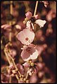
 Apple Trees, Seven Oaks 4-5-14a (13738643713).jpg 1 670 × 1 737; 1,41 MB
-
 Arms of Maarra.png 592 × 633; 123 kB
-
 Border Patrol's Beach Mess (16036442905).jpg 5 760 × 3 840; 22,77 MB
-
 Border Region.png 809 × 623; 369 kB
-
 Bottlecraft (16039662972).jpg 4 514 × 2 774; 8,44 MB
-
 Boy Scout Trailhead (16460476134).jpg 2 880 × 1 920; 1,55 MB
-
 Bristle Cone, Seven Oaks 4-5-14 (13738638033).jpg 1 770 × 1 258; 1,12 MB
-
 Building Omega Block Scorches Southern California (NESDIS 2020-05-27).gif 1 742 × 980; 11,77 MB
-
 Cahuilla Tewanet Vista Point (15398073964).jpg 5 760 × 3 840; 15,09 MB
-
 California National Guard (25758719298).jpg 5 316 × 3 544; 7,42 MB
-
 California National Guard (27870146329).jpg 3 651 × 5 477; 3,17 MB
-
 California National Guard (38863174625).jpg 5 616 × 3 744; 8,37 MB
-
 California National Guard (38921753494).jpg 4 032 × 3 024; 652 kB
-
 California National Guard (38921848754).jpg 4 998 × 3 332; 4,25 MB
-
 California National Guard (39052463234).jpg 5 616 × 3 744; 7,9 MB
-
 California National Guard (39600431712).jpg 4 837 × 3 225; 6,15 MB
-
 California National Guard (39630190101).jpg 3 024 × 4 032; 1,85 MB
-
 California National Guard (39762122941).jpg 4 883 × 3 255; 5,44 MB
-
 Channel-islands-nasa-space-view.jpg 399 × 397; 47 kB
-
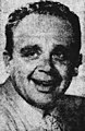 Cliffie stone circa 1952.jpg 522 × 801; 113 kB
-
-

-

-

-

-
 Cottonwood Spring Blue Hour Sunset (22705518461).jpg 5 760 × 3 840; 13,63 MB
-
 Downtown Rush.jpg 5 107 × 3 346; 9,17 MB
-

-

-

-

-

-

-

-

-

-

-

-

-

-

-

-

-

-

-

-

-

-

-

-

-

-

-

-
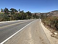 El Toro Road.jpg 4 032 × 3 024; 5,75 MB
-
 EM Southern California Coast Line (2602602661).jpg 3 872 × 2 592; 1,39 MB
-
 Fall Leaves Ca.JPG 1 536 × 2 048; 1,19 MB
-
 Foggy street in Southern California.jpg 3 008 × 5 344; 7,98 MB
-
 Forest Home Pickup 4-5-14 (13738669423).jpg 1 770 × 1 667; 1,44 MB
-
 Forest Home Pond 4-5-14 (13739023514).jpg 1 970 × 1 407; 1,37 MB
-
 Former Arms of Maarra (2022).png 643 × 917; 230 kB
-
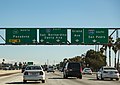
 Freeway Flags.jpg 6 000 × 2 740; 12,17 MB
-
-
 GOES-17 Captures Woolsey Fire in Southern California (44969954265).png 1 243 × 937; 2,75 MB
-
 Highway 74 from Coachella Valley Vista Point (15833142890).jpg 5 760 × 3 399; 14,29 MB
-
 Iridium 9575 Extreme & Garmin GPSMAP 64st (16014581691).jpg 5 760 × 3 840; 12,94 MB
-
ISS pass over Southern California to Hudson Bay.ogv 21 s, 640 × 425; 2,87 MB
-
 ISS View of the Southwestern USA.JPG 4 288 × 2 850; 2,27 MB
-
 ISS-36 Storm clouds over Southern California.jpg 2 832 × 4 256; 2,7 MB
-
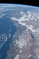
 ISS061-E-101164 - View of Earth (Cropped).jpg 3 712 × 4 463; 2,11 MB
-
 ISS061-E-101164 - View of Earth.jpg 3 712 × 5 568; 2,2 MB
-
 Julia Boynton Green (1905).png 267 × 568; 179 kB
-
 Junegloom 16jun2004.gif 680 × 480; 118 kB
-
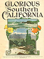 La-et-ms-los-angeles-sheet-music-20130529-dto-002.jpg 350 × 470; 100 kB
-
 Log School House, 7 Oaks 4-5-14a (13739097524).jpg 1 870 × 1 117; 1,03 MB
-
 Log School House, 7 Oaks 4-5-14d (13739093364).jpg 1 870 × 969; 1,07 MB
-
 Los Angeles LA Traffic (22828753351).jpg 5 032 × 3 560; 8,07 MB
-
 Los angeles MSA historical population.png 1 275 × 812; 60 kB
-
 CarpOffshore.jpg 3 300 × 2 550; 1 019 kB
-
 Mark Skovorodko Photography - Daley Ranch Escondido Aerial.jpg 3 600 × 2 398; 8,8 MB
-
 Mark Skovorodko Photography - Daley Ranch Mountain Biking Escondido.jpg 3 600 × 2 025; 5,65 MB
-
 Mark Skovorodko Photography - Dixon Lake Boating Escondido.jpg 3 600 × 2 400; 7,22 MB
-
 Mark Skovorodko Photography - Dixon Lake Escondido Sunrise Aerial.jpg 3 600 × 2 025; 6,45 MB
-
 Mark Skovorodko Photography - Dixon Lake Picnic Area.jpg 3 600 × 2 025; 10,76 MB
-
 Mark Skovorodko Photography - Downtown Escondido Aerial (cropped).jpg 2 957 × 937; 3,29 MB
-
 Mark Skovorodko Photography - Downtown Escondido Aerial.jpg 3 600 × 2 025; 6,71 MB
-
 Mark Skovorodko Photography - Escondido City Hall.jpg 3 600 × 2 025; 6,3 MB
-
 Mark Skovorodko Photography - Escondido Geography Aerial.jpg 3 600 × 1 800; 5,81 MB
-
 Mark Skovorodko Photography - Escondido Grand Avenue Sign.jpg 3 600 × 2 025; 5,55 MB
-
 Mark Skovorodko Photography - Escondido Historic District Neighborhood Afternoon.jpg 3 600 × 2 250; 10,06 MB
-
 Mark Skovorodko Photography - Escondido Historic Downtown Aerial.jpg 3 600 × 2 025; 5,97 MB
-
 Mark Skovorodko Photography - Kit Carson Park Escondido.jpg 3 600 × 2 400; 10,52 MB
-
 Mark Skovorodko Photography - San Pascual Valley Orchard Escondido.jpg 3 600 × 2 398; 11,17 MB
-
 Mastodon Peak Cottonwood Spring Sunset, Joshua Tree National Park, California (24335591272).jpg 5 760 × 3 840; 18,89 MB
-
 Mayer Reprographics (15420715823).jpg 4 842 × 3 249; 7,75 MB
-
 Mojave Evoque.jpg 945 × 1 339; 360 kB
-
 Moon in Sunrise Sky.jpg 2 112 × 2 816; 1,29 MB
-
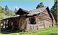
 Mt. Baldy Hut 1937-1938.jpg 1 881 × 2 035; 1,22 MB
-
 Old El Toro Road Underpass.jpg 4 032 × 3 024; 5,12 MB
-
 Palm and Fog, Redlands 3-17-13 (8568651163).jpg 1 359 × 1 750; 361 kB
-
 Palms and Fog, Redlands 3-17-13 (8568651545).jpg 1 750 × 1 511; 730 kB
-
 Peaks, Seven Oaks 4-5-14 (13738686945).jpg 2 070 × 855; 994 kB
-
 Pinto Basin - Black Eagle Mine - Old Dale (15833084160).jpg 5 305 × 3 439; 11,44 MB
-
 Pinto Basin Road (16043301515).jpg 5 759 × 3 523; 16,3 MB
-
 Point Dume Malibu scattered clouds.jpg 3 523 × 5 285; 8,51 MB
-
 Police Dogs Used for Your Protection (17219531839).jpg 2 448 × 2 602; 7,16 MB
-
 Port of San Diego's Harbor Police Department (Historical Photos) -a.jpg 3 043 × 2 048; 3,8 MB
-
 Port of San Diego's Harbor Police Department (Historical Photos) -c.jpg 2 048 × 3 043; 3,1 MB
-
 Port of San Diego's Harbor Police Department (Historical Photos) -e.jpg 3 043 × 2 048; 2,54 MB
-
 Red Door, Redlands 5-11-14 (14358755858).jpg 1 369 × 2 160; 1,32 MB
-
 Russ Allison Loar Self Portrait.jpg 6 000 × 4 000; 7,9 MB
-
 San Gorgonio summit hiker.jpg 4 032 × 1 960; 2,19 MB
-
 San pedro breakwater cross-section 1896.png 824 × 513; 388 kB
-
 Santa Anna Creek, 7 Oaks 4-5-14e (13738664515).jpg 1 729 × 1 870; 1,98 MB
-
 Santiago Canyon.jpg 5 184 × 3 456; 4,39 MB
-
 Sea-lavender gently sways during sunset in Laguna Beach, California.jpg 2 048 × 3 089; 2,17 MB
-
 Seafood market in Santa Barbara Harbor.jpg 1 500 × 1 000; 1,32 MB
-
 Seagull (15862153835).jpg 5 760 × 3 840; 10,58 MB
-
 Skull Rock Trail (15833095630).jpg 5 760 × 3 024; 15,11 MB
-
 Skull Rock Trail (16895162168).jpg 5 760 × 3 578; 16,57 MB
-
 Snow on the mountains of Southern California.jpg 1 280 × 930; 283 kB
-
 So Cal Coastline photo D Ramey Logan.jpg 4 800 × 3 200; 9,28 MB
-
 So Cal Sunset photo D Ramey Logan.jpg 3 520 × 1 368; 2,05 MB
-
 SoCal Faults.svg 675 × 397; 158 kB
-
 SoCalMontage.jpg 3 200 × 5 120; 2,72 MB
-
 Socalmontage.png 500 × 562; 536 kB
-
 Southern California (MODIS 2015-08-22).jpg 5 200 × 6 000; 7,06 MB
-
 Southern California (MODIS 2017-01-01).jpg 1 928 × 2 320; 473 kB
-
 Southern California (MODIS 2020-04-28).jpg 2 456 × 1 778; 398 kB
-
 Southern California - Between Night and Day.jpg 640 × 640; 162 kB
-
 Southern California - NARA - 543465.jpg 2 031 × 3 000; 1,22 MB
-
 Southern California - NARA - 543466.jpg 3 000 × 2 036; 1,39 MB
-
 Southern California - NARA - 543467.jpg 3 000 × 2 024; 1,23 MB
-
 Southern California - NARA - 543468.jpg 3 000 × 2 024; 1,21 MB
-
 Southern California aerial photography.jpg 3 658 × 2 400; 887 kB
-
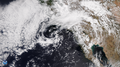
 Southern California and Nevada (MODIS 2019-04-02).jpg 2 309 × 1 654; 549 kB
-
 Southern California counties in red.png 596 × 676; 17 kB
-
 Southern California Köppen.png 7 800 × 6 662; 520 kB
-
 Southern California night.jpg 366 × 296; 26 kB
-
 Southern California ru.png 725 × 417; 143 kB
-
 Southern California Shrouded in Smoke (MODIS 2021-09-28).jpg 5 217 × 4 184; 1,64 MB
-
 Southern California.jpg 4 088 × 4 096; 2,26 MB
-
 Spread Love, Not Germs.jpg 5 472 × 3 648; 26,93 MB
-
 Summer In The Park 01 Santa Fe Dam Recreation Area.jpg 6 016 × 4 016; 32,68 MB
-
 Summer In The Park 02 Santa Fe Dam Recreation Area.jpg 6 016 × 2 629; 22,31 MB
-
 Summer Lake at Santa Fe Dam Recreation Area.jpg 6 016 × 4 016; 24,95 MB
-

-

-

-
 The Dog walker (36971647851).jpg 4 604 × 2 590; 1,7 MB
-
 The Getty - Exterior (38094711521).jpg 4 122 × 2 319; 4,49 MB
-
 The Getty - Geometry (26492848929).jpg 4 608 × 2 592; 4,76 MB
-
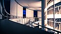 The Getty - Interior (38044839876).jpg 4 201 × 2 363; 3,64 MB
-
 The Surfer (36896743322).jpg 4 563 × 2 567; 5,62 MB
-
 The Torches Motel - Barstow, California (34735409871).jpg 5 557 × 3 705; 7,91 MB
-
 They have a family, not just you (16034476581).jpg 5 759 × 3 691; 9,39 MB
-

-
 Thomas Fire Erupts in Southern California (NESDIS 2017-12-05).jpg 1 920 × 1 080; 170 kB
-
 Three Arch Bay in Laguna Beach, California.jpg 2 048 × 1 536; 521 kB
-
 Tijuana from Border Field State Park (15838124850).jpg 4 805 × 2 851; 10,7 MB
-
 Tunnel To Eternity.jpg 6 016 × 4 016; 31,3 MB
-
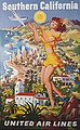 United Airlines So Cal Poster (19471602022).jpg 678 × 1 100; 882 kB
-
 Upper Newport Bay mud flats - panoramio.jpg 1 280 × 960; 282 kB
-

-
 Southern California - NARA - 543469.jpg 3 000 × 2 032; 1 MB
-
 WATCHES (16040371805).jpg 5 482 × 3 601; 8,48 MB
-
 Westfield UTC (15994625846).jpg 5 255 × 3 527; 12,23 MB
-
 Whale Watch Charter, Dana Point, CA 1986 (6390458913).jpg 1 407 × 1 014; 237 kB
-
 Wild Rivers (Irvine).jpg 4 032 × 3 024; 2,68 MB
-
-

-
-


.jpg)

.jpg)
.jpg)
.jpg)
.jpg)
.jpg)

_underway_off_the_coast_of_Southern_California_-_DPLA_-_8a752987d3b66c3501df2f4a30b5428d.jpg)
_underway_off_the_coast_of_Southern_California_-_DPLA_-_d6b131a181fac9b5f407b1e57bf18fd5.jpeg)
.jpg)

.jpg)

.jpg)
.jpg)
.jpg)
.gif)
.jpg)
.jpg)
.jpg)
.jpg)
.jpg)
.jpg)
.jpg)
.jpg)
.jpg)
.jpg)


._WORK_HERE_WAS..._-_NARA_-_557455.jpg)
._DEVELOPMENT_HERE..._-_NARA_-_557454.jpg)
.jpg)

.jpg)
.jpg)
.jpg)
.jpg)
.jpg)
.jpg)
.jpg)
.jpg)
.jpg)
.jpg)
.jpg)
.jpg)
.jpg)
.jpg)
.jpg)
.jpg)
.jpg)
.jpg)
.jpg)
.jpg)
.jpg)
.jpg)
.jpg)
.jpg)
.jpg)
.jpg)
.jpg)

.jpg)


.jpg)
.jpg)
.png)

.png)
.png)
.jpg)
.jpg)


.jpg)

.png)


.jpg)
.jpg)
.jpg)


.jpg)
.jpg)


.jpg)
.jpg)
.jpg)
.jpg)
.jpg)

.jpg)
_-a.jpg)
_-c.jpg)
_-e.jpg)
.jpg)


.jpg)


.jpg)
.jpg)
.jpg)


.jpg)
.jpg)
.jpg)


.jpg)


.jpg)


.jpg)
.jpg)
.jpg)
.jpg)
.jpg)
.jpg)
.jpg)

.jpg)

.jpg)

.jpg)


.jpg)
.jpg)
.jpg)
.jpg)


.jpg)