Category:Kern County, California
Jump to navigation
Jump to search
Counties of California: Alameda · Alpine · Amador · Butte · Calaveras · Colusa · Contra Costa · Del Norte · El Dorado · Fresno · Glenn · Humboldt · Imperial · Inyo · Kern · Kings · Lake · Lassen · Los Angeles · Madera · Marin · Mariposa · Mendocino · Merced · Modoc · Mono · Monterey · Napa · Nevada · Orange · Placer · Plumas · Riverside · Sacramento · San Benito · San Bernardino · San Diego · San Joaquin · San Luis Obispo · San Mateo · Santa Barbara · Santa Clara · Santa Cruz · Shasta · Sierra · Siskiyou · Solano · Sonoma · Stanislaus ·Sutter · Tehama · Trinity · Tulare · Tuolumne · Ventura · Yolo · Yuba – Consolidated city-county: San Francisco
- English: Kern County — of California.
- Located in central California (San Joaquin Valley and Sierra Nevada );
and in Southern California (Transverse Ranges and Mojave Desert ).
- Located in central California (San Joaquin Valley and Sierra Nevada );
- Español: Condado de Kern - California.
county in California, United States     | |||||
| Upload media | |||||
| Instance of | |||||
|---|---|---|---|---|---|
| Named after | |||||
| Location | California, Pacific States Region | ||||
| Capital | |||||
| Inception |
| ||||
| Population |
| ||||
| Area |
| ||||
| official website | |||||
 | |||||
Subcategories
This category has the following 21 subcategories, out of 21 total.
A
- Alta Wind Energy Center (5 F)
B
D
- Democrat Hot Springs (1 F)
E
G
H
K
- Kern County Raceway Park (20 F)
M
N
O
P
T
- Tehachapi Pass Wind Farm (50 F)
V
Media in category "Kern County, California"
The following 200 files are in this category, out of 324 total.
(previous page) (next page)-
 Map of California highlighting Kern County.svg 916 × 1,054; 151 KB
-

-
 A memorial off of Trona Road. (50610753251).jpg 4,032 × 3,024; 2.09 MB
-
 A memorial off of Trona Road. (50610871052).jpg 4,032 × 3,024; 2.83 MB
-
 A memorial off of Trona Road. (50610871057).jpg 4,032 × 3,024; 3.38 MB
-
 Aerial photograph of Kern County farmland (35035715562).jpg 4,032 × 3,024; 2.04 MB
-
Aerial views of Buena Vista Lake in Kern County, California, USA 2.webm 2 min 46 s, 3,840 × 2,160; 249.82 MB
-
Aerial views of Buena Vista Lake in Kern County, California, USA.webm 2 min 30 s, 3,840 × 2,160; 253.76 MB
-
 Agbayani Village Entrance Sign (fe974fdb-0081-4ee1-8aab-722f1f0c01d7).jpg 1,600 × 1,200; 326 KB
-
 Aged woman from Oklahoma, Kern County migrant camp, California, 8b31631.jpg 8,874 × 6,938; 21.92 MB
-
 Aged woman from Oklahoma, Kern County migrant camp, California, 8b31631.tif 9,528 × 7,520; 136.73 MB
-
 Almost a Burning Bush - panoramio.jpg 1,505 × 2,007; 1.42 MB
-
 Along Kern River - panoramio.jpg 4,288 × 2,848; 6.45 MB
-
 Along the fenceline - California Poppies Tehachapi Mtns - panoramio.jpg 2,736 × 3,648; 6.33 MB
-

-
 Artesian well in the desert. Kern County, Cal. LCCN2016653508.jpg 1,536 × 1,230; 244 KB
-
 Artesian well. Kern County, Cal. LCCN2016653500.jpg 640 × 512; 50 KB
-
 August 2012 - panoramio (114).jpg 4,000 × 3,000; 4.53 MB
-
 August 2012 - panoramio (116).jpg 4,000 × 3,000; 4.64 MB
-
 August 2012 - panoramio (119).jpg 4,000 × 3,000; 4.55 MB
-
 August 2012 - panoramio (120).jpg 4,000 × 3,000; 4.55 MB
-
 August 2012 - panoramio (121).jpg 4,000 × 3,000; 4.7 MB
-
 August 2012 - panoramio (122).jpg 4,000 × 3,000; 4.56 MB
-
 August 2012 - panoramio (123).jpg 4,000 × 3,000; 4.56 MB
-
 August 2012 - panoramio (124).jpg 4,000 × 3,000; 4.85 MB
-
 August 2012 - panoramio (125).jpg 4,000 × 3,000; 4.58 MB
-
 August 2012 - panoramio (126).jpg 4,000 × 3,000; 4.83 MB
-
 August 2012 - panoramio (127).jpg 4,000 × 3,000; 4.75 MB
-
 August 2012 - panoramio (128).jpg 4,000 × 3,000; 4.47 MB
-
 August 2012 - panoramio (129).jpg 4,000 × 3,000; 4.35 MB
-
 August 2012 - panoramio (130).jpg 4,000 × 3,000; 4.72 MB
-
 August 2012 - panoramio (131).jpg 4,000 × 3,000; 4.81 MB
-
 August 2012 - panoramio (132).jpg 4,000 × 3,000; 4.74 MB
-
 August 2012 - panoramio (133).jpg 4,000 × 3,000; 4.61 MB
-
 August 2012 - panoramio (134).jpg 3,000 × 4,000; 4.98 MB
-
 August 2012 - panoramio (135).jpg 4,000 × 3,000; 4.58 MB
-
 August 2012 - panoramio (137).jpg 4,000 × 3,000; 4.72 MB
-
 August 2012 - panoramio (138).jpg 4,000 × 3,000; 4.65 MB
-
 August 2012 - panoramio (139).jpg 4,000 × 3,000; 4.33 MB
-
 August 2012 - panoramio (147).jpg 4,000 × 3,000; 4.63 MB
-
 August 2012 - panoramio (148).jpg 4,000 × 3,000; 4.7 MB
-
 August 2012 - panoramio (149).jpg 4,000 × 3,000; 4.31 MB
-
 August 2012 - panoramio (150).jpg 4,000 × 3,000; 4.61 MB
-
 Batrachoseps relictus.jpg 2,048 × 1,365; 2.27 MB
-
 Bellevue Ranch - the machinery sheds, Kern County, Calif. LCCN2002706075.jpg 1,536 × 1,181; 260 KB
-
 Bellevue Ranch - the machinery sheds, Kern County, Calif. LCCN2002706075.tif 1,536 × 1,181; 1.73 MB
-
 Blooming Hills (142018029).jpeg 1,680 × 1,050; 1.06 MB
-
 Buena Vista Farm LCCN98503901.jpg 1,536 × 1,252; 232 KB
-
 Buena Vista Farm, Kern County, California LCCN2006679269.jpg 1,536 × 1,037; 151 KB
-
 Bulldozed wash - panoramio.jpg 3,837 × 2,711; 2.21 MB
-
 Burning Gas - Oil Field - panoramio.jpg 3,456 × 5,184; 502 KB
-
 Burnt Joshua Trees kz1.jpg 3,216 × 2,144; 1.55 MB
-
 Burnt Joshua Trees kz2.jpg 3,216 × 2,144; 1.56 MB
-
 Burnt Joshua Trees kz3.jpg 2,144 × 3,216; 1.26 MB
-
 Burnt Joshua Trees kz4.jpg 3,216 × 2,144; 1.54 MB
-
 Burnt Joshua Trees kz5.jpg 3,216 × 2,144; 1.56 MB
-
 Burnt Joshua Trees kz6.jpg 3,216 × 2,144; 3.73 MB
-
 Burnt Joshua Trees kz7.jpg 3,216 × 2,144; 1.52 MB
-
 California -Kern County (part) - Modoc County (part)- - NARA - 17388248 (page 116).jpg 1,359 × 1,788; 871 KB
-
 Cane Brake Cafe (3214738351).jpg 1,650 × 1,238; 1.38 MB
-
 Carleton Watkins - Compromise cph.3b03101.jpg 1,502 × 1,162; 794 KB
-
 Carleton Watkins - Egyptian cornfield, Kern County CA cph.3b03099.jpg 1,512 × 1,151; 858 KB
-
 Cesar E Chavez Quote.jpg 534 × 479; 122 KB
-
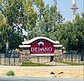 City of Delano entry sign.jpg 1,182 × 1,134; 507 KB
-
 City of Delano entry signage (cropped).jpg 1,182 × 813; 289 KB
-
 Close to the horizon - panoramio.jpg 960 × 720; 245 KB
-
 Cotton Farming 1930s.jpg 490 × 640; 86 KB
-

-
 Cupressus nevadensis resin glands.jpg 3,456 × 2,304; 1.87 MB
-
 DerbyAcres.jpg 3,260 × 2,014; 2.04 MB
-
-
 Dry Waterfall - panoramio.jpg 3,000 × 4,000; 3.26 MB
-
 Early Morning at Sandcut, CA. Santa Fe Trains -- 4 Photos (31309667995).jpg 2,000 × 1,335; 1.75 MB
-
 East above Randsburg, CA, Kern Co., CA - panoramio.jpg 997 × 556; 744 KB
-
 East Ridgecrest, CA.jpg 331 × 219; 10 KB
-
 Edwards AFB - panoramio.jpg 9,898 × 2,400; 4.35 MB
-
 Fiddleneck Invasion (142134961).jpeg 1,680 × 1,050; 1.12 MB
-
 Flying in a field.jpg 3,264 × 2,448; 3.01 MB
-

-

-
 FS31.JPG 3,504 × 2,336; 2.57 MB
-
 Gas station, Kern County, California, 8b32529.jpg 4,143 × 4,375; 7.07 MB
-
 Gas station, Kern County, California, 8b32529.tif 4,838 × 4,984; 46.03 MB
-
 Get me out of here (5108022481).jpg 1,200 × 803; 855 KB
-
 Get me there (4586637018).jpg 1,200 × 803; 726 KB
-
 Getting Away (4895436743).jpg 1,200 × 803; 939 KB
-
 Giant rocks rolled down hill - panoramio.jpg 4,000 × 3,000; 4.72 MB
-
 Golden Fiddlenecks (142618309).jpeg 1,648 × 1,019; 125 KB
-
 Grapevine, California - panoramio.jpg 4,378 × 2,004; 3.59 MB
-
 Graph of particulate pollution (PM 2.5 vs date) in Kern County, California.jpg 2,200 × 1,701; 612 KB
-
 Greenfields Ranch - Camp 36, Kern County, CA cph.3b14486.jpg 1,496 × 1,149; 717 KB
-
 Greenhorn Mountains.jpg 3,264 × 2,448; 2.49 MB
-
 Hart Memorial Park.jpg 4,032 × 3,024; 3.65 MB
-
 Harvesting alfalfa, Kern County, Calif. LCCN2002697532.jpg 1,536 × 1,110; 234 KB
-
 Harvesting alfalfa, Kern County, Calif. LCCN2002697533.jpg 640 × 504; 60 KB
-
 High Desert Wildflowers (142340041).jpeg 1,680 × 1,050; 256 KB
-
 Hot Springs House in 1900.jpg 2,112 × 992; 651 KB
-
 HSR Garces Highway Viaduct.png 1,472 × 828; 1.45 MB
-
 Hyundai Motor Group California Proving Ground from space.jpg 386 × 261; 61 KB
-
 Hyundai Motor Group California Proving Ground – satellite image.jpg 405 × 349; 79 KB
-
 Img0288SCE 500kV.JPG 2,048 × 1,536; 542 KB
-
 In the forest (5042685769).jpg 1,200 × 803; 820 KB
-
 Inyokern Airport - panoramio.jpg 2,368 × 1,052; 1,013 KB
-
 Isurus planus teeth.png 1,440 × 928; 392 KB
-
 Jackson Ranch - Irrigating alfalfa; from the ditch to the check LCCN2002699861.jpg 1,536 × 1,208; 192 KB
-
 Jackson ranch- irrigating alfalfa. Kern County, Cal. LCCN2016652688.jpg 1,536 × 1,214; 181 KB
-
 Jackson ranch- the superintendent's residence. Kern County, Cal. LCCN2016652687.jpg 1,536 × 1,196; 224 KB
-
-

-
 James ranch- residence and farm buildings. Kern County, Cal. LCCN2016652698.jpg 1,536 × 1,202; 190 KB
-
 Jimson Weed 02 (3810998177).jpg 2,860 × 2,288; 1.12 MB
-
 Jimson Weed 03 (3811812678).jpg 3,648 × 2,736; 1.83 MB
-
 Johannesburg Ghost Town, CA 1987 (6390459495).jpg 1,048 × 1,171; 269 KB
-
 John Neill in the early 1900s.png 932 × 1,286; 782 KB
-
 Kern 5982.jpg 4,032 × 3,024; 4.74 MB
-
 Kern County Aerial.jpg 4,032 × 3,024; 1.68 MB
-
 Kern County Map, 1877.png 1,652 × 2,032; 2.76 MB
-
 Kern county scrub terrain tumbleweeds trash.jpg 620 × 465; 81 KB
-
 Kern County Young Republicans logo.jpg 147 × 121; 5 KB
-
 Kern County, CA, USA - panoramio (1).jpg 1,600 × 1,200; 322 KB
-
 Kern County, CA, USA - panoramio (15).jpg 3,264 × 2,448; 2.04 MB
-
 Kern County, CA, USA - panoramio (16).jpg 3,264 × 2,448; 2.05 MB
-
 Kern County, CA, USA - panoramio (2).jpg 4,000 × 3,000; 3.26 MB
-
 Kern County, CA, USA - panoramio (20).jpg 3,264 × 1,538; 757 KB
-
 Kern County, CA, USA - panoramio (21).jpg 3,231 × 2,119; 651 KB
-
 Kern County, CA, USA - panoramio (22).jpg 3,214 × 2,380; 693 KB
-
 Kern County, CA, USA - panoramio (23).jpg 3,188 × 2,344; 696 KB
-
 Kern County, CA, USA - panoramio (24).jpg 2,447 × 2,447; 1.18 MB
-
 Kern County, CA, USA - panoramio (25).jpg 2,363 × 2,363; 847 KB
-
 Kern County, CA, USA - panoramio (26).jpg 3,234 × 2,408; 716 KB
-
 Kern County, CA, USA - panoramio (27).jpg 3,251 × 2,255; 980 KB
-
 Kern County, CA, USA - panoramio (28).jpg 3,264 × 2,448; 2.71 MB
-
 Kern County, CA, USA - panoramio (29).jpg 3,264 × 2,448; 3.01 MB
-
 Kern County, CA, USA - panoramio (3).jpg 4,000 × 3,000; 2.68 MB
-
 Kern County, CA, USA - panoramio (30).jpg 3,264 × 2,448; 1.91 MB
-
 Kern County, CA, USA - panoramio (31).jpg 3,264 × 2,448; 2.08 MB
-
 Kern County, CA, USA - panoramio (33).jpg 3,264 × 2,448; 1.73 MB
-
 Kern County, CA, USA - panoramio (36).jpg 3,196 × 2,354; 805 KB
-
 Kern County, CA, USA - panoramio (37).jpg 3,230 × 2,000; 653 KB
-
 Kern County, CA, USA - panoramio (39).jpg 3,264 × 2,448; 1.82 MB
-
 Kern County, CA, USA - panoramio (4).jpg 4,000 × 2,658; 2.1 MB
-
 Kern County, CA, USA - panoramio (40).jpg 3,264 × 2,448; 1.91 MB
-
 Kern County, CA, USA - panoramio (44).jpg 3,264 × 2,448; 1.44 MB
-
 Kern County, CA, USA - panoramio (45).jpg 3,264 × 2,448; 1.73 MB
-
 Kern County, CA, USA - panoramio (46).jpg 3,264 × 2,448; 1.92 MB
-
 Kern County, CA, USA - panoramio (47).jpg 3,049 × 2,040; 1.37 MB
-
 Kern County, CA, USA - panoramio (48).jpg 3,264 × 2,448; 1.52 MB
-
 Kern County, CA, USA - panoramio (49).jpg 3,264 × 2,448; 1.53 MB
-
 Kern County, CA, USA - panoramio (50).jpg 3,264 × 2,448; 1.56 MB
-
 Kern County, CA, USA - panoramio (51).jpg 3,264 × 2,448; 1.51 MB
-
 Kern County, CA, USA - panoramio (52).jpg 3,262 × 2,444; 743 KB
-
 Kern County, CA, USA - panoramio (53).jpg 3,246 × 2,424; 702 KB
-
 Kern County, CA, USA - panoramio (54).jpg 3,264 × 2,448; 1.79 MB
-
 Kern County, CA, USA - panoramio (55).jpg 3,247 × 1,961; 590 KB
-
 Kern County, CA, USA - panoramio (56).jpg 3,264 × 2,448; 1.73 MB
-
 Kern County, CA, USA - panoramio (57).jpg 2,436 × 2,240; 779 KB
-
 Kern County, CA, USA - panoramio (58).jpg 3,264 × 2,448; 823 KB
-
 Kern County, CA, USA - panoramio (59).jpg 3,264 × 2,448; 1.48 MB
-
 Kern County, CA, USA - panoramio (60).jpg 4,000 × 3,000; 3.72 MB
-
 Kern County, CA, USA - panoramio (61).jpg 4,000 × 3,000; 4.42 MB
-
 Kern County, CA, USA - panoramio (62).jpg 4,000 × 3,000; 3.96 MB
-
 Kern County, CA, USA - panoramio (63).jpg 4,000 × 3,000; 4.26 MB
-
 Kern County, CA, USA - panoramio (64).jpg 4,000 × 3,000; 3.18 MB
-
 Kern County, CA, USA - panoramio (65).jpg 4,000 × 3,000; 4.47 MB
-
 Kern County, CA, USA - panoramio (66).jpg 4,000 × 3,000; 2.99 MB
-
 Kern County, CA, USA - panoramio (67).jpg 4,000 × 3,000; 3.23 MB
-
 Kern County, CA, USA - panoramio (68).jpg 3,212 × 2,378; 1.15 MB
-
 Kern County, CA, USA - panoramio (69).jpg 3,190 × 2,346; 1.12 MB
-
 Kern County, CA, USA - panoramio (70).jpg 3,264 × 2,028; 1.1 MB
-
 Kern County, CA, USA - panoramio (71).jpg 3,264 × 2,448; 1.57 MB
-
 Kern County, CA, USA - panoramio (72).jpg 3,264 × 2,448; 1.88 MB
-
 Kern County, CA, USA - panoramio (73).jpg 3,215 × 2,128; 1.25 MB
-
 Kern County, CA, USA - panoramio (74).jpg 3,264 × 2,448; 1.91 MB
-
 Kern County, CA, USA - panoramio (75).jpg 3,072 × 2,048; 830 KB
-
 Kern County, CA, USA - panoramio (8).jpg 3,192 × 1,902; 1,001 KB
-
 Kern County, CA, USA - panoramio (9).jpg 3,175 × 1,829; 1.11 MB
-
 Kern County, CA, USA - panoramio.jpg 1,600 × 1,200; 266 KB
-
 Kern County, California – Map.pdf 2,479 × 1,752; 1.86 MB
-
 Kern County, California)- Bellevue Ranch. Stacking alfalfa hay LCCN2003662211.jpg 1,536 × 1,202; 258 KB
-
 Kern County, California)- Collins Ranch. Haying- the haymakers' camp LCCN2003662214.jpg 1,536 × 1,202; 282 KB
-
 Kern County, California)- McClung Ranch LCCN2003662215.jpg 1,536 × 1,189; 212 KB
-
 Kern County, California)- The Creasy Ranch. A ditching camp LCCN2003662216.jpg 1,536 × 1,202; 271 KB
-
 Kern County, California)- The Hop Ranch. The hop-yard LCCN2003662213.jpg 1,536 × 1,204; 351 KB
-
 Kern County, California, United States (CAPELLA C02 SP GEO HH 20210106050228 20210106050252).tiff 25,134 × 25,289, 6 pages; 444.13 MB
-
 Kern River County Park.jpg 4,032 × 3,024; 6.02 MB
-
 Kern River Farm Panorama - panoramio.jpg 4,912 × 1,080; 921 KB
-
 Kern-County-farms-and-mountains-Aerial-from-west-August-2014.jpg 3,126 × 1,840; 3.93 MB
-
 KernFrontWells1.jpg 1,441 × 1,008; 397 KB
-
 Kernville 5979.jpg 4,032 × 3,024; 3.26 MB
-
 Kernville 5980.jpg 3,024 × 4,032; 5.11 MB
-
 Kernville 5981.jpg 4,032 × 3,024; 4.06 MB
-
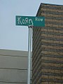 Korn Row street sign outside Rabobank arena.jpg 375 × 500; 21 KB
-
 Lake of the Woods, California.jpg 4,032 × 3,024; 4.16 MB
-
 LakeviewGusher.jpg 405 × 700; 170 KB
-

-
 LangeNextTimeTryTheTrain.jpg 8,460 × 6,000; 8.11 MB
-
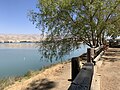
 Little Lake (5039021522).jpg 1,200 × 803; 1.04 MB
-
 Lizard - Flickr - GregTheBusker (20).jpg 3,072 × 2,304; 1.41 MB
-
 Looking North - panoramio (3).jpg 4,000 × 3,000; 3.16 MB
-
 Looking North - panoramio (4).jpg 4,000 × 2,508; 2.57 MB

.jpg)
.jpg)
.jpg)
.jpg)
.jpg)


.jpg)
.jpg)
.jpg)
.jpg)
.jpg)
.jpg)
.jpg)
.jpg)
.jpg)
.jpg)
.jpg)
.jpg)
.jpg)
.jpg)
.jpg)
.jpg)
.jpg)
.jpg)
.jpg)
.jpg)
.jpg)
.jpg)
.jpg)
.jpg)
.jpg)
.jpg)


.jpeg)


_-_Modoc_County_(part)-_-_NARA_-_17388248_(page_116).jpg)
.jpg)


.jpg)


.jpg)


.jpeg)


.jpg)
.jpg)
.jpg)

.jpeg)

_in_Kern_County,_California.jpg)


.jpeg)


.jpg)


.jpg)
.jpg)
.jpg)


.jpg)
.jpg)
.jpg)
.jpg)
.jpg)
.jpg)
.jpg)
.jpg)
.jpg)
.jpg)
.jpg)
.jpg)
.jpg)
.jpg)
.jpg)
.jpg)
.jpg)
.jpg)
.jpg)
.jpg)
.jpg)
.jpg)
.jpg)
.jpg)
.jpg)
.jpg)
.jpg)
.jpg)
.jpg)
.jpg)
.jpg)
.jpg)
.jpg)
.jpg)
.jpg)
.jpg)
.jpg)
.jpg)
.jpg)
.jpg)
.jpg)
.jpg)
.jpg)
.jpg)
.jpg)
.jpg)
.jpg)
.jpg)
.jpg)
.jpg)
.jpg)
.jpg)
.jpg)
.jpg)
.jpg)
.jpg)
.jpg)

-_Bellevue_Ranch._Stacking_alfalfa_hay_LCCN2003662211.jpg)
-_Collins_Ranch._Haying-_the_haymakers%27_camp_LCCN2003662214.jpg)
-_McClung_Ranch_LCCN2003662215.jpg)
-_The_Creasy_Ranch._A_ditching_camp_LCCN2003662216.jpg)
-_The_Hop_Ranch._The_hop-yard_LCCN2003662213.jpg)


.jpg)
.jpg)
.jpg)
.jpg)