Category:Southland District
Vai alla navigazione
Vai alla ricerca
territorial authority district in New Zealand's Southland region .JPG)  | |||||
| Carica un file multimediale | |||||
| Istanza di | |||||
|---|---|---|---|---|---|
| Luogo | Southland, Nuova Zelanda | ||||
| Data di inizio |
| ||||
| Popolazione |
| ||||
| Superficie |
| ||||
| Ha sostituito |
| ||||
| Distinto da | |||||
| sito web ufficiale | |||||
 | |||||
Sottocategorie
Questa categoria contiene le 19 sottocategorie indicate di seguito, su un totale di 19.
A
- Ardlussa, New Zealand (1 F)
C
- Cleddau River (15 F)
D
- Dacre, New Zealand (3 F)
- Donne River (1 F)
E
- Eglinton River (3 F)
F
- Freshwater River (1 F)
G
- Gulliver River (1 F)
H
- Hokonui, New Zealand (6 F)
L
- Lake Quill (2 F)
- Longridge, New Zealand (1 F)
M
- Mararoa River (2 F)
- Mataura River (10 F)
- Mount Tinsley (2 F)
P
- Pyke River (4 F)
S
T
- Tūtoko River (2 F)
W
File nella categoria "Southland District"
Questa categoria contiene 12 file, indicati di seguito, su un totale di 12.
-
 All roads lead from Garston - panoramio.jpg 2 592 × 3 888; 3,46 MB
-
 Crown Grant Map - Longwood Survey District, Blocks 1, 2, 3.jpg 1 080 × 655; 36 KB
-
 Crown Grant Map - Longwood Survey District, Part.jpg 1 079 × 945; 45 KB
-
 Crown Grant Map - Nokomai Survey District, Blocks II, III, IV, VII.jpg 16 120 × 17 782; 42,12 MB
-
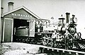 K class loco at Waimahaka.jpg 640 × 420; 92 KB
-
 Nokomai about 1873.jpg 2 557 × 1 678; 1,4 MB
-
 Nokomai railway station in 1964.jpg 1 260 × 928; 534 KB
-
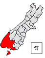 Southland DC.PNG 289 × 375; 27 KB
-
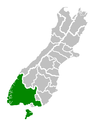 Southland Territorial Authority.png 520 × 677; 11 KB
-
 Store at Nokomai River in 1903.jpg 321 × 464; 85 KB
-
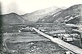
 Waimahaka in 1952.jpg 1 464 × 1 153; 596 KB
-
 Winton Hundred.jpg 2 875 × 3 549; 3,88 MB


