Category:Southwick, Northamptonshire
Vai alla navigazione
Vai alla ricerca
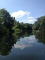
English: Southwick (pronounced "Suth-ick") is a small village in Northamptonshire, England. It is approximately 3 miles north of the town of Oundle and is set in a valley of the river Nene.
village and civil parish in Northamptonshire, United Kingdom  | |||||
| Carica un file multimediale | |||||
| Istanza di | |||||
|---|---|---|---|---|---|
| Luogo | North Northamptonshire, Northamptonshire, Midlands Orientali, Inghilterra | ||||
 | |||||
Sottocategorie
Questa categoria contiene le 2 sottocategorie indicate di seguito, su un totale di 2.
S
- St Mary, Southwick (6 F)
File nella categoria "Southwick, Northamptonshire"
Questa categoria contiene 88 file, indicati di seguito, su un totale di 88.
-
 A distant Fotheringhay church - geograph.org.uk - 2883413.jpg 640 × 480; 89 KB
-
 Access to the Nene floodplain - geograph.org.uk - 3698241.jpg 800 × 450; 244 KB
-
 Access track to the woods - geograph.org.uk - 2477714.jpg 640 × 480; 126 KB
-
 Across to Short Wood - geograph.org.uk - 3180612.jpg 2 560 × 1 920; 1 007 KB
-
 Arable and grazing land near Provost Lodge - geograph.org.uk - 3180615.jpg 2 560 × 1 920; 968 KB
-
 Beef on the hoof - geograph.org.uk - 3180602.jpg 2 560 × 1 920; 978 KB
-
 Bench Mark on field cottage - geograph.org.uk - 1858450.jpg 3 648 × 2 736; 2,28 MB
-
 Bendy lane by Perio Barn Farm - geograph.org.uk - 3698240.jpg 800 × 450; 274 KB
-
 Blackmore Thick Farm - geograph.org.uk - 3292247.jpg 4 000 × 3 000; 2,96 MB
-
 Boar's Head Farm - geograph.org.uk - 4827421.jpg 640 × 480; 42 KB
-
 Boot scraper and a half - geograph.org.uk - 2477711.jpg 640 × 480; 132 KB
-
 Bridge near Crossway Hand farm entrance - geograph.org.uk - 1285941.jpg 640 × 480; 115 KB
-

-

-

-

-

-
 Bridleway through the barley - geograph.org.uk - 6226963.jpg 1 024 × 768; 194 KB
-
 Bridleway to Crossway Hand Cottages - geograph.org.uk - 269345.jpg 640 × 480; 81 KB
-
 Bridleway to Holey Brookes - geograph.org.uk - 4827399.jpg 480 × 640; 68 KB
-
 Bridleway to Holey Brookes - geograph.org.uk - 4827402.jpg 480 × 640; 91 KB
-
 Bridleway to Holey Brookes - geograph.org.uk - 4827410.jpg 480 × 640; 63 KB
-
 Bridleway to Holey Brookes - geograph.org.uk - 4827414.jpg 480 × 640; 69 KB
-
 Bridleway to Holey Brookes - geograph.org.uk - 4827428.jpg 480 × 640; 51 KB
-
 Bridleway to Holey Brookes - geograph.org.uk - 4827430.jpg 480 × 640; 116 KB
-
 Bridleway view - geograph.org.uk - 4827406.jpg 480 × 640; 47 KB
-
 Cottage in pasture land - geograph.org.uk - 1858421.jpg 3 648 × 2 736; 1,95 MB
-
 Crew yard - geograph.org.uk - 3180607.jpg 2 560 × 1 920; 971 KB
-
 Crossway Hand Farm - geograph.org.uk - 1285950.jpg 640 × 480; 74 KB
-
 Cube house, Southwick - geograph.org.uk - 1285795.jpg 640 × 480; 109 KB
-
 Farm buildings at Tottenhoe Lodge - geograph.org.uk - 3180585.jpg 2 560 × 1 920; 990 KB
-
 Farming machinery near Southwick Grange - geograph.org.uk - 4613459.jpg 4 320 × 3 240; 5,99 MB
-
 Farmland and tree near Perio Mill - geograph.org.uk - 4487924.jpg 4 320 × 3 240; 6,08 MB
-
 Field boundary - geograph.org.uk - 3180589.jpg 2 560 × 1 920; 977 KB
-
 Flush Bracket Bench Mark - geograph.org.uk - 1858433.jpg 2 736 × 3 648; 2,24 MB
-
 Footbridge into Holey Brookes - geograph.org.uk - 6226968.jpg 1 024 × 768; 311 KB
-
 Footpath from Perio Mill - geograph.org.uk - 3698236.jpg 800 × 450; 227 KB
-
 Footpath to The Spa - geograph.org.uk - 6226941.jpg 1 024 × 768; 193 KB
-
 Frere Hill Wood - geograph.org.uk - 3180590.jpg 2 560 × 1 920; 1 006 KB
-
 Gates and abandoned cottage - geograph.org.uk - 6226961.jpg 1 024 × 768; 176 KB
-
 Gentle rolling hills - geograph.org.uk - 3180605.jpg 2 560 × 1 920; 986 KB
-
 Glimpse of a harvested cereal field - geograph.org.uk - 3698218.jpg 800 × 450; 267 KB
-
 Guards van in Southwick Wood - geograph.org.uk - 2475396.jpg 640 × 480; 145 KB
-

-
 Ordnance Survey Trig Pillar S6789 - geograph.org.uk - 3293219.jpg 4 000 × 3 000; 3,09 MB
-
 Ordnance Survey Trig Pillar S6790 - geograph.org.uk - 3293253.jpg 640 × 480; 126 KB
-
 Pasture land near Lower Benefield - geograph.org.uk - 3180581.jpg 2 560 × 1 920; 977 KB
-
 Perio Barn Farm north of Cotterstock - geograph.org.uk - 4487812.jpg 4 320 × 3 240; 5,68 MB
-
 Pond at Boar's Head Farm - geograph.org.uk - 4827423.jpg 640 × 480; 94 KB
-
 Red Kite overhead - geograph.org.uk - 4827431.jpg 480 × 640; 52 KB
-
 River of the River Nene from a canoe - geograph.org.uk - 4553603.jpg 480 × 640; 65 KB
-
 River of the River Nene from a canoe - geograph.org.uk - 4553604.jpg 480 × 640; 64 KB
-
 River of the River Nene from a canoe - geograph.org.uk - 4553609.jpg 480 × 640; 54 KB
-
 River up the River Nene from a canoe - geograph.org.uk - 4553598.jpg 480 × 640; 55 KB
-
 Road by Perio Mill - geograph.org.uk - 3698238.jpg 800 × 450; 192 KB
-

-
 Sooee ^^ - geograph.org.uk - 1285902.jpg 640 × 480; 80 KB
-
 Southwick bridge - geograph.org.uk - 1285842.jpg 640 × 480; 105 KB
-
 Southwick Grange - geograph.org.uk - 187431.jpg 640 × 480; 77 KB
-
 Southwick Grange - geograph.org.uk - 3698221.jpg 800 × 450; 235 KB
-
 Southwick street scene - geograph.org.uk - 2477724.jpg 640 × 480; 61 KB
-
 Southwick water tower - geograph.org.uk - 2887639.jpg 640 × 480; 82 KB
-
 SouthwickPub.JPG 2 085 × 2 477; 3,85 MB
-
 Spa Farm - geograph.org.uk - 6226945.jpg 1 024 × 768; 183 KB
-
 Spring lambs, Southwick - geograph.org.uk - 2887698.jpg 640 × 480; 131 KB
-
 St Mary the Virgin church, Southwick - geograph.org.uk - 5786525.jpg 1 944 × 2 446; 939 KB
-
 Stretching credulity a little - geograph.org.uk - 2477705.jpg 640 × 480; 92 KB
-
 Thatched house, Southwick - geograph.org.uk - 269319.jpg 640 × 480; 85 KB
-
 The road through Wych Spinney - geograph.org.uk - 2887680.jpg 640 × 480; 123 KB
-
 Towards Frere Hill Wood - geograph.org.uk - 4827444.jpg 480 × 640; 64 KB
-
 Towards Tottenhoe Lodge - geograph.org.uk - 3180582.jpg 2 560 × 1 920; 1 005 KB
-
 Track between fields below Morehay Lawn - geograph.org.uk - 6226972.jpg 1 024 × 768; 151 KB
-
 Track towards Wymond Hill - geograph.org.uk - 2364834.jpg 640 × 469; 72 KB
-
 Triangulation Pillar near Blackmore Thick Farm - geograph.org.uk - 1858406.jpg 3 648 × 2 736; 2,28 MB
-
 Uphill heading towards Tottenhoe Lodge - geograph.org.uk - 3180583.jpg 2 560 × 1 920; 979 KB
-
 Vicarage Farm - geograph.org.uk - 1285972.jpg 640 × 480; 107 KB
-
 Vicarage farm near Southwick - geograph.org.uk - 3180598.jpg 2 560 × 1 920; 971 KB
-
 View from bridleway to Holey Brookes - geograph.org.uk - 4827419.jpg 640 × 480; 40 KB
-
 View from Crossway Hand Farm - geograph.org.uk - 4827435.jpg 640 × 480; 60 KB
-
 View of the River Nene from a canoe - geograph.org.uk - 4553611.jpg 640 × 480; 82 KB
-
 View of the River Nene from a canoe - geograph.org.uk - 4553613.jpg 480 × 640; 67 KB
-
 Water course, Southwick - geograph.org.uk - 1285827.jpg 640 × 480; 123 KB
-
 Water in the Trees - geograph.org.uk - 187422.jpg 480 × 640; 72 KB
-
 Water tower, Southwick - geograph.org.uk - 4560732.jpg 4 320 × 3 240; 4,5 MB
-
 Wind pump - geograph.org.uk - 3180593.jpg 2 560 × 1 920; 1,04 MB
-
 Footpath at Southwick near Oundle - geograph.org.uk - 93825.jpg 640 × 480; 142 KB
-
 Older oak, near Shire Hill Lodge - geograph.org.uk - 269274.jpg 480 × 640; 161 KB
-
 Shire Hill Lodge - geograph.org.uk - 269299.jpg 640 × 480; 87 KB


