Category:Spaldwick
Aller à la navigation
Aller à la recherche
localité britannique du comté anglais de Cambridgeshire  | |||||
| Téléverser des médias | |||||
| Nature de l’élément | |||||
|---|---|---|---|---|---|
| Lieu | Huntingdonshire, Cambridgeshire, Angleterre de l'Est, Angleterre | ||||
| Population |
| ||||
 | |||||
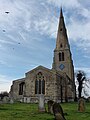
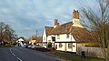
English: Spaldwick – in Huntingdonshire (now part of Cambridgeshire), England – is a village near Catworth west of Huntingdon. It sports a service station, a school, a church, a beauty salon and a pub called The George. Across from the school is a tot lot (a playground for toddlers), and behind the houses are beautiful trees and walking paths.
Sous-catégories
Cette catégorie comprend 2 sous-catégories, dont les 2 ci-dessous.
G
- The George, Spaldwick (2 F)
Média dans la catégorie « Spaldwick »
Cette catégorie comprend 101 fichiers, dont les 101 ci-dessous.
-
 A green area on the bend in Spaldwick - geograph.org.uk - 2742571.jpg 3 648 × 2 736 ; 2,19 Mio
-
 A long wait for harvest - geograph.org.uk - 2742563.jpg 3 648 × 2 736 ; 2,13 Mio
-
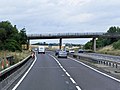
 A14 - Belton's Hill bridge - geograph.org.uk - 3580489.jpg 640 × 480 ; 53 kio
-
 A14 - Belton's Hill junction - geograph.org.uk - 3580488.jpg 640 × 480 ; 47 kio
-
 A14 at Spaldwick - geograph.org.uk - 1072694.jpg 640 × 428 ; 89 kio
-
 A14 eastbound - geograph.org.uk - 485638.jpg 640 × 480 ; 95 kio
-
 A14 near West Lodge Farm - geograph.org.uk - 5082638.jpg 640 × 481 ; 36 kio
-
 Agrovista distribution centre - geograph.org.uk - 2742559.jpg 3 648 × 2 736 ; 2,09 Mio
-
 Agrovista Spaldwick - geograph.org.uk - 1087330.jpg 640 × 480 ; 55 kio
-
 Approaching Spaldwick from the east - geograph.org.uk - 3018843.jpg 2 592 × 1 944 ; 1,69 Mio
-
 Approaching Woolley from the south - geograph.org.uk - 2855641.jpg 2 592 × 1 944 ; 1,44 Mio
-
 Barham junction - A14 east - geograph.org.uk - 6570777.jpg 768 × 1 024 ; 57 kio
-
 Barns, Upthorpe Lodge - geograph.org.uk - 5599645.jpg 640 × 480 ; 123 kio
-
 Belton's Hill - geograph.org.uk - 2689961.jpg 640 × 480 ; 67 kio
-
 Belton's Hill - geograph.org.uk - 2999168.jpg 1 024 × 768 ; 134 kio
-
 Belton's Hill - geograph.org.uk - 5599672.jpg 640 × 480 ; 133 kio
-
 Belton's Hill Bridge, Westbound A14 - geograph.org.uk - 3876112.jpg 640 × 480 ; 234 kio
-
 Belton's Hill near Spaldwick - geograph.org.uk - 6013273.jpg 800 × 571 ; 145 kio
-
 Bench Mark, Spaldwick - geograph.org.uk - 1191384.jpg 480 × 640 ; 112 kio
-
 Bridleway and fields west of Belton's Hill - geograph.org.uk - 2855662.jpg 2 592 × 1 944 ; 1,48 Mio
-
 Certainly not Mondeo Man - geograph.org.uk - 3290810.jpg 2 560 × 1 920 ; 1,13 Mio
-
 Church Lane, Spaldwick - geograph.org.uk - 638958.jpg 480 × 640 ; 45 kio
-
 Cottages in Spaldwick, near Huntingdon - geograph.org.uk - 3788950.jpg 640 × 360 ; 66 kio
-
 Eastbound A14 approaching Junction 18 - geograph.org.uk - 3823554.jpg 640 × 480 ; 249 kio
-
 Eastbound A14 near Spaldwick - geograph.org.uk - 3824439.jpg 640 × 480 ; 309 kio
-
 Eastbound A14, Belton's Hill - geograph.org.uk - 3824431.jpg 640 × 480 ; 255 kio
-
 Eastbound A14, Belton's Hill Bridge - geograph.org.uk - 3824434.jpg 640 × 480 ; 230 kio
-
 Emergency layby on the A14 - geograph.org.uk - 3580485.jpg 640 × 480 ; 47 kio
-
 Farm Machinery Retailer Spaldwick - geograph.org.uk - 1087348.jpg 640 × 480 ; 57 kio
-
 Farm track alongside a barley field - geograph.org.uk - 6533517.jpg 1 024 × 768 ; 161 kio
-
 Farmland near Spaldwick - geograph.org.uk - 6166886.jpg 4 827 × 2 970 ; 2,82 Mio
-
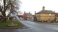
 High Street in Spaldwick - geograph.org.uk - 6009202.jpg 800 × 508 ; 140 kio
-
 High Street, Spaldwick - geograph.org.uk - 1072811.jpg 640 × 428 ; 103 kio
-
 Junction 18 on the A14 at Spaldwick - geograph.org.uk - 6013281.jpg 800 × 510 ; 117 kio
-
 Lane closed to Barham - geograph.org.uk - 1072727.jpg 640 × 428 ; 111 kio
-
 Lane descending Belton's Hill towards Spaldwick - geograph.org.uk - 6013277.jpg 800 × 730 ; 210 kio
-

-
 Looking north off the A14 west of Spaldwick - geograph.org.uk - 5538649.jpg 1 383 × 960 ; 218 kio
-
 Mad Bridge and Woolley Hill - geograph.org.uk - 2855635.jpg 2 592 × 1 944 ; 1,5 Mio
-
 Men at work - geograph.org.uk - 3290766.jpg 2 560 × 1 920 ; 1,03 Mio
-
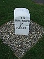
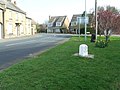
 Milestone in Spaldwick - geograph.org.uk - 2742568.jpg 3 648 × 2 736 ; 2,13 Mio
-
 Old Milepost - geograph.org.uk - 2880575.jpg 768 × 1 024 ; 269 kio
-
 Ordnance Survey Cut Mark - geograph.org.uk - 4139085.jpg 4 000 × 3 000 ; 4,92 Mio
-
 Public bridleway near Upthorpe Lodge - geograph.org.uk - 6009228.jpg 800 × 669 ; 158 kio
-
 Pylons across the field - geograph.org.uk - 1266531.jpg 640 × 480 ; 63 kio
-
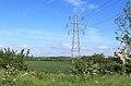 Pylons near Spaldwick - geograph.org.uk - 6166900.jpg 4 710 × 3 107 ; 2,69 Mio
-
 S-bend on Stow Road - geograph.org.uk - 5599658.jpg 640 × 480 ; 112 kio
-
 Slip road from A14 at Spaldwick eastbound - geograph.org.uk - 2071978.jpg 640 × 480 ; 58 kio
-
 17th century house, Spaldwick - geograph.org.uk - 638951.jpg 640 × 480 ; 64 kio
-
 Bench Mark on Spaldwick Bridge - geograph.org.uk - 1191372.jpg 480 × 640 ; 128 kio
-
 Farmhouse, Spaldwick - geograph.org.uk - 638952.jpg 640 × 480 ; 68 kio
-
 Spaldwick - geograph.org.uk - 1072759.jpg 640 × 428 ; 128 kio
-
 Spaldwick - geograph.org.uk - 1072774.jpg 640 × 428 ; 137 kio
-
 Spaldwick - geograph.org.uk - 3514435.jpg 4 168 × 3 028 ; 1,72 Mio
-
 Spaldwick from Beltons Hill - geograph.org.uk - 1192619.jpg 640 × 480 ; 58 kio
-
 Spaldwick Service Station - geograph.org.uk - 6009199.jpg 800 × 476 ; 69 kio
-
 Spaldwick Services - Viewed from A14 - geograph.org.uk - 3681087.jpg 640 × 480 ; 33 kio
-
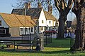
 Spaldwick village - geograph.org.uk - 638956.jpg 490 × 640 ; 120 kio
-
 Spaldwick's recycling bins - geograph.org.uk - 1193734.jpg 640 × 480 ; 100 kio
-
 Spaldwick, near Huntingdon - geograph.org.uk - 3788961.jpg 640 × 360 ; 78 kio
-
 Spaldwick, near Huntingdon - geograph.org.uk - 3788976.jpg 640 × 360 ; 68 kio
-
 Spaldwick, near Huntingdon - geograph.org.uk - 3788984.jpg 640 × 360 ; 81 kio
-
 Spaldwick, St James - geograph.org.uk - 3514412.jpg 3 240 × 4 320 ; 1,95 Mio
-
 Spaldwick, St James - geograph.org.uk - 3514416.jpg 3 160 × 4 262 ; 1,64 Mio
-
 Spaldwick, St James - geograph.org.uk - 6358037.jpg 3 456 × 4 608 ; 3,77 Mio
-
 St James church, Spaldwick - geograph.org.uk - 2742573.jpg 2 736 × 3 648 ; 2,24 Mio
-
 St James the Great church, Spaldwick - geograph.org.uk - 3018855.jpg 1 944 × 2 592 ; 1,07 Mio
-
 Stow, or Spaldwick, Road - geograph.org.uk - 6166896.jpg 5 184 × 3 456 ; 2,64 Mio
-
 The Church of St James at Spaldwick - geograph.org.uk - 4101461.jpg 3 000 × 4 000 ; 2,2 Mio
-
 The Dairy in Spaldwick - geograph.org.uk - 1191381.jpg 480 × 640 ; 98 kio
-
 The George, Spaldwick - geograph.org.uk - 3788957.jpg 640 × 360 ; 68 kio
-
 The road from Barham to Spaldwick - geograph.org.uk - 2855660.jpg 2 592 × 1 944 ; 1,16 Mio
-
 The road to Stow Longa - geograph.org.uk - 6009216.jpg 800 × 499 ; 106 kio
-
 Thrapston Road in Spaldwick - geograph.org.uk - 6013285.jpg 800 × 564 ; 141 kio
-
 Three flags at Kirbys Agricultural machinery depot - geograph.org.uk - 2742560.jpg 3 648 × 2 736 ; 2,16 Mio
-
 Three Shires Way towards Easton - geograph.org.uk - 6009249.jpg 800 × 554 ; 130 kio
-
 To Thrapston 10 - geograph.org.uk - 2880587.jpg 1 024 × 768 ; 232 kio
-
 Towards Coton Barn - geograph.org.uk - 5661647.jpg 480 × 640 ; 121 kio
-
 Track to Glebe Farm - geograph.org.uk - 5599678.jpg 640 × 480 ; 113 kio
-
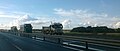 Traffic on the A14, outside Spaldwick - geograph.org.uk - 5538699.jpg 1 600 × 679 ; 137 kio
-
 Traffic on the A14, outside Spaldwick - geograph.org.uk - 5538792.jpg 1 600 × 641 ; 156 kio
-
 Tree Guards beyond the call of duty - geograph.org.uk - 1193758.jpg 480 × 640 ; 138 kio
-
 UK Spaldwick.jpg 765 × 1 797 ; 319 kio
-
 Westbound A14, Exit at Spaldwick - geograph.org.uk - 3876106.jpg 640 × 427 ; 224 kio
-
 Wheat field and former railway bridge - geograph.org.uk - 6533546.jpg 1 024 × 768 ; 165 kio
-
 Woolley Hill - geograph.org.uk - 4736311.jpg 640 × 480 ; 98 kio
-
 Beltons hill - geograph.org.uk - 393436.jpg 640 × 474 ; 90 kio
-
 Bridleway to Buckworth from Woolley - geograph.org.uk - 445781.jpg 640 × 480 ; 152 kio
-
 Fields near to Glebe Farm - geograph.org.uk - 540292.jpg 640 × 480 ; 84 kio
-
 Filling station at Spaldwick - geograph.org.uk - 499377.jpg 640 × 480 ; 102 kio
-
 High Street Spaldwick - geograph.org.uk - 497641.jpg 640 × 425 ; 85 kio
-
 Large ploughed field - geograph.org.uk - 67478.jpg 640 × 427 ; 64 kio
-
 Looking northwest at Woolley hill - geograph.org.uk - 485654.jpg 640 × 480 ; 89 kio
-
 Looking toward Glebe farm - geograph.org.uk - 393371.jpg 640 × 480 ; 108 kio
-
 Looking towards Lumber hill - geograph.org.uk - 485632.jpg 640 × 480 ; 89 kio
-
 Path through crop - geograph.org.uk - 488339.jpg 640 × 480 ; 132 kio
-
 Pylons in wheat field - geograph.org.uk - 485630.jpg 640 × 480 ; 78 kio
-
 Road near Lumber hill - geograph.org.uk - 485634.jpg 640 × 480 ; 76 kio
-
 Track to Glebe Farm - geograph.org.uk - 540293.jpg 640 × 480 ; 65 kio
-
 View southwest from Barham road - geograph.org.uk - 393394.jpg 640 × 480 ; 105 kio
-
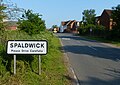
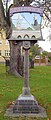
 Village sign Spaldwick - geograph.org.uk - 76727.jpg 640 × 480 ; 147 kio


