Category:Spetisbury
Naar navigatie springen
Naar zoeken springen
English: Spetisbury is a village in north Dorset, England, situated on the River Stour and the A350 road, four miles south east of Blandford Forum. The village has a population of 542 . It is notable for being a very linear settlement, with mostly only one line of buildings adjacent to the A350 road. Currently, a large project is underway which may lead to the construction of a new bypass of the A350, meaning that the high traffic that currently passes through would be redirected.
plaats in Dorset  | |||||
| Media uploaden | |||||
| Is een | |||||
|---|---|---|---|---|---|
| Locatie | Dorset (district), Dorset, Zuidwest-Engeland, Engeland | ||||
| Inwonertal |
| ||||
 | |||||
Ondercategorieën
Deze categorie bevat de volgende 4 subcategorieën, van de 4 in totaal.
C
- Crawford Bridge, Spetisbury (12 B)
S
- Spetisbury Rings (6 B)
Media in categorie "Spetisbury"
Deze categorie bevat de volgende 103 bestanden, van in totaal 103.
-
 A350 through Spetisbury - geograph.org.uk - 5725129.jpg 640 × 428; 120 kB
-
 A350 through Spetisbury - geograph.org.uk - 5725141.jpg 640 × 428; 111 kB
-
 B3075, Spetisbury - geograph.org.uk - 5725231.jpg 640 × 480; 145 kB
-
 Back gardens in Spetisbury - geograph.org.uk - 1281188.jpg 640 × 480; 87 kB
-
 Charlton Downs - geograph.org.uk - 3339850.jpg 640 × 480; 92 kB
-
 Drax Arms, Spetisbury - geograph.org.uk - 1063202.jpg 640 × 480; 52 kB
-
 Entering Spetisbury - geograph.org.uk - 322752.jpg 430 × 640; 103 kB
-
 Flooded bridle path - geograph.org.uk - 3239309.jpg 480 × 640; 119 kB
-
 Footbridge at Keynston Mill - geograph.org.uk - 3239728.jpg 640 × 480; 135 kB
-
 Grazing swans near Tarrant Crawford - geograph.org.uk - 1691888.jpg 640 × 480; 163 kB
-
 Hill Dairy, Louse Lane, Spetisbury - geograph.org.uk - 2398919.jpg 800 × 600; 117 kB
-

-

-

-
 Keynston Mill (2) - geograph.org.uk - 608308.jpg 640 × 427; 187 kB
-
 Keynston Mill - geograph.org.uk - 608307.jpg 640 × 427; 176 kB
-
 Louse Lane - geograph.org.uk - 1281197.jpg 640 × 480; 104 kB
-
 Louse Lane - geograph.org.uk - 3240300.jpg 640 × 480; 67 kB
-
 Milestone, Spetisbury - geograph.org.uk - 1063192.jpg 640 × 480; 70 kB
-
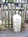 Milestone, Spetisbury - geograph.org.uk - 1657862.jpg 480 × 640; 198 kB
-
 Milestone, Spetisbury - geograph.org.uk - 1657866.jpg 640 × 480; 138 kB
-
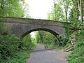 Old Railway Bridge - geograph.org.uk - 1281260.jpg 640 × 480; 98 kB
-
 Old railway bridge, Spetisbury - geograph.org.uk - 1063287.jpg 640 × 480; 99 kB
-
 Old railway station, Spetisbury - geograph.org.uk - 1063225.jpg 640 × 480; 92 kB
-
 Old trailer near Spetisbury - geograph.org.uk - 1281502.jpg 640 × 480; 88 kB
-
 Ordnance Survey Cut Mark - geograph.org.uk - 3685116.jpg 480 × 640; 98 kB
-
 Railway footbridge, Spetisbury - geograph.org.uk - 1063241.jpg 640 × 480; 100 kB
-
 River Stour - geograph.org.uk - 3239298.jpg 640 × 480; 129 kB
-
 River Stour - geograph.org.uk - 3239314.jpg 640 × 480; 101 kB
-
 River Stour - geograph.org.uk - 3239621.jpg 640 × 480; 115 kB
-
 River Stour - geograph.org.uk - 3240286.jpg 640 × 480; 111 kB
-
 River Stour at Spetisbury - geograph.org.uk - 3239287.jpg 640 × 480; 107 kB
-

-
 River Stour, Spetisbury - geograph.org.uk - 1053749.jpg 640 × 480; 54 kB
-
 River Stour, Spetisbury - geograph.org.uk - 1145804.jpg 640 × 480; 167 kB
-
 River Stour, Spetisbury - geograph.org.uk - 1146333.jpg 640 × 480; 241 kB
-
 River Stour, Spetisbury - geograph.org.uk - 2564912.jpg 640 × 481; 84 kB
-
 Round concrete tower - geograph.org.uk - 420380.jpg 640 × 480; 100 kB
-
 Spetisbury Ford - geograph.org.uk - 4806899.jpg 1.086 × 724; 366 kB
-
 Spetisbury Hall (geograph 2946784).jpg 640 × 480; 91 kB
-
 Spetisbury Hall - geograph.org.uk - 1063356.jpg 640 × 480; 67 kB
-
 Spetisbury Halt, abandoned platform (geograph 2135894).jpg 640 × 480; 119 kB
-
 Spetisbury, causeway (geograph 2778931).jpg 1.024 × 768; 333 kB
-
 Spetisbury, Clapcotts Farm - geograph.org.uk - 2778489.jpg 1.024 × 768; 119 kB
-
 Spetisbury, Crawford Bridge - geograph.org.uk - 2778384.jpg 1.024 × 767; 300 kB
-
 Spetisbury, cricket pavilion - geograph.org.uk - 2778408.jpg 1.024 × 768; 158 kB
-
 Spetisbury, disused railway bridge - geograph.org.uk - 2778437.jpg 1.024 × 768; 235 kB
-
 Spetisbury, disused stile - geograph.org.uk - 2778952.jpg 1.024 × 768; 232 kB
-
 Spetisbury, ford - geograph.org.uk - 2778423.jpg 1.024 × 768; 250 kB
-
 Spetisbury, postbox No. DT11 106 - geograph.org.uk - 1072358.jpg 640 × 480; 105 kB
-
 Spetisbury, postbox No. DT11 12 - geograph.org.uk - 1072338.jpg 640 × 480; 51 kB
-
 Spetisbury, postbox No. DT11 55 - geograph.org.uk - 1072352.jpg 640 × 480; 71 kB
-
 Spetisbury, river Stour - geograph.org.uk - 91235.jpg 640 × 433; 93 kB
-
 Spetisbury, snowdrops (geograph 2815773).jpg 1.024 × 768; 368 kB
-
 Spetisbury, snowdrops - geograph.org.uk - 2778562.jpg 1.024 × 768; 343 kB
-
 Spetisbury, stream (geograph 2778479).jpg 1.024 × 768; 281 kB
-
 Spetisbury, swans - geograph.org.uk - 2778399.jpg 1.024 × 767; 126 kB
-

-

-
 Spetisbury, The Woodpecker - geograph.org.uk - 2778464.jpg 1.024 × 767; 126 kB
-
 Spetisbury, trailway - geograph.org.uk - 2892586.jpg 1.024 × 768; 229 kB
-
 Spetisbury, weir (geograph 2778936).jpg 1.024 × 768; 278 kB
-
 Spettisbury Rings trig point - geograph.org.uk - 2135896.jpg 640 × 480; 116 kB
-

-
 Stile on the Stour Valley Way - geograph.org.uk - 1145795.jpg 480 × 640; 194 kB
-
 Swans at Crawford Bridge - geograph.org.uk - 1281174.jpg 640 × 480; 62 kB
-
 Tarrant Crawford, Clapcotts Hatches - geograph.org.uk - 2778941.jpg 1.024 × 768; 201 kB
-
 Tarrant Crawford, footbridge - geograph.org.uk - 2778943.jpg 1.024 × 768; 322 kB
-
 Tarrant Crawford, Stour Valley Way - geograph.org.uk - 2778947.jpg 1.024 × 768; 162 kB
-

-
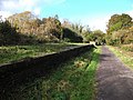
 Trailway, Spetisbury - geograph.org.uk - 1063258.jpg 640 × 480; 115 kB
-
 Village school, Spetisbury - geograph.org.uk - 1063305.jpg 640 × 480; 75 kB
-
 Watercress beds, Spetisbury - geograph.org.uk - 1063277.jpg 640 × 480; 64 kB
-
 Weather vane, Spetisbury - geograph.org.uk - 1657817.jpg 481 × 640; 56 kB
-
 Weir at Spetisbury - geograph.org.uk - 1275829.jpg 640 × 480; 102 kB
-
 Bales on trailer at Field Dairy - geograph.org.uk - 330080.jpg 640 × 430; 127 kB
-
 Bridleway to Westley Wood - geograph.org.uk - 294932.jpg 600 × 450; 105 kB
-
 Clump near South Farm - geograph.org.uk - 334725.jpg 640 × 480; 69 kB
-
 Copse with pheasant feeder - geograph.org.uk - 330114.jpg 430 × 640; 153 kB
-
 Dorset Farmland - geograph.org.uk - 330391.jpg 640 × 480; 59 kB
-
 Downland near South Farm - geograph.org.uk - 322793.jpg 640 × 430; 126 kB
-
 Edge of Westley Wood - geograph.org.uk - 330106.jpg 640 × 430; 131 kB
-
 Farmland between Field and Middle Dairies - geograph.org.uk - 330095.jpg 640 × 430; 133 kB
-
 Field Dairy - geograph.org.uk - 322746.jpg 640 × 430; 114 kB
-
 Field Dairy Farm - geograph.org.uk - 330406.jpg 640 × 430; 106 kB
-
 Field Gate - geograph.org.uk - 329025.jpg 640 × 480; 160 kB
-
 Gate - geograph.org.uk - 329007.jpg 640 × 480; 106 kB
-
 Lane from Field Dairy - geograph.org.uk - 330094.jpg 430 × 640; 95 kB
-
 Lane to South Farm - geograph.org.uk - 322791.jpg 640 × 430; 171 kB
-
 New Growth - geograph.org.uk - 334635.jpg 640 × 480; 68 kB
-
 Old style caravans at Keynston Mill - geograph.org.uk - 452296.jpg 640 × 432; 103 kB
-
 Small copse opposite Westley Wood - geograph.org.uk - 330103.jpg 640 × 430; 131 kB
-
 South Farm - geograph.org.uk - 322744.jpg 640 × 430; 122 kB
-
 Tending the crops - geograph.org.uk - 16875.jpg 640 × 480; 154 kB
-
 The Stour at Crawford Bridge - geograph.org.uk - 294923.jpg 450 × 600; 80 kB
-
 Track from Westley Wood back to road - geograph.org.uk - 330111.jpg 640 × 430; 151 kB
-
 Track to Westley Wood - geograph.org.uk - 330101.jpg 640 × 430; 154 kB
-
 View across South Farm downland - geograph.org.uk - 322788.jpg 640 × 430; 119 kB
-
 View over farmland towards River Stour - geograph.org.uk - 330412.jpg 640 × 430; 139 kB
-
 View towards Little Almer Wood - geograph.org.uk - 330078.jpg 640 × 430; 99 kB
-
 View towards South Farm - geograph.org.uk - 322789.jpg 640 × 430; 127 kB
-
 Vineyard buildings at Keynston Mill - geograph.org.uk - 452303.jpg 640 × 480; 88 kB
-
 Westley Wood - geograph.org.uk - 322749.jpg 640 × 430; 125 kB


_-_geograph.org.uk_-_3806145.jpg)
_-_geograph.org.uk_-_3806158.jpg)
_-_geograph.org.uk_-_3806160.jpg)
_-_geograph.org.uk_-_608308.jpg)


.jpg)

.jpg)
.jpg)


.jpg)

.jpg)


.jpg)

_(geograph_2962644).jpg)


