Category:Sproxton, North Yorkshire
Vai alla navigazione
Vai alla ricerca
village and civil parish in North Yorkshire, United Kingdom  | |||||
| Carica un file multimediale | |||||
| Istanza di | |||||
|---|---|---|---|---|---|
| Luogo | Ryedale, North Yorkshire, Yorkshire e Humber, Inghilterra | ||||
 | |||||
English: Sproxton is a village and civil parish in the Ryedale district of North Yorkshire, England. It is about 1 mile south of Helmsley and on the A170 road.
Sottocategorie
Questa categoria contiene un'unica sottocategoria, indicata di seguito.
S
- St Chad's Church, Sproxton (5 F)
File nella categoria "Sproxton, North Yorkshire"
Questa categoria contiene 103 file, indicati di seguito, su un totale di 103.
-
 A country crossroads and milestone - geograph.org.uk - 167695.jpg 640 × 480; 106 KB
-
 A public footpath on High Street - geograph.org.uk - 3008681.jpg 800 × 600; 194 KB
-

-
 A sunny spot - geograph.org.uk - 5091854.jpg 1 024 × 768; 395 KB
-
 A Yorkshire Milestone - geograph.org.uk - 1066551.jpg 640 × 480; 69 KB
-
 A Yorkshire Milestone - geograph.org.uk - 1066555.jpg 640 × 480; 64 KB
-
 A Yorkshire Milestone - geograph.org.uk - 1066556.jpg 640 × 480; 96 KB
-
 A170 at Court House Farm - geograph.org.uk - 6076398.jpg 4 298 × 2 177; 1,44 MB
-

-
 A170 eastbound at Court House Farm - geograph.org.uk - 4731521.jpg 640 × 481; 26 KB
-
 A170 heading west - geograph.org.uk - 2718527.jpg 640 × 393; 32 KB
-
 A170 near turning for Sproxton - geograph.org.uk - 2718523.jpg 800 × 525; 101 KB
-
 A170 nears bend at Sproxton - geograph.org.uk - 4731528.jpg 640 × 481; 30 KB
-
 Approaching Sproxton - geograph.org.uk - 3565378.jpg 1 024 × 768; 211 KB
-
 Barn beside Low Street - geograph.org.uk - 3980711.jpg 640 × 480; 216 KB
-
 Copse beside Cote Lane - geograph.org.uk - 2718525.jpg 800 × 591; 136 KB
-
 Cote Lane Milestone - geograph.org.uk - 1066553.jpg 640 × 480; 105 KB
-
 Cote Lane over Sproxton Moor - geograph.org.uk - 2718536.jpg 800 × 496; 101 KB
-
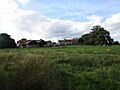
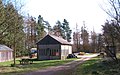
 Court House Farm - geograph.org.uk - 3885365.jpg 800 × 496; 541 KB
-
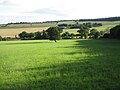
 Crop field south of Sproxton - geograph.org.uk - 3565373.jpg 1 024 × 768; 324 KB
-
 Double Dikes - geograph.org.uk - 6354555.jpg 640 × 480; 187 KB
-
 Double Dykes, Pry Rigg - geograph.org.uk - 2328155.jpg 3 264 × 2 448; 2,1 MB
-
 Ebor Way junction near Sproxton - geograph.org.uk - 387785.jpg 640 × 462; 109 KB
-
 Farm track near Sproxton Hall - geograph.org.uk - 5091830.jpg 1 024 × 768; 143 KB
-
 Footpath through the long grass - geograph.org.uk - 5091863.jpg 1 024 × 768; 307 KB
-
 Footpath to Helmsley - geograph.org.uk - 5091285.jpg 1 024 × 768; 211 KB
-
 Footpath to Helmsley - geograph.org.uk - 5091287.jpg 1 024 × 768; 230 KB
-
 Footpath to Sproxton - geograph.org.uk - 5090630.jpg 1 024 × 768; 226 KB
-
 Forest ride, Pry Rigg - geograph.org.uk - 2327348.jpg 2 448 × 3 264; 2,83 MB
-
 Forest track, Waterloo Plantation - geograph.org.uk - 5634217.jpg 3 240 × 4 320; 3,41 MB
-
 Gate on a path to Helmsley - geograph.org.uk - 5090634.jpg 1 024 × 768; 303 KB
-
 Gateway with unhelpful sign - geograph.org.uk - 5634223.jpg 4 320 × 3 240; 3,49 MB
-
 George VI Postbox - geograph.org.uk - 869316.jpg 640 × 427; 91 KB
-
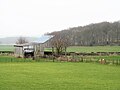 Grey barn, grey day - geograph.org.uk - 6076421.jpg 4 320 × 3 240; 2,27 MB
-
 Harvested field near Tom Smith's Cross - geograph.org.uk - 5859342.jpg 4 320 × 3 240; 3,23 MB
-
 Heading for Hovingham - geograph.org.uk - 3565379.jpg 1 024 × 768; 242 KB
-
 Hedge near Sproxton - geograph.org.uk - 2130006.jpg 640 × 481; 150 KB
-
 Hedgerow trees - geograph.org.uk - 5091858.jpg 1 024 × 768; 167 KB
-
 Looking Back - geograph.org.uk - 2748105.jpg 1 024 × 768; 135 KB
-
 Low Parks Farm - geograph.org.uk - 5091280.jpg 1 024 × 768; 160 KB
-
 Low Parks Farm - geograph.org.uk - 6073051.jpg 4 298 × 2 111; 1,83 MB
-
 Mixed grains - geograph.org.uk - 5091842.jpg 1 024 × 768; 222 KB
-
 NE end of Oxclose Wood - geograph.org.uk - 6076440.jpg 4 320 × 3 240; 3,43 MB
-
 Near Ellers Wood - geograph.org.uk - 3856163.jpg 1 600 × 1 200; 665 KB
-
 Near Low Parks Farm - geograph.org.uk - 3856157.jpg 1 600 × 1 200; 658 KB
-
 Near Sproxton - geograph.org.uk - 5980496.jpg 2 048 × 1 536; 950 KB
-
 Nelson Gate, Sproxton - geograph.org.uk - 2005831.jpg 800 × 600; 207 KB
-
 Oak tree in the field - geograph.org.uk - 6070335.jpg 4 320 × 3 240; 1,73 MB
-
 Oilseed Rape and spring foliage - geograph.org.uk - 801803.jpg 640 × 486; 114 KB
-
 Oilseed rape by the A170 - geograph.org.uk - 801795.jpg 640 × 479; 124 KB
-
 Open gate - geograph.org.uk - 5092893.jpg 1 024 × 768; 230 KB
-
 Parish church of St Chad Sproxton - geograph.org.uk - 4636837.jpg 3 072 × 2 302; 3,03 MB
-
 Proud to be Yorkshire - geograph.org.uk - 5090655.jpg 1 024 × 768; 261 KB
-
 Pry Rigg Farm - geograph.org.uk - 2327381.jpg 1 636 × 2 177; 1,09 MB
-
 Pry Rigg Plantation - geograph.org.uk - 3705972.jpg 1 600 × 1 200; 785 KB
-
 Pry Rigg Plantation - geograph.org.uk - 5470760.jpg 2 048 × 1 536; 1,29 MB
-
 Pry Rigg Plantation - geograph.org.uk - 5980485.jpg 2 048 × 1 536; 1,53 MB
-
 Sheep with lambs - geograph.org.uk - 6076435.jpg 4 320 × 2 853; 2,58 MB
-
 Signs of former coppicing - geograph.org.uk - 6073042.jpg 4 320 × 3 240; 4,97 MB
-
 Sproxton Hall - geograph.org.uk - 5091293.jpg 1 024 × 768; 226 KB
-
 Sproxton Moor - geograph.org.uk - 4790561.jpg 1 600 × 1 200; 823 KB
-
 Sproxton Moor - geograph.org.uk - 5640580.jpg 2 560 × 1 440; 1,22 MB
-
 Sproxton Village Hall dated 1949 - geograph.org.uk - 4636846.jpg 4 526 × 3 346; 5 MB
-
 Sproxton war memorial and church - geograph.org.uk - 6076420.jpg 4 320 × 3 240; 4,07 MB
-
 St Chad's Church, Sproxton - geograph.org.uk - 3533362.jpg 1 024 × 768; 226 KB
-
 Telephone box, Sproxton - geograph.org.uk - 2129992.jpg 640 × 481; 176 KB
-
 Temporary lights at Sproxton - geograph.org.uk - 854751.jpg 640 × 427; 69 KB
-
 The edge of Beech Wood - geograph.org.uk - 2811495.jpg 1 024 × 768; 224 KB
-
 The edge of the wood - geograph.org.uk - 2327370.jpg 2 448 × 3 264; 2,08 MB
-
 The entrance to Pry Rigg Farm - geograph.org.uk - 3020583.jpg 800 × 600; 192 KB
-
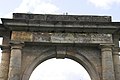 The inscription on Nelson's Gate - geograph.org.uk - 173809.jpg 640 × 427; 52 KB
-
 The Nelson Gate to Duncombe Park - geograph.org.uk - 4606406.jpg 1 600 × 1 067; 1,06 MB
-
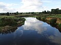 The River Rye - geograph.org.uk - 5090645.jpg 1 024 × 768; 126 KB
-
 The River Rye below Low Woods Farm - geograph.org.uk - 5091082.jpg 1 024 × 768; 138 KB
-
 The War Memorial at Sproxton - geograph.org.uk - 3533364.jpg 768 × 1 024; 279 KB
-
 The War Memorial at Sproxton - geograph.org.uk - 3533366.jpg 768 × 1 024; 241 KB
-
 The War Memorial at Sproxton - geograph.org.uk - 3533368.jpg 768 × 1 024; 246 KB
-
 The War Memorial at Sproxton - geograph.org.uk - 3533369.jpg 768 × 1 024; 223 KB
-
 The War Memorial at Sproxton - geograph.org.uk - 3533370.jpg 768 × 1 024; 203 KB
-
 Towards Throstle Nest Farm - geograph.org.uk - 6070323.jpg 4 319 × 2 708; 2,44 MB
-
 Track and pheasant feeders - geograph.org.uk - 5092892.jpg 1 024 × 768; 216 KB
-
 Track into Dropping Gill - geograph.org.uk - 2327240.jpg 3 264 × 2 448; 2,53 MB
-
 Track over Far Moor - geograph.org.uk - 553603.jpg 640 × 480; 132 KB
-
 Track running down Castle Gill - geograph.org.uk - 553610.jpg 640 × 480; 106 KB
-
 Track to Far Moor Plantation - geograph.org.uk - 5634228.jpg 4 320 × 3 240; 3,38 MB
-
 Track to Low Parks Farm - geograph.org.uk - 5091837.jpg 1 024 × 768; 226 KB
-
 Track to Low Parks Farm - geograph.org.uk - 5091844.jpg 1 024 × 768; 188 KB
-
 Track to Throstle Nest - geograph.org.uk - 5091849.jpg 1 024 × 768; 282 KB
-
 Traffic on A170 - geograph.org.uk - 6077147.jpg 4 320 × 2 339; 2,09 MB
-
 Tumulus on Westwood Rigg - geograph.org.uk - 5634224.jpg 4 320 × 2 603; 2,23 MB
-
 Upstream along the Rye - geograph.org.uk - 6073067.jpg 4 320 × 3 240; 3,21 MB
-
 View from Ebor Way - geograph.org.uk - 3856152.jpg 1 600 × 1 200; 637 KB
-
 View from Hag Lane - geograph.org.uk - 5980489.jpg 2 048 × 1 536; 1,09 MB
-
 View from the forest track junction - geograph.org.uk - 2755116.jpg 1 024 × 768; 201 KB
-
 View towards Belt Plantation and Seamer Wood - geograph.org.uk - 5091860.jpg 1 024 × 768; 234 KB
-
 View towards Newton Grange Farm - geograph.org.uk - 5090626.jpg 1 024 × 768; 183 KB
-
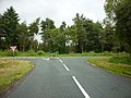 Wass Bank Road, joins the A170 - geograph.org.uk - 2467580.jpg 800 × 600; 318 KB
-
 Waterloo Plantation - geograph.org.uk - 2718531.jpg 800 × 553; 80 KB
-
 Wetland area close to the River Rye - geograph.org.uk - 6073061.jpg 3 240 × 4 319; 4,99 MB
-
 Woodland path to Oxclose Wood - geograph.org.uk - 2327361.jpg 2 448 × 3 264; 3,41 MB
-
 Woodland track towards Sproxton - geograph.org.uk - 6073033.jpg 3 240 × 4 319; 4,89 MB
-
 Workshops in Pry Rigg Plantation - geograph.org.uk - 2327337.jpg 3 217 × 2 000; 1,91 MB
-


