Category:St. Marys River (Michigan-Ontario)
Aller à la navigation
Aller à la recherche
décharge du lac Supérieur  | |||||
| Téléverser des médias | |||||
| Nature de l’élément | |||||
|---|---|---|---|---|---|
| Lieu | |||||
| Longueur |
| ||||
| Source | |||||
| Se jette dans | |||||
| Bassin versant | |||||
| Affluent |
| ||||
| Lac sur le cours d'eau | |||||
| À ne pas confondre avec | |||||
 | |||||
English: St. Marys River — an international river on the Canada-United States border, in Michigan and Ontario.
- Part of the Great Lakes Waterway system.
Sous-catégories
Cette catégorie comprend 14 sous-catégories, dont les 14 ci-dessous.
Média dans la catégorie « St. Marys River (Michigan-Ontario) »
Cette catégorie comprend 111 fichiers, dont les 111 ci-dessous.
-
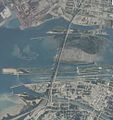
 Sault Ste. Marie satellite.jpg 900 × 900 ; 735 kio
-
 Lower St. Marys shipping channels.jpg 843 × 721 ; 78 kio
-
 "Entering American Soo Canal" (3792914395).jpg 5 056 × 3 832 ; 1,42 Mio
-
 20150707 - 25 - Sault Ste. Marie, Ont. - Clergue Park.jpg 2 013 × 1 208 ; 723 kio
-
 20150707 - 26 - Sault Ste. Marie, Ont. - SSM Michigan skyline from Clergue Park.jpg 2 046 × 1 151 ; 566 kio
-
 20150707 - 27 - Sault Ste. Marie, Ont. - International panorama from Clergue Park.jpg 2 700 × 630 ; 652 kio
-
 A lake tour to picturesque Mackinac via the D. and C (1890) (14764195165).jpg 2 896 × 1 766 ; 1,32 Mio
-
 Admiralty Chart No 324 A Survey of St. Mary's River, Published 1828.jpg 6 136 × 4 207 ; 4,5 Mio
-
-
 Beaver dams, Whitefish Channel.JPG 3 264 × 2 448 ; 3,81 Mio
-
 Boat in the St Marys River, North Channel.JPG 2 560 × 1 920 ; 808 kio
-
 Boat launch at Pumpkin Point 1.JPG 2 560 × 1 920 ; 822 kio
-
 Boat launch at Pumpkin Point 2.JPG 2 560 × 1 920 ; 812 kio
-
 Boats in the St Marys River, North Channel.JPG 2 560 × 1 920 ; 800 kio
-
 Calumet aground St Marys river 1.jpg 3 648 × 5 472 ; 3,43 Mio
-
 Calumet aground St Marys river 2.jpg 5 472 × 3 648 ; 2,99 Mio
-
 Calumet aground St Marys river 3.jpg 5 472 × 3 648 ; 3,82 Mio
-

-
 CCGS Samuel Risley patrols the St Mary's River.jpg 3 072 × 2 304 ; 1,54 Mio
-
 Chinook salmon (Garden R) 1.JPG 2 560 × 1 920 ; 814 kio
-
 Chinook salmon (Garden R) crop.jpg 2 228 × 1 023 ; 1,01 Mio
-
 Clergue Park boardwalk extension.JPG 2 560 × 1 920 ; 808 kio
-
 Coast Guard rescues 2 from boat fire 130829-G-ZZ999-001.jpg 1 600 × 1 200 ; 420 kio
-

-

-
 Diversion of water from the Great lakes and Niagara river (1921) (14741555256).jpg 2 960 × 2 024 ; 1,53 Mio
-
 Echo Bay 1.JPG 2 560 × 1 920 ; 804 kio
-
 Echo Bay 2.JPG 2 560 × 1 920 ; 813 kio
-
 Echo Bay wetlands 1.JPG 2 560 × 1 920 ; 809 kio
-
 Echo Bay wetlands 2.JPG 2 560 × 1 920 ; 809 kio
-
 Edison powerhouse from Sault Ontario.JPG 3 264 × 2 448 ; 3,65 Mio
-
 Edison Sault hydroelectric power plant.JPG 1 600 × 1 200 ; 367 kio
-
 Edison Sault power plant and ship 2010-04-20 USACE.jpg 6 144 × 4 088 ; 8,89 Mio
-
 Edison Sault power plant and Soo Locks 2010-04-20 USACE.jpg 6 144 × 4 088 ; 8,93 Mio
-
 Edmund Fitzgerald-USACE.jpg 2 677 × 1 894 ; 3,47 Mio
-
 Fishing at Saint Mary's River, Sault Sainte Marie, Michigan, 1901.jpg 3 726 × 1 839 ; 2,18 Mio
-
 Fort Creek meets St Marys River.JPG 3 264 × 2 448 ; 1,5 Mio
-
 Internation bridge sault ste marie.jpg 1 035 × 462 ; 66 kio
-
 International Bridge (14518919092).jpg 1 691 × 900 ; 321 kio
-
 International Bridge from Wetland.jpg 1 632 × 1 232 ; 384 kio
-
 International Bridge, St. Mary's River, Sault Ste Marie, Ontario.jpg 3 396 × 2 128 ; 4,14 Mio
-
 ISS-56 Michigan and Ontario, St. Mary's River.jpg 3 712 × 5 568 ; 4,06 Mio
-
 ISS067-E-7701.JPG St. Marys River in Michigan and Ontario.jpg 5 568 × 3 712 ; 3,46 Mio
-
 Laker (14333386369).jpg 1 920 × 805 ; 303 kio
-
 Laker (14516607771).jpg 1 487 × 682 ; 172 kio
-
 Laker (14540101543).jpg 1 920 × 1 080 ; 325 kio
-
 LightningVolt Soo Lock Empty.jpg 512 × 352 ; 35 kio
-
 Locks (14333417048).jpg 1 364 × 668 ; 201 kio
-
 Low water at Echo Bay boat launch 1.JPG 2 560 × 1 920 ; 804 kio
-
 Low water at Echo Bay boat launch 2.JPG 2 560 × 1 920 ; 814 kio
-
 Mallards (Sault Boardwalk) 1.JPG 3 264 × 2 448 ; 3,79 Mio
-
 Millennium Fountain, Sault Ste. Marie ON.jpg 1 632 × 1 232 ; 481 kio
-
 Mouth of Fort Creek.JPG 3 264 × 2 448 ; 3,67 Mio
-
 Navigation buoys on the St Marys River.JPG 3 264 × 2 448 ; 3,62 Mio
-
 Neebish Island, Michigan.JPG 1 936 × 2 608 ; 6,03 Mio
-
-
 Shooting the Rapids, Sault Ste. Marie, Mich (NYPL b12647398-68353).tiff 2 408 × 1 581 ; 10,9 Mio
-
-
 Portable Derrick Handling Timber For Crib Construction - DPLA - b91add035ae4238db40358e1212a1bf2.jpg 2 987 × 2 424 ; 3,77 Mio
-
 Powerplant (14333333910).jpg 1 199 × 900 ; 275 kio
-
 Pumpkin Point wetlands.JPG 2 560 × 1 920 ; 820 kio
-
 Rainbow trout (SSM Canal) 2.JPG 3 264 × 2 448 ; 3,84 Mio
-
 Rainbow trout head (SSM Canal).JPG 3 264 × 2 448 ; 3,76 Mio
-
 Resurvey of St. Marys River- Larke Station - DPLA - 89dcdbb88dba9149b462e4662e295569.jpg 1 596 × 2 217 ; 1,89 Mio
-

-
 Sault Ste Marie (ASTER).jpg 2 356 × 2 239 ; 918 kio
-
 Sault Ste Marie 1978 LOC 571573cu.jpg 4 234 × 3 300 ; 1,31 Mio
-
 Sault Ste Marie Boardwalk.JPG 3 264 × 2 448 ; 3,67 Mio
-
 Sault Ste Marie, Ontario and Michigan.JPG 2 848 × 4 288 ; 8,47 Mio
-
 Sault Ste. Marie - state visits (I0015178).jpg 2 478 × 1 966 ; 2,75 Mio
-
 Sault Ste. Marie Bridge Company USGS view.jpg 487 × 518 ; 52 kio
-
 Sault waterfront at the Civic Centre 1.JPG 3 264 × 2 448 ; 3,67 Mio
-
 Sault waterfront at the Civic Centre 2.JPG 3 264 × 2 448 ; 3,7 Mio
-
 Sault waterfront in winter 1.JPG 3 264 × 2 448 ; 3,63 Mio
-
 Sault waterfront in winter 2 (cropped).JPG 3 257 × 465 ; 986 kio
-
 Sault waterfront in winter 2.JPG 3 264 × 2 448 ; 3,63 Mio
-
 Sault waterfront in winter 3.JPG 3 264 × 2 448 ; 3,62 Mio
-
 Sault waterfront in winter 4.JPG 3 264 × 2 448 ; 3,56 Mio
-
 Sault waterfront in winter 5.JPG 3 264 × 2 448 ; 3,63 Mio
-
 Sault waterfront in winter 6.JPG 3 264 × 2 448 ; 3,64 Mio
-
 SaultSteMarieCanalLock.jpg 2 048 × 1 360 ; 1,27 Mio
-
 Sea lamprey wounds (Garden R).JPG 2 560 × 1 920 ; 801 kio
-
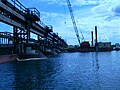
 Soo Locks and International Bridge USACE 2010-04-19.jpg 6 144 × 4 088 ; 9,29 Mio
-
 Soo Michigan skyline.JPG 2 592 × 1 481 ; 1,24 Mio
-
 SSM (14519984585).jpg 1 920 × 692 ; 224 kio
-
 SSM International Railway Bridge 1905.png 998 × 210 ; 145 kio
-
 St Mary’s River.jpg 750 × 742 ; 156 kio
-
 St. Joseph Island detail 1783 Abel Buell map.JPG 744 × 563 ; 58 kio
-
 St. Mary's River & International Bridge.JPG 1 632 × 1 232 ; 494 kio
-
 St. Mary's River, from SSM Civic Centre.JPG 1 632 × 1 232 ; 471 kio
-
 St. Marys River Compensation Works 1.JPG 2 560 × 1 920 ; 805 kio
-
 St. Marys River Compensation Works 2.JPG 2 560 × 1 920 ; 808 kio
-
 St. Marys River Compensation Works 3.JPG 2 560 × 1 920 ; 806 kio
-
 St. Marys River Compensation Works 4.JPG 2 560 × 1 920 ; 802 kio
-
 St. Marys River Compensation Works 5.JPG 2 560 × 1 920 ; 821 kio
-
 St. Marys River Compensation Works 6.JPG 2 560 × 1 920 ; 808 kio
-
 St. Marys River Compensation Works 7.JPG 2 560 × 1 920 ; 809 kio
-
 St. Mary’s River.jpg 750 × 564 ; 92 kio
-
 StMarys-River.png 2 000 × 1 356 ; 208 kio
-

-
 Tugs on stand-by (7795906644).jpg 4 320 × 3 240 ; 2,69 Mio
-
 USCGC Katmai Bay ice breaking in the Great Lakes (5426244902).jpg 1 050 × 750 ; 163 kio
-
 USCGC Mackinaw to the rescue 131217-G-ZZ999-002.jpg 2 144 × 1 424 ; 710 kio
-
 Waves at the flood control gates.JPG 2 560 × 1 920 ; 813 kio
-
 Whitefish Channel 9.JPG 2 560 × 1 920 ; 807 kio
-
 Canoemen shaking hands, by Childs, B. F. cleaned.jpg 1 135 × 1 141 ; 439 kio
-
 Canoemen shaking hands, by Childs, B. F..jpg 2 737 × 1 370 ; 1,42 Mio
-
 Rapids of the Sault Ste. Marie (instantaneous), by Childs, B. F..jpg 2 737 × 1 406 ; 1,39 Mio
-
 Residence of the "Lo" family, Ste. Marie Rapids, by Childs, B. F..jpg 2 737 × 1 413 ; 1,58 Mio
-
 The picturesque of Ste. Marie River, canoe building, by Childs, B. F..jpg 2 737 × 1 414 ; 1,61 Mio
-
 The Rapids Pilot, Sault Ste. Marie, by Childs, B. F..jpg 2 737 × 1 405 ; 1,34 Mio


.jpg)


_(14764195165).jpg)


_1.JPG)
_crop.jpg)


_(14741555256).jpg)


.jpg)


.jpg)
.jpg)
.jpg)
.jpg)


_1.JPG)


.jpg)

_2.JPG)
.JPG)


.jpg)


.jpg)


.JPG)


.jpg)
.jpg)


,_by_Childs,_B._F..jpg)


.JPG)
.jpg)
Catégories :
- Rivers of Michigan
- Rivers of Ontario
- International rivers of North America
- Geography of the Great Lakes
- Rivers of the Upper Peninsula
- Geography of Algoma District, Ontario
- Nature of Sault Ste. Marie, Ontario
- Sault Ste. Marie, Michigan
- Canada-United States border
- Canadian Heritage Rivers
- Rivers of the United States by name
- Rivers of Canada by name