Category:St Agnes, Cornwall
Aller à la navigation
Aller à la recherche
village britannique  | |||||
| Téléverser des médias | |||||
| Nature de l’élément | |||||
|---|---|---|---|---|---|
| Lieu | Cornouailles, Angleterre du Sud-Ouest, Angleterre | ||||
| Propriétaire | |||||
| Opérateur | |||||
| Réputé identique à | St. Agnes (page en doublon, paroisse civile) | ||||
| site officiel | |||||
 | |||||
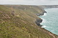
Deutsch: St Agnes ( kornisch Breanek) ist ein englischer Ort an der Nordküste der Grafschaft Cornwall. In früheren Zeiten war die Gegend um St Agnes berühmt für den Zinn-Abbau. Heute finden sich noch viele Relikte aus diesen Zeiten, wie z. B. Ruinen der Maschinenhäuser.
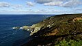
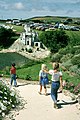
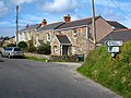
English: St Agnes ( Cornish Breanek) is a village and a parish on the north coast of Cornwall, England. It is in the Cornwall and West Devon Mining Landscape World Heritage Site, and lies halfway between the artists' colony of St Ives and the surfers' paradise at Newquay. It is one of the twelve sections of the Cornwall Area of Outstanding Natural Beauty (AONB).
Sous-catégories
Cette catégorie comprend 21 sous-catégories, dont les 21 ci-dessous.
B
- Barkla Shop (10 F)
- Bawden Rocks (12 F)
- Blowinghouse Ford (3 F)
C
- Chapel Porth (50 F)
G
- Graffiti in St Agnes, Cornwall (42 F)
L
M
- Mount Hawke (13 F)
N
- Newdowns Head, Cornwall (18 F)
P
S
- Seal Hole Mine (2 F)
T
- Transport in St Agnes, Cornwall (16 F)
- Trevaunance Cove (60 F)
Média dans la catégorie « St Agnes, Cornwall »
Cette catégorie comprend 408 fichiers, dont les 200 ci-dessous.
(page précédente) (page suivante)-
 "Bat Hat" by the South West Coast Path - geograph.org.uk - 6277680.jpg 1 024 × 768 ; 592 kio
-
 "Cripes, lads^ Leg it..." - geograph.org.uk - 3217545.jpg 1 142 × 857 ; 395 kio
-
 A rainy day - geograph.org.uk - 4153116.jpg 3 827 × 2 448 ; 7,56 Mio
-
 A Tourist Attraction - geograph.org.uk - 179062.jpg 640 × 427 ; 147 kio
-
 A30 - geograph.org.uk - 5145013.jpg 640 × 426 ; 47 kio
-
 A30 - geograph.org.uk - 5145015.jpg 640 × 426 ; 48 kio
-
 A30 approaching overbridge near Briars Farm - geograph.org.uk - 4040762.jpg 640 × 422 ; 48 kio
-
 A30 road junction near Scorrier - geograph.org.uk - 4040764.jpg 640 × 417 ; 47 kio
-
 Above Hanover Cove - geograph.org.uk - 2780131.jpg 640 × 427 ; 177 kio
-
 Aircraft over St Agnes Head (6120).jpg 4 288 × 2 848 ; 3,77 Mio
-
 All that remains of Cameron Camp - geograph.org.uk - 3216601.jpg 1 142 × 857 ; 289 kio
-
 Approaching Goonvrea - geograph.org.uk - 4153163.jpg 4 000 × 2 664 ; 4,1 Mio
-
 Approaching Redruth - geograph.org.uk - 4179153.jpg 4 000 × 2 664 ; 4,15 Mio
-
 At Porthtowan - geograph.org.uk - 4153124.jpg 4 000 × 2 664 ; 5,49 Mio
-
 B3285 Entering St Agnes - geograph.org.uk - 5835639.jpg 640 × 480 ; 94 kio
-
 B3285 Trevellas Village Road Junction - geograph.org.uk - 5834389.jpg 640 × 451 ; 80 kio
-
 B3285 Trevellas Village Sign - geograph.org.uk - 5834381.jpg 640 × 445 ; 54 kio
-
 B3285 Turn Left For Portreath - geograph.org.uk - 5835626.jpg 640 × 480 ; 56 kio
-
 B3285 Turn Left For Truro - geograph.org.uk - 5835622.jpg 640 × 480 ; 76 kio
-
 Bales on arable land - geograph.org.uk - 6295027.jpg 800 × 600 ; 126 kio
-
 Beach and Boulders - geograph.org.uk - 5782329.jpg 427 × 640 ; 324 kio
-
 Beach at Chapel Porth - geograph.org.uk - 4153195.jpg 4 000 × 2 664 ; 5,23 Mio
-
 Beacon Cottage Farm and St Agnes Beacon (6102).jpg 4 288 × 2 848 ; 6,03 Mio
-
 Beacon Cottage Farm and St Agnes Beacon (6105).jpg 4 288 × 2 848 ; 5,22 Mio
-
 Beaconsfield Place, St Agnes, Cornwall - July 2022.jpg 3 854 × 2 640 ; 2,18 Mio
-
 Blackwater Cornwall - geograph.org.uk - 5022355.jpg 640 × 439 ; 51 kio
-
 Blackwater Road Crossroads Cornwall - geograph.org.uk - 5022360.jpg 640 × 400 ; 37 kio
-
 Blue Hills Mine, Trevellas Coombe - geograph.org.uk - 5815597.jpg 640 × 480 ; 161 kio
-
 Bridge Farm near Skinner's Bottom - geograph.org.uk - 3217549.jpg 1 142 × 857 ; 259 kio
-
 Bridge over a disused railway - geograph.org.uk - 4305303.jpg 1 024 × 680 ; 235 kio
-
 British Road in St Agnes, Cornwall - geograph.org.uk - 5387918.jpg 4 000 × 3 000 ; 3,43 Mio
-
 Bryony Berries - geograph.org.uk - 69837.jpg 640 × 442 ; 111 kio
-
 Bungalow and mine chimney, Rose Hill, Porthtowan - geograph.org.uk - 4874426.jpg 1 200 × 1 600 ; 255 kio
-
 Bus shelter at Buckshead - geograph.org.uk - 4871683.jpg 1 600 × 1 202 ; 207 kio
-
 Bus shelter, Coast Road, Porthtowan - geograph.org.uk - 4873034.jpg 1 600 × 1 200 ; 183 kio
-
 Bus to Porthtowan - geograph.org.uk - 6295030.jpg 800 × 600 ; 84 kio
-
 Cabbages and cottage - geograph.org.uk - 6295055.jpg 800 × 600 ; 128 kio
-
 Calciner ruins - geograph.org.uk - 6297255.jpg 800 × 600 ; 115 kio
-
 Cannonball Farm - geograph.org.uk - 3216624.jpg 1 142 × 857 ; 304 kio
-
 Capped shaft and spoil - geograph.org.uk - 6295032.jpg 800 × 600 ; 110 kio
-
 Car park and homes - geograph.org.uk - 23510.jpg 640 × 479 ; 91 kio
-
 Carn Brea from St Agnes Head (6310).jpg 4 288 × 2 848 ; 4,29 Mio
-
 Carnival day in St Agnes - geograph.org.uk - 2015899.jpg 640 × 427 ; 97 kio
-
 Catching a wave - Porthtowan - geograph.org.uk - 5132511.jpg 640 × 466 ; 76 kio
-
 Chacewater , A30 - geograph.org.uk - 6305352.jpg 6 000 × 4 000 ; 6,63 Mio
-
 Chacewater , A30 - geograph.org.uk - 6305353.jpg 6 000 × 4 000 ; 6,43 Mio
-
 Chapel Porth - geograph.org.uk - 5782290.jpg 640 × 427 ; 276 kio
-
 Chapel Porth beach and cave - geograph.org.uk - 3830947.jpg 427 × 640 ; 90 kio
-
 Chapel Porth, 1950 - geograph.org.uk - 6369934.jpg 1 280 × 821 ; 362 kio
-
 Chapel Porth, 1950 - geograph.org.uk - 6369939.jpg 1 280 × 843 ; 338 kio
-
 Churchtown, St Agnes, Cornwall - July 2022.jpg 4 185 × 3 439 ; 3,17 Mio
-
 Cliff between Green Island and Hanover Cove - geograph.org.uk - 2537265.jpg 640 × 481 ; 78 kio
-
 Cliff scenery S of Cligga Head near Perranporth - geograph.org.uk - 5246300.jpg 5 184 × 2 920 ; 5,81 Mio
-
 Cliffs above Porth Towan - geograph.org.uk - 3804566.jpg 1 024 × 680 ; 216 kio
-
 Cliffs above Tobban Horse (6386).jpg 4 288 × 2 848 ; 6,72 Mio
-
 Cliffs and beach at Tobban Horse - geograph.org.uk - 3205028.jpg 814 × 1 088 ; 259 kio
-
 Cliffs and beach, Porthtowan - geograph.org.uk - 4221354.jpg 640 × 479 ; 31 kio
-
 Cliffs and Wheal Charlotte - geograph.org.uk - 3804584.jpg 1 024 × 680 ; 165 kio
-
 Cliffs at Porth Towan - geograph.org.uk - 3799489.jpg 800 × 531 ; 58 kio
-
 Cliffs at St Agnes Head (6308).jpg 4 288 × 2 848 ; 6,29 Mio
-
 Cliffs below Wheal Charlotte Moor (6350).jpg 4 288 × 2 848 ; 6,37 Mio
-
 Cliffs from above Polberro Cove - geograph.org.uk - 23533.jpg 640 × 479 ; 85 kio
-
 Cliffs near Cross Coombe - geograph.org.uk - 6277682.jpg 768 × 1 024 ; 287 kio
-
 Cliffs north of Pen a Gader (6257).jpg 4 288 × 2 848 ; 6,2 Mio
-
 Cliffs north of Tobban Horse (6387).jpg 4 288 × 2 848 ; 6,02 Mio
-
 Cliffs north of Tobban Horse (6389).jpg 4 288 × 2 848 ; 5,91 Mio
-
 Cliffs north of Tobban Horse (6391).jpg 4 288 × 2 848 ; 5,78 Mio
-
 Cliffs south of Cligga Head (6270).jpg 4 288 × 2 848 ; 6,21 Mio
-
 Cliffs south of Cligga Head (6274).jpg 4 288 × 2 848 ; 5,86 Mio
-
 Cliffs south of Cligga Head (6275).jpg 4 288 × 2 848 ; 6,38 Mio
-
 Cliffs south of Cligga Head (6276).jpg 4 288 × 2 848 ; 6,29 Mio
-
 Cliffs west of St Agnes Head - geograph.org.uk - 3209167.jpg 857 × 1 142 ; 322 kio
-
 Cliffs, Carn Gowla - geograph.org.uk - 6295062.jpg 800 × 600 ; 109 kio
-
 Cliffscape, Porthtowan - geograph.org.uk - 6286967.jpg 800 × 600 ; 110 kio
-
 Clifftop Dispersal - Perranporth Airfield - geograph.org.uk - 4161712.jpg 1 600 × 1 064 ; 388 kio
-
 Cligga Head (6265).jpg 4 288 × 2 848 ; 6,21 Mio
-
 Cligga Head - geograph.org.uk - 2954402.jpg 640 × 480 ; 69 kio
-
 Closed church of Mithian St Peter - geograph.org.uk - 4305289.jpg 1 024 × 680 ; 260 kio
-
 Coast path above Hanover Cove - geograph.org.uk - 2008939.jpg 640 × 480 ; 100 kio
-
 Coast path above Polberra Cove - geograph.org.uk - 2007493.jpg 640 × 480 ; 120 kio
-
 Coast path E of St Agnes Head - geograph.org.uk - 5246294.jpg 5 184 × 2 920 ; 5,76 Mio
-
 Coast path leading N to St Agnes Head - geograph.org.uk - 5246293.jpg 5 184 × 2 920 ; 5,19 Mio
-
 Coast path near Towanroath shaft, St Agnes, Cornwall (14876932142).jpg 5 000 × 2 878 ; 13,99 Mio
-
 Coast path near Towanroath shaft, St Agnes, Cornwall - 2 (14776820968).jpg 5 000 × 3 312 ; 16,92 Mio
-
 Coast path north from Tubby's Head - geograph.org.uk - 5757176.jpg 640 × 480 ; 185 kio
-
 Coast path north from Wheal Coates - geograph.org.uk - 5757138.jpg 640 × 480 ; 148 kio
-
 Coast Road Approaching Porthtowan - geograph.org.uk - 5835726.jpg 640 × 452 ; 60 kio
-
 Coast Road Towan Cross - geograph.org.uk - 5835686.jpg 640 × 480 ; 55 kio
-
 Coast Road, Porthtowan - geograph.org.uk - 4873052.jpg 1 600 × 1 200 ; 311 kio
-
 Coast south of Wheal Coates - geograph.org.uk - 3464568.jpg 640 × 480 ; 90 kio
-
 Coastal footpath - geograph.org.uk - 6295064.jpg 800 × 600 ; 125 kio
-
 Coastal path at White Rocks - geograph.org.uk - 2570461.jpg 640 × 424 ; 214 kio
-
 Coastal slope north of Tubby's Head - geograph.org.uk - 5757202.jpg 640 × 480 ; 156 kio
-

-
 Collapsing cliff - geograph.org.uk - 797312.jpg 640 × 480 ; 105 kio
-
 Communications from Trevellas - geograph.org.uk - 4871660.jpg 1 600 × 1 203 ; 220 kio
-
 Copper Mineralisation - geograph.org.uk - 5782292.jpg 640 × 427 ; 435 kio
-
 Cornish hedges on the road to Mingoose - geograph.org.uk - 4873025.jpg 1 600 × 1 201 ; 374 kio
-
 Cornish hedges south of Bolster - geograph.org.uk - 4872987.jpg 1 600 × 1 280 ; 291 kio
-
 Cornwall in Miniature, 1977 - geograph.org.uk - 2615691.jpg 428 × 640 ; 129 kio
-
 Cornwall St Agnes (231897091).jpeg 2 048 × 1 365 ; 1,19 Mio
-
 Cottage south of Menagissey - geograph.org.uk - 3217496.jpg 979 × 734 ; 370 kio
-
 Cottages and hill, Manor Parsley - geograph.org.uk - 6295033.jpg 800 × 600 ; 118 kio
-
 Cottages at Higher Bal - geograph.org.uk - 1477277.jpg 640 × 480 ; 93 kio
-
 Cottages at Mingoose - geograph.org.uk - 1886312.jpg 640 × 480 ; 111 kio
-
 Crams rocks - geograph.org.uk - 3209164.jpg 857 × 1 142 ; 335 kio
-
 Crams, St. Agnes Head - geograph.org.uk - 3464528.jpg 640 × 480 ; 107 kio
-
 Creamery, Wheal Rose - geograph.org.uk - 2807715.jpg 2 592 × 1 944 ; 1,05 Mio
-
 Dairy cattle near St. Agnes - geograph.org.uk - 3787818.jpg 640 × 480 ; 82 kio
-

-
 Disused Building at Cross Coombe - geograph.org.uk - 181478.jpg 640 × 474 ; 129 kio
-
 Down The Hill Into Porthtowan - geograph.org.uk - 5835730.jpg 640 × 480 ; 63 kio
-
 Driftwood Spars Brewery - geograph.org.uk - 4688405.jpg 640 × 424 ; 63 kio
-
 Dwelling Near Tywarnhayle Mine - geograph.org.uk - 5046926.jpg 1 600 × 1 200 ; 511 kio
-
 Engine house - geograph.org.uk - 6295066.jpg 600 × 800 ; 86 kio
-
 Engine house chimney - geograph.org.uk - 6294186.jpg 800 × 600 ; 150 kio
-
 Engine House, Wheal Ellen - geograph.org.uk - 5046901.jpg 1 200 × 1 600 ; 702 kio
-
 Enginehouse at Wheal Coates (6319).jpg 4 288 × 2 848 ; 6,96 Mio
-
 Enginehouse at Wheal Coates (6321).jpg 4 288 × 2 848 ; 6,15 Mio
-
 Entering St Agnes - geograph.org.uk - 2572253.jpg 640 × 427 ; 220 kio
-

-
 Fallen cliffs between Trevaunance and Polberro coves - geograph.org.uk - 3209125.jpg 1 142 × 857 ; 309 kio
-
 Family walk on beach - geograph.org.uk - 5561930.jpg 2 592 × 1 944 ; 2,18 Mio
-
 Farmland near Blackwater - geograph.org.uk - 4304896.jpg 800 × 531 ; 121 kio
-
 Farmland near Blackwater - geograph.org.uk - 4305292.jpg 800 × 531 ; 116 kio
-
 Faulting a Fault - geograph.org.uk - 3166093.jpg 424 × 640 ; 326 kio
-
 Faulting and trial level at St Agnes - geograph.org.uk - 6010074.jpg 640 × 480 ; 276 kio
-
 Faults in Porth Chapel - geograph.org.uk - 3122173.jpg 640 × 424 ; 70 kio
-
 Field on Mithian Downs - geograph.org.uk - 4305306.jpg 800 × 531 ; 138 kio
-
 Finger post at Higher Goonvrea - geograph.org.uk - 3454745.jpg 640 × 480 ; 77 kio
-
 Flowers in garden above Trevaunance Cove near St Agnes - geograph.org.uk - 5246295.jpg 5 184 × 2 920 ; 6,59 Mio
-
 Flowers in St Agnes (6293).jpg 4 288 × 2 848 ; 6,33 Mio
-
 Folded rocks - geograph.org.uk - 6289341.jpg 800 × 600 ; 160 kio
-
 Folded rocks 2 - geograph.org.uk - 6289344.jpg 800 × 600 ; 160 kio
-
 Footpath at Barkla Shop - geograph.org.uk - 4871695.jpg 1 600 × 1 200 ; 585 kio
-
 Footpath, St.Agnes Beacon - geograph.org.uk - 6295053.jpg 800 × 600 ; 134 kio
-
 Ford at Coldharbour - geograph.org.uk - 4680933.jpg 6 000 × 4 000 ; 6,56 Mio
-
 Ford near Silverwell - geograph.org.uk - 1210392.jpg 640 × 427 ; 103 kio
-
 Former quarry - geograph.org.uk - 6295060.jpg 800 × 600 ; 105 kio
-
 From St Agnes Head towards Bawden Rocks - geograph.org.uk - 2570467.jpg 640 × 427 ; 191 kio
-
 Gate on the coastal path at Blue Hills - geograph.org.uk - 1886059.jpg 640 × 480 ; 99 kio
-
 Gateway to a field - geograph.org.uk - 4304875.jpg 800 × 531 ; 131 kio
-

-
 Godrevy Island and St Ives from Porthtowan (6385).jpg 4 288 × 2 848 ; 4,23 Mio
-
 Goonbell Village - geograph.org.uk - 367623.jpg 640 × 426 ; 81 kio
-
 Goonown Road at Goonbell - geograph.org.uk - 2243135.jpg 640 × 480 ; 93 kio
-
 Gorse on the cliff top at Polberrow - geograph.org.uk - 3454680.jpg 640 × 480 ; 114 kio
-
 Green Island - geograph.org.uk - 23545.jpg 640 × 479 ; 105 kio
-
 Green Island - geograph.org.uk - 2954398.jpg 640 × 480 ; 87 kio
-
 Hanover Cove - geograph.org.uk - 2537276.jpg 640 × 480 ; 105 kio
-
 Hanover Cove - geograph.org.uk - 2954403.jpg 480 × 640 ; 112 kio
-
 Hawthorn Blossom - Crataegus monogyna - geograph.org.uk - 181699.jpg 640 × 576 ; 100 kio
-
 Heritage Trail - geograph.org.uk - 4688459.jpg 424 × 640 ; 51 kio
-
 High level coastal path south of Wheal Coates - geograph.org.uk - 3466894.jpg 640 × 480 ; 100 kio
-
 Houses on the old A30 road through Blackwater, St Agnes - geograph.org.uk - 4799479.jpg 2 048 × 1 536 ; 736 kio
-
 In St Agnes - geograph.org.uk - 4153168.jpg 4 000 × 2 664 ; 5,4 Mio
-
 In St Agnes - geograph.org.uk - 4153173.jpg 4 000 × 2 664 ; 7,65 Mio
-
 Inside Driftwood Spars - geograph.org.uk - 4688417.jpg 640 × 424 ; 60 kio
-
 John's Shaft Engine House, Tywarnhayle Mine - geograph.org.uk - 5046934.jpg 1 200 × 1 600 ; 570 kio
-
 Kayaks on the coast - geograph.org.uk - 4161753.jpg 1 600 × 1 064 ; 287 kio
-
 Kneehigh Theatre's 'Asylum' - geograph.org.uk - 2565129.jpg 640 × 480 ; 73 kio
-
 Lane junction near Mawla - geograph.org.uk - 5832559.jpg 1 024 × 768 ; 187 kio
-
 Lane through Cross Coombe - geograph.org.uk - 1356992.jpg 640 × 426 ; 114 kio
-
 Leaving the A30 - geograph.org.uk - 4179144.jpg 4 000 × 2 664 ; 6,56 Mio
-
 Little Orchard Holiday Village - geograph.org.uk - 4688533.jpg 640 × 424 ; 114 kio
-
 Lode Exposure - Wheal Coates - geograph.org.uk - 3122150.jpg 424 × 640 ; 79 kio
-
 Lode in the Cliff - geograph.org.uk - 3122204.jpg 640 × 424 ; 106 kio
-
 Lode in the Cliffs - St Agnes - geograph.org.uk - 3164884.jpg 424 × 640 ; 276 kio
-
 Look Out Station, St Agnes Head - geograph.org.uk - 4566757.jpg 3 264 × 2 448 ; 2,11 Mio
-
 Looking along the Coast from St Agnes Beacon - geograph.org.uk - 4711847.jpg 4 000 × 3 000 ; 3,87 Mio
-
 Looking along the coast towards Cross Coombe - geograph.org.uk - 1886028.jpg 640 × 480 ; 63 kio
-
 Looking at the big sky... - geograph.org.uk - 3804545.jpg 1 024 × 680 ; 136 kio
-

-
 Lookout station, St. Agnes Head - geograph.org.uk - 3787859.jpg 640 × 480 ; 89 kio
-
 Low tide at Porth Towan - geograph.org.uk - 3804576.jpg 1 024 × 680 ; 152 kio
-
 Low tide at Porth Towan - geograph.org.uk - 3804905.jpg 1 024 × 680 ; 56 kio
-
 Low tide at Porth Towan - geograph.org.uk - 3804909.jpg 1 024 × 680 ; 146 kio
-
 Low tide below the cliffs at Porth Towan - geograph.org.uk - 3804571.jpg 1 024 × 680 ; 167 kio
-
 Mawla Methodist Church - geograph.org.uk - 3190153.jpg 857 × 1 142 ; 302 kio
-
 Mawla Methodist Church - geograph.org.uk - 3190161.jpg 1 142 × 857 ; 367 kio
-
 Mawla Methodist Church - geograph.org.uk - 4154638.jpg 4 000 × 2 664 ; 2,9 Mio
-
 Middle adit at Wheal Coates - geograph.org.uk - 3122201.jpg 424 × 640 ; 87 kio
-
 Milestone on the B3277 - geograph.org.uk - 4304863.jpg 1 024 × 680 ; 342 kio
-
 Milestone on the B3277 - geograph.org.uk - 4304865.jpg 531 × 800 ; 186 kio
-
 Mill foundations - geograph.org.uk - 6294205.jpg 600 × 800 ; 161 kio
-
 Mine Adit - geograph.org.uk - 5782324.jpg 480 × 640 ; 443 kio
-
 Mine Drainage - geograph.org.uk - 3122171.jpg 424 × 640 ; 68 kio
-
 Miners and Mechanics Institute, St Agnes - geograph.org.uk - 5832564.jpg 1 024 × 768 ; 258 kio
-
 Mining near Hanover Cove (6262).jpg 4 288 × 2 848 ; 6,35 Mio
-
 Mining Track to Wheal Charlotte - geograph.org.uk - 5387940.jpg 4 000 × 3 000 ; 2,75 Mio
-
 Minor road - geograph.org.uk - 4153160.jpg 3 000 × 1 998 ; 6 Mio
-
 Minor road - geograph.org.uk - 4154623.jpg 3 000 × 1 998 ; 4,47 Mio
-
 Minor road bridge over A30, Hallenbeagle - geograph.org.uk - 4884039.jpg 1 600 × 1 201 ; 173 kio
-
 Minor road to Porthtowan - geograph.org.uk - 4153185.jpg 3 000 × 1 998 ; 4,9 Mio
-
 Mithian Ford - geograph.org.uk - 4679276.jpg 6 000 × 4 000 ; 6,48 Mio
-
 Motorcycle Club Gate, Blue Hills nr. St Agnes, Cornwall - July 2022.jpg 3 615 × 3 023 ; 4,32 Mio
-
 Mount Hawke Church Cemetery - geograph.org.uk - 5387953.jpg 4 000 × 3 000 ; 4,07 Mio
-
 Mount Hawke old school - geograph.org.uk - 6295029.jpg 800 × 600 ; 73 kio
-
 Natural Rock Arch - geograph.org.uk - 4688478.jpg 424 × 640 ; 72 kio
-
 Near Chiverton Cross - geograph.org.uk - 4198597.jpg 640 × 426 ; 71 kio


.jpg)


.jpg)


.jpg)


.jpg)
.jpg)


.jpg)
.jpg)
.jpg)
.jpg)
.jpg)
.jpg)
.jpg)
.jpg)


.jpg)


.jpg)
.jpg)


.jpeg)


.jpg)
.jpg)


.jpg)


.jpg)


.jpg)


.jpg)
.jpg)