Category:St Bees
Aller à la navigation
Aller à la recherche
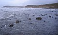
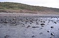
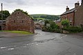
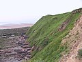
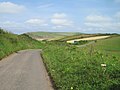
English: St Bees is a village and civil parish in the Copeland district of Cumbria, in the north of England, about five miles west south-west of Whitehaven. The parish had a population of 1,717 according to the 2001 census. Within the parish is St. Bees Head, the most westerly point of Northern England upon which stands St Bees Lighthouse.
localité britannique du comté anglais de Cumbria  | |||||
| Téléverser des médias | |||||
| Nature de l’élément | |||||
|---|---|---|---|---|---|
| Lieu | Copeland (district), Cumbria, Angleterre du Nord-Ouest, Angleterre | ||||
 | |||||
Sous-catégories
Cette catégorie comprend 9 sous-catégories, dont les 9 ci-dessous.
G
H
L
- St Bees Lifeboat Station (4 F)
M
- Manor Stead (2 F)
P
- Pow Bridge, St Bees (2 F)
R
- St Bees railway station (24 F)
S
W
Média dans la catégorie « St Bees »
Cette catégorie comprend 373 fichiers, dont les 200 ci-dessous.
(page précédente) (page suivante)-
-
 2nd in series left to right. - geograph.org.uk - 98329.jpg 640 × 443 ; 59 kio
-
 4th in the series here. - geograph.org.uk - 98339.jpg 640 × 418 ; 84 kio
-

-
 A cottage border on Scalebarrow - geograph.org.uk - 1973350.jpg 3 872 × 2 592 ; 4,28 Mio
-
 A line of trees follows Pow Beck - geograph.org.uk - 1348429.jpg 640 × 430 ; 51 kio
-
 A path leading to Gutter Foot - geograph.org.uk - 3125700.jpg 800 × 600 ; 227 kio
-
 A public footpath in Rottington - geograph.org.uk - 3125694.jpg 800 × 600 ; 342 kio
-
 A sheltered stretch of path - geograph.org.uk - 1971878.jpg 3 872 × 2 592 ; 5,29 Mio
-
 A wet day at St Bees - geograph.org.uk - 1971690.jpg 3 704 × 2 461 ; 750 kio
-
 Abbey Road, heading towards St Bees centre - geograph.org.uk - 3026387.jpg 1 024 × 683 ; 146 kio
-
 Abbott's Court House - geograph.org.uk - 1344470.jpg 640 × 430 ; 67 kio
-
 Adams recreation ground, St Bees - geograph.org.uk - 1344478.jpg 640 × 430 ; 46 kio
-
 Albert Hotel, Finkle Street, St Bees - May 2018 - geograph.org.uk - 5775357.jpg 1 088 × 1 250 ; 1,25 Mio
-
 Alley beside ^18 Main Street - geograph.org.uk - 3236965.jpg 683 × 1 024 ; 120 kio
-
 Along the Coastal Way path towards Fleswick Bay - geograph.org.uk - 4667889.jpg 1 142 × 857 ; 407 kio
-
 Along the shingle at high tide - geograph.org.uk - 4668280.jpg 1 142 × 857 ; 470 kio
-
 Alternate red and white cars and gates - geograph.org.uk - 6214426.jpg 1 024 × 575 ; 117 kio
-
 An old field boundary above South Head - geograph.org.uk - 4668275.jpg 1 142 × 857 ; 426 kio
-
 An unnamed farm - geograph.org.uk - 89991.jpg 640 × 480 ; 85 kio
-
 Approaching St Bees - geograph.org.uk - 5802197.jpg 1 600 × 991 ; 317 kio
-
 Approaching St Bees from the south - geograph.org.uk - 5559559.jpg 2 421 × 1 815 ; 731 kio
-
 Arrival at St Bees (geograph 7482040).jpg 1 600 × 1 067 ; 318 kio
-
 Battered groynes - geograph.org.uk - 4781338.jpg 3 264 × 1 836 ; 1,93 Mio
-
 Beach at St Bees - geograph.org.uk - 3509061.jpg 640 × 470 ; 458 kio
-
 Beach at St Bees - geograph.org.uk - 3509070.jpg 478 × 640 ; 453 kio
-
 Beach at St Bees - geograph.org.uk - 3750789.jpg 4 608 × 3 456 ; 4,16 Mio
-
 Behold St Bees - geograph.org.uk - 5799265.jpg 1 600 × 1 067 ; 951 kio
-
 Bench by the end of the footpath - geograph.org.uk - 1344469.jpg 640 × 430 ; 96 kio
-
 Benchmark at Grindell Place, Finkle Street - geograph.org.uk - 3236949.jpg 683 × 1 024 ; 244 kio
-
 Benchmark on the Priory Church - geograph.org.uk - 3236972.jpg 683 × 1 024 ; 213 kio
-
 Benchmark on ^18 Main Street - geograph.org.uk - 3236959.jpg 683 × 1 024 ; 213 kio
-
 Between South Head and St Bees Head - geograph.org.uk - 4667893.jpg 1 142 × 857 ; 382 kio
-
 Birkhams Quarry (2) - geograph.org.uk - 1346357.jpg 640 × 430 ; 83 kio
-
 Birkhams Quarry (3) - geograph.org.uk - 1346362.jpg 640 × 430 ; 76 kio
-
 Birkhams Quarry - geograph.org.uk - 1346348.jpg 640 × 430 ; 72 kio
-
 Birkhams Quarry - geograph.org.uk - 1971903.jpg 3 872 × 2 592 ; 4,56 Mio
-
 Birkhams Quarry - geograph.org.uk - 5753956.jpg 1 024 × 768 ; 236 kio
-
 Birkhams Quarry - geograph.org.uk - 5901918.jpg 640 × 480 ; 115 kio
-
 Birkhams Quarry Lane - geograph.org.uk - 5901916.jpg 640 × 360 ; 115 kio
-
 Blown and Stuck - geograph.org.uk - 3509033.jpg 480 × 640 ; 450 kio
-
 Bockram Breccia - geograph.org.uk - 4595579.jpg 640 × 384 ; 96 kio
-
 Boulders, Coast to Coast Footpath - geograph.org.uk - 5901901.jpg 640 × 427 ; 97 kio
-
 Bridge across a small stream - geograph.org.uk - 1343810.jpg 640 × 405 ; 40 kio
-
 Bridge across Rottington Beck - geograph.org.uk - 1344518.jpg 640 × 430 ; 72 kio
-
 Bridge and carpark - geograph.org.uk - 4487124.jpg 1 600 × 1 200 ; 534 kio
-
 Caravan park, St Bees - geograph.org.uk - 1344532.jpg 640 × 430 ; 58 kio
-
 Children's playground - geograph.org.uk - 5804993.jpg 1 600 × 1 067 ; 355 kio
-
 Children's playground near the lifeboat station - geograph.org.uk - 4487142.jpg 1 600 × 1 200 ; 312 kio
-
 Christmas Sun Setting at St Bees Beach - geograph.org.uk - 3276458.jpg 3 264 × 2 448 ; 2,07 Mio
-
 Class 37 at St Bees Station - geograph.org.uk - 4570838.jpg 640 × 384 ; 63 kio
-
 Class 37 at St Bees station - geograph.org.uk - 4576758.jpg 384 × 640 ; 70 kio
-
 Class 37s pass at St Bees - geograph.org.uk - 4595602.jpg 640 × 384 ; 57 kio
-
 Cliff 'Face' on Saint Bees Head - geograph.org.uk - 3080021.jpg 640 × 480 ; 74 kio
-
 Cliff Path Erosion, St. Bees - geograph.org.uk - 1752673.jpg 427 × 640 ; 118 kio
-
 Cliffs at Fleswick - geograph.org.uk - 5805016.jpg 1 600 × 1 067 ; 445 kio
-
 Cliffs on South Head - geograph.org.uk - 4276507.jpg 640 × 480 ; 87 kio
-
 Cliffs on South Head - geograph.org.uk - 4276508.jpg 640 × 480 ; 53 kio
-
 Cliffs south of Fleswick - geograph.org.uk - 1195846.jpg 640 × 480 ; 77 kio
-
 Cliffs south of Fleswick Bay - geograph.org.uk - 1345290.jpg 640 × 430 ; 98 kio
-
 Cliffs, North Head (2) - geograph.org.uk - 1346232.jpg 640 × 459 ; 99 kio
-
 Cliffs, North Head - geograph.org.uk - 1346229.jpg 640 × 413 ; 73 kio
-
 Clifftop at South Head, St Bees - geograph.org.uk - 2105413.jpg 640 × 480 ; 89 kio
-
 Coast path near Tomlin - geograph.org.uk - 1345178.jpg 640 × 430 ; 75 kio
-
 Coast to Coast at Bell House - geograph.org.uk - 5212176.jpg 640 × 480 ; 39 kio
-
 Coast to Coast Footpath - geograph.org.uk - 5901889.jpg 640 × 427 ; 103 kio
-
 Coast to Coast Footpath - geograph.org.uk - 5901915.jpg 640 × 360 ; 52 kio
-

-
 Coastal path - geograph.org.uk - 1346247.jpg 640 × 430 ; 84 kio
-
 Coastal path climbing to South Head - geograph.org.uk - 1344535.jpg 640 × 430 ; 75 kio
-
 Coastal path descends to Fleswick Bay - geograph.org.uk - 1345251.jpg 640 × 430 ; 90 kio
-
 Coastal path heading for Fleswick Bay - geograph.org.uk - 1345208.jpg 640 × 430 ; 73 kio
-
 Coastal path near St Bees - geograph.org.uk - 1345185.jpg 640 × 430 ; 67 kio
-
 Coastal path north of North Head - geograph.org.uk - 1346230.jpg 640 × 430 ; 84 kio
-
 Coastal path on St Bees Head - geograph.org.uk - 5805010.jpg 1 600 × 1 067 ; 500 kio
-
 Coastal path redirected around Birkhams Quarry - geograph.org.uk - 1346354.jpg 640 × 430 ; 106 kio
-
 Coastal path through an old quarry - geograph.org.uk - 1346244.jpg 640 × 430 ; 112 kio
-
 Coastal Scenery At Fleswick - geograph.org.uk - 2966088.jpg 3 448 × 4 592 ; 3,71 Mio
-
 Coastal view from Birkhams Quarry - geograph.org.uk - 5901920.jpg 640 × 427 ; 84 kio
-

-
 Colourful Beach Boulders - geograph.org.uk - 3509078.jpg 640 × 480 ; 562 kio
-
 Communication Mast, St Bees - geograph.org.uk - 1343894.jpg 640 × 430 ; 41 kio
-
 Communications masts - geograph.org.uk - 5802810.jpg 1 200 × 1 588 ; 166 kio
-
 Concrete Blocks by the coastal path - geograph.org.uk - 1345443.jpg 640 × 430 ; 83 kio
-

-
 Cottages in St Bees - geograph.org.uk - 4487073.jpg 1 600 × 1 200 ; 378 kio
-
 Cottages, Beech Rd - geograph.org.uk - 1344484.jpg 640 × 430 ; 77 kio
-
 Country Lane near St. Bees - geograph.org.uk - 3566166.jpg 1 024 × 768 ; 163 kio
-
 Cricket field at St Bees - geograph.org.uk - 513196.jpg 640 × 426 ; 79 kio
-
 Cumbrian Coastal Path, St Bees - geograph.org.uk - 1344531.jpg 640 × 430 ; 62 kio
-
 Descending to Fleswick Bay - geograph.org.uk - 1971797.jpg 3 872 × 2 592 ; 4,42 Mio
-
 Disused quarry - geograph.org.uk - 1346235.jpg 640 × 430 ; 92 kio
-
 Disused Quarry, North Head - geograph.org.uk - 1346208.jpg 640 × 430 ; 67 kio
-
 Disused Railway at Moor Row - geograph.org.uk - 5753960.jpg 1 024 × 768 ; 312 kio
-
 Dramatic slumping of the glacial deposit cliffs - geograph.org.uk - 4487133.jpg 1 600 × 1 200 ; 401 kio
-
 Egremont Road, St Bees - geograph.org.uk - 1973381.jpg 3 872 × 2 485 ; 2,59 Mio
-
 Ellerbeck Manor - geograph.org.uk - 5559574.jpg 2 592 × 1 944 ; 1 004 kio
-
 Ellergill Beck - geograph.org.uk - 4563154.jpg 1 333 × 2 000 ; 1,38 Mio
-
 Engineering works on Rottington Beck - geograph.org.uk - 3025828.jpg 4 000 × 3 000 ; 5,36 Mio
-
 Fence by the coastal path, North Head - geograph.org.uk - 1345473.jpg 640 × 430 ; 67 kio
-
 Fence corner, South Head - geograph.org.uk - 5901890.jpg 640 × 427 ; 91 kio
-
 Fence, St Bees Head - geograph.org.uk - 5901887.jpg 640 × 427 ; 134 kio
-
 Field on South Head - geograph.org.uk - 5805005.jpg 1 600 × 1 067 ; 409 kio
-
 Fields above Sandwith - geograph.org.uk - 6334444.jpg 2 592 × 1 944 ; 1,12 Mio
-
 Fields near Ellergill Bridge - geograph.org.uk - 4561988.jpg 2 000 × 1 333 ; 1,27 Mio
-
 Finger post sign at Loughrigg - geograph.org.uk - 4561999.jpg 1 333 × 2 000 ; 1,31 Mio
-
 Finger post sign at Loughrigg - geograph.org.uk - 4562007.jpg 1 333 × 2 000 ; 1,32 Mio
-
 Finkle Street on a damp day - geograph.org.uk - 3236954.jpg 1 024 × 683 ; 160 kio
-
 Five ways junction at Loughrigg - geograph.org.uk - 4562017.jpg 2 000 × 1 333 ; 1,36 Mio
-
 Fleswick - geograph.org.uk - 5901892.jpg 640 × 427 ; 129 kio
-
 Fleswick Bay - geograph.org.uk - 1345245.jpg 640 × 430 ; 77 kio
-
 Fleswick Bay - geograph.org.uk - 1971805.jpg 3 872 × 2 475 ; 2,88 Mio
-
 Fleswick Bay - geograph.org.uk - 3027098.jpg 4 000 × 3 000 ; 5,01 Mio
-
 Fleswick Bay - geograph.org.uk - 4557361.jpg 640 × 424 ; 65 kio
-
 Fleswick Bay from the valley behind - geograph.org.uk - 1345283.jpg 640 × 430 ; 85 kio
-
 Foghorn at North Head - geograph.org.uk - 2105334.jpg 640 × 480 ; 78 kio
-
 Footbridge ^ horses - geograph.org.uk - 4487105.jpg 1 600 × 1 271 ; 625 kio
-
 Footpath along top of old wall - geograph.org.uk - 5901912.jpg 640 × 427 ; 111 kio
-
 Footpath through St Bees - geograph.org.uk - 1344461.jpg 640 × 430 ; 80 kio
-
 Footpath to South Head - geograph.org.uk - 5032185.jpg 600 × 800 ; 115 kio
-
 Foreshore at Seamill - geograph.org.uk - 3027423.jpg 4 000 × 3 000 ; 6,62 Mio
-
 Former Coastguard Lookout - geograph.org.uk - 2966144.jpg 4 592 × 3 448 ; 4,07 Mio
-
 Full cliffs panorama.jpg 20 562 × 2 363 ; 2,45 Mio
-
 Gate by the coastal path, South Head - geograph.org.uk - 1345092.jpg 640 × 430 ; 68 kio
-
 Gate on the clifftop path - geograph.org.uk - 2105404.jpg 640 × 480 ; 69 kio
-

-
 Gate on the footpath, St Bees - geograph.org.uk - 1344460.jpg 640 × 430 ; 71 kio
-
 Glacial Deposits at St Bees - geograph.org.uk - 4595550.jpg 384 × 640 ; 102 kio
-
 Glacial Deposits at St Bees - geograph.org.uk - 4595588.jpg 384 × 640 ; 120 kio
-
 Glacial deposits at St Bees beach - geograph.org.uk - 4595568.jpg 384 × 640 ; 69 kio
-
 Glacial Erratic - geograph.org.uk - 4557381.jpg 640 × 424 ; 128 kio
-
 Glaciotectonic faulting - geograph.org.uk - 4569602.jpg 640 × 384 ; 95 kio
-
 Gorse and Bracken by the Cumbrian Coastline - geograph.org.uk - 1348464.jpg 640 × 484 ; 113 kio
-
 Gorse Bush, North Head - geograph.org.uk - 1345479.jpg 640 × 391 ; 74 kio
-
 Gorse by the coastal path - geograph.org.uk - 1345084.jpg 640 × 430 ; 95 kio
-
 Gorse by the coastal path - geograph.org.uk - 1345411.jpg 640 × 430 ; 94 kio
-

-
 Grazing and woodland near Stanley House - geograph.org.uk - 5290291.jpg 640 × 421 ; 66 kio
-
 Grazing near Stanley House - geograph.org.uk - 5290289.jpg 640 × 344 ; 29 kio
-
 Grazing, St Bees - geograph.org.uk - 5269969.jpg 640 × 430 ; 41 kio
-
 Groynes and Seawall, St Bees - geograph.org.uk - 1344503.jpg 640 × 430 ; 56 kio
-
 Groynes At St Bees - geograph.org.uk - 2966026.jpg 3 448 × 4 592 ; 3,65 Mio
-
 Groynes at St Bees - geograph.org.uk - 3509026.jpg 640 × 477 ; 375 kio
-
 Groynes at St Bees - geograph.org.uk - 3509106.jpg 640 × 478 ; 396 kio
-
 Groynes, St Bees - geograph.org.uk - 1344523.jpg 640 × 430 ; 66 kio
-
 Groynes, St Bees - geograph.org.uk - 1520696.jpg 640 × 238 ; 47 kio
-
 Hannah Moor - geograph.org.uk - 3309920.jpg 1 600 × 1 200 ; 1,26 Mio
-
 Hannah Moor - geograph.org.uk - 6334442.jpg 2 592 × 1 944 ; 1,53 Mio
-
 Hartley's Shop and Cafe - geograph.org.uk - 3025899.jpg 4 000 × 3 000 ; 5,02 Mio
-
 Heading south towards Nethertown - geograph.org.uk - 3125739.jpg 800 × 600 ; 169 kio
-
 Hillside grazing, St Bees - geograph.org.uk - 5269966.jpg 640 × 432 ; 49 kio
-
 Houses near the Beach - geograph.org.uk - 3509038.jpg 640 × 389 ; 244 kio
-
 Into Fleswick Bay from the Coastal Path - geograph.org.uk - 4668268.jpg 1 142 × 857 ; 465 kio
-
 Ivy Hill - geograph.org.uk - 5212136.jpg 640 × 480 ; 49 kio
-
 Ivy Hill transmitter masts - geograph.org.uk - 4563130.jpg 2 000 × 1 333 ; 1,22 Mio
-
 Junction of Abbey Rd and Station Rd - geograph.org.uk - 1344475.jpg 640 × 430 ; 49 kio
-
 Kissing gate north of North Head - geograph.org.uk - 1346199.jpg 640 × 430 ; 84 kio
-
 Kissing gate on the coast path - geograph.org.uk - 1345233.jpg 640 × 430 ; 81 kio
-
 Kissing gate, Fleswick Bay - geograph.org.uk - 1345259.jpg 640 × 430 ; 100 kio
-
 Kissing gate, North Head - geograph.org.uk - 1346215.jpg 640 × 430 ; 61 kio
-
 Kittiwakes on the cliff - geograph.org.uk - 1345408.jpg 640 × 430 ; 94 kio
-
 Landslip - geograph.org.uk - 3509055.jpg 480 × 640 ; 485 kio
-
 Landslump, North Head - geograph.org.uk - 5901898.jpg 640 × 427 ; 95 kio
-
 Level crossing - geograph.org.uk - 5805039.jpg 1 600 × 1 067 ; 419 kio
-
 Level Crossing, St Bees - geograph.org.uk - 1344442.jpg 640 × 430 ; 77 kio
-
 Locomotive hauled service at St.Bees - geograph.org.uk - 4570834.jpg 640 × 384 ; 66 kio
-
 Looking across Saltom Bay - geograph.org.uk - 1346945.jpg 640 × 429 ; 60 kio
-

-
 Looking down the cliffs north of North Head - geograph.org.uk - 1346225.jpg 640 × 430 ; 87 kio
-
 Looking east across the valley of Pow Beck - geograph.org.uk - 1348434.jpg 640 × 366 ; 41 kio
-
 Looking east across the valley of Pow Beck - geograph.org.uk - 1348441.jpg 640 × 430 ; 54 kio
-
 Looking north along Pow Beck - geograph.org.uk - 4487114.jpg 1 600 × 1 200 ; 573 kio
-
 Looking north along the rail line - geograph.org.uk - 4487080.jpg 1 600 × 1 200 ; 440 kio
-
 Looking out to sea from St. Bees - geograph.org.uk - 1494013.jpg 480 × 640 ; 88 kio
-
 Looking south along Pow Beck - geograph.org.uk - 4487115.jpg 1 600 × 1 433 ; 503 kio
-
 Looking south along the rail line - geograph.org.uk - 4487084.jpg 1 600 × 1 200 ; 454 kio
-
 Looking south from Fleswick Bay - geograph.org.uk - 1345300.jpg 561 × 640 ; 97 kio
-
 Looking south towards Nethertown - geograph.org.uk - 3125748.jpg 800 × 600 ; 207 kio
-
 Looking south towards Nethertown - geograph.org.uk - 3125755.jpg 800 × 600 ; 195 kio
-
 Looking west along the coastal path - geograph.org.uk - 1971886.jpg 3 746 × 2 489 ; 3,41 Mio
-
 Looks like he's been all at sea...... - geograph.org.uk - 1494007.jpg 480 × 640 ; 66 kio
-
 Low and narrow bridge under the railway - geograph.org.uk - 5802237.jpg 1 600 × 1 067 ; 246 kio
-
 Low Hall Farm, Whitehaven - geograph.org.uk - 2557139.jpg 640 × 480 ; 71 kio
-
 Low Hall Farm, Whitehaven - geograph.org.uk - 2557142.jpg 640 × 480 ; 70 kio
-
 Low Walton - geograph.org.uk - 1348423.jpg 640 × 430 ; 54 kio
-
 Low Walton Wood - geograph.org.uk - 1348419.jpg 640 × 430 ; 54 kio
-
 Main Street - geograph.org.uk - 4484451.jpg 1 600 × 1 200 ; 366 kio
-
 Main street at cross hill.jpg 1 350 × 974 ; 168 kio
-
 Main Street St Bees - geograph.org.uk - 3025917.jpg 4 000 × 3 000 ; 2,42 Mio
-
 Main Street St Bees UK 2011.jpg 1 218 × 939 ; 251 kio
-
 Main Street, St Bees - geograph.org.uk - 1973397.jpg 3 872 × 2 489 ; 2,61 Mio
-
 MAN at St Bees (geograph 7783614).jpg 1 600 × 1 067 ; 281 kio
-
 Manor House, Rottington - geograph.org.uk - 1973317.jpg 3 872 × 2 592 ; 4,77 Mio
-
 Nethertown Road, St Bees - geograph.org.uk - 3125734.jpg 800 × 600 ; 193 kio
-
 No new housing here^ - geograph.org.uk - 1973356.jpg 3 872 × 2 485 ; 2,65 Mio
-
 Observation Point, South Head - geograph.org.uk - 1344538.jpg 640 × 430 ; 62 kio
-
 Oddfellows Arms, Main Street, St Bees - geograph.org.uk - 3125727.jpg 800 × 600 ; 215 kio
-

-
 Old Milestone by the B5345, north of St Bees - geograph.org.uk - 6021007.jpg 640 × 487 ; 117 kio
-
 Ordnance Survey 1GL Bolt - geograph.org.uk - 5680790.jpg 425 × 640 ; 56 kio


.jpg)


_-_geograph.org.uk_-_1346357.jpg)
_-_geograph.org.uk_-_1346362.jpg)


_-_geograph.org.uk_-_1346232.jpg)


.jpg)


