Category:St Gennys
Aller à la navigation
Aller à la recherche
village britannique  Eglwys Sant Genesius, St Gennys | |||||
| Téléverser des médias | |||||
| Nature de l’élément | |||||
|---|---|---|---|---|---|
| Lieu | Cornouailles, Angleterre du Sud-Ouest, Angleterre | ||||
 | |||||
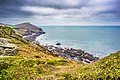
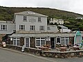
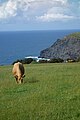
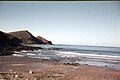
English: St. Gennys is a small village and civil parish near Bude in north Cornwall, England. The village church is also the parish church and is dedicated to Saint Genesius. Also in the parish is the village of Crackington Haven.
Sous-catégories
Cette catégorie comprend 19 sous-catégories, dont les 19 ci-dessous.
B
- Bray's Point, St Gennys (5 F)
C
- Cambeak (17 F)
- Cleave Strand, Cornwall (6 F)
- Cleave Valley, Cornwall (7 F)
D
- Dizzard, Cornwall (13 F)
H
- High Cliff, Cornwall (10 F)
- Higher Crackington (6 F)
M
- Mineshope (1 F)
P
- Pencannow Point, St Gennys (11 F)
- Pengold (1 F)
R
- Raven's Beak, St Gennys (6 F)
- Rosecare (3 F)
S
- Scrade Valley, Cornwall (6 F)
- Sweets, Cornwall (1 F)
T
Média dans la catégorie « St Gennys »
Cette catégorie comprend 152 fichiers, dont les 152 ci-dessous.
-
 A39 heading to Bude - geograph.org.uk - 3303433.jpg 640 × 480 ; 61 kio
-
 A39, Wainhouse Corner - geograph.org.uk - 2536537.jpg 640 × 480 ; 62 kio
-
 Above Tremouth Haven - geograph.org.uk - 5260075.jpg 3 068 × 1 922 ; 1,38 Mio
-
 Beach life at Little Strand - geograph.org.uk - 4228253.jpg 640 × 427 ; 92 kio
-
 Bench on the coast path - geograph.org.uk - 5547101.jpg 640 × 480 ; 193 kio
-
 Cambeak (4811).jpg 4 211 × 2 848 ; 5,59 Mio
-
 Cambeak from Crackington Haven (4800).jpg 3 942 × 2 848 ; 3,89 Mio
-
 Cambeak, Cornwall - geograph.org.uk - 4577292.jpg 1 600 × 1 067 ; 697 kio
-
 Cleave Ford - geograph.org.uk - 4684391.jpg 6 000 × 4 000 ; 6,54 Mio
-
 Cliffs above Cleave Strand.jpg 4 028 × 2 848 ; 4,75 Mio
-
 Cliffs at Crackington Haven - geograph.org.uk - 5572217.jpg 640 × 427 ; 208 kio
-
 Coast path and blackthorn, Millook - geograph.org.uk - 411248.jpg 640 × 480 ; 248 kio
-
 Coast path heading north - geograph.org.uk - 5547103.jpg 640 × 480 ; 194 kio
-
 Coast path south of the Strangles, Cornwall - geograph.org.uk - 4579834.jpg 593 × 800 ; 206 kio
-
 Coast west of Thorn's Beach - geograph.org.uk - 2912393.jpg 640 × 480 ; 97 kio
-
 Coast, St Gennys - geograph.org.uk - 6155834.jpg 1 024 × 768 ; 250 kio
-

-
 Coastal path on Bynorth Cliff - geograph.org.uk - 501114.jpg 640 × 470 ; 110 kio
-
 Coastline near Bynorth Cliff - geograph.org.uk - 2912427.jpg 640 × 480 ; 87 kio
-
 Coastline, St Gennys - geograph.org.uk - 6155809.jpg 1 024 × 756 ; 290 kio
-
 Cottage at Trevigue - geograph.org.uk - 5075269.jpg 1 024 × 768 ; 175 kio
-
 Cottage, near Tresparrett - geograph.org.uk - 1006140.jpg 640 × 480 ; 57 kio
-
 Cracjkington haven Beach - geograph.org.uk - 4426000.jpg 640 × 640 ; 100 kio
-
 Crackington Haven - geograph.org.uk - 1937719.jpg 2 288 × 1 712 ; 843 kio
-
 Crackington Haven - geograph.org.uk - 2912009.jpg 640 × 477 ; 84 kio
-
 Crackington Haven - geograph.org.uk - 5075245.jpg 1 024 × 810 ; 183 kio
-
 Crackington Haven - geograph.org.uk - 6238210.jpg 5 472 × 3 648 ; 3,14 Mio
-
 Crackington Haven and Bray's Point - geograph.org.uk - 6238218.jpg 5 472 × 3 648 ; 3,7 Mio
-
 Crackington Haven Cornwall United Kingdom (68081155).jpeg 2 048 × 1 365 ; 1,14 Mio
-
 Crackington Haven from the road bridge - geograph.org.uk - 1961271.jpg 640 × 427 ; 69 kio
-
 Crackington haven rocks and sea - geograph.org.uk - 1971183.jpg 640 × 422 ; 71 kio
-
 Crackington Haven to Cambeak - geograph.org.uk - 6238221.jpg 5 472 × 3 648 ; 3,77 Mio
-
 Crackington Institute Crackington Cornwall - geograph.org.uk - 102616.jpg 640 × 480 ; 105 kio
-
 Crackington Stream - geograph.org.uk - 3304461.jpg 640 × 480 ; 104 kio
-

-
 Crossroads at Tremayna - geograph.org.uk - 1808328.jpg 640 × 480 ; 95 kio
-
 Curious cattle, Tresmorn, Cornwall - geograph.org.uk - 4579698.jpg 5 221 × 3 492 ; 2,25 Mio
-
 Dartmoor from St Gennys.jpg 3 344 × 2 408 ; 2,96 Mio
-
 Descent to Little Strand - geograph.org.uk - 2911996.jpg 640 × 480 ; 77 kio
-
 Dusk at the coastal path near Rusey Beach - geograph.org.uk - 4211619.jpg 480 × 640 ; 170 kio
-
 Evening at Lower Tresmorne, Cornwall - geograph.org.uk - 4615220.jpg 800 × 494 ; 72 kio
-
 Evening light, Crackington Haven, Cornwall - geograph.org.uk - 4576762.jpg 6 016 × 4 000 ; 6,06 Mio
-
 Farmland near Pengold Farm - geograph.org.uk - 4211631.jpg 640 × 360 ; 69 kio
-
 Farmland, Crackington, Cornwall - geograph.org.uk - 4587582.jpg 4 230 × 2 771 ; 2,3 Mio
-
 Farmland, St Gennys - geograph.org.uk - 6155932.jpg 1 024 × 768 ; 264 kio
-
 Farmland, St Gennys - geograph.org.uk - 6155942.jpg 1 024 × 768 ; 293 kio
-
 Fields near Hill - geograph.org.uk - 5393773.jpg 2 805 × 1 109 ; 751 kio
-
 Footpath Through Tamp's Wood - geograph.org.uk - 3916937.jpg 768 × 1 024 ; 493 kio
-
 Ford on a minor road at Lansweden - geograph.org.uk - 1808376.jpg 640 × 480 ; 132 kio
-
 Graveyard and view, St Gennys - geograph.org.uk - 1387429.jpg 640 × 474 ; 121 kio
-
 High Cliff and Cambeak (4830).jpg 4 071 × 2 848 ; 4,01 Mio
-
 High Cliffs Crackington Haven Cornwall United Kingdom (68115145).jpeg 2 048 × 1 365 ; 1,4 Mio
-
 Higher Tresmorn - geograph.org.uk - 212700.jpg 640 × 480 ; 81 kio
-
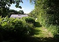
 Holiday cottages at St Gennys - geograph.org.uk - 1808279.jpg 640 × 480 ; 99 kio
-
 Inn and café, Crackington Haven - geograph.org.uk - 5075257.jpg 1 024 × 756 ; 183 kio
-
 Landslip above Dizzard Point.jpg 3 616 × 2 765 ; 5,03 Mio
-
 Lane to Crackington Haven - geograph.org.uk - 5393743.jpg 3 072 × 1 609 ; 844 kio
-
 Little Strand - geograph.org.uk - 4211629.jpg 480 × 640 ; 61 kio
-

-
 Memorial stone, St Gennys - geograph.org.uk - 1387421.jpg 480 × 640 ; 171 kio
-
 Middle Crackington Ford - geograph.org.uk - 4684360.jpg 6 000 × 4 000 ; 6,5 Mio
-
 Mineshop Ford - geograph.org.uk - 4684382.jpg 6 000 × 4 000 ; 6,48 Mio
-
 Minor road junction at Higher Crannow - geograph.org.uk - 3524728.jpg 640 × 480 ; 67 kio
-
 Northern Door, Crackington Haven.jpg 4 038 × 2 692 ; 5,49 Mio
-

-
 On the beach at Crackington Haven, Cornwall - geograph.org.uk - 4595123.jpg 627 × 800 ; 161 kio
-
 Pasture above Crackington Haven - geograph.org.uk - 6238232.jpg 3 648 × 5 472 ; 3,31 Mio
-
 Pasture and woodland, St Gennys - geograph.org.uk - 6155770.jpg 1 024 × 760 ; 240 kio
-
 Pasture, St Gennys - geograph.org.uk - 6155776.jpg 1 024 × 768 ; 252 kio
-
 Pasture, St Gennys - geograph.org.uk - 6155862.jpg 1 024 × 768 ; 237 kio
-
 Pasture, St Gennys - geograph.org.uk - 6155888.jpg 1 024 × 756 ; 233 kio
-
 Pasture, St Gennys - geograph.org.uk - 6155892.jpg 1 024 × 768 ; 226 kio
-
 Pasture, St Gennys - geograph.org.uk - 6155952.jpg 1 024 × 768 ; 271 kio
-
 Pasture, St Gennys - geograph.org.uk - 6155962.jpg 1 024 × 768 ; 265 kio
-
 Path to the Strangles - geograph.org.uk - 4228371.jpg 640 × 480 ; 235 kio
-
 Pencannow Point - geograph.org.uk - 6238224.jpg 5 472 × 3 648 ; 4,44 Mio
-
 Pencuke Ford - geograph.org.uk - 4684346.jpg 6 000 × 4 000 ; 6,38 Mio
-
 Penkenna House - geograph.org.uk - 5075235.jpg 1 024 × 874 ; 184 kio
-
 Plaque on a bridge, Crackington Haven, St Gennys - geograph.org.uk - 1387354.jpg 640 × 490 ; 126 kio
-
 Road heading to St Genesius Church - geograph.org.uk - 3303207.jpg 640 × 480 ; 76 kio
-
 Road heading to St Gensius church - geograph.org.uk - 3303214.jpg 640 × 480 ; 54 kio
-
 Road heading to Wainhouse corner - geograph.org.uk - 3303222.jpg 640 × 480 ; 66 kio
-
 Road nearing Trelay Bungalow - geograph.org.uk - 3303396.jpg 640 × 480 ; 85 kio
-
 Road to Atlantic View - geograph.org.uk - 3303155.jpg 640 × 480 ; 69 kio
-
 Road to Cancleave - geograph.org.uk - 3303148.jpg 640 × 480 ; 76 kio
-
 Road to Dizzard Farm - geograph.org.uk - 3303163.jpg 640 × 480 ; 79 kio
-
 Rock pools at Crackington Haven, Cornwall - geograph.org.uk - 4595229.jpg 533 × 800 ; 149 kio
-
 Rocks at Crackington Haven (4799).jpg 2 985 × 2 268 ; 3,88 Mio
-
 Rocks at Little Strand - geograph.org.uk - 4211628.jpg 640 × 427 ; 96 kio
-
 Rocks on Crackington Haven beach - geograph.org.uk - 2048323.jpg 640 × 431 ; 71 kio
-

-
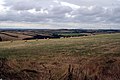
 Rolling north Cornwall countryside - geograph.org.uk - 1561016.jpg 640 × 480 ; 96 kio
-
 Roundhayes Farm Cottages - geograph.org.uk - 846907.jpg 640 × 392 ; 98 kio
-
 Rusey Beach from the coast path at High Cliff - geograph.org.uk - 473994.jpg 640 × 414 ; 64 kio
-
 Samphire Rock from Little Strand - geograph.org.uk - 4211625.jpg 640 × 427 ; 64 kio
-
 Sheep and Castle Point.jpg 4 108 × 2 848 ; 5,15 Mio
-
 Shoreline at Crackington Haven - geograph.org.uk - 4595274.jpg 800 × 529 ; 127 kio
-
 Small Valley on the Northern Side of High Cliff - geograph.org.uk - 1490651.jpg 640 × 426 ; 110 kio
-
 South West Coast Path above Bynorth Cliff.jpg 3 515 × 2 704 ; 7,33 Mio
-
 South West Coast Path on Castle Point.jpg 4 156 × 2 848 ; 4,72 Mio
-
 St Gennys Cornish cottages - geograph.org.uk - 1970305.jpg 640 × 401 ; 72 kio
-
 St Gennys, above Thorn's Beach - geograph.org.uk - 1267825.jpg 640 × 427 ; 486 kio
-
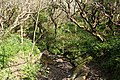 St Gennys, Coxford stream - geograph.org.uk - 1267861.jpg 640 × 427 ; 581 kio
-
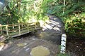
 St Gennys, footbridge - geograph.org.uk - 1267780.jpg 640 × 427 ; 573 kio
-
 St Gennys, footbridge on the Coxford Water - geograph.org.uk - 1267799.jpg 640 × 427 ; 533 kio
-
 St Gennys, from Thorn's Beach to Chipman Cliff - geograph.org.uk - 1267854.jpg 640 × 427 ; 384 kio
-
 St Gennys, near St Gennys House - geograph.org.uk - 1267794.jpg 640 × 427 ; 544 kio
-
 St Gennys, nearing Churchtown - geograph.org.uk - 1267869.jpg 640 × 425 ; 384 kio
-
 St Gennys, path to ridge - geograph.org.uk - 1267867.jpg 640 × 427 ; 497 kio
-
 St Gennys, paths meet - geograph.org.uk - 1267801.jpg 640 × 427 ; 519 kio
-
 St Gennys, rolling a pasture - geograph.org.uk - 1267868.jpg 640 × 427 ; 364 kio
-
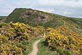
 St Gennys, steps on the coastpath - geograph.org.uk - 1267755.jpg 640 × 427 ; 448 kio
-
 St Gennys, through apple and gorse - geograph.org.uk - 1267748.jpg 640 × 427 ; 550 kio
-
 St Gennys, towards Castle Point - geograph.org.uk - 1267875.jpg 640 × 427 ; 99 kio
-
 St Gennys, towards Chipman Cliff - geograph.org.uk - 1267811.jpg 640 × 427 ; 391 kio
-
 St Gennys, towards Orchard Strand - geograph.org.uk - 1267783.jpg 640 × 427 ; 378 kio
-
 St Gennys, towards St Gennys Churchtown - geograph.org.uk - 1267806.jpg 427 × 640 ; 436 kio
-

-
 The cemetery at Brockhill Methodist Church - geograph.org.uk - 1808368.jpg 640 × 480 ; 89 kio
-
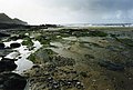
 The Coast at Scrade - geograph.org.uk - 2912409.jpg 640 × 480 ; 75 kio
-
 The house on the junction - geograph.org.uk - 1808295.jpg 640 × 480 ; 65 kio
-

-
 The road down to Crackington Haven - geograph.org.uk - 1808264.jpg 640 × 480 ; 69 kio
-
 Through a Cornish gateway - geograph.org.uk - 1971197.jpg 640 × 457 ; 95 kio
-
 Towards the Millook River valley - geograph.org.uk - 5391166.jpg 2 775 × 1 517 ; 1,01 Mio
-
 Towards the Millook River valley - geograph.org.uk - 5393647.jpg 3 037 × 1 677 ; 1,43 Mio
-
 Towards Trehole Farm - geograph.org.uk - 5393761.jpg 3 064 × 1 223 ; 828 kio
-
 Track and pasture, St Gennys - geograph.org.uk - 6155972.jpg 1 024 × 768 ; 236 kio
-
 Trehole Farm - geograph.org.uk - 1004911.jpg 640 × 480 ; 87 kio
-
 Trengayor, St Gennys - geograph.org.uk - 6155783.jpg 1 024 × 768 ; 197 kio
-
 Tresparrett Posts - geograph.org.uk - 210832.jpg 640 × 480 ; 71 kio
-
 Tresparrett Posts road junction - geograph.org.uk - 715175.jpg 640 × 480 ; 49 kio
-
 Trevigue - geograph.org.uk - 5260832.jpg 2 700 × 1 506 ; 748 kio
-
 Trevigue Farmhouse - geograph.org.uk - 5260845.jpg 2 043 × 1 434 ; 619 kio
-
 Valley and Trehole Farm - geograph.org.uk - 5260100.jpg 1 662 × 843 ; 322 kio
-
 Valley below St Gennys.jpg 4 028 × 2 848 ; 5,82 Mio
-
 Victorian wall postbox at St Gennys - geograph.org.uk - 715478.jpg 480 × 640 ; 130 kio
-
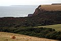
 View to Cambeak - geograph.org.uk - 4553698.jpg 2 394 × 1 596 ; 759 kio
-

-
 Voter Run - geograph.org.uk - 4228290.jpg 640 × 426 ; 191 kio
-
 Wainhouse Corner junction - geograph.org.uk - 3303415.jpg 640 × 480 ; 61 kio
-
 Watching the Waves - geograph.org.uk - 2356218.jpg 1 024 × 768 ; 114 kio
-
 Well and seat, Coxford - geograph.org.uk - 210846.jpg 640 × 480 ; 156 kio
-
 White Lodge - geograph.org.uk - 5075226.jpg 1 024 × 786 ; 150 kio
-
 Whitemoor Bus Shelter - geograph.org.uk - 211225.jpg 640 × 480 ; 124 kio
-
 Cancleave Strand - geograph.org.uk - 498375.jpg 640 × 480 ; 143 kio
-
 Fields by Rosmoran - geograph.org.uk - 708703.jpg 640 × 480 ; 171 kio
-
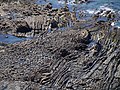 Folding on the foreshore - geograph.org.uk - 501109.jpg 640 × 480 ; 182 kio
-
 Footpath approaching The Den - geograph.org.uk - 503050.jpg 640 × 454 ; 148 kio
-
 Meadow by Millook Water - geograph.org.uk - 498468.jpg 640 × 480 ; 122 kio
-
 Millook Common - geograph.org.uk - 445529.jpg 640 × 426 ; 79 kio
-
 St Gennys - geograph.org.uk - 470288.jpg 640 × 426 ; 73 kio


.jpg)
.jpg)


.jpeg)


.jpg)
.jpeg)


.jpg)


