Category:St Ive
Vai alla navigazione
Vai alla ricerca
comune in Inghilterra  St. Ive parish church | |||||
| Carica un file multimediale | |||||
| Istanza di | |||||
|---|---|---|---|---|---|
| Luogo | St Ive and Pensilva, Cornwall, Sud Ovest dell'Inghilterra, Inghilterra | ||||
| Distinto da | |||||
 | |||||

English: St Ive is a village in the civil parish of St Ive and Pensilva, south-east Cornwall, United Kingdom.
Euskara: St Ive Erresuma Batuan dagoen Kornuallesko hego-ekialdean kokatzen den Caradon barrutiko udalerria eta parrokia da.
Nederlands: St Ive is een plaats in het Engelse graafschap Cornwall met 2121 inwoners.
Deutsch: St Ive ist eine Gemeinde vormals im District Caradon der Grafschaft Cornwall im Vereinigten Königreich.
Sottocategorie
Questa categoria contiene le 2 sottocategorie indicate di seguito, su un totale di 2.
B
- Butcher's Arms, St Ive (4 F)
C
File nella categoria "St Ive"
Questa categoria contiene 200 file, indicati di seguito, su un totale di 246.
(pagina precedente) (pagina successiva)-
 A390 near Cholwell Plantation - geograph.org.uk - 4126239.jpg 1 920 × 1 368; 740 KB
-
 A390 west of St Ive - geograph.org.uk - 4120684.jpg 1 920 × 1 440; 620 KB
-
 Access to Cadson Bury Down - geograph.org.uk - 3985340.jpg 1 920 × 1 440; 813 KB
-
 Alan Gimblett Cars, St Ive - geograph.org.uk - 3488187.jpg 800 × 600; 91 KB
-
 Approaching Gang - geograph.org.uk - 3978574.jpg 1 920 × 1 345; 517 KB
-
 Arable field near Queena Lodge - geograph.org.uk - 4124440.jpg 1 920 × 1 278; 609 KB
-
 Bank erosion on the Lynher - geograph.org.uk - 3984151.jpg 1 920 × 2 560; 1,28 MB
-
 Barn near Pensilva - geograph.org.uk - 4284878.jpg 1 920 × 2 308; 1,06 MB
-
 Bend in the Lynher - geograph.org.uk - 3984829.jpg 1 920 × 1 440; 823 KB
-
 Bicton Wood - geograph.org.uk - 3978861.jpg 1 920 × 2 560; 1,21 MB
-
 Bluebells, field and hedge north of Cadson Bury - geograph.org.uk - 3986110.jpg 1 920 × 1 314; 678 KB
-
 Bridge at Bicton Mill - geograph.org.uk - 4124180.jpg 1 920 × 2 560; 1,62 MB
-
 Burnt Wood Ford - geograph.org.uk - 4679143.jpg 6 000 × 4 000; 6,49 MB
-
 By the Lynher - geograph.org.uk - 3984599.jpg 1 920 × 1 440; 978 KB
-
 Byway to Sleeve - geograph.org.uk - 3978525.jpg 1 920 × 1 274; 515 KB
-
 Cadson - geograph.org.uk - 3985712.jpg 1 920 × 1 440; 635 KB
-
 Cadson Bury - geograph.org.uk - 3985532.jpg 1 920 × 1 370; 625 KB
-
 Cadson Bury - geograph.org.uk - 3985720.jpg 1 920 × 1 313; 682 KB
-
 Cadson Bury Down - geograph.org.uk - 3985312.jpg 1 920 × 1 366; 534 KB
-
 Cadson Bury Down - geograph.org.uk - 3985384.jpg 1 920 × 1 218; 500 KB
-
 Cadson Bury Down - geograph.org.uk - 3985401.jpg 1 920 × 1 440; 685 KB
-

-
 Car park, Newbridge - geograph.org.uk - 3983567.jpg 1 920 × 2 560; 1,47 MB
-
 Charaton Ford - geograph.org.uk - 4679171.jpg 6 000 × 4 000; 6,45 MB
-
 Confluence, River Lynher - geograph.org.uk - 3985087.jpg 1 920 × 2 560; 1,27 MB
-
 Cornish Recycling Van - geograph.org.uk - 5033798.jpg 4 608 × 3 456; 6,59 MB
-
 Cornwall Council aggregates dump - geograph.org.uk - 2613124.jpg 3 040 × 2 288; 2,79 MB
-
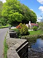
 Cottage and church at St Ive, Cornwall - geograph.jpg 1 920 × 1 467; 647 KB
-
 Cottage, St Ive - geograph.org.uk - 4120894.jpg 1 911 × 1 382; 762 KB
-
 Countryside near Newbridge - geograph.org.uk - 3985664.jpg 1 920 × 2 410; 995 KB
-
 Countryside near Pensilva - geograph.org.uk - 4120964.jpg 1 920 × 1 440; 668 KB
-
 Countryside near Woolston - geograph.org.uk - 4283708.jpg 1 920 × 1 331; 556 KB
-
 Crop at Gang - geograph.org.uk - 4124459.jpg 1 920 × 1 268; 679 KB
-

-
 Derelict barn near Higher Keason - geograph.org.uk - 4126128.jpg 1 920 × 1 440; 969 KB
-
 Disused tip at Woolston - geograph.org.uk - 2900163.jpg 3 040 × 2 288; 2,83 MB
-
 Driveway to Ashlake - geograph.org.uk - 4970152.jpg 4 608 × 3 456; 6,54 MB
-
 Electricity substation, Pensilva - geograph.org.uk - 4284830.jpg 1 920 × 2 278; 697 KB
-
 Entering St Ive Church End - geograph.org.uk - 3488171.jpg 800 × 600; 89 KB
-
 Entering St Ive Keason - geograph.org.uk - 3488217.jpg 800 × 600; 121 KB
-
 Entering St Ive Parkfield - geograph.org.uk - 3488197.jpg 800 × 600; 106 KB
-
 Entrance to Cadson Bury - geograph.org.uk - 3985602.jpg 1 920 × 1 217; 664 KB
-
 Entrance to Tokenbury Manor - geograph.org.uk - 2900061.jpg 3 040 × 2 288; 2,77 MB
-
 Farm track near St Ive Cross - geograph.org.uk - 3986628.jpg 1 920 × 1 214; 500 KB
-
 Farmhouse and Farmyard near Penharget - geograph.org.uk - 5033777.jpg 4 608 × 3 456; 6,52 MB
-
 Farmland near Gang - geograph.org.uk - 3978943.jpg 3 805 × 2 552; 2,54 MB
-
 Farmland near Gang - geograph.org.uk - 4125971.jpg 1 885 × 1 412; 854 KB
-
 Farmland near Higher Keason - geograph.org.uk - 4126001.jpg 1 920 × 1 300; 513 KB
-
 Farmland near St Ive - geograph.org.uk - 4120721.jpg 1 920 × 1 207; 585 KB
-
 Farmland north of Woolston - geograph.org.uk - 4283835.jpg 1 920 × 1 320; 838 KB
-
 Field and view near Nineoaks - geograph.org.uk - 3986311.jpg 1 920 × 1 100; 426 KB
-
 Field at Scrawsdon - geograph.org.uk - 4121632.jpg 1 920 × 1 251; 655 KB
-
 Field boundary near Pensilva - geograph.org.uk - 4284798.jpg 1 883 × 1 440; 579 KB
-
 Field boundary near Pensilva - geograph.org.uk - 4285346.jpg 1 920 × 1 440; 903 KB
-
 Field by Tenacres Lane - geograph.org.uk - 4283892.jpg 1 920 × 1 377; 649 KB
-
 Field by the church, St Ive - geograph.org.uk - 4120891.jpg 3 648 × 2 736; 1,29 MB
-
 Field near Burnt Wood - geograph.org.uk - 4121536.jpg 1 920 × 1 172; 553 KB
-
 Field near Furzenapp - geograph.org.uk - 3986284.jpg 1 920 × 1 374; 659 KB
-
 Field near Furzenapp - geograph.org.uk - 3986293.jpg 1 920 × 1 420; 810 KB
-
 Field near Gang - geograph.org.uk - 4124465.jpg 1 920 × 1 277; 639 KB
-
 Field near Higher Keason - geograph.org.uk - 4126166.jpg 1 920 × 1 262; 926 KB
-
 Field near Nineoaks - geograph.org.uk - 3986337.jpg 3 946 × 2 760; 2,63 MB
-
 Field near Pensilva - geograph.org.uk - 4284892.jpg 1 920 × 1 311; 393 KB
-
 Field near Pensilva - geograph.org.uk - 4285297.jpg 1 920 × 1 280; 377 KB
-
 Field near St Ive Cross - geograph.org.uk - 3986394.jpg 1 920 × 1 440; 690 KB
-
 Field near St Ive Cross - geograph.org.uk - 4119838.jpg 1 920 × 1 356; 555 KB
-
 Field near Thornton - geograph.org.uk - 3986324.jpg 1 913 × 1 393; 741 KB
-
 Field near Thornton - geograph.org.uk - 4119611.jpg 1 920 × 1 355; 810 KB
-
 Field near Tokenbury Manor - geograph.org.uk - 4967956.jpg 3 264 × 1 840; 2,46 MB
-
 Field near Woodcock's Eye - geograph.org.uk - 4119872.jpg 1 920 × 1 238; 527 KB
-
 Field near Woolston - geograph.org.uk - 4283750.jpg 3 988 × 2 425; 1,44 MB
-
 Field north of St Ive - geograph.org.uk - 4120919.jpg 1 920 × 2 560; 1,6 MB
-
 Field south of Middlehill - geograph.org.uk - 4283872.jpg 3 348 × 2 425; 1,66 MB
-
 Field, Woodcock's Eye - geograph.org.uk - 4119884.jpg 1 920 × 1 333; 736 KB
-
 Fields near Lower Tokenbury Farm - geograph.org.uk - 4967947.jpg 3 264 × 1 840; 1,95 MB
-
 Fields near Lower Tokenbury Farm - geograph.org.uk - 4967948.jpg 3 264 × 1 840; 2,09 MB
-
 Fields north of St Ive - geograph.org.uk - 4120925.jpg 1 920 × 1 440; 1,04 MB
-
 Former tip, Woolston - geograph.org.uk - 4283566.jpg 1 920 × 1 268; 551 KB
-
 Gate, Cadson Bury Down - geograph.org.uk - 3985493.jpg 1 920 × 1 440; 719 KB
-
 Hard fern below Cadson Bury - geograph.org.uk - 3985246.jpg 1 920 × 1 440; 573 KB
-
 House near Pensilva - geograph.org.uk - 4121191.jpg 1 920 × 1 440; 954 KB
-
 Houses at St Ive - geograph.org.uk - 414114.jpg 640 × 427; 114 KB
-
 Immaculate Driveway to Tokenbury Manor - geograph.org.uk - 4967958.jpg 3 264 × 1 840; 1,86 MB
-
 Island in the Lynher - geograph.org.uk - 3984583.jpg 1 920 × 2 642; 1,2 MB
-
 Island in the Lynher - geograph.org.uk - 3984592.jpg 1 920 × 1 440; 709 KB
-
 Junction at Kerney Bridge near Berrio Mill - geograph.org.uk - 5031787.jpg 4 608 × 3 456; 6,88 MB
-
 Junction near Kerney Bridge - geograph.org.uk - 3986851.jpg 1 920 × 1 440; 794 KB
-
 Junction, Middlehill - geograph.org.uk - 4283977.jpg 1 920 × 1 440; 1,03 MB
-
 Kerney Bridge - geograph.org.uk - 4122034.jpg 1 920 × 1 460; 747 KB
-
 Kerney Bridge on the River Lynher - geograph.org.uk - 4970147.jpg 4 608 × 3 456; 6,8 MB
-
 Landscape near Pensilva - geograph.org.uk - 4284907.jpg 1 920 × 1 440; 375 KB
-
 Lane at Redwood - geograph.org.uk - 3978582.jpg 1 920 × 1 440; 762 KB
-
 Lane at Redwood - geograph.org.uk - 4121323.jpg 1 877 × 1 410; 826 KB
-
 Lane at Woolston - geograph.org.uk - 4283536.jpg 1 920 × 1 440; 806 KB
-
 Lane by the Lynher - geograph.org.uk - 3984021.jpg 1 920 × 1 440; 1 MB
-
 Lane from Crift - geograph.org.uk - 3978493.jpg 1 920 × 1 268; 646 KB
-
 Lane from Crift - geograph.org.uk - 3986134.jpg 1 920 × 1 140; 398 KB
-
 Lane from St Ive - geograph.org.uk - 4120620.jpg 1 920 × 2 560; 1,55 MB
-
 Lane in Bicton Wood - geograph.org.uk - 4124323.jpg 1 920 × 2 560; 1,33 MB
-
 Lane in Bicton Wood - geograph.org.uk - 4124352.jpg 1 920 × 1 440; 859 KB
-
 Lane in Bicton Wood - geograph.org.uk - 4124389.jpg 1 920 × 1 440; 1,06 MB
-
 Lane near Bicton Mill - geograph.org.uk - 4124168.jpg 1 920 × 2 560; 1,9 MB
-
 Lane near Bicton Mill - geograph.org.uk - 4124314.jpg 1 920 × 2 560; 1,84 MB
-
 Lane near Cadson Bury - geograph.org.uk - 3984527.jpg 1 920 × 2 560; 1,49 MB
-
 Lane near Pensilva - geograph.org.uk - 4284846.jpg 1 920 × 1 465; 876 KB
-
 Lane near Queena Lodge - geograph.org.uk - 4124427.jpg 1 920 × 1 319; 646 KB
-
 Lane to Appledore - geograph.org.uk - 3978960.jpg 1 920 × 1 440; 737 KB
-
 Lane to Appledore - geograph.org.uk - 4126154.jpg 1 920 × 1 248; 575 KB
-
 Lane to Appledore Farm - geograph.org.uk - 4126107.jpg 1 920 × 1 215; 707 KB
-
 Lane to Caradon Town - geograph.org.uk - 4284748.jpg 1 920 × 2 432; 665 KB
-
 Lane to Crift - geograph.org.uk - 3985261.jpg 1 920 × 1 440; 856 KB
-
 Lane to Crift - geograph.org.uk - 3985276.jpg 1 920 × 2 431; 1,17 MB
-
 Lane to Crift - geograph.org.uk - 3986171.jpg 1 920 × 2 390; 1,09 MB
-
 Lane to Gang - geograph.org.uk - 3978881.jpg 1 920 × 2 560; 1,34 MB
-
 Lane to Gang - geograph.org.uk - 4120972.jpg 1 920 × 1 324; 649 KB
-
 Lane to Golberdon - geograph.org.uk - 4121492.jpg 1 920 × 1 424; 651 KB
-
 Lane to Golberdon - geograph.org.uk - 4121565.jpg 1 920 × 2 524; 1,78 MB
-
 Lane to Golberdon - geograph.org.uk - 4121678.jpg 1 920 × 2 434; 1,55 MB
-
 Lane to Kerney Bridge - geograph.org.uk - 4121928.jpg 1 920 × 2 410; 1,43 MB
-
 Lane to Kerney Bridge - geograph.org.uk - 4122156.jpg 1 920 × 1 440; 1,16 MB
-
 Lane to Newbridge - geograph.org.uk - 3985301.jpg 1 920 × 1 440; 880 KB
-
 Lane to Nineoaks - geograph.org.uk - 3986300.jpg 1 920 × 2 538; 1 024 KB
-
 Lane to Pensilva - geograph.org.uk - 4283739.jpg 3 000 × 4 000; 2,69 MB
-
 Lane to Pensilva - geograph.org.uk - 4283745.jpg 3 000 × 4 000; 2,06 MB
-
 Lane to Pensilva - geograph.org.uk - 4283754.jpg 1 920 × 2 622; 1,48 MB
-
 Lane to Thornton - geograph.org.uk - 4119629.jpg 1 920 × 2 560; 1,91 MB
-
 Laneside trees, Nineoaks - geograph.org.uk - 3978508.jpg 1 920 × 2 560; 1,4 MB
-
 Lay-by near St Ive - geograph.org.uk - 4120649.jpg 1 920 × 1 261; 460 KB
-
 Lower Venn - geograph.org.uk - 4124421.jpg 1 920 × 1 337; 936 KB
-
 Lynher below Cadson Bury - geograph.org.uk - 3984751.jpg 1 920 × 2 560; 1,27 MB
-
 Lynher valley - geograph.org.uk - 3983145.jpg 1 920 × 1 260; 583 KB
-
 Lynher valley - geograph.org.uk - 3985515.jpg 1 920 × 1 400; 742 KB
-
 Lynher valley - geograph.org.uk - 3985626.jpg 1 920 × 1 440; 688 KB
-
 Lynher valley - geograph.org.uk - 3985634.jpg 1 920 × 1 440; 621 KB
-
 Lynher valley - geograph.org.uk - 3985650.jpg 1 920 × 1 415; 665 KB
-
 Lynher valley - geograph.org.uk - 3986092.jpg 1 920 × 2 477; 1,24 MB
-
 Middle Hill Farm - geograph.org.uk - 4283992.jpg 1 920 × 1 373; 617 KB
-
 Middle Hill Farm - geograph.org.uk - 4284014.jpg 1 920 × 1 389; 612 KB
-
 Minor Road from Charaton Cross to Plushabridge - geograph.org.uk - 5033792.jpg 4 608 × 3 456; 5,72 MB
-
 Moorshead Gated Driveway near Pensilva - geograph.org.uk - 5031757.jpg 1 536 × 2 048; 558 KB
-
 Newbridge and smithy - geograph.org.uk - 3983884.jpg 1 920 × 2 560; 1,3 MB
-
 No Dumping here - geograph.org.uk - 2900031.jpg 3 040 × 2 288; 3,12 MB
-
 Oak near Thornton - geograph.org.uk - 3986346.jpg 1 920 × 1 440; 500 KB
-

-

-
 Old Milestone by the A390 - geograph.org.uk - 5623252.jpg 800 × 600; 214 KB
-

-

-
 One arm of the Lynher - geograph.org.uk - 3984578.jpg 1 920 × 2 560; 1,29 MB
-
 Path by the Lynher - geograph.org.uk - 3984041.jpg 2 736 × 3 648; 1,21 MB
-
 Path by the Lynher - geograph.org.uk - 3984107.jpg 1 920 × 1 440; 1,12 MB
-
 Path by the Lynher - geograph.org.uk - 3984136.jpg 1 920 × 1 440; 845 KB
-
 Path by the Lynher - geograph.org.uk - 3984932.jpg 1 920 × 2 560; 959 KB
-
 Path by the Lynher - geograph.org.uk - 3984948.jpg 1 920 × 1 440; 964 KB
-
 Path by the Lynher - geograph.org.uk - 3985030.jpg 1 920 × 2 560; 1,42 MB
-
 Path by the Lynher - geograph.org.uk - 3985061.jpg 1 920 × 1 440; 825 KB
-
 Path from Cadson Bury - geograph.org.uk - 3986070.jpg 1 920 × 2 560; 1,19 MB
-
 Path on Cadson Bury Down - geograph.org.uk - 3985389.jpg 1 920 × 1 440; 825 KB
-
 Penharget Ford - geograph.org.uk - 4679152.jpg 6 000 × 4 000; 6,45 MB
-

-
 Pink purslane near the Lynher - geograph.org.uk - 3984060.jpg 1 920 × 2 416; 1,2 MB
-
 Ploughed field near Dunnerdake - geograph.org.uk - 3986184.jpg 1 920 × 1 482; 842 KB
-
 Ploughed field near Dunnerdake - geograph.org.uk - 3986206.jpg 1 920 × 1 272; 660 KB
-
 Ploughed field near Dunnerdake - geograph.org.uk - 3986220.jpg 1 920 × 1 361; 578 KB
-
 Pond, Cadson - geograph.org.uk - 3986053.jpg 1 920 × 1 440; 826 KB
-
 Rampart, Cadson Bury - geograph.org.uk - 3985597.jpg 1 920 × 1 392; 737 KB
-
 Ramsons near Kerney Bridge - geograph.org.uk - 4121984.jpg 1 920 × 1 440; 1,23 MB
-
 Reflection in pool below Cadson Bury - geograph.org.uk - 3985220.jpg 1 920 × 2 560; 1,47 MB
-
 River Lynher - geograph.org.uk - 3983584.jpg 1 920 × 1 440; 959 KB
-
 River Lynher - geograph.org.uk - 3983899.jpg 1 920 × 2 560; 1,74 MB
-
 River Lynher - geograph.org.uk - 3984093.jpg 1 920 × 2 560; 1,44 MB
-
 River Lynher - geograph.org.uk - 3984515.jpg 1 920 × 2 560; 1,27 MB
-
 River Lynher - geograph.org.uk - 3984836.jpg 1 920 × 2 460; 1,26 MB
-
 River Lynher at Bicton Mill - geograph.org.uk - 4124188.jpg 1 920 × 2 560; 1,51 MB
-
 River Lynher at Bicton Mill - geograph.org.uk - 4124195.jpg 1 920 × 2 560; 1,35 MB
-
 River Lynher at Kerney Bridge - geograph.org.uk - 4122047.jpg 1 920 × 1 440; 1,17 MB
-
 River Lynher at Kerney Bridge - geograph.org.uk - 4122063.jpg 1 920 × 2 560; 1,74 MB
-
 River Lynher below Cadson Bury - geograph.org.uk - 3984789.jpg 1 920 × 2 465; 1,16 MB
-
 River Tiddy - geograph.org.uk - 4283551.jpg 1 920 × 1 440; 1,03 MB
-
 Road at Woodcock's Eye - geograph.org.uk - 3986643.jpg 1 920 × 1 364; 645 KB
-
 Road to Gang - geograph.org.uk - 4120916.jpg 1 920 × 1 440; 777 KB
-
 Road to Pensilva - geograph.org.uk - 4120931.jpg 1 920 × 1 333; 704 KB
-
 Road to St Ive - geograph.org.uk - 3986829.jpg 1 920 × 1 388; 697 KB
-
 Road to St Ive Cross - geograph.org.uk - 4119764.jpg 1 920 × 1 325; 635 KB
-
 Roadside bank, A390 - geograph.org.uk - 4120701.jpg 1 920 × 1 305; 847 KB
-
 Rural Road and Fields near Penharget - geograph.org.uk - 5033784.jpg 4 608 × 3 456; 5,66 MB
-
 Rural Road next to Dwellamill Woods - geograph.org.uk - 4967960.jpg 3 264 × 1 840; 3,39 MB
-
 Scene at Redwood - geograph.org.uk - 4121334.jpg 1 920 × 1 290; 714 KB
-
 Sheep at Charaton - geograph.org.uk - 4121198.jpg 1 847 × 1 127; 481 KB
-
 Sheep Farming near Moorshead - geograph.org.uk - 5031769.jpg 4 608 × 3 456; 5,65 MB
-
 Sheep pasture above Tiddy valley - geograph.org.uk - 4283762.jpg 1 920 × 1 332; 682 KB
-
 Sheep pasture near Burntwood - geograph.org.uk - 4121867.jpg 1 920 × 1 281; 815 KB
-
 Sheep pen near Crift - geograph.org.uk - 3986167.jpg 1 920 × 1 256; 434 KB
-
 Sheep west of Crift - geograph.org.uk - 3986161.jpg 1 920 × 1 461; 569 KB
-
 Solar farm, Great Ley - geograph.org.uk - 4120512.jpg 1 920 × 1 191; 617 KB
-
 Solar farm, Great Ley - geograph.org.uk - 4120537.jpg 1 920 × 1 003; 616 KB
-
 St Ive near the Pensilva turn off - geograph.org.uk - 3488178.jpg 800 × 600; 100 KB
-
 Steep Footpath between Shute Lane and Quarry Road - geograph.org.uk - 4968016.jpg 3 264 × 1 840; 3,1 MB
-
 Steps below Cadson Bury - geograph.org.uk - 3986122.jpg 1 920 × 2 521; 834 KB
-
 Steps to Cadson Bury - geograph.org.uk - 3986080.jpg 1 920 × 2 595; 1,59 MB


