Category:St Levan
Aller à la navigation
Aller à la recherche
village britannique  Eglwys Sant Levan, St Levan | |||||
| Téléverser des médias | |||||
| Nature de l’élément | |||||
|---|---|---|---|---|---|
| Lieu | Cornouailles, Angleterre du Sud-Ouest, Angleterre | ||||
 | |||||
Sous-catégories
Cette catégorie comprend 11 sous-catégories, dont les 11 ci-dessous.
B
- Bottoms, Cornwall (3 F)
L
- Logan Rock, Cornwall (31 F)
P
- Polgigga (13 F)
- Porth Chapel Beach (16 F)
- Porthgwarra (64 F)
S
- St Levan's Church, St Levan (25 F)
T
- Trethewey (6 F)
Média dans la catégorie « St Levan »
Cette catégorie comprend 447 fichiers, dont les 200 ci-dessous.
(page précédente) (page suivante)-
 'Polventon', Porthgwarra - geograph.org.uk - 5141164.jpg 1 024 × 768 ; 331 kio
-
 A Cornish stone stile - geograph.org.uk - 6139115.jpg 1 024 × 768 ; 202 kio
-
 A ruined farmhouse - geograph.org.uk - 6330770.jpg 4 000 × 3 000 ; 3,4 Mio
-
 A touch of history at Carnguthenbras - geograph.org.uk - 3715026.jpg 1 224 × 918 ; 518 kio
-
 A white bungalow on a hill - geograph.org.uk - 6139105.jpg 1 024 × 768 ; 179 kio
-
 Above Carn Barra - geograph.org.uk - 4223570.jpg 3 872 × 2 592 ; 5,9 Mio
-
 Above Folly Cove - geograph.org.uk - 2777281.jpg 640 × 427 ; 178 kio
-
 Across the bay - geograph.org.uk - 2761284.jpg 640 × 427 ; 161 kio
-
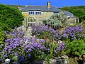
 Agapanthus flowers at the Minack Theatre - geograph.org.uk - 2589435.jpg 640 × 480 ; 131 kio
-
 Agave and Logan Rock - geograph.org.uk - 3191834.jpg 640 × 384 ; 74 kio
-
 Almost the heart of the community - geograph.org.uk - 6139123.jpg 1 024 × 768 ; 162 kio
-

-
 Ardensawah Cottages - geograph.org.uk - 5155186.jpg 1 024 × 768 ; 265 kio
-
 Barren Lode - geograph.org.uk - 3124168.jpg 640 × 424 ; 247 kio
-
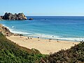 Beach at Porth Curno - geograph.org.uk - 5140933.jpg 1 024 × 769 ; 230 kio
-
 Beach scene at Porthchapel - geograph.org.uk - 3081530.jpg 640 × 480 ; 89 kio
-
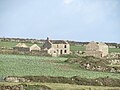
 Bosfranken Farm - geograph.org.uk - 1583584.jpg 640 × 480 ; 72 kio
-
 Bosistow Farmhouse - geograph.org.uk - 5268434.jpg 4 636 × 3 074 ; 4,2 Mio
-
 Brassica field near Trendrennen Farm - geograph.org.uk - 5155201.jpg 1 024 × 768 ; 294 kio
-
 Bridle path near Trengothal Farm - geograph.org.uk - 4741252.jpg 4 896 × 3 672 ; 6,44 Mio
-
 BT Communications Station - geograph.org.uk - 4741246.jpg 4 896 × 3 672 ; 6,52 Mio
-
 Bulging Wall, Chair Ladder - geograph.org.uk - 2993777.jpg 3 000 × 4 000 ; 2,52 Mio
-
 Bungalows, houses and apartments at Porthcurno - geograph.org.uk - 4627187.jpg 1 600 × 1 200 ; 504 kio
-
 Cabbages galore - geograph.org.uk - 4748673.jpg 4 896 × 3 672 ; 6,9 Mio
-
 Cable monument - geograph.org.uk - 2761311.jpg 640 × 525 ; 215 kio
-
 Cable monument - geograph.org.uk - 2761317.jpg 640 × 427 ; 177 kio
-
 Cable Station Inn, Porthcurno - geograph.org.uk - 1941674.jpg 640 × 480 ; 77 kio
-
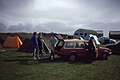 Camp site, Treen - geograph.org.uk - 6449969.jpg 1 024 × 686 ; 190 kio
-
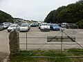 Car park at Porthcurno - geograph.org.uk - 4627191.jpg 1 600 × 1 200 ; 395 kio
-
 Carn Barra and Longships lighthouse - geograph.org.uk - 1660209.jpg 640 × 423 ; 57 kio
-
 Carn Guthenbras - geograph.org.uk - 2990448.jpg 4 000 × 3 000 ; 3,41 Mio
-
 Carn Guthensbras from the north - geograph.org.uk - 5155146.jpg 1 024 × 768 ; 298 kio
-
 Carn Scathe - geograph.org.uk - 4223397.jpg 3 872 × 2 592 ; 6,15 Mio
-
 Cattle near south-west coast path - geograph.org.uk - 5140915.jpg 1 024 × 767 ; 275 kio
-
 Cattle rubbing stone near Treen - geograph.org.uk - 5155216.jpg 1 024 × 767 ; 242 kio
-
 Chair Ladder - geograph.org.uk - 6453257.jpg 708 × 1 024 ; 236 kio
-
 Cliff Arch at Nanjizal - geograph.org.uk - 4771533.jpg 480 × 640 ; 90 kio
-
 Cliff-top field near the Minack Theatre - geograph.org.uk - 3111286.jpg 640 × 427 ; 67 kio
-
 Cliffs above Folly Cove - geograph.org.uk - 1939972.jpg 640 × 480 ; 72 kio
-
 Cliffs east of Cribba Head (7218).jpg 4 288 × 2 848 ; 6,21 Mio
-
 Cliffs east of Porthgwarra (7187).jpg 4 288 × 2 848 ; 5,9 Mio
-
 Cliffs east of Porthgwarra (7189).jpg 4 288 × 2 848 ; 6,68 Mio
-
 Cliffs on Logan Rock headland - geograph.org.uk - 4626641.jpg 4 896 × 3 672 ; 6,44 Mio
-
 Clifftop above Folly Cove - geograph.org.uk - 4223556.jpg 3 872 × 2 592 ; 5,21 Mio
-
 Coast Path - geograph.org.uk - 4772040.jpg 640 × 480 ; 65 kio
-
 Coast path above Pendower Coves - geograph.org.uk - 1939969.jpg 640 × 480 ; 98 kio
-
 Coast path to the east of Porthgwarra - geograph.org.uk - 1940777.jpg 640 × 480 ; 109 kio
-
 Coastal Cottage Penberth Cove - geograph.org.uk - 2774459.jpg 427 × 640 ; 359 kio
-
 Coastal path above Pellitras Point - geograph.org.uk - 4223525.jpg 3 872 × 2 592 ; 5,68 Mio
-
 Coastal path approaching Black Carn - geograph.org.uk - 4223546.jpg 3 872 × 2 592 ; 6,21 Mio
-
 Coastline east of Porthgwarra - geograph.org.uk - 5142149.jpg 1 024 × 768 ; 284 kio
-
 Coastline near Minack Point - geograph.org.uk - 4222187.jpg 3 872 × 2 592 ; 6,12 Mio
-
 Coastwatch Lookout, Gwennap Head - geograph.org.uk - 5155117.jpg 1 024 × 768 ; 185 kio
-
 Copper Mineralisation - Porth Chapel - geograph.org.uk - 3124161.jpg 424 × 640 ; 312 kio
-
 Cottages at St. Levan - geograph.org.uk - 3674343.jpg 640 × 427 ; 80 kio
-
 Cove Cottage, Porthgwarra - geograph.org.uk - 230027.jpg 640 × 480 ; 87 kio
-
 Cove Farm Cottage - geograph.org.uk - 5139674.jpg 1 024 × 768 ; 231 kio
-
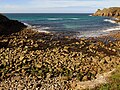
 Crean Bottoms, 1 - geograph.org.uk - 3383156.jpg 1 200 × 900 ; 597 kio
-
 Crean Bottoms, 2 - geograph.org.uk - 3383159.jpg 1 200 × 900 ; 557 kio
-
 Cross at Trebehor - geograph.org.uk - 2282056.jpg 427 × 640 ; 98 kio
-
 Cross on churchyard wall - geograph.org.uk - 3674351.jpg 427 × 640 ; 98 kio
-
 Cross on footpath between St Levan and Portcurno - geograph.org.uk - 1530889.jpg 425 × 640 ; 109 kio
-
 Disused bunker near Trengothal Farm - geograph.org.uk - 5156592.jpg 1 024 × 768 ; 261 kio
-
 Dry stone wall above Folly Cove (7170).jpg 4 288 × 2 848 ; 4,52 Mio
-
 Emergency point above Cripp's Cove - geograph.org.uk - 4626594.jpg 4 896 × 3 672 ; 6,73 Mio
-
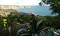
 Exotic plants above the Minack Theatre - geograph.org.uk - 4222153.jpg 3 872 × 2 592 ; 4,15 Mio
-
 Exploring Porthgwarra - geograph.org.uk - 5987157.jpg 4 032 × 3 024 ; 5,04 Mio
-
 Faraway Cottage - geograph.org.uk - 5155255.jpg 1 024 × 768 ; 198 kio
-
 Faraway Cottage - geograph.org.uk - 5268473.jpg 1 600 × 1 200 ; 322 kio
-
 Farmland near Bosistow Farm - geograph.org.uk - 5155244.jpg 1 024 × 768 ; 245 kio
-
 Field east of Treen - geograph.org.uk - 5139480.jpg 1 024 × 768 ; 222 kio
-
 Field path east of Treen - geograph.org.uk - 5139590.jpg 1 024 × 768 ; 251 kio
-
 First view of Porthgwarra - geograph.org.uk - 2777243.jpg 640 × 410 ; 179 kio
-
 Fishing boats at Penberth Cove - geograph.org.uk - 2761255.jpg 640 × 427 ; 191 kio
-
 Fishing boats at Penberth Cove - geograph.org.uk - 2761256.jpg 640 × 427 ; 171 kio
-
 Fishing Boats, Penberth Cove - geograph.org.uk - 1942818.jpg 640 × 480 ; 94 kio
-
 Fishing Boats, Penberth Cove - geograph.org.uk - 1942820.jpg 640 × 480 ; 99 kio
-
 Footpath west of Polgigga - geograph.org.uk - 2546418.jpg 640 × 404 ; 183 kio
-
 Gap in the cliff, Nanjizal Bay - geograph.org.uk - 1939964.jpg 2 304 × 3 072 ; 2,48 Mio
-
 Gateway to the sea - geograph.org.uk - 2085707.jpg 800 × 600 ; 181 kio
-
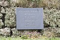 Groves memorial slate - geograph.org.uk - 3674355.jpg 640 × 427 ; 128 kio
-
 Gunnera near Chmoy Mill - geograph.org.uk - 5139636.jpg 1 024 × 766 ; 370 kio
-
 Hay field at Higher Bosistow - geograph.org.uk - 5268455.jpg 1 600 × 1 200 ; 450 kio
-
 Heather on Higher Bosistow Cliff (7163).jpg 4 288 × 2 848 ; 6,37 Mio
-
 Heather on Higher Bosistow Cliffs - geograph.org.uk - 2546445.jpg 640 × 546 ; 331 kio
-
 Heathland, Ardensawah Cliff - geograph.org.uk - 5155165.jpg 1 024 × 768 ; 248 kio
-
 Higher Bosistow - geograph.org.uk - 5155252.jpg 1 024 × 769 ; 245 kio
-
 Higher Bosistow Cliffs - geograph.org.uk - 2546452.jpg 640 × 425 ; 224 kio
-
 Higher Bosistow Farm - geograph.org.uk - 851429.jpg 640 × 480 ; 62 kio
-
 Highfield near Trethewey - geograph.org.uk - 1740236.jpg 640 × 427 ; 70 kio
-
 Holiday lets at Trebehor - geograph.org.uk - 2282063.jpg 640 × 427 ; 79 kio
-
 Horrace Headland - geograph.org.uk - 5660238.jpg 1 000 × 662 ; 850 kio
-
 Horrace Headland - geograph.org.uk - 5660246.jpg 1 000 × 662 ; 819 kio
-
 Horrace Headland and Pednvounder Beach - geograph.org.uk - 5659538.jpg 1 000 × 662 ; 646 kio
-
 Houses above Porth Chapel - geograph.org.uk - 5141089.jpg 1 024 × 769 ; 340 kio
-
 Houses near St Levan - geograph.org.uk - 4627275.jpg 1 600 × 1 200 ; 455 kio
-
 Houses near St Levan - geograph.org.uk - 5141115.jpg 1 024 × 768 ; 223 kio
-
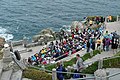
 Jesus Christ Superstar at the Minack Theatre - geograph.org.uk - 1903089.jpg 640 × 467 ; 60 kio
-
 John Mulcaster Carrick - Carrick-Crop-98418 - At St Levan, near Land’s End - 1887.jpg 2 250 × 1 309 ; 594 kio
-
 Landmark on Gwennap Head (7177).jpg 4 288 × 2 848 ; 6,14 Mio
-
 Landmark on Gwennap Head (7178).jpg 4 288 × 2 848 ; 6,27 Mio
-
 Landmarks above Gwennap Head - geograph.org.uk - 5142165.jpg 1 024 × 768 ; 184 kio
-
 Landmarks above Polostoc Zawn - geograph.org.uk - 6296231.jpg 1 024 × 768 ; 614 kio
-
 Landmarks on Gwennap Head (7179).jpg 4 288 × 2 848 ; 6,3 Mio
-
 Lane near Raftra Farm - geograph.org.uk - 5155194.jpg 1 024 × 768 ; 246 kio
-
 Lane through Trebehor - geograph.org.uk - 4771271.jpg 640 × 480 ; 69 kio
-
 Large Phenocrysts in Lands End Granite - geograph.org.uk - 3124165.jpg 640 × 424 ; 325 kio
-
 Leaving Treen - geograph.org.uk - 2761246.jpg 640 × 428 ; 241 kio
-
 Life in the bunker - geograph.org.uk - 4741248.jpg 4 896 × 3 672 ; 6,99 Mio
-
 Lifeguard, Porthcurno Beach - geograph.org.uk - 6370061.jpg 2 000 × 1 079 ; 2,5 Mio
-
 Logan Rock - geograph.org.uk - 5140878.jpg 1 024 × 768 ; 281 kio
-
 Logan Rock - geograph.org.uk - 6370043.jpg 2 000 × 1 127 ; 2,36 Mio
-
 Logan Rock and Treen Cliff from the west (7197).jpg 4 288 × 2 848 ; 6,42 Mio
-
 Logan Rock from Minack - geograph.org.uk - 2398484.jpg 1 600 × 727 ; 211 kio
-
 Logan Rock headland ^ Seghy - geograph.org.uk - 4626648.jpg 4 896 × 3 672 ; 6,7 Mio
-
 Logan Rock Outcrop - geograph.org.uk - 4770987.jpg 640 × 480 ; 64 kio
-
 Logan Rock seen from the Minack Theatre - geograph.org.uk - 6440155.jpg 2 000 × 1 132 ; 2,31 Mio
-
 Longships and Carn Les Boel (7167).jpg 4 288 × 2 848 ; 5,87 Mio
-
 Looking along the coast east of Porthcurno - geograph.org.uk - 1933905.jpg 640 × 480 ; 95 kio
-
 Looking down on Carn Barra - geograph.org.uk - 4223585.jpg 3 872 × 2 592 ; 5,82 Mio
-
 Looking down on Pednvounder Beach - geograph.org.uk - 1933839.jpg 480 × 640 ; 89 kio
-
 Looking down on Porthgwarra - geograph.org.uk - 4772050.jpg 640 × 480 ; 95 kio
-
 Looking north-east towards Minack Point - geograph.org.uk - 4627230.jpg 4 896 × 3 672 ; 6,8 Mio
-
 Looking north-west on Pedn-mên-an-mere - geograph.org.uk - 4627237.jpg 1 600 × 1 200 ; 395 kio
-
 Looking to Pednvounder Beach - geograph.org.uk - 4770940.jpg 640 × 480 ; 52 kio
-
 Looking to the disused Trevean - geograph.org.uk - 4772782.jpg 640 × 480 ; 74 kio
-
 Looking west from the base of Hella Point - geograph.org.uk - 3674382.jpg 1 224 × 918 ; 685 kio
-
 Lookout station on Gwennap Head (7172).jpg 4 288 × 2 848 ; 4,8 Mio
-
 Lower Bosistow - geograph.org.uk - 2546425.jpg 640 × 443 ; 247 kio
-
 Lush vegetation at Pedn-mên-an-mere headland - geograph.org.uk - 4627217.jpg 4 896 × 3 672 ; 6,47 Mio
-
 Mallow on the cliffs west of Pednvounder - geograph.org.uk - 1933926.jpg 453 × 640 ; 115 kio
-
 Mast base, Pedn-mên-an-mere - geograph.org.uk - 5660370.jpg 1 000 × 662 ; 1,08 Mio
-
 Mast base, Pedn-mên-an-mere - geograph.org.uk - 5660378.jpg 1 000 × 662 ; 792 kio
-
 Mast pivot on Pedn-men-an-mere headland - geograph.org.uk - 4523426.jpg 1 024 × 768 ; 199 kio
-
 Milestone on the bend at Polgigga - geograph.org.uk - 2432297.jpg 640 × 480 ; 87 kio
-
 Mill Bay - geograph.org.uk - 2939631.jpg 439 × 640 ; 96 kio
-
 Mill Bay or Nanjizal - geograph.org.uk - 2546490.jpg 640 × 396 ; 175 kio
-

-
 Minack Point - geograph.org.uk - 5660339.jpg 1 000 × 662 ; 1,01 Mio
-
 Minack Point - geograph.org.uk - 5660385.jpg 1 000 × 662 ; 829 kio
-
 Minack Point from Rôspletha Cliff - geograph.org.uk - 5141030.jpg 1 024 × 768 ; 202 kio
-
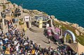
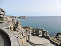
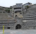 Minack Theatre - geograph.org.uk - 1882437.jpg 505 × 480 ; 75 kio
-
 Minack Theatre - geograph.org.uk - 2566112.jpg 640 × 426 ; 244 kio
-
 Minack Theatre - geograph.org.uk - 2566121.jpg 640 × 435 ; 218 kio
-
 Minack Theatre - geograph.org.uk - 2566127.jpg 640 × 429 ; 164 kio
-
 Minack Theatre - geograph.org.uk - 4997615.jpg 640 × 480 ; 101 kio
-
 Minack Theatre - geograph.org.uk - 5660162.jpg 1 000 × 662 ; 1,04 Mio
-
 Minack Theatre - geograph.org.uk - 5660202.jpg 1 000 × 662 ; 956 kio
-
 Minack Theatre - geograph.org.uk - 5660206.jpg 1 000 × 662 ; 965 kio
-
 Minack Theatre - geograph.org.uk - 6440149.jpg 2 000 × 1 190 ; 2,49 Mio
-
 Minack Theatre - geograph.org.uk - 6440157.jpg 2 000 × 1 290 ; 2,82 Mio
-
 Minack Theatre and Horrace Headland - geograph.org.uk - 5659548.jpg 1 000 × 662 ; 833 kio
-
 Minack Theatre and Horrace Headland - geograph.org.uk - 5659678.jpg 662 × 1 000 ; 907 kio
-
 Minack Theatre and Porth Curno - geograph.org.uk - 6204374.jpg 1 024 × 768 ; 284 kio
-
 Minack Theatre from the SW Coastal Path - geograph.org.uk - 5141024.jpg 1 024 × 768 ; 199 kio
-
 Minack Theatre, Cornwall - geograph.org.uk - 2400149.jpg 1 600 × 1 200 ; 560 kio
-
 Minack Theatre, Cornwall - geograph.org.uk - 2400160.jpg 1 600 × 1 200 ; 400 kio
-
 Minack Theatre, Porthcurno, 1949 - geograph.org.uk - 6366705.jpg 853 × 1 280 ; 287 kio
-
 Nanjizal (Mill Bay) - geograph.org.uk - 5155266.jpg 1 024 × 768 ; 236 kio
-
 Nanjizal (Mill Bay) - geograph.org.uk - 5155271.jpg 1 024 × 768 ; 301 kio
-
 Nanjizal - geograph.org.uk - 2546498.jpg 640 × 371 ; 194 kio
-
 Nanjizal Bay (or Mill Bay) on a stormy afternoon - geograph.org.uk - 5987154.jpg 3 918 × 2 938 ; 3,64 Mio
-
 Nanjizal Beach (7161).jpg 4 288 × 2 848 ; 6,91 Mio
-
 Nanjizal cove, 1950 - geograph.org.uk - 6370916.jpg 1 280 × 847 ; 460 kio
-
 Nanjizal house - geograph.org.uk - 5268468.jpg 4 896 × 3 672 ; 6,75 Mio
-
 Nanjizal, 1950 - geograph.org.uk - 6369973.jpg 1 280 × 819 ; 313 kio
-
 National Trust sign, Pedn-mên-an-mere - geograph.org.uk - 5660364.jpg 1 000 × 662 ; 1,03 Mio
-
 Navigation landmarks, Gwennap Head - geograph.org.uk - 1939978.jpg 480 × 640 ; 54 kio
-
 New fencing at Porthgwarra - geograph.org.uk - 1054456.jpg 640 × 480 ; 132 kio
-
 Old AA Sign in Treen - geograph.org.uk - 6076785.jpg 600 × 800 ; 122 kio
-
-

-
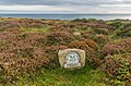
 Old Wayside Cross (geograph 6497301).jpg 960 × 720 ; 140 kio
-
 Old Wayside Cross towards Ardensawah in St Levan parish (geograph 7097709).jpg 1 536 × 2 048 ; 1,02 Mio
-
 Old winch at Penberth - geograph.org.uk - 5139685.jpg 1 024 × 768 ; 314 kio
-
 On Stand-by - geograph.org.uk - 2085673.jpg 800 × 600 ; 87 kio
-
 On the coast path by Roskestal West Cliff - geograph.org.uk - 4772023.jpg 640 × 480 ; 59 kio
-
 Once you get past Trengothal the bridleway becomes rather narrow - geograph.org.uk - 6331281.jpg 3 000 × 4 000 ; 3,71 Mio
-
 Ordnance Survey Cut Mark - geograph.org.uk - 5293882.jpg 640 × 417 ; 139 kio
-
 Outcrops on Carn Barra - geograph.org.uk - 4223579.jpg 3 872 × 2 592 ; 5,49 Mio
-
 Overlooking the Minack Theatre at Porthcurno - geograph.org.uk - 5323950.jpg 4 000 × 3 000 ; 4,03 Mio
-
 Oy^^ That's my lunch^ - geograph.org.uk - 4626665.jpg 2 806 × 2 138 ; 2,45 Mio
-
 Path down to Porth Curno beach - geograph.org.uk - 6203767.jpg 480 × 640 ; 90 kio
-
 Path heading towards Raftra Farm - geograph.org.uk - 4771263.jpg 640 × 480 ; 79 kio
-
 Path nearing Polgigga - geograph.org.uk - 4771267.jpg 640 × 480 ; 77 kio
-
 Pausing for a breather - geograph.org.uk - 2777237.jpg 640 × 427 ; 193 kio
-
 Pedn-mên-an-mere - geograph.org.uk - 5660351.jpg 1 000 × 662 ; 754 kio
-
 Pedn-mên-an-mere - geograph.org.uk - 5660355.jpg 1 000 × 662 ; 890 kio
-
 Pedn-mên-an-mere - geograph.org.uk - 5660361.jpg 1 000 × 662 ; 693 kio
-
 Pednvounder Beach - geograph.org.uk - 2761298.jpg 640 × 431 ; 169 kio
-
 Pednvounder Beach - geograph.org.uk - 2761301.jpg 620 × 640 ; 293 kio
-
 Pednvounder Beach - geograph.org.uk - 2761302.jpg 427 × 640 ; 151 kio
-
 Pednvounder Beach - geograph.org.uk - 5660231.jpg 1 000 × 662 ; 902 kio
-
 Pednvounder beach 1948 - geograph.org.uk - 6366584.jpg 878 × 1 280 ; 402 kio
-
 Pednvounder Beach and Treen Cliff - geograph.org.uk - 2589416.jpg 480 × 640 ; 72 kio
-
 Pednvounder Beach and Treryn Dinas headland - geograph.org.uk - 2589408.jpg 640 × 480 ; 60 kio
-
 Pednvounder Beach, 1950 – 4 - geograph.org.uk - 6369874.jpg 851 × 1 280 ; 224 kio
-
 Pednvounder Cove, 1950 - geograph.org.uk - 6369954.jpg 1 280 × 813 ; 321 kio
-
 Penberth - geograph.org.uk - 2313850.jpg 640 × 426 ; 88 kio
-
 Penberth - geograph.org.uk - 5139705.jpg 1 024 × 768 ; 329 kio


.jpg)
.jpg)
.jpg)


.jpg)


.jpg)


.jpg)
.jpg)


.jpg)


.jpg)


.jpg)


.jpg)


_-_geograph.org.uk_-_5155266.jpg)
_-_geograph.org.uk_-_5155271.jpg)

_on_a_stormy_afternoon_-_geograph.org.uk_-_5987154.jpg)
.jpg)


.jpg)
.jpg)


