Category:Staintondale
Aller à la navigation
Aller à la recherche
localité britannique du comté anglais de North Yorkshire  | |||||
| Téléverser des médias | |||||
| Nature de l’élément | |||||
|---|---|---|---|---|---|
| Lieu | Staintondale, Scarborough (district), Yorkshire du Nord, Yorkshire-et-Humber, Angleterre | ||||
 | |||||
English: Staintondale is a small village in North Yorkshire, within the civil parish of Staintondale
Sous-catégories
Cette catégorie comprend 3 sous-catégories, dont les 3 ci-dessous.
T
- Three Lords' Stones (1 F)
Média dans la catégorie « Staintondale »
Cette catégorie comprend 82 fichiers, dont les 82 ci-dessous.
-
 A "Green" Cottage - geograph.org.uk - 1164105.jpg 640 × 480 ; 94 kio
-
 A171 in Harwood Dale Forest - geograph.org.uk - 220097.jpg 640 × 480 ; 60 kio
-
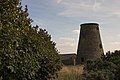 Beacon Windmill near Ravenscar - geograph.org.uk - 94016.jpg 640 × 427 ; 66 kio
-
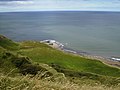 Blea Wyke Point - geograph.org.uk - 527259.jpg 640 × 480 ; 148 kio
-
 Calfthwaite Farm Crowden.jpg 640 × 480 ; 71 kio
-
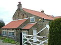
 Church Farm Staintondale - geograph.org.uk - 1164115.jpg 640 × 480 ; 48 kio
-
 Cycle track at Bent Rigg - geograph.org.uk - 658589.jpg 640 × 480 ; 153 kio
-
 Cycle Trail to Whitby - geograph.org.uk - 1547101.jpg 640 × 480 ; 146 kio
-
 En route to OV 0000 (2) - geograph.org.uk - 213640.jpg 640 × 426 ; 167 kio
-
 Hayburn Beck - geograph.org.uk - 1547111.jpg 640 × 480 ; 151 kio
-
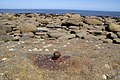
 Low tide north of Herbert Hole - geograph.org.uk - 597761.jpg 640 × 480 ; 140 kio
-
 Meeting of the Myriads - geograph.org.uk - 203832.jpg 640 × 426 ; 145 kio
-
 Moorside House - geograph.org.uk - 1162539.jpg 640 × 480 ; 77 kio
-
 OV00 square distant view from Petard Point. - geograph.org.uk - 527270.jpg 640 × 480 ; 136 kio
-
 OV0000 in 1987. Old Descent Route, now defunct. - geograph.org.uk - 1138643.jpg 426 × 640 ; 105 kio
-
 Quarry Farm Staintondale - geograph.org.uk - 1164063.jpg 640 × 480 ; 76 kio
-

-
 Shipwreck at OV - geograph.org.uk - 213638.jpg 640 × 426 ; 154 kio
-
 Staintondale - geograph.org.uk - 1964079.jpg 3 088 × 2 056 ; 3,42 Mio
-
 Staintondale from the disused railway lane - geograph.org.uk - 2178025.jpg 800 × 600 ; 242 kio
-
 Staintondale Village Hall.jpg 640 × 480 ; 60 kio
-
 The Falcon Inn - geograph.org.uk - 2006442.jpg 3 648 × 2 736 ; 3,48 Mio
-
 The Falcon Inn - geograph.org.uk - 84872.jpg 640 × 480 ; 60 kio
-
 Thorny Beck from footbridge - geograph.org.uk - 1164370.jpg 640 × 480 ; 137 kio
-
 Track beside Harwood Dale Forest - geograph.org.uk - 1547192.jpg 640 × 480 ; 62 kio
-
 Track to Old Station House - geograph.org.uk - 1547105.jpg 640 × 480 ; 96 kio
-
 Track to Providence Heath - geograph.org.uk - 1547185.jpg 640 × 480 ; 106 kio
-
 Unstable cliff north of Hayburn Wyke - geograph.org.uk - 597751.jpg 480 × 640 ; 128 kio
-
 View over Hunter Howe from the A171 road - geograph.org.uk - 266373.jpg 640 × 480 ; 147 kio
-
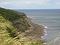
 Below Beast Cliff - geograph.org.uk - 203863.jpg 640 × 426 ; 153 kio
-
 Cleveland Way - geograph.org.uk - 196062.jpg 640 × 369 ; 94 kio
-
 Cleveland Way above Little Cliff - geograph.org.uk - 659277.jpg 640 × 480 ; 149 kio
-
 Cloughton Triangulation Pillar - geograph.org.uk - 249838.jpg 640 × 480 ; 110 kio
-
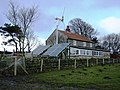
 Coastguard Lookout above Common Cliff - geograph.org.uk - 527265.jpg 640 × 480 ; 141 kio
-
 Common Cliff - geograph.org.uk - 162271.jpg 640 × 480 ; 86 kio
-
 Cycle track near Newlands Dale - geograph.org.uk - 659281.jpg 640 × 480 ; 148 kio
-
 Downdale Road, Staintondale - geograph.org.uk - 447403.jpg 600 × 450 ; 260 kio
-
 Ellis Close and Thirley Beck farms - geograph.org.uk - 121326.jpg 586 × 389 ; 53 kio
-
 Forest road, Harwood Dale Forest - geograph.org.uk - 220106.jpg 640 × 480 ; 95 kio
-
 Forest road, Harwood Dale Forest - geograph.org.uk - 220108.jpg 480 × 640 ; 94 kio
-
 Forest trailer, Harwood Dale Forest - geograph.org.uk - 220107.jpg 640 × 480 ; 118 kio
-
 From Herbert Hole looking south at low tide - geograph.org.uk - 597752.jpg 640 × 480 ; 156 kio
-
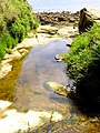
 Haburn Beck, Haburn Wyke, Nth. Yorks. - geograph.org.uk - 770290.jpg 640 × 480 ; 288 kio
-
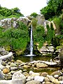 Haburn Wyke Waterfall - geograph.org.uk - 196069.jpg 480 × 640 ; 193 kio
-
 Hayburn Wike - geograph.org.uk - 42474.jpg 640 × 360 ; 62 kio
-

-
 High and dry - geograph.org.uk - 220118.jpg 640 × 480 ; 106 kio
-
 Looking towards Whitby in grid square TA 0198 - geograph.org.uk - 597763.jpg 640 × 480 ; 157 kio
-

-
 Old sheepfold, Thirley Bank - geograph.org.uk - 220102.jpg 640 × 480 ; 96 kio
-
 OV - Distant View from Common Cliff - geograph.org.uk - 217728.jpg 640 × 426 ; 146 kio
-
 Petard Point view - geograph.org.uk - 196058.jpg 640 × 337 ; 78 kio
-
 Radio Bolt at OV - geograph.org.uk - 213642.jpg 640 × 426 ; 141 kio
-
 Rebuilt section of the Cleveland Way - geograph.org.uk - 597766.jpg 480 × 640 ; 116 kio
-
 Road drain, Harwood Dale Forest - geograph.org.uk - 220119.jpg 640 × 480 ; 95 kio
-
 Road Junction - geograph.org.uk - 220459.jpg 640 × 480 ; 66 kio
-
 Roadside Farm, Harwood Dale - geograph.org.uk - 220116.jpg 640 × 480 ; 92 kio
-
 Scots pines in Harwood Dale Forest - geograph.org.uk - 220096.jpg 640 × 480 ; 134 kio
-

-
 Spring House Farm - geograph.org.uk - 390948.jpg 640 × 480 ; 110 kio
-
 Staircase on The Cleveland Way - geograph.org.uk - 597748.jpg 480 × 640 ; 97 kio
-
 Streams - geograph.org.uk - 196078.jpg 480 × 640 ; 179 kio
-
 The A171 road near Standingstones Rigg - geograph.org.uk - 266378.jpg 640 × 480 ; 145 kio
-
 The A171 to Ravenscar road - geograph.org.uk - 220454.jpg 640 × 480 ; 64 kio
-
 The Cleveland Way above Beast Cliff - geograph.org.uk - 658603.jpg 640 × 480 ; 161 kio
-
 The Cleveland Way above Beast Cliff - geograph.org.uk - 658670.jpg 640 × 480 ; 162 kio
-
 The Cleveland Way approaching Ravenscar - geograph.org.uk - 658581.jpg 640 × 480 ; 134 kio
-
 The Cleveland Way from Petard Point - geograph.org.uk - 658665.jpg 640 × 480 ; 116 kio
-
 The Cleveland Way towards Hayburn Wyke - geograph.org.uk - 658659.jpg 640 × 480 ; 152 kio
-
 The coast at low water mark north of Herbert Hole - geograph.org.uk - 597764.jpg 640 × 480 ; 174 kio
-
 The Falcon Inn - geograph.org.uk - 270521.jpg 640 × 480 ; 114 kio
-
 The Old Line - geograph.org.uk - 172279.jpg 480 × 640 ; 227 kio
-
 The road to Whitby - geograph.org.uk - 220473.jpg 640 × 480 ; 65 kio
-
 The Scarborough to Whitby road. - geograph.org.uk - 220446.jpg 640 × 480 ; 78 kio
-
 The West Syme, Harwood Dale - geograph.org.uk - 220103.jpg 640 × 480 ; 60 kio
-
 Thisley Cote Cottage, Harwood Dale - geograph.org.uk - 220104.jpg 640 × 480 ; 73 kio
-
 Timber operations, Harwood Dale Forest - geograph.org.uk - 220105.jpg 640 × 480 ; 95 kio
-
 Towards Petard Point - geograph.org.uk - 164302.jpg 640 × 480 ; 74 kio
-
 Towards White Hall Farm - geograph.org.uk - 658598.jpg 640 × 480 ; 166 kio
-

-
 War Dyke - geograph.org.uk - 133478.jpg 640 × 480 ; 88 kio
-
 Woodland - geograph.org.uk - 196073.jpg 640 × 480 ; 257 kio


_-_geograph.org.uk_-_213640.jpg)


