Category:Standburn
Aller à la navigation
Aller à la recherche
English: Standburn is a small village in Central Scotland near Falkirk. It is located on the B825 between Maddiston and Avonbridge.
Gàidhlig: 'S e baile ann an Comhairle na h-Eaglaise Brice a tha ann an Standburn. Tha e suidhichte air a' mhòr-rathaid B825 eadar Maddiston agus Drochaid Abhainne. Tha an cuid as motha de na taighean suidhichte air gach taobh dhen rathaid a tha a' ruith tron bhaile. Tha bun-sgoil ann ris an canar Drumbowie Primary School.
village britannique  | |||||
| Téléverser des médias | |||||
| Nature de l’élément | |||||
|---|---|---|---|---|---|
| Lieu |
| ||||
| site officiel | |||||
 | |||||
Sous-catégories
Cette catégorie comprend 3 sous-catégories, dont les 3 ci-dessous.
C
- Candie brickworks (4 F)
- Candie Wood (4 F)
- Craigend brickworks (2 F)
Média dans la catégorie « Standburn »
Cette catégorie comprend 13 fichiers, dont les 13 ci-dessous.
-
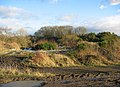 Bing, Candie. - geograph.org.uk - 85209.jpg 638 × 460 ; 84 kio
-
 Drumbowie Park. - geograph.org.uk - 90370.jpg 640 × 480 ; 94 kio
-
 Easter Blackrig. - geograph.org.uk - 90393.jpg 640 × 457 ; 86 kio
-
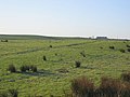 Grassland below Greencraig. - geograph.org.uk - 90404.jpg 640 × 480 ; 70 kio
-
 Greencraig - geograph.org.uk - 85222.jpg 640 × 460 ; 73 kio
-
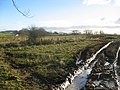 Muddy field, Woodend. - geograph.org.uk - 85196.jpg 640 × 480 ; 92 kio
-
 Redding Co-operative Society store in Standburn.jpg 963 × 604 ; 81 kio
-
 Six shop workers outside Redding Co-operative Society store in Standburn.jpg 1 200 × 827 ; 175 kio
-
 Snabhead. - geograph.org.uk - 90381.jpg 640 × 480 ; 142 kio
-
 Standburn branch of the Redding Co-operative Society circa 1918.jpg 1 200 × 784 ; 175 kio
-
 Standburn from Snabhead. - geograph.org.uk - 90384.jpg 640 × 480 ; 76 kio
-
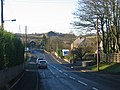 Standburn.jpg 640 × 480 ; 85 kio
-
 Wester Blackrig. - geograph.org.uk - 90396.jpg 640 × 480 ; 96 kio


