Category:Standish, Gloucestershire
Aller à la navigation
Aller à la recherche
localité britannique du comté anglais de Gloucestershire  | |||||
| Téléverser des médias | |||||
| Nature de l’élément | |||||
|---|---|---|---|---|---|
| Lieu | Stroud, Gloucestershire, Angleterre du Sud-Ouest, Angleterre | ||||
 | |||||
English: Standish is a small village and civil parish in the Stroud local government district in Gloucestershire, England. The village is north-west of Stroud, on the B4008 road to Quedgeley. The parish, which in the 2001 census had a population of 285, also contains the hamlet of Stroud Green, situated south-east of Standish village.
Sous-catégories
Cette catégorie comprend 3 sous-catégories, dont les 3 ci-dessous.
B
L
- Little Haresfield (13 F)
Média dans la catégorie « Standish, Gloucestershire »
Cette catégorie comprend 214 fichiers, dont les 200 ci-dessous.
(page précédente) (page suivante)-
 'Unsuitable for motor vehicles' - geograph.org.uk - 1123673.jpg 426 × 640 ; 98 kio
-

-
 A bench and a bus shelter, Stroud Green - geograph.org.uk - 3281139.jpg 640 × 571 ; 128 kio
-
 A butchered tree in Standish Wood - geograph.org.uk - 5056305.jpg 6 000 × 4 000 ; 5,3 Mio
-
 A cross road of paths in Standish Wood - geograph.org.uk - 3443684.jpg 800 × 600 ; 150 kio
-

-

-
 A green traffic sign, Stroud Green - geograph.org.uk - 3272417.jpg 640 × 606 ; 113 kio
-
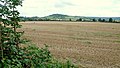
 A muddy field in Standish - geograph.org.uk - 3269606.jpg 640 × 493 ; 115 kio
-
 A rare break in the trees in Standish Wood - geograph.org.uk - 5056394.jpg 6 000 × 4 000 ; 6,15 Mio
-
 A roadside field near Crowcomepill - geograph.org.uk - 3269621.jpg 640 × 505 ; 106 kio
-
 A Standish field - geograph.org.uk - 3281288.jpg 640 × 480 ; 102 kio
-
 A view west along Horsemarling Lane, Standish - geograph.org.uk - 3358516.jpg 640 × 510 ; 110 kio
-
 Alpaca at the edge of Standish Wood - geograph.org.uk - 5490541.jpg 3 776 × 2 520 ; 4,35 Mio
-
 Approaching the car park at the top of Ash Lane - geograph.org.uk - 5490500.jpg 3 776 × 2 520 ; 3,96 Mio
-
 Arle Brook, Standish - geograph.org.uk - 3281243.jpg 640 × 514 ; 158 kio
-
 Arle Brook, Standish - geograph.org.uk - 3295567.jpg 640 × 480 ; 163 kio
-
 B4008 Road Bridge at Standish Junction - geograph.org.uk - 5955844.jpg 640 × 480 ; 89 kio
-
 Barbed wire or broken stile^ - geograph.org.uk - 4195633.jpg 800 × 451 ; 202 kio
-
 Barley field at Little Haresfield - geograph.org.uk - 4737939.jpg 1 024 × 680 ; 326 kio
-
 Barn Nurseries car park, Standish near Stonehouse - geograph.org.uk - 5908219.jpg 1 024 × 723 ; 147 kio
-

-
 Boston Ivy, Parthenocissus tricuspidata - geograph.org.uk - 4195683.jpg 800 × 601 ; 277 kio
-
 Brambles - geograph.org.uk - 4193522.jpg 800 × 800 ; 408 kio
-
 Bridleway to Standish Wood, Randwick - geograph.org.uk - 5464998.jpg 2 000 × 1 500 ; 1,08 Mio
-
 Bridleway, Crowcomepill - geograph.org.uk - 3269607.jpg 640 × 517 ; 94 kio
-
 Bridleway, Maiden Hill - geograph.org.uk - 5805200.jpg 4 000 × 3 000 ; 5,02 Mio
-
 Brook at the northern edge of Brisbane, Stonehouse - geograph.org.uk - 6428214.jpg 1 491 × 1 520 ; 675 kio
-
 By the Haresfield Road - geograph.org.uk - 4193518.jpg 800 × 451 ; 195 kio
-
 Campfire atop Randwick Long Barrow.jpg 3 264 × 4 896 ; 10,1 Mio
-
 Car park for Standish Wood, Randwick - geograph.org.uk - 5465007.jpg 2 000 × 1 414 ; 979 kio
-
 Cattle under trees - geograph.org.uk - 4740337.jpg 800 × 531 ; 176 kio
-
 Check speed 20 near Moreton Hill Farm, Standish - geograph.org.uk - 3582277.jpg 800 × 764 ; 320 kio
-

-
 Cotswold outliers near Haresfield - geograph.org.uk - 4192149.jpg 800 × 451 ; 203 kio
-
 Cotswold Way 061 - Toposcope - geograph.org.uk - 3977591.jpg 640 × 480 ; 73 kio
-
 Cotswold Way 062 - geograph.org.uk - 3977595.jpg 640 × 480 ; 132 kio
-
 Cotswold Way 063 - In Standish Wood - geograph.org.uk - 3977601.jpg 640 × 480 ; 142 kio
-
 Cotswold Way 064 - Go left, not right - geograph.org.uk - 3977604.jpg 640 × 480 ; 138 kio
-
 Cotswold Way 065 - geograph.org.uk - 3977606.jpg 640 × 480 ; 147 kio
-
 Cotswold Way into the Severn Vale-Randwick, Glos - geograph.org.uk - 2872018.jpg 3 264 × 2 448 ; 2,14 Mio
-
 Cotswold way near Haresfield topograph - geograph.org.uk - 1823646.jpg 4 752 × 3 168 ; 7,12 Mio
-
-
 Cotswold Way through the gate - Haresfield, Gloucestershire - geograph.org.uk - 4934307.jpg 3 264 × 2 448 ; 7,33 Mio
-
 Countryside near Little Haresfield - geograph.org.uk - 4520184.jpg 1 920 × 784 ; 240 kio
-
 Culvert near Brisbane, Stonehouse - geograph.org.uk - 6428554.jpg 1 395 × 1 600 ; 672 kio
-
 Disused side road, Standish Hospital, Standish - geograph.org.uk - 3358762.jpg 549 × 640 ; 156 kio
-
 Diverging paths in Standish Wood - geograph.org.uk - 5056280.jpg 6 000 × 4 000 ; 4,51 Mio
-
 Dog walkers in Standish Wood - geograph.org.uk - 3443708.jpg 800 × 600 ; 146 kio
-

-
 Entering a field with dairy cows - geograph.org.uk - 4195640.jpg 800 × 451 ; 198 kio
-
 Entering Randwick - geograph.org.uk - 3443711.jpg 800 × 600 ; 157 kio
-
 Entrance barrier, Standish Hospital - geograph.org.uk - 3358795.jpg 640 × 424 ; 124 kio
-
 Entrance to Barn Nurseries in Standish near Stonehouse - geograph.org.uk - 5908146.jpg 1 024 × 659 ; 153 kio
-
 Evidence of fires and other debris atop Randwick Long Barrow.jpg 4 896 × 3 264 ; 10,46 Mio
-
 Farmland near Manor Farm - geograph.org.uk - 2801551.jpg 1 024 × 680 ; 257 kio
-
 Farmland near Oaktree Farm - geograph.org.uk - 4387843.jpg 800 × 503 ; 74 kio
-
 Farmland near Stagholt Farm - geograph.org.uk - 4386379.jpg 640 × 454 ; 75 kio
-
 Farmland near Standish - geograph.org.uk - 4698772.jpg 2 257 × 943 ; 200 kio
-
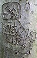 Fascist Graffiti in Standish Wood, Gloucestershire.jpg 2 446 × 3 847 ; 6,64 Mio
-
 Field of green and gold - geograph.org.uk - 5698233.jpg 1 600 × 901 ; 683 kio
-
 Field, lane and allotments north of Stonehouse - geograph.org.uk - 3380068.jpg 1 024 × 755 ; 110 kio
-
 Fields north of Stonehouse, from the train - geograph.org.uk - 3380073.jpg 1 024 × 834 ; 97 kio
-
 Finger post at Standish - geograph.org.uk - 4195606.jpg 800 × 451 ; 287 kio
-
 Flooded entrance to a field near Stroud Green - geograph.org.uk - 3272297.jpg 640 × 449 ; 108 kio
-
 Flower tub alongside Gloucester Road, Stonehouse - geograph.org.uk - 6428179.jpg 1 600 × 1 419 ; 600 kio
-
 Footpath and drive to Pidgemoor Farm - geograph.org.uk - 4740336.jpg 800 × 531 ; 170 kio
-
 Footpath at Little Haresfield - geograph.org.uk - 4737950.jpg 800 × 531 ; 144 kio
-
 Frisky cows, again - geograph.org.uk - 4195654.jpg 800 × 451 ; 220 kio
-
 Frosty Maiden Hill - geograph.org.uk - 1125415.jpg 640 × 426 ; 49 kio
-
 Gate and Track into Field - geograph.org.uk - 5874678.jpg 800 × 600 ; 1,13 Mio
-
 Gate on the Cotswold Way - geograph.org.uk - 986283.jpg 640 × 480 ; 141 kio
-
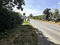
 Gloucester Road bus stop, Stonehouse - geograph.org.uk - 5792689.jpg 800 × 522 ; 107 kio
-
 Gloucester Road from Standish towards Stonehouse - geograph.org.uk - 5908187.jpg 1 024 × 931 ; 155 kio
-

-

-
 Gloucester Vale dairy land - geograph.org.uk - 4193513.jpg 800 × 451 ; 235 kio
-
 Gloucestershire Energy From Waste Facility - geograph.org.uk - 6107544.jpg 800 × 533 ; 558 kio
-
 Grass triangle, Standish - geograph.org.uk - 3296727.jpg 640 × 480 ; 86 kio
-
 Hairpin bend, Moreton Hill, Standish - geograph.org.uk - 3582654.jpg 800 × 600 ; 152 kio
-
 Harvested silage field - geograph.org.uk - 4737953.jpg 800 × 531 ; 147 kio
-
 Hoar frost on trees near the Cotswold Way - geograph.org.uk - 1123703.jpg 426 × 640 ; 115 kio
-
 Hoar frost, Maiden Hill - geograph.org.uk - 1125426.jpg 640 × 426 ; 61 kio
-
 Horse Chestnuts at Stroud Green - geograph.org.uk - 4195673.jpg 800 × 451 ; 224 kio
-
 Horsemarling Farmhouse - geograph.org.uk - 5199462.jpg 800 × 600 ; 130 kio
-
 Horsemarling Lane - geograph.org.uk - 1953776.jpg 1 200 × 1 600 ; 378 kio
-

-
 Horsemarling Lane near Stonehouse - geograph.org.uk - 3252012.jpg 640 × 576 ; 110 kio
-
 In a field of barley - geograph.org.uk - 5698229.jpg 1 600 × 901 ; 673 kio
-
 In Standish Wood - geograph.org.uk - 5490531.jpg 3 776 × 2 520 ; 3,98 Mio
-

-
 Lane above Stroud Green - geograph.org.uk - 1123665.jpg 640 × 426 ; 108 kio
-
 Lane up to Moreton Hill Farm - geograph.org.uk - 5056454.jpg 6 000 × 4 000 ; 5,45 Mio
-
 Letter box and noticeboard - geograph.org.uk - 5200480.jpg 800 × 600 ; 158 kio
-
 Line of a footpath - geograph.org.uk - 4192847.jpg 800 × 451 ; 191 kio
-
 Logs and branches in Standish Wood - geograph.org.uk - 5056272.jpg 6 000 × 4 000 ; 5,08 Mio
-

-

-

-
 Moreton Hill Farm - geograph.org.uk - 5056444.jpg 6 000 × 4 000 ; 4,57 Mio
-
 Moreton Hill Farm - geograph.org.uk - 5805205.jpg 4 000 × 3 000 ; 4,88 Mio
-
 Moreton Hill, Standish looking towards Stonehouse - geograph.org.uk - 1763323.jpg 1 000 × 741 ; 116 kio
-
 Narrow drainage channel, Standish - geograph.org.uk - 3295445.jpg 640 × 572 ; 157 kio
-
 Newhouse Farm - geograph.org.uk - 5698238.jpg 1 600 × 901 ; 744 kio
-
 Newly-planted oak - geograph.org.uk - 4195663.jpg 600 × 800 ; 287 kio
-
 No access to hospital, Stroud Green - geograph.org.uk - 3272512.jpg 640 × 571 ; 141 kio
-

-
 Northern Slope of Randwick Long Barrow.jpg 4 896 × 3 264 ; 10,84 Mio
-
 Not the Lancashire Standish - Gloucestershire - geograph.org.uk - 4465779.jpg 3 072 × 2 304 ; 3,55 Mio
-
 Oak trees - geograph.org.uk - 4195555.jpg 800 × 451 ; 196 kio
-
 Old Standish Lane - geograph.org.uk - 5698244.jpg 1 600 × 901 ; 713 kio
-
 One of the Standish Wood Round Barrows.jpg 4 896 × 3 264 ; 11,33 Mio
-
 Orchard near New Moreton Farm - geograph.org.uk - 2801543.jpg 1 024 × 680 ; 271 kio
-
 Overgrown footpath - geograph.org.uk - 4195644.jpg 800 × 451 ; 220 kio
-
 Overgrown footpath - geograph.org.uk - 4195649.jpg 800 × 451 ; 226 kio
-
 Part of the Standish Wood Cross Dyke.jpg 4 896 × 3 264 ; 10,44 Mio
-
 Passing place near Moreton Hill Farm, Standish - geograph.org.uk - 3582290.jpg 800 × 600 ; 182 kio
-
 Pastoral footpath - geograph.org.uk - 4195621.jpg 800 × 451 ; 188 kio
-
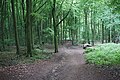
 Path in Standish Wood - geograph.org.uk - 986269.jpg 480 × 640 ; 135 kio
-
 Path Junction on the Cotswold Way - geograph.org.uk - 986299.jpg 640 × 480 ; 130 kio
-

-
 Postbox and parish noticeboard, Stroud Green - geograph.org.uk - 3272521.jpg 640 × 432 ; 74 kio
-
 Reduce Speed Now, Gloucester Road, Standish - geograph.org.uk - 5908208.jpg 1 024 × 754 ; 199 kio
-
 Rejoining the Cotswold Way in Randwick Wood - geograph.org.uk - 3443984.jpg 800 × 600 ; 165 kio
-
 Remains of a shelter in Standish Wood - geograph.org.uk - 1125590.jpg 640 × 426 ; 120 kio
-
 Right of way above Standish - geograph.org.uk - 1123684.jpg 426 × 640 ; 116 kio
-
 Ripening barley - geograph.org.uk - 5473037.jpg 1 600 × 901 ; 670 kio
-
 Road ESE of Moreton Hill Farm, Standish - geograph.org.uk - 3582353.jpg 800 × 653 ; 190 kio
-
 Road junction at Stroud Green - geograph.org.uk - 5199469.jpg 800 × 600 ; 169 kio
-
 Road junction at Stroud Green - geograph.org.uk - 5858667.jpg 1 954 × 1 402 ; 1,54 Mio
-

-
 Road to Harescombe and Haresfield - geograph.org.uk - 3296795.jpg 640 × 446 ; 103 kio
-
 Road to Stonehouse from Moreton Hill, Standish - geograph.org.uk - 3582525.jpg 800 × 518 ; 143 kio
-
 Robbers Road at Ash Lane - geograph.org.uk - 3444011.jpg 800 × 600 ; 168 kio
-
 Round barrow on Standish Wood.jpg 4 896 × 3 264 ; 12,48 Mio
-
 Samaritans' sign on railway bridge - geograph.org.uk - 4195575.jpg 800 × 451 ; 217 kio
-
 SE boundary of Standish - geograph.org.uk - 3582661.jpg 800 × 544 ; 149 kio
-
 Severn and Stonehouse from the Cotswold Way-Glos - geograph.org.uk - 3580995.jpg 3 264 × 2 448 ; 2,36 Mio
-
 Sheltering cows on Bunker's Bank - geograph.org.uk - 5056033.jpg 6 000 × 4 000 ; 6,09 Mio
-
 Silage bales - geograph.org.uk - 4737952.jpg 800 × 531 ; 137 kio
-
 Some light has penetrated Standish Wood - geograph.org.uk - 5056325.jpg 6 000 × 4 000 ; 5,28 Mio
-
 Stagholt Farm - geograph.org.uk - 4698849.jpg 2 587 × 1 400 ; 598 kio
-
 Standish Lane, Standish - geograph.org.uk - 3295498.jpg 640 × 456 ; 92 kio
-
 Standish Park - geograph.org.uk - 4195688.jpg 800 × 451 ; 198 kio
-
 Standish stubble field - geograph.org.uk - 4195588.jpg 800 × 451 ; 207 kio
-
 Standish Wood - geograph.org.uk - 1125519.jpg 640 × 426 ; 122 kio
-
 Standish, Gloucester Road - geograph.org.uk - 5874675.jpg 800 × 600 ; 737 kio
-
 Standish, view towards the church, from the train - geograph.org.uk - 3380065.jpg 1 024 × 718 ; 75 kio
-
 Stocks Barn, Gloucester Road, Standish near Stonehouse - geograph.org.uk - 5908160.jpg 1 024 × 778 ; 199 kio
-
 Stone Marker in Standish Woods.jpg 3 264 × 4 896 ; 10,67 Mio
-
 Stroud District , M5 Motorway - geograph.org.uk - 5951360.jpg 6 000 × 4 000 ; 6,06 Mio
-
 The Bank of the Standish Wood Cross Dyke.jpg 4 896 × 3 264 ; 11,59 Mio
-
 The beginning of the footpath to Moreton Valence - geograph.org.uk - 3379266.jpg 1 024 × 768 ; 255 kio
-
 The Bronze Age Round Barrows of Standish Wood.jpg 4 896 × 3 264 ; 12,24 Mio
-
 The Cotswold Way and the Topograph - geograph.org.uk - 3443636.jpg 800 × 600 ; 159 kio
-
 The Cotswold Way at Bunker's Bank - geograph.org.uk - 3443561.jpg 800 × 600 ; 126 kio
-
 The Cotswold Way at Bunker's Bank - geograph.org.uk - 3443610.jpg 800 × 600 ; 131 kio
-
 The Cotswold Way at Robbers Road - geograph.org.uk - 3444004.jpg 800 × 600 ; 181 kio
-
 The Cotswold Way at Shortwood - geograph.org.uk - 3443626.jpg 800 × 600 ; 151 kio
-
 The Cotswold Way from Ash Lane - geograph.org.uk - 3444020.jpg 800 × 600 ; 152 kio
-
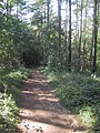
 The Cotswold Way in Standish Wood - geograph.org.uk - 3443655.jpg 800 × 600 ; 133 kio
-
 The Cotswold Way in Standish Wood - geograph.org.uk - 3443673.jpg 800 × 600 ; 130 kio
-
 The Cotswold Way in Standish Wood - geograph.org.uk - 3443678.jpg 800 × 600 ; 135 kio
-
 The Cotswold Way in Standish Wood - geograph.org.uk - 3443689.jpg 800 × 600 ; 134 kio
-
 The Cotswold Way in Standish Wood - geograph.org.uk - 3443705.jpg 800 × 600 ; 149 kio
-
 The Cotswold Way in Standish Wood - geograph.org.uk - 5056259.jpg 6 000 × 4 000 ; 5,08 Mio
-
 The Cotswold Way in Standish Wood - geograph.org.uk - 5490501.jpg 3 776 × 2 520 ; 3,12 Mio
-
 The Cotswold Way leaves Maiden Hill - geograph.org.uk - 3444398.jpg 800 × 600 ; 154 kio
-
 The Cotswold Way on Maiden Hill - geograph.org.uk - 3444088.jpg 800 × 600 ; 172 kio
-
 The Cotswold Way on Maiden Hill - geograph.org.uk - 3444096.jpg 800 × 600 ; 154 kio
-
 The Cotswold Way through Standish Wood - geograph.org.uk - 986290.jpg 480 × 640 ; 137 kio
-
 The Cotswold Way towards Shortwood - geograph.org.uk - 3443620.jpg 800 × 600 ; 189 kio
-
 The Cotswold Way towards Shortwood - geograph.org.uk - 3443640.jpg 800 × 600 ; 135 kio
-
 The Horned Entrance of Randwick Long Barrow.jpg 4 896 × 3 264 ; 11,3 Mio
-
 The Northern Side of Randwick Long Barrow.jpg 4 896 × 3 264 ; 12,37 Mio
-
 The south-western side of Maiden Hill - geograph.org.uk - 5056425.jpg 6 000 × 4 000 ; 3,86 Mio
-
 The Top of Randwick Long Barrow.jpg 3 264 × 4 896 ; 11,3 Mio
-
 The view from Ring Hill - geograph.org.uk - 3443507.jpg 800 × 600 ; 149 kio
-
 Thieves Lane - geograph.org.uk - 5056366.jpg 6 000 × 4 000 ; 4,77 Mio
-
 Three electricity poles in a field, Standish - geograph.org.uk - 3281302.jpg 640 × 476 ; 104 kio
-
 Time for an ice cream - geograph.org.uk - 3443646.jpg 800 × 600 ; 162 kio
-
 Topograph on Haresfield Hill - geograph.org.uk - 5056032.jpg 5 760 × 3 670 ; 4,08 Mio
-
 Towards Moreton Hill Care Centre, Standish - geograph.org.uk - 3582417.jpg 799 × 800 ; 226 kio
-
 Track and footpath - geograph.org.uk - 4195530.jpg 800 × 451 ; 207 kio
-
 Track by the railway - geograph.org.uk - 3379282.jpg 1 024 × 768 ; 211 kio
-
-

-
 Track past the northern edge of Brisbane, Stonehouse - geograph.org.uk - 6428204.jpg 1 024 × 748 ; 227 kio
-
 Track through Farmland off Gloucester Road - geograph.org.uk - 5874681.jpg 800 × 600 ; 957 kio
-
 Tree-lined access road to Standish Hospital - geograph.org.uk - 3358757.jpg 640 × 534 ; 138 kio
-

-
 Trees in the afternoon - Randwick, Gloucestershire - geograph.org.uk - 4089928.jpg 2 101 × 2 304 ; 2,41 Mio
-
 Trees on the escarpment - geograph.org.uk - 5056251.jpg 6 000 × 4 000 ; 5,01 Mio
-

-
 Type 4 Diesel on Up 'Devonian' north of Standish Junction, 1961 - geograph.org.uk - 5603949.jpg 2 106 × 1 322 ; 1,23 Mio
-

-
 View of Landscape from the Standish Wood Cross Dyke.jpg 4 729 × 3 158 ; 11,47 Mio
-
 View to Standish Wood - geograph.org.uk - 4192169.jpg 800 × 451 ; 211 kio
-
 View towards Stonehouse - geograph.org.uk - 3867293.jpg 1 600 × 1 063 ; 363 kio
-


