Category:Stanfield, Norfolk
Vai alla navigazione
Vai alla ricerca
village and civil parish in Norfolk, United Kingdom  | |||||
| Carica un file multimediale | |||||
| Istanza di | |||||
|---|---|---|---|---|---|
| Luogo | Breckland, Norfolk, Est dell'Inghilterra, Inghilterra | ||||
| Superficie |
| ||||
 | |||||
Sottocategorie
Questa categoria contiene le 3 sottocategorie indicate di seguito, su un totale di 3.
E
N
S
File nella categoria "Stanfield, Norfolk"
Questa categoria contiene 22 file, indicati di seguito, su un totale di 22.
-
 Neale(1818) p3.090 - Stanfield Hall, Norfolk.jpg 1 872 × 1 273; 540 KB
-
 B1145 with Manor Farm on the right - geograph.org.uk - 4562250.jpg 640 × 480; 150 KB
-
 B1146 north of East Bilney - geograph.org.uk - 5015217.jpg 2 137 × 1 370; 1,76 MB
-
 B1146 with 7 miles to Fakenham - geograph.org.uk - 5015228.jpg 1 987 × 1 338; 1,77 MB
-
 Cable laying near Stanfield, Norfolk (for Dudgeon Wind Farm) - geograph.org.uk - 4696313.jpg 4 320 × 3 240; 5,77 MB
-
 Church and graveyard in Stanfield, Norfolk - geograph.org.uk - 4695827.jpg 4 320 × 3 240; 5,51 MB
-
 Church Lane, Stanfield - geograph.org.uk - 2983152.jpg 1 024 × 768; 153 KB
-
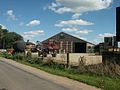
 Converted farm buildings Stansfield - geograph.org.uk - 6391545.jpg 800 × 533; 150 KB
-
 Crossroads north of Mileham - geograph.org.uk - 4127805.jpg 4 320 × 3 240; 4,29 MB
-
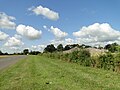
 Farmland west of Stanfield, Norfolk - geograph.org.uk - 4695842.jpg 4 320 × 3 240; 5,72 MB
-
 Hall Farm, Stanfield - geograph.org.uk - 45388.jpg 640 × 480; 65 KB
-
 Overgrown track at Stanfield - geograph.org.uk - 2983163.jpg 1 024 × 768; 239 KB
-
 S Margaret's church Stanfield - geograph.org.uk - 4127939.jpg 4 320 × 3 240; 2,9 MB
-
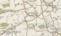 Stanfield map.PNG 539 × 321; 368 KB
-
 Stanfield St Margaret's church - geograph.org.uk - 2280937.jpg 760 × 570; 261 KB
-
 The sign says-"Valken Wire Fox Terriers" - geograph.org.uk - 524956.jpg 640 × 480; 110 KB
-
 Track to Home Farm, Bittering - geograph.org.uk - 505078.jpg 640 × 427; 86 KB
-
 Tuttle Farm - geograph.org.uk - 6391561.jpg 800 × 533; 82 KB
-
 Water tower and industrial units - geograph.org.uk - 4127967.jpg 4 320 × 3 240; 4,27 MB
-
 Water tower near Stanfield - geograph.org.uk - 5300785.jpg 523 × 640; 194 KB
-
 Wheat field near Stanfield - geograph.org.uk - 504686.jpg 640 × 427; 91 KB
-
 Wicken Farm - geograph.org.uk - 504957.jpg 640 × 427; 71 KB
_p3.090_-_Stanfield_Hall,_Norfolk.jpg)


_-_geograph.org.uk_-_4696313.jpg)


