Category:Stanion
Vai alla navigazione
Vai alla ricerca
village and civil parish in Northamptonshire, England, UK .jpg) | |||||
| Carica un file multimediale | |||||
| Istanza di | |||||
|---|---|---|---|---|---|
| Luogo | North Northamptonshire, Northamptonshire, Midlands Orientali, Inghilterra | ||||
 | |||||
Sottocategorie
Questa categoria contiene un'unica sottocategoria, indicata di seguito.
P
File nella categoria "Stanion"
Questa categoria contiene 47 file, indicati di seguito, su un totale di 47.
-
 'Clay Dick' track - geograph.org.uk - 363417.jpg 640 × 480; 134 KB
-
 A "Lunar Landscape". - geograph.org.uk - 443543.jpg 640 × 480; 89 KB
-
 A4300 junction near Little Oakley - geograph.org.uk - 6255008.jpg 1 024 × 768; 126 KB
-
 Bridleway to Corby - geograph.org.uk - 461912.jpg 640 × 428; 113 KB
-
 Brigstock Road leaving Corby - geograph.org.uk - 6200508.jpg 1 878 × 1 214; 1,65 MB
-
 Cycle and foot path, A6116 - geograph.org.uk - 323670.jpg 640 × 480; 67 KB
-
 Entrance to (closed^) recycling plant - geograph.org.uk - 6254959.jpg 1 024 × 768; 205 KB
-
 Footpath through the churchyard, Stanion - geograph.org.uk - 6254964.jpg 1 024 × 768; 184 KB
-
 Holiday Inn Corby - geograph.org.uk - 1428150.jpg 640 × 480; 91 KB
-
 New junction on Stamford Road, Corby - geograph.org.uk - 6198557.jpg 1 920 × 1 280; 1,17 MB
-
 Postbox, Stanion - geograph.org.uk - 2122856.jpg 480 × 640; 72 KB
-
 Stamford Road Corby - geograph.org.uk - 1428161.jpg 640 × 480; 66 KB
-

-
 UK Stanion-2.jpg 777 × 669; 133 KB
-
 UK Stanion.jpg 777 × 1 669; 352 KB
-
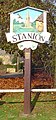
 Village sign, Stanion (geograph 2122845).jpg 480 × 640; 125 KB
-
 Warren Lane (geograph 3627998).jpg 640 × 478; 54 KB
-
 Weldon Landfill Site III, borehole - geograph.org.uk - 324381.jpg 640 × 480; 100 KB
-
 A Peaceful Lane. - geograph.org.uk - 443548.jpg 640 × 480; 108 KB
-
 Approaching Old Lodge Farm - geograph.org.uk - 363560.jpg 640 × 480; 54 KB
-
 Bridleway north of Brigstock - geograph.org.uk - 323719.jpg 640 × 480; 80 KB
-

-
 Byway west of Chase Farm - geograph.org.uk - 363365.jpg 640 × 480; 124 KB
-
 Chase Farm, near Brigstock - geograph.org.uk - 363348.jpg 640 × 480; 133 KB
-
 Cleared land on the edge of Corby - geograph.org.uk - 499558.jpg 640 × 480; 100 KB
-
 Culverts beneath the A6116 - geograph.org.uk - 323682.jpg 640 × 480; 136 KB
-
 Dusthill Road, Brigstock - geograph.org.uk - 363330.jpg 640 × 480; 75 KB
-
 Footpath junction with Dusthill road - geograph.org.uk - 363309.jpg 640 × 480; 74 KB
-
 Geddington Chase Wood (northern end) - geograph.org.uk - 363380.jpg 640 × 480; 136 KB
-
 Great Weldon High Street - geograph.org.uk - 533687.jpg 640 × 427; 67 KB
-
 Harper's Brook - geograph.org.uk - 323662.jpg 640 × 480; 87 KB
-
 Hedgerow on footpath to Brigstock - geograph.org.uk - 363578.jpg 640 × 480; 79 KB
-
 High Street - geograph.org.uk - 533673.jpg 640 × 427; 78 KB
-
 High Street - geograph.org.uk - 533675.jpg 640 × 427; 56 KB
-
 Industrial Development. - geograph.org.uk - 443538.jpg 640 × 480; 93 KB
-
 Little lane, Stanion - geograph.org.uk - 323651.jpg 640 × 480; 91 KB
-
 New cars at Eurohub central - geograph.org.uk - 351553.jpg 640 × 426; 97 KB
-
 New housing, Stanion - geograph.org.uk - 323656.jpg 640 × 480; 59 KB
-
 Park Farm, near Brigstock - geograph.org.uk - 363586.jpg 640 × 480; 45 KB
-
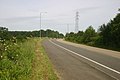
 Power lines - geograph.org.uk - 375701.jpg 640 × 480; 72 KB
-
 Road down to Weldon landfill site - geograph.org.uk - 472239.jpg 640 × 425; 61 KB
-

-
 Road up to Euro Hub - geograph.org.uk - 471565.jpg 640 × 425; 67 KB
-
 Stanion's village sign - geograph.org.uk - 319908.jpg 640 × 428; 99 KB
-
 Weldon Landfill Site I, southern end - geograph.org.uk - 324368.jpg 640 × 480; 61 KB
-
 Weldon Landfill Site II - geograph.org.uk - 324374.jpg 640 × 480; 68 KB
-


_recycling_plant_-_geograph.org.uk_-_6254959.jpg)


.jpg)
.jpg)


_-_geograph.org.uk_-_363380.jpg)


