Category:Stanton in Peak
Aller à la navigation
Aller à la recherche
Article Wikipédia principal : Stanton in Peak.

village britannique  | |||||
| Téléverser des médias | |||||
| Nature de l’élément | |||||
|---|---|---|---|---|---|
| Lieu | Stanton, Derbyshire Dales, Derbyshire, Midlands de l'Est, Angleterre | ||||
 | |||||
Sous-catégories
Cette catégorie comprend 2 sous-catégories, dont les 2 ci-dessous.
H
- Holy Trinity, Stanton in Peak (15 F)
Média dans la catégorie « Stanton in Peak »
Cette catégorie comprend 64 fichiers, dont les 64 ci-dessous.
-
 A Ring with a View - geograph.org.uk - 87889.jpg 640 × 480 ; 290 kio
-
 Abandoned Millstones - geograph.org.uk - 3876.jpg 640 × 427 ; 123 kio
-
 Car Park for Chapel visitors - geograph.org.uk - 1336135.jpg 640 × 480 ; 105 kio
-
 Cottages, Stanton in Peak.jpg 6 000 × 4 000 ; 4,69 Mio
-
 Delphiniums and housing, Stanton-in-Peak - geograph.org.uk - 3561216.jpg 3 342 × 2 674 ; 1,83 Mio
-
 Descending into Stanton in Peak - geograph.org.uk - 2331155.jpg 479 × 640 ; 359 kio
-
 End of an era at Shiningbank Quarry - geograph.org.uk - 288057.jpg 638 × 480 ; 186 kio
-
 Footpath to Stanton Hall - geograph.org.uk - 299465.jpg 640 × 480 ; 173 kio
-
 Gate near Stanton Moor - geograph.org.uk - 584129.jpg 640 × 426 ; 40 kio
-
 Grim Gargoyle - geograph.org.uk - 599680.jpg 507 × 640 ; 48 kio
-
 Hillside cottage at Stanton Lees - geograph.org.uk - 1454503.jpg 640 × 480 ; 147 kio
-
 Holly House, Stanton in Peak.JPG 1 000 × 820 ; 163 kio
-
 Ivy-Covered Street Lamp - geograph.org.uk - 1218487.jpg 427 × 640 ; 165 kio
-
 Looking into an abandoned quarry - geograph.org.uk - 584108.jpg 640 × 426 ; 73 kio
-
 Lost your way? Stanton Peak, Derbyshire (3549473504).jpg 806 × 527 ; 68 kio
-
 Milestone, Stoney Ley Woods.jpg 640 × 418 ; 116 kio
-
 Near Birchover. - geograph.org.uk - 136207.jpg 640 × 480 ; 126 kio
-
 Old quarry buildings - geograph.org.uk - 584104.jpg 640 × 426 ; 60 kio
-
 Old stables and workshops - geograph.org.uk - 288024.jpg 640 × 480 ; 112 kio
-
 Over the crest of the hill - geograph.org.uk - 1454513.jpg 640 × 480 ; 92 kio
-
 Painted Gate, by Endcliffe Quarry - geograph.org.uk - 1330023.jpg 640 × 480 ; 131 kio
-
 Pilhough - Pilhough Road - geograph.org.uk - 959805.jpg 640 × 480 ; 85 kio
-
 Pilhough - Postbox marks the top of Peak Tor Lane - geograph.org.uk - 959899.jpg 640 × 480 ; 124 kio
-
 Pilhough - Road Junction - geograph.org.uk - 960305.jpg 640 × 480 ; 72 kio
-
 Pilhough - Telephone Box on Pilhough Road - geograph.org.uk - 959809.jpg 640 × 480 ; 135 kio
-
 Pilhough Road - Junction - geograph.org.uk - 959819.jpg 640 × 480 ; 114 kio
-
 Pilhough Road - View across fields - geograph.org.uk - 960319.jpg 640 × 480 ; 87 kio
-

-
 Polite Notice at Stanton Lees - geograph.org.uk - 1336120.jpg 640 × 480 ; 135 kio
-
 Rhododendron Ponticum, near Stanton Woodhouse - geograph.org.uk - 1330001.jpg 640 × 480 ; 125 kio
-
 Rush hour at Stanton-in-Peak - geograph.org.uk - 4642398.jpg 640 × 480 ; 100 kio
-
 Rush hour in Stanton Lees - geograph.org.uk - 4642372.jpg 640 × 480 ; 86 kio
-
 Smithy Cottage, Stanton in Peak - geograph.org.uk - 3561010.jpg 3 648 × 2 736 ; 2,35 Mio
-
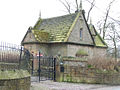 Stanton hall lodge.jpg 640 × 480 ; 121 kio
-
 Stanton in Peak (7648773900).jpg 4 576 × 3 056 ; 2,72 Mio
-
 Stanton in Peak - Birchover Road - geograph.org.uk - 959840.jpg 640 × 480 ; 74 kio
-
 Stanton in Peak - Dale View Quarry Entrance - geograph.org.uk - 959827.jpg 640 × 480 ; 72 kio
-
 Stanton in Peak - geograph.org.uk - 2748701.jpg 4 000 × 3 000 ; 2,51 Mio
-
 Stanton in Peak - geograph.org.uk - 2893884.jpg 1 280 × 856 ; 261 kio
-
 Stanton in Peak - Road Junction - geograph.org.uk - 959831.jpg 640 × 480 ; 72 kio
-
 Stanton in Peak Cricket Club - geograph.org.uk - 3201406.jpg 4 000 × 3 000 ; 2,3 Mio
-
 Stanton Lees Chapel - geograph.org.uk - 1199818.jpg 640 × 427 ; 87 kio
-
 The Flying Childers - geograph.org.uk - 5865312.jpg 1 024 × 683 ; 191 kio
-
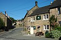 The Flying Childers Inn at Stanton in Peak - geograph.org.uk - 768955.jpg 640 × 426 ; 88 kio
-
 The Flying Childers Inn, Stanton in Peak - geograph.org.uk - 2893913.jpg 1 280 × 856 ; 281 kio
-
 The Flying Childers Inn, Stanton in the Peak, Derbyshire - geograph.org.uk - 1988854.jpg 1 024 × 768 ; 208 kio
-
 The Flying Childers, Stanton in Peak.jpg 1 600 × 1 200 ; 455 kio
-
 The Lodge, Stanton Hall.jpg 4 000 × 3 000 ; 4,85 Mio
-
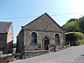 The old Wesleyan Chapel in Stanton in Peak - geograph.org.uk - 3561005.jpg 3 648 × 2 736 ; 2,23 Mio
-
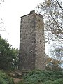 The Reform Tower - geograph.org.uk - 1711119.jpg 480 × 640 ; 93 kio
-
 Tin roof barn - geograph.org.uk - 1336116.jpg 640 × 473 ; 121 kio
-
 Village street at Stanton in Peak - geograph.org.uk - 5865316.jpg 1 024 × 683 ; 215 kio
-
 Nine Ladies - geograph.org.uk - 988.jpg 640 × 436 ; 61 kio
-
 Nine Ladies Stone Circle - geograph.org.uk - 109668.jpg 640 × 307 ; 128 kio
-
 Nine Ladies stone circle - geograph.org.uk - 112575.jpg 640 × 350 ; 72 kio
-
 Old Bridge over River Lathkill - geograph.org.uk - 34454.jpg 640 × 467 ; 115 kio
-
 Pilhough Cottages - geograph.org.uk - 87890.jpg 640 × 480 ; 201 kio
-
 Reform Tower - geograph.org.uk - 203504.jpg 480 × 640 ; 152 kio
-
 River Bradford. - geograph.org.uk - 110508.jpg 640 × 480 ; 173 kio
-
 River in Spate at Congreave - geograph.org.uk - 87891.jpg 640 × 480 ; 239 kio
-
 Robin Hood's Stride and Cratcliffe - geograph.org.uk - 6869.jpg 450 × 600 ; 122 kio
-
 The Cork Stone - geograph.org.uk - 21122.jpg 640 × 480 ; 85 kio
-
 The Reform Tower in Autumn - geograph.org.uk - 584436.jpg 426 × 640 ; 41 kio
-
 View from the B5056 road. - geograph.org.uk - 110656.jpg 640 × 480 ; 115 kio


.jpg)


.jpg)


