Category:Stanwix Rural
Aller à la navigation
Aller à la recherche
English: Stanwix Rural is a civil parish in the City of Carlisle in Cumbria, England immediately to the north east of Carlisle itself. Parts of the Carlisle urban area are in the parish which, at the 2001 census, had a population of 3,043.
localité britannique du comté anglais de Cumbria  | |||||
| Téléverser des médias | |||||
| Nature de l’élément | |||||
|---|---|---|---|---|---|
| Lieu | cité de Carlisle, Cumbria, Angleterre du Nord-Ouest, Angleterre | ||||
 | |||||
Sous-catégories
Cette catégorie comprend 14 sous-catégories, dont les 14 ci-dessous.
B
- Brunstock (2 F)
C
E
- Eden Grove, Carlisle (3 F)
H
L
- Linstock Bridge (over M6) (7 F)
M
- Millbrooke Bridge (2 F)
P
- Park Broom (6 F)
R
S
- St John's Bridge, Cumbria (2 F)
T
- Tarraby (4 F)
W
- Walby (2 F)
Média dans la catégorie « Stanwix Rural »
Cette catégorie comprend 310 fichiers, dont les 200 ci-dessous.
(page précédente) (page suivante)-

-

-

-

-
 "The Beast from the East" hits Houghton - February 2018 (5) - geograph.org.uk - 5694551.jpg 1 250 × 886 ; 1,27 Mio
-

-

-
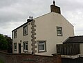 'Garthside', on south side of A689 - geograph.org.uk - 6188476.jpg 1 024 × 786 ; 111 kio
-
 'Old Vicarage', High Crosby - geograph.org.uk - 6187975.jpg 1 024 × 683 ; 183 kio
-
 'The Beeches' beside minor road to Linstock - geograph.org.uk - 6272019.jpg 1 024 × 683 ; 320 kio
-
 A field of bales - geograph.org.uk - 4115835.jpg 4 608 × 3 456 ; 6,4 Mio
-
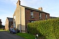
 A house in Rickerby - geograph.org.uk - 6445716.jpg 2 000 × 1 185 ; 2,88 Mio
-
 A sculpture at Rickerby House - geograph.org.uk - 2885926.jpg 600 × 800 ; 200 kio
-
 A thatched cottage at Linstock - geograph.org.uk - 5488654.jpg 640 × 480 ; 353 kio
-
 A tree sculpture at Rickerby House - geograph.org.uk - 3494142.jpg 2 592 × 1 944 ; 2,35 Mio
-
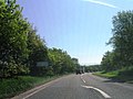
 A689 approaching Houghton - geograph.org.uk - 3477283.jpg 640 × 334 ; 56 kio
-
 A689 at Crosby-on-Eden - geograph.org.uk - 3870980.jpg 1 280 × 857 ; 1,23 Mio
-
 A689 at Crosbymoor - geograph.org.uk - 3871040.jpg 1 024 × 619 ; 152 kio
-
 A689 eastbound - geograph.org.uk - 3494920.jpg 640 × 480 ; 55 kio
-
 A689 eastbound - geograph.org.uk - 3494927.jpg 640 × 480 ; 72 kio
-
 A689 eastbound - geograph.org.uk - 3494945.jpg 640 × 496 ; 92 kio
-
 A689 eastbound - geograph.org.uk - 3494949.jpg 640 × 560 ; 60 kio
-
 A689 eastbound - geograph.org.uk - 3494972.jpg 640 × 480 ; 58 kio
-
 A689 eastbound - geograph.org.uk - 3494981.jpg 640 × 480 ; 44 kio
-
 A689 eastbound - geograph.org.uk - 3494987.jpg 640 × 480 ; 60 kio
-
 A689 Eastbound - geograph.org.uk - 5068432.jpg 640 × 427 ; 347 kio
-
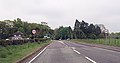
 A689 roundabout at Old Grove - geograph.org.uk - 3477294.jpg 640 × 416 ; 75 kio
-
 A689 towards Brampton - geograph.org.uk - 6358745.jpg 800 × 600 ; 77 kio
-
 Activities at Walby Farm Park - geograph.org.uk - 5049665.jpg 640 × 427 ; 245 kio
-
 An entrance to Rickerby House - geograph.org.uk - 2885910.jpg 800 × 600 ; 148 kio
-
 An old farm trailer - geograph.org.uk - 5159034.jpg 640 × 480 ; 330 kio
-
 Antinousmedaiilon Carlisle-Stanwix.png 921 × 902 ; 53 kio
-
 Approaching junction 44 on the M6 northbound - geograph.org.uk - 2717574.jpg 2 657 × 1 978 ; 715 kio
-
 Approaching junction for Crosby - geograph.org.uk - 3477298.jpg 640 × 261 ; 34 kio
-
 Approaching junction on the A689, Houghton - geograph.org.uk - 6358746.jpg 800 × 573 ; 79 kio
-
 Autumn field off the A689 near Houghton - geograph.org.uk - 6358743.jpg 800 × 600 ; 131 kio
-
 B6264 ahead - geograph.org.uk - 6227124.jpg 1 024 × 768 ; 124 kio
-
 Bales of Hay by Hadrian's Wall Path - geograph.org.uk - 4115742.jpg 4 608 × 3 456 ; 6,45 Mio
-
 Barley crop at Wall Dub - geograph.org.uk - 855948.jpg 640 × 480 ; 83 kio
-
 Barley field at Wall Dub - geograph.org.uk - 855945.jpg 640 × 480 ; 86 kio
-
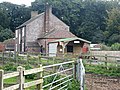
 Barn and old farm buildings, Newfieldhead - geograph.org.uk - 5159032.jpg 640 × 427 ; 297 kio
-
 Barn, Linstock - geograph.org.uk - 5940432.jpg 2 000 × 1 333 ; 385 kio
-
 Benchmark on Bramblewood, Stile Farm - geograph.org.uk - 6272025.jpg 1 024 × 683 ; 269 kio
-
 Benchmark on gatepost at entrance to The Beeches - geograph.org.uk - 6272013.jpg 683 × 1 024 ; 197 kio
-
 Benchmark on old boys' school in Rickerby - geograph.org.uk - 6271820.jpg 1 024 × 653 ; 139 kio
-
 Blaylock Riggs Common - geograph.org.uk - 5159036.jpg 640 × 480 ; 344 kio
-
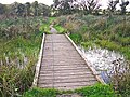 Boardwalk across a pond - geograph.org.uk - 5666590.jpg 640 × 480 ; 391 kio
-
 Boardwalk around wetland, Gosling Sike Farm - geograph.org.uk - 5666586.jpg 640 × 480 ; 354 kio
-
 Bramblewood, Stile Farm - geograph.org.uk - 6272030.jpg 1 024 × 678 ; 197 kio
-
 Brick building on the edge of Linstock - geograph.org.uk - 5940393.jpg 2 000 × 1 333 ; 464 kio
-
 Bridge over the M6 near Houghton - geograph.org.uk - 5725738.jpg 640 × 427 ; 325 kio
-
 Bridge over the Southbound M6 - geograph.org.uk - 6005733.jpg 800 × 533 ; 672 kio
-
 Brompton Old Road heading NE - geograph.org.uk - 6187940.jpg 1 024 × 683 ; 297 kio
-
 Brunstock Beck - geograph.org.uk - 4323366.jpg 449 × 640 ; 133 kio
-
 Brunstock Farmhouse - geograph.org.uk - 5053151.jpg 640 × 480 ; 291 kio
-
 BS Zwischenturm Kastell Stanwix.png 1 685 × 1 107 ; 155 kio
-
 Bungalow at Newby Grange - geograph.org.uk - 3870057.jpg 1 024 × 686 ; 149 kio
-
 Bungalows at Park Broom - geograph.org.uk - 5488675.jpg 640 × 480 ; 333 kio
-
 Bus shelter and a courtyard, Green Lane, Low Crosby - geograph.org.uk - 6445882.jpg 2 000 × 1 131 ; 1,8 Mio
-
 Bus shelter, east side, Houghton Road - geograph.org.uk - 4731175.jpg 1 024 × 768 ; 116 kio
-
 Bus stop alongside the A689 - geograph.org.uk - 3870999.jpg 1 280 × 857 ; 1,44 Mio
-
 Bus stop and shelter on Houghton Road, Houghton - geograph.org.uk - 6358770.jpg 800 × 548 ; 172 kio
-
 Bus stop on Houghton Road, Houghton - geograph.org.uk - 6358782.jpg 800 × 600 ; 108 kio
-
 Carlisle Airport - geograph.org.uk - 3182057.jpg 3 264 × 2 448 ; 2,85 Mio
-
 Carlisle Driving Range - geograph.org.uk - 5159025.jpg 640 × 427 ; 260 kio
-
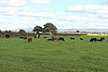 Cattle grazing east of Moor House - geograph.org.uk - 5940448.jpg 2 000 × 1 333 ; 330 kio
-
 Centurions Walk, Carlisle - geograph.org.uk - 5938551.jpg 2 000 × 1 333 ; 450 kio
-
 Church Street, Stanwix, Carlisle - geograph.org.uk - 2182539.jpg 640 × 480 ; 209 kio
-
 City of Carlisle , The M6 Motorway - geograph.org.uk - 4939801.jpg 6 000 × 4 000 ; 6,21 Mio
-
 City of Carlisle , The M6 Motorway - geograph.org.uk - 4939804.jpg 6 000 × 4 000 ; 6,62 Mio
-
 City of Carlisle , The M6 Motorway - geograph.org.uk - 4939807.jpg 6 000 × 4 000 ; 6,43 Mio
-
 Communication in Rickerby - geograph.org.uk - 5943166.jpg 1 333 × 2 000 ; 534 kio
-
 Contrails at sunset - Carlisle - March 2017 - geograph.org.uk - 5329026.jpg 7 360 × 3 393 ; 889 kio
-
 Cottages on lane to Scaleby - geograph.org.uk - 3550190.jpg 640 × 481 ; 99 kio
-
 Course of Hadrian's Wall - geograph.org.uk - 3871066.jpg 1 280 × 857 ; 1,25 Mio
-
 Crosby Lodge Hotel - geograph.org.uk - 1181507.jpg 640 × 480 ; 71 kio
-
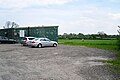
 Crosby Moor Garage - geograph.org.uk - 3871036.jpg 1 280 × 857 ; 1,03 Mio
-
 Crossing over the A689 near Crosby-on-Eden - geograph.org.uk - 2886144.jpg 800 × 600 ; 102 kio
-
 Crossing over the M6 by Linstock Bridge - geograph.org.uk - 2885940.jpg 800 × 600 ; 98 kio
-

-
 Cut grass crop at Whitrigg House Farm - geograph.org.uk - 855957.jpg 640 × 480 ; 76 kio
-
 Decaying farm buildings, Newfieldhead - geograph.org.uk - 5159033.jpg 640 × 427 ; 321 kio
-
 DIY tearoom at High Crosby Farm - geograph.org.uk - 983216.jpg 640 × 480 ; 112 kio
-
 Drive to Rickerby Hall - geograph.org.uk - 5943173.jpg 2 000 × 1 333 ; 673 kio
-
 Eden Valley Farmland - geograph.org.uk - 4323383.jpg 640 × 442 ; 83 kio
-
 Embankment by the M6 - geograph.org.uk - 3152319.jpg 640 × 430 ; 56 kio
-
 Entering Houghton - geograph.org.uk - 6358752.jpg 800 × 600 ; 78 kio
-
 Entrance to 'Old Grove' from A689 - geograph.org.uk - 6187962.jpg 1 024 × 683 ; 243 kio
-
 Entrance to Hadrian's Park, Carlisle - geograph.org.uk - 5938554.jpg 2 000 × 1 333 ; 471 kio
-
 Fairholme Poultry Farm - currently vacant - geograph.org.uk - 5049668.jpg 640 × 480 ; 344 kio
-
 Farm buildings at Edenlin - geograph.org.uk - 5938569.jpg 2 000 × 1 333 ; 461 kio
-
 Farm buildings at Linstock - geograph.org.uk - 5940387.jpg 2 000 × 1 333 ; 454 kio
-
 Farmland and buildings - geograph.org.uk - 3870079.jpg 1 280 × 857 ; 1,36 Mio
-
 Farmland by the M6 - geograph.org.uk - 3152329.jpg 640 × 430 ; 38 kio
-
 Farmland east of Tarraby (1) - geograph.org.uk - 4731168.jpg 1 024 × 768 ; 156 kio
-
 Farmland east of Tarraby (2) - geograph.org.uk - 4731169.jpg 1 024 × 768 ; 201 kio
-
 Farmland east of Tarraby (3) - geograph.org.uk - 4731171.jpg 1 024 × 768 ; 192 kio
-
 Field east of Moor House - geograph.org.uk - 5943154.jpg 2 000 × 1 333 ; 580 kio
-
 Field near Houghton - geograph.org.uk - 6358748.jpg 800 × 600 ; 99 kio
-
 Field off Brampton Old Road, Carlisle - geograph.org.uk - 5938549.jpg 2 000 × 1 333 ; 447 kio
-
 Fields south-west of Linstock - geograph.org.uk - 3494116.jpg 2 592 × 1 944 ; 1,65 Mio
-
 Foot-cycle path over Brunstock Beck - geograph.org.uk - 3314948.jpg 1 024 × 685 ; 336 kio
-
 Footbridge across Gosling Sike - geograph.org.uk - 5159054.jpg 640 × 480 ; 386 kio
-
 Footbridge over A689 north of Crosby on Eden - geograph.org.uk - 3477302.jpg 640 × 375 ; 41 kio
-
 Footpath crossing a ditch - geograph.org.uk - 5940374.jpg 2 000 × 1 333 ; 656 kio
-
 Footpath gate north west of Tarraby - geograph.org.uk - 5938540.jpg 1 333 × 2 000 ; 687 kio
-
 Former "The Far Boot Inn", Houghton - February 2018 (1) - geograph.org.uk - 5672149.jpg 1 250 × 1 039 ; 997 kio
-
 Former "The Far Boot Inn", Houghton - February 2018 (2) - geograph.org.uk - 5672152.jpg 1 250 × 896 ; 851 kio
-
 Frosty morning - Eden Gate, Carlisle - geograph.org.uk - 5958274.jpg 6 807 × 4 642 ; 3,64 Mio
-
 Gate piers at the entrance to Brunstock House - geograph.org.uk - 5053146.jpg 640 × 480 ; 452 kio
-
 George V postbox on Houghton Road, Houghton - geograph.org.uk - 6360985.jpg 2 725 × 4 801 ; 2,19 Mio
-
 George V postbox on Whiteclosegate, Carlisle - geograph.org.uk - 6360977.jpg 2 530 × 4 537 ; 1,85 Mio
-
 George VI postbox on Houghton Road North, Houghton - geograph.org.uk - 6360990.jpg 1 980 × 3 280 ; 1,38 Mio
-
 Golf Club entrance - geograph.org.uk - 3870035.jpg 1 280 × 777 ; 1,23 Mio
-
 Golf course road crossing - geograph.org.uk - 3869994.jpg 1 179 × 823 ; 1,29 Mio
-
 Gosling Sike going into a culvert - geograph.org.uk - 5159055.jpg 640 × 480 ; 372 kio
-
 Grass crop field, after harvest - geograph.org.uk - 855960.jpg 640 × 480 ; 103 kio
-
 Grass field at Tarraby - geograph.org.uk - 5938537.jpg 2 000 × 1 333 ; 430 kio
-
 Grass field south of Moor House - geograph.org.uk - 5943159.jpg 2 000 × 1 333 ; 506 kio
-
 Grassland near Crosshill - geograph.org.uk - 6358734.jpg 640 × 419 ; 55 kio
-

-
 Green Lane, Crosby-on-Eden - geograph.org.uk - 2886005.jpg 800 × 600 ; 147 kio
-
 Hadrian's Wall beehives - geograph.org.uk - 3871071.jpg 1 024 × 686 ; 333 kio
-
 Hadrian's Wall Path passing Eden Grove - geograph.org.uk - 3494044.jpg 2 592 × 1 944 ; 2,25 Mio
-
 Hard standing, Hadrian's Park, Carlisle - geograph.org.uk - 5938561.jpg 2 000 × 1 333 ; 601 kio
-
 Heading east towards Bleatarn Farm - geograph.org.uk - 2886175.jpg 800 × 600 ; 174 kio
-
 Heading north on Sandy Lane - geograph.org.uk - 2886148.jpg 800 × 600 ; 96 kio
-
 High Crosby Farm - geograph.org.uk - 2886142.jpg 800 × 600 ; 109 kio
-
 Highfieldmoor Farm - geograph.org.uk - 3502943.jpg 2 592 × 1 944 ; 1,81 Mio
-
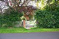
 Houghton Hall garden centre entrance - geograph.org.uk - 3477289.jpg 640 × 345 ; 65 kio
-
 Houghton Road North - geograph.org.uk - 6358751.jpg 800 × 600 ; 142 kio
-
 Houghton Road, on the edge of Carlisle - geograph.org.uk - 4731176.jpg 1 024 × 768 ; 110 kio
-
 Houghton Village Green - February 2018 - geograph.org.uk - 5672314.jpg 1 250 × 800 ; 684 kio
-
 Houghton Village Store - February 2018 - geograph.org.uk - 5672312.jpg 1 250 × 824 ; 957 kio
-
 House at Edenlin - geograph.org.uk - 5938571.jpg 2 000 × 1 333 ; 500 kio
-
 House near the A689 Linstock roundabout - geograph.org.uk - 5488661.jpg 640 × 480 ; 327 kio
-
 Houses in Tarraby - geograph.org.uk - 5938546.jpg 2 000 × 1 333 ; 370 kio
-
 Houses on Houghton Road North, Houghton - geograph.org.uk - 6358753.jpg 800 × 600 ; 75 kio
-
 Houses on Tribune Drive, Houghton - geograph.org.uk - 6358774.jpg 800 × 600 ; 81 kio
-
 Houses on Whiteclosegate, Carlisle - geograph.org.uk - 6358786.jpg 800 × 502 ; 69 kio
-
 In the grounds of Rickerby House - geograph.org.uk - 3494134.jpg 2 592 × 1 944 ; 2,23 Mio
-
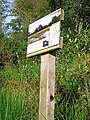 Information board, Gosling Sike Farm - geograph.org.uk - 5666600.jpg 480 × 640 ; 402 kio
-
 Inscription on Low Crosby Bridge - geograph.org.uk - 5053154.jpg 640 × 480 ; 512 kio
-
 Junction 44 on the M6, northbound - geograph.org.uk - 2641798.jpg 800 × 519 ; 85 kio
-
 Junction 44 on the M6, northbound - geograph.org.uk - 2717579.jpg 2 941 × 2 320 ; 757 kio
-
 KX100 telephone box, Houghton - geograph.org.uk - 6358768.jpg 640 × 452 ; 45 kio
-
 Ladder stile and field gate at Close House - geograph.org.uk - 5940379.jpg 2 000 × 1 333 ; 766 kio
-
 Lane at The Knells village boundary - geograph.org.uk - 3550191.jpg 640 × 480 ; 103 kio
-
 Lane nearing Green Acres Farm - geograph.org.uk - 3550199.jpg 640 × 480 ; 59 kio
-
 Lane to Moor House - geograph.org.uk - 5943157.jpg 2 000 × 1 333 ; 453 kio
-
 Lane towards Keysmount - geograph.org.uk - 6358735.jpg 800 × 615 ; 218 kio
-
 Layby on Eastbound A689 - geograph.org.uk - 5068443.jpg 640 × 427 ; 353 kio
-
 Layby on the A689 - geograph.org.uk - 5068435.jpg 640 × 481 ; 407 kio
-

-
 Linstock Bridge - geograph.org.uk - 92941.jpg 640 × 427 ; 65 kio
-
 Longhorn cattle at Gosling Sike Farm - geograph.org.uk - 5666596.jpg 640 × 480 ; 388 kio
-
 Looking down the M6 from Linstock Bridge - geograph.org.uk - 5940443.jpg 2 000 × 1 333 ; 380 kio
-
 Looking NE along the B6264 - geograph.org.uk - 6272358.jpg 1 024 × 683 ; 224 kio
-
 Looking north along the M6 - geograph.org.uk - 5938566.jpg 2 000 × 1 333 ; 309 kio
-
 Looking south down the M6 - geograph.org.uk - 5938567.jpg 2 000 × 1 333 ; 314 kio
-
 M6 Greymoorhill - geograph.org.uk - 2680700.jpg 640 × 480 ; 168 kio
-
 M6 junction 44 northbound - geograph.org.uk - 3494670.jpg 640 × 439 ; 50 kio
-
 M6 motorway north of Carlisle - geograph.org.uk - 1867967.jpg 2 565 × 1 912 ; 1,15 Mio
-
 M6 near Houghton - February 2018 - geograph.org.uk - 5672334.jpg 1 250 × 956 ; 823 kio
-
 M6 north bound - geograph.org.uk - 6227123.jpg 1 024 × 768 ; 80 kio
-
 M6 northbound at Brunstock - geograph.org.uk - 3507467.jpg 640 × 481 ; 61 kio
-
 M6 northbound nears Junction 44 - geograph.org.uk - 3507484.jpg 640 × 481 ; 55 kio
-
 M6 northbound nears Linstock Bridge - geograph.org.uk - 3507460.jpg 640 × 481 ; 56 kio
-
 M6 seen from Rickerby Lane - geograph.org.uk - 940844.jpg 640 × 480 ; 59 kio
-
 M6 signage - north bound - geograph.org.uk - 6227126.jpg 1 024 × 768 ; 100 kio
-
 M6 signage - north bound - geograph.org.uk - 6227127.jpg 1 024 × 768 ; 113 kio
-
 M6 signage - north bound - geograph.org.uk - 6227128.jpg 1 024 × 768 ; 96 kio
-
 M6 southbound - geograph.org.uk - 3429843.jpg 640 × 480 ; 46 kio
-
 M6 southbound - geograph.org.uk - 3429847.jpg 640 × 480 ; 37 kio
-
 M6, approaching J44 - geograph.org.uk - 3152327.jpg 640 × 393 ; 35 kio
-
 M6, Motorway - geograph.org.uk - 1918056.jpg 3 648 × 2 736 ; 4,73 Mio
-
 Milestone east of Low Crosby Bridge - geograph.org.uk - 6187966.jpg 1 024 × 683 ; 195 kio
-
 Milestone on south side of A689 in Crosbymoor - geograph.org.uk - 6187990.jpg 1 024 × 683 ; 280 kio
-
 Mill House - geograph.org.uk - 6187957.jpg 1 024 × 678 ; 182 kio
-
 Minor road at Crosby-on-Eden - geograph.org.uk - 3870948.jpg 1 024 × 686 ; 430 kio
-
 Minor road from Crosby-on-Eden - geograph.org.uk - 3871052.jpg 1 280 × 857 ; 1,27 Mio
-
 Muddy field and shed, Houghton - geograph.org.uk - 6358772.jpg 800 × 600 ; 111 kio
-
 New housing on Gladwin Drive, Houghton - geograph.org.uk - 6358779.jpg 800 × 600 ; 104 kio
-
 Newby Grange - geograph.org.uk - 1469990.jpg 640 × 404 ; 176 kio
-
 Newby Grange, entrance - geograph.org.uk - 3870050.jpg 1 280 × 857 ; 1,52 Mio
-
 Northbound M6 near Linstock - geograph.org.uk - 5725324.jpg 640 × 427 ; 385 kio
-
 Notice of diversion on Hadrian's Wall Path - geograph.org.uk - 5488679.jpg 480 × 640 ; 357 kio
-
 Old benchmark on gatepost at entrance to Old Grove - geograph.org.uk - 6374940.jpg 683 × 1 024 ; 275 kio
-
 Old Boundary Marker - geograph.org.uk - 6425038.jpg 960 × 466 ; 231 kio
-
 Old C Road - geograph.org.uk - 3314923.jpg 768 × 1 024 ; 256 kio
-
 Old Grove, near Linstock - geograph.org.uk - 5488658.jpg 640 × 480 ; 343 kio
-
 Old Grove, off A689 - geograph.org.uk - 6374924.jpg 1 024 × 683 ; 220 kio
-
 One mile south of junction 44 on the M6 - geograph.org.uk - 1867882.jpg 2 048 × 1 536 ; 457 kio
-
 Ordnance Survey Cut Mark - geograph.org.uk - 4913459.jpg 480 × 640 ; 133 kio
-
 Over the gate at Crosbymoor - geograph.org.uk - 3871045.jpg 1 280 × 857 ; 1,22 Mio
-
 Park Broom Lodge Guest House - geograph.org.uk - 5488657.jpg 640 × 480 ; 324 kio
-
 Part of the parking area at Houghton Hall Garden Centre - geograph.org.uk - 6217211.jpg 4 000 × 3 000 ; 3,18 Mio
-
 Petrol station, Brampton Old Road, Carlisle - geograph.org.uk - 5938548.jpg 2 000 × 1 333 ; 420 kio
-
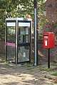
 Phone box, Linstock - geograph.org.uk - 5940406.jpg 1 333 × 2 000 ; 404 kio
-
 Phonebox in Rickerby - geograph.org.uk - 5943170.jpg 1 333 × 2 000 ; 458 kio
_-_geograph.org.uk_-_5694542.jpg)
_-_geograph.org.uk_-_5694545.jpg)
_-_geograph.org.uk_-_5694548.jpg)
_-_geograph.org.uk_-_5694549.jpg)
_-_geograph.org.uk_-_5694551.jpg)
_-_geograph.org.uk_-_5694555.jpg)
_-_geograph.org.uk_-_5694559.jpg)


_-_geograph.org.uk_-_4731168.jpg)
_-_geograph.org.uk_-_4731169.jpg)
_-_geograph.org.uk_-_4731171.jpg)


_-_geograph.org.uk_-_5672149.jpg)
_-_geograph.org.uk_-_5672152.jpg)


