Category:State Highway 83 (New Zealand)
Zur Navigation springen
Zur Suche springen
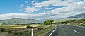
English: State Highway 83 is a South Island State Highway in New Zealand running up the Waitaki Valley between the settlements of Pukeuri and Omarama. It forms part of the southernmost of the east-west roads crossing the South Island (via Haast Pass). (→New Zealand State Highway 83)
Straße in Neuseeland  | |||||
| Medium hochladen | |||||
| Ist ein(e) | |||||
|---|---|---|---|---|---|
| Ort |
| ||||
| Transportnetz |
| ||||
| Länge |
| ||||
| |||||
Medien in der Kategorie „State Highway 83 (New Zealand)“
Folgende 14 Dateien sind in dieser Kategorie, von 14 insgesamt.
-
 Duntroon Main Street.JPG 3.608 × 2.416; 3,64 MB
-
 Kurow Bledisloe Street 001.JPG 3.532 × 2.472; 3,61 MB
-
 Kurow Bledisloe Street 002.JPG 3.692 × 2.520; 3,59 MB
-
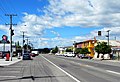
 Omarama State Highway 83.JPG 3.272 × 2.380; 3,05 MB
-
 Otematata Main Street.JPG 3.492 × 2.460; 3,3 MB
-
 SH 83 by Lake Benmore, New Zealand.jpg 5.472 × 3.648; 15,81 MB
-
 State Highway 83 near Lake Aviemore.jpg 2.966 × 683; 1,35 MB
-
 State Highway 83 NZ 01.jpg 4.049 × 1.733; 4,32 MB
-
 State Highway 83 NZ 02.jpg 4.032 × 1.414; 3,98 MB
-
 State Highway 84 near Lake Aviemore.jpg 2.893 × 1.462; 2,51 MB
-
 State Highway 85 near Lake Aviemore.jpg 2.887 × 1.373; 2,57 MB
-
 View of Otematata.jpg 3.799 × 1.316; 2,6 MB
-
 Waitaki Dam State Highway 83.JPG 3.872 × 2.592; 3,86 MB
-
 牛群 cows - panoramio.jpg 2.200 × 1.467; 1,58 MB


