Category:Staverton, Gloucestershire
Aller à la navigation
Aller à la recherche
village britannique (Gloucestershire)  | |||||
| Téléverser des médias | |||||
| Nature de l’élément | |||||
|---|---|---|---|---|---|
| Lieu | Tewkesbury, Gloucestershire, Angleterre du Sud-Ouest, Angleterre | ||||
 | |||||
English: Staverton is a village between the city of Gloucester and the town of Cheltenham in Gloucestershire, England, in the borough of Tewkesbury.
Sous-catégories
Cette catégorie comprend 2 sous-catégories, dont les 2 ci-dessous.
S
- Swanbrook (bus company) (63 F)
Média dans la catégorie « Staverton, Gloucestershire »
Cette catégorie comprend 110 fichiers, dont les 110 ci-dessous.
-
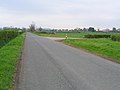 A junction of two minor roads - geograph.org.uk - 5290.jpg 640 × 480 ; 47 kio
-
 A40 underpass - geograph.org.uk - 882226.jpg 640 × 480 ; 188 kio
-
 Ashville Business Park - geograph.org.uk - 5280.jpg 640 × 480 ; 56 kio
-
 Autumn colour beside the M5 - geograph.org.uk - 3187166.jpg 846 × 1 208 ; 560 kio
-
 B4063 at The Pheasant pub - geograph.org.uk - 2514071.jpg 640 × 480 ; 56 kio
-
 B4063 east of Golden Valley - geograph.org.uk - 5234289.jpg 1 600 × 963 ; 556 kio
-
 B4063, Gloucester Road - geograph.org.uk - 4274179.jpg 640 × 480 ; 83 kio
-
 B4063. Gloucester Road - geograph.org.uk - 4274177.jpg 640 × 480 ; 56 kio
-
 B4634 bridge over M5 - geograph.org.uk - 3187153.jpg 1 024 × 768 ; 527 kio
-
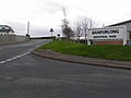
 Bamfurlong Industrial Park - geograph.org.uk - 4446996.jpg 640 × 478 ; 52 kio
-
 Bamfurlong Industrial Park - geograph.org.uk - 678145.jpg 640 × 480 ; 53 kio
-
 Bamfurlong Industrial Park - geograph.org.uk - 678146.jpg 640 × 480 ; 57 kio
-
 Bamfurlong Lane - geograph.org.uk - 1135910.jpg 640 × 422 ; 252 kio
-
 Bamfurlong Lane - geograph.org.uk - 2263137.jpg 800 × 600 ; 178 kio
-
 Barrow Hill Farm - geograph.org.uk - 5287.jpg 640 × 480 ; 122 kio
-
 Billy no mates - geograph.org.uk - 590280.jpg 640 × 480 ; 84 kio
-
 Brick barn - geograph.org.uk - 2636434.jpg 800 × 450 ; 314 kio
-
 Brick barn, 2016 - geograph.org.uk - 5167198.jpg 1 600 × 901 ; 714 kio
-
 Brock Farm - geograph.org.uk - 5283.jpg 640 × 480 ; 74 kio
-
 Chalet homes - geograph.org.uk - 1135907.jpg 640 × 402 ; 227 kio
-
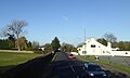
 Cheltenham Regency Hotel - geograph.org.uk - 4274175.jpg 640 × 480 ; 52 kio
-
 Cheltenham Regency Hotel - geograph.org.uk - 4583229.jpg 1 024 × 680 ; 206 kio
-
 Country lane to Barrow - geograph.org.uk - 882291.jpg 640 × 480 ; 143 kio
-
 Crossroads in Staverton - geograph.org.uk - 5234294.jpg 1 600 × 1 200 ; 754 kio
-
 Dowty Aerospace Propellers - geograph.org.uk - 590308.jpg 640 × 480 ; 96 kio
-
 Dundry Garden Centre - geograph.org.uk - 1135998.jpg 640 × 392 ; 269 kio
-
 Dundry Nurseries and Garden Centre - geograph.org.uk - 1135117.jpg 640 × 427 ; 242 kio
-
 Entrance to Bridge Farm - geograph.org.uk - 589886.jpg 640 × 480 ; 126 kio
-
 Entrance to Green Meadow Park Homes - geograph.org.uk - 504742.jpg 640 × 480 ; 370 kio
-
 Farm on B4063 - geograph.org.uk - 590288.jpg 640 × 480 ; 78 kio
-
 Farmland, Golden Valley - geograph.org.uk - 2329599.jpg 1 024 × 768 ; 207 kio
-
 Feeder in a field - geograph.org.uk - 2329601.jpg 1 024 × 768 ; 246 kio
-
 Fence on the Old Gloucester Road - geograph.org.uk - 810938.jpg 640 × 480 ; 118 kio
-
 Field and houses on the B4063 - geograph.org.uk - 4894577.jpg 800 × 363 ; 67 kio
-
 Field by the A40 - geograph.org.uk - 1222727.jpg 640 × 461 ; 91 kio
-
 Finger post at the centre of Staverton (geograph 2636436).jpg 800 × 600 ; 400 kio
-
 Footpath over pasture - geograph.org.uk - 2990350.jpg 1 024 × 577 ; 297 kio
-
 Former farm buildings at Staverton Park - geograph.org.uk - 4013097.jpg 1 600 × 1 056 ; 829 kio
-
 G-EGTB (6877945973).jpg 2 256 × 1 496 ; 899 kio
-
 Grey barn - geograph.org.uk - 5167195.jpg 1 600 × 901 ; 634 kio
-
 Hayden Green residents - geograph.org.uk - 2990345.jpg 1 024 × 577 ; 291 kio
-
 Hayden Lane - geograph.org.uk - 2514096.jpg 640 × 480 ; 47 kio
-
 House at the end of the runway - geograph.org.uk - 453962.jpg 640 × 483 ; 343 kio
-
 House In The Tree Pub - geograph.org.uk - 684807.jpg 640 × 480 ; 79 kio
-
 Junction 11, Southbound M5 - geograph.org.uk - 3407377.jpg 640 × 480 ; 364 kio
-
 Junction with Old Gloucester Road - geograph.org.uk - 4894561.jpg 800 × 492 ; 85 kio
-
 Lane to Brock Farm, Staverton - geograph.org.uk - 1087653.jpg 640 × 480 ; 78 kio
-
 M5 - geograph.org.uk - 678128.jpg 640 × 480 ; 60 kio
-
 M5 bridge - geograph.org.uk - 2329603.jpg 1 024 × 768 ; 195 kio
-
 M5 crosses B4063 - geograph.org.uk - 589887.jpg 640 × 440 ; 89 kio
-
 M5 crosses the B4063 - geograph.org.uk - 2046404.jpg 640 × 480 ; 51 kio
-

-
 M5 Motorway - geograph.org.uk - 5291.jpg 480 × 640 ; 60 kio
-
 M5 Motorway Junction 11 - geograph.org.uk - 1170707.jpg 640 × 364 ; 42 kio
-
 M5 Motorway near Staverton - geograph.org.uk - 2046407.jpg 640 × 480 ; 51 kio
-
 M5 north of Junction 11 - geograph.org.uk - 2329616.jpg 1 024 × 768 ; 123 kio
-
 M5 north of junction 11 - geograph.org.uk - 4740639.jpg 640 × 404 ; 111 kio
-
 M5 northbound near Staverton Bridge - geograph.org.uk - 4242247.jpg 640 × 481 ; 44 kio
-
 M5 northbound towards junction 10 - geograph.org.uk - 4326336.jpg 1 600 × 1 200 ; 1,09 Mio
-
 M5 northbound towards junction 10 - geograph.org.uk - 4326343.jpg 1 600 × 1 200 ; 1,1 Mio
-
 M5 south near Staverton Airport - geograph.org.uk - 3046804.jpg 640 × 480 ; 42 kio
-
 M5 southbound - geograph.org.uk - 3536763.jpg 640 × 393 ; 30 kio
-
 M5 southbound - geograph.org.uk - 3536778.jpg 640 × 419 ; 35 kio
-
 M5 southbound - geograph.org.uk - 3536788.jpg 640 × 511 ; 34 kio
-
 M5 southbound - geograph.org.uk - 4624900.jpg 1 024 × 553 ; 77 kio
-
 M5 southbound 1 mile to Junction 11 - geograph.org.uk - 4688526.jpg 1 600 × 1 061 ; 304 kio
-
 M5 tourist signs for Gloucester area - geograph.org.uk - 4686172.jpg 2 044 × 1 328 ; 1,35 Mio
-
 Motorway Bridge (Old Gloucester Road) - geograph.org.uk - 3407345.jpg 640 × 480 ; 340 kio
-
 Old farm buildings - geograph.org.uk - 2263127.jpg 800 × 600 ; 163 kio
-
 Orchard by the B4063 - geograph.org.uk - 590298.jpg 640 × 480 ; 139 kio
-
 Orchard House - geograph.org.uk - 1135104.jpg 640 × 437 ; 288 kio
-
 Overbridge near Staverton - geograph.org.uk - 4740647.jpg 640 × 361 ; 109 kio
-
 Pasture by the M5 - geograph.org.uk - 2636430.jpg 800 × 450 ; 263 kio
-
 Pheasant Inn - geograph.org.uk - 880956.jpg 640 × 472 ; 73 kio
-
 Pheasant Lane - geograph.org.uk - 2263306.jpg 800 × 600 ; 201 kio
-
 Pillbox overlooking Staverton Airport - geograph.org.uk - 2329609.jpg 1 024 × 768 ; 166 kio
-
 Poor cows^ - geograph.org.uk - 453989.jpg 640 × 382 ; 253 kio
-
 Potato Weekend at Dundry nurseries - geograph.org.uk - 1135111.jpg 640 × 427 ; 302 kio
-
 Power lines south of Boddington - geograph.org.uk - 589876.jpg 640 × 480 ; 75 kio
-
 Road bridge crossing the M5 - geograph.org.uk - 1541210.jpg 640 × 401 ; 38 kio
-
 Road junction at Bamfurlong Lane - geograph.org.uk - 504749.jpg 640 × 480 ; 305 kio
-
 Road junction with telephone box - geograph.org.uk - 504745.jpg 640 × 431 ; 232 kio
-
 Southbound M5 Motorway, Golden Valley - geograph.org.uk - 3407358.jpg 640 × 480 ; 322 kio
-
 Southbound M5 near Chletenham and Gloucester - geograph.org.uk - 3407367.jpg 640 × 480 ; 361 kio
-
 Staverton , M5 Motorway - geograph.org.uk - 6283964.jpg 6 000 × 4 000 ; 5,13 Mio
-
 Staverton , M5 Motorway - geograph.org.uk - 6283965.jpg 6 000 × 4 000 ; 3,85 Mio
-
 Staverton Flying School - geograph.org.uk - 589884.jpg 640 × 432 ; 74 kio
-
 Staverton from the air - geograph.org.uk - 929297.jpg 640 × 426 ; 64 kio
-
 Staverton House - geograph.org.uk - 1086842.jpg 640 × 480 ; 100 kio
-
 Staverton Park - geograph.org.uk - 589885.jpg 640 × 463 ; 69 kio
-
 Staverton Park on Bamfurlong Lane - geograph.org.uk - 4974330.jpg 1 600 × 1 099 ; 709 kio
-
 Tewkesbury , The M5 Motorway Southbound - geograph.org.uk - 2795417.jpg 4 002 × 2 655 ; 3,92 Mio
-
 Tewkesbury Borough , M5 Motorway - geograph.org.uk - 5951400.jpg 6 000 × 4 000 ; 5,93 Mio
-
 Tewkesbury Borough , M5 Motorway - geograph.org.uk - 5951401.jpg 6 000 × 4 000 ; 6,35 Mio
-
 Tewkesbury District , Cheltenham Road - geograph.org.uk - 3724129.jpg 4 288 × 2 848 ; 5,27 Mio
-
 Tewkesbury District , The M5 Motorway - geograph.org.uk - 4930144.jpg 6 000 × 4 000 ; 6,03 Mio
-
 The M5 Motorway at Staverton - geograph.org.uk - 929293.jpg 640 × 426 ; 67 kio
-
 The Old Manor House, Staverton - geograph.org.uk - 1086838.jpg 480 × 640 ; 137 kio
-
 The Pavillion - geograph.org.uk - 2712804.jpg 640 × 420 ; 53 kio
-
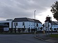
 The White House Hotel - geograph.org.uk - 5311.jpg 640 × 480 ; 79 kio
-
 Tourist information on the M5 - geograph.org.uk - 2288770.jpg 640 × 309 ; 25 kio
-
 Traffic Lights at Bamfurlong Lane - geograph.org.uk - 589883.jpg 640 × 494 ; 119 kio
-
 Trianglular junction on Hayden Lane - geograph.org.uk - 2514099.jpg 640 × 480 ; 70 kio
-
 Wheat field south of Barrow - geograph.org.uk - 882289.jpg 467 × 640 ; 186 kio
-
 White Lion House on the B4063 - geograph.org.uk - 4013091.jpg 1 600 × 1 064 ; 519 kio
-

-
 Bamfurlong Technology Park - geograph.org.uk - 5293.jpg 640 × 480 ; 33 kio
-
 Paint it Black - geograph.org.uk - 589878.jpg 640 × 480 ; 136 kio
-
 The House in the Tree - geograph.org.uk - 45937.jpg 640 × 426 ; 104 kio
-
 The phone box at Staverton - geograph.org.uk - 589879.jpg 640 × 480 ; 113 kio


.jpg)


.jpg)


_-_geograph.org.uk_-_3407345.jpg)


