Category:Stelling Minnis
Zur Navigation springen
Zur Suche springen

Gemeinde in der englischen Grafschaft Kent  | |||||
| Medium hochladen | |||||
| Ist ein(e) | |||||
|---|---|---|---|---|---|
| Ort | Folkestone and Hythe, Kent, Südostengland, England | ||||
 | |||||
Unterkategorien
Es werden 3 von insgesamt 3 Unterkategorien in dieser Kategorie angezeigt:
In Klammern die Anzahl der enthaltenen Kategorien (K), Seiten (S), Dateien (D)
Medien in der Kategorie „Stelling Minnis“
Folgende 145 Dateien sind in dieser Kategorie, von 145 insgesamt.
-
 A dusting of snow on the trees - geograph.org.uk - 735405.jpg 640 × 480; 235 KB
-
 Anvil House - geograph.org.uk - 1969447.jpg 3.072 × 2.304; 1,91 MB
-
 Bean Crops - geograph.org.uk - 3550524.jpg 3.696 × 2.448; 2,36 MB
-
 Bomber over Kent - geograph.org.uk - 1927792.jpg 3.072 × 2.304; 1,4 MB
-
 Bossingham Road - geograph.org.uk - 1969677.jpg 3.072 × 2.304; 1,58 MB
-
 Bossingham Road towards Bossingham - geograph.org.uk - 5939608.jpg 1.024 × 684; 278 KB
-
 Bossingham Road, Stelling Minnis - geograph.org.uk - 5939582.jpg 1.024 × 684; 291 KB
-
 Bossingham Road, Stelling Minnis - geograph.org.uk - 5939597.jpg 1.024 × 684; 217 KB
-
 Bridleway to Eastleigh Court and Lower Courthope Farm - geograph.org.uk - 1927738.jpg 3.072 × 2.304; 1,9 MB
-
 Bridleway to Stone Street - geograph.org.uk - 1927742.jpg 3.072 × 2.304; 2,26 MB
-
 Buildings on Stelling Lodge Farm - geograph.org.uk - 1244828.jpg 640 × 480; 111 KB
-
 Bungalow on Bossingham Road - geograph.org.uk - 1957184.jpg 1.024 × 768; 217 KB
-
 Cherry Garden Farm - geograph.org.uk - 1969682.jpg 3.072 × 2.304; 1,51 MB
-
 Cherry Garden Farm - geograph.org.uk - 4119317.jpg 881 × 660; 184 KB
-
 Courthope Farmhouse - geograph.org.uk - 1927814.jpg 3.072 × 2.304; 1,71 MB
-
 Coxhole Farm - geograph.org.uk - 1974138.jpg 3.072 × 2.304; 1,63 MB
-
 Crop Field near Stelling Lodge Farm - geograph.org.uk - 1957190.jpg 1.024 × 683; 276 KB
-
 Crop Field south of Stelling Minnis - geograph.org.uk - 3550521.jpg 3.696 × 2.448; 2,29 MB
-
 Erection of two storey house and garage - geograph.org.uk - 4784993.jpg 3.264 × 2.448; 4,01 MB
-
 Farm Buildings at Stelling Lodge Farm - geograph.org.uk - 1968564.jpg 1.024 × 768; 233 KB
-
 Farm Buildings at Wheelbarrow Town - geograph.org.uk - 1958366.jpg 800 × 600; 121 KB
-
 Field near Atchester Wood - geograph.org.uk - 1968575.jpg 1.024 × 768; 218 KB
-
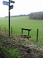 Finger post and stile - geograph.org.uk - 330888.jpg 480 × 640; 247 KB
-
 Finger post near Little Plamstead Farm - geograph.org.uk - 1969866.jpg 3.072 × 2.304; 1,51 MB
-
-
 Footpath in Bower Wood - geograph.org.uk - 1969614.jpg 3.072 × 2.304; 2,59 MB
-
 Footpath junction near Church Lane - geograph.org.uk - 1930619.jpg 3.072 × 2.304; 1,95 MB
-
 Footpath junction near Stelling Lodge farm - geograph.org.uk - 1930680.jpg 3.072 × 2.304; 1,53 MB
-
 Footpath junction near Stone Street - geograph.org.uk - 1969488.jpg 3.072 × 2.304; 2,1 MB
-
 Footpath sign and stile - geograph.org.uk - 4776152.jpg 640 × 428; 106 KB
-
 Footpath to Bossingham - geograph.org.uk - 1930633.jpg 3.072 × 2.304; 1,69 MB
-
 Footpath to Bossingham Village - geograph.org.uk - 3307228.jpg 640 × 427; 276 KB
-
 Footpath to Bower Wood - geograph.org.uk - 1969612.jpg 3.072 × 2.304; 1,21 MB
-
 Footpath to Stone Street - geograph.org.uk - 1927903.jpg 3.072 × 2.304; 2,34 MB
-
 Footpath to Stone Street - geograph.org.uk - 1969457.jpg 3.072 × 2.304; 2,09 MB
-
 Footpath towards Church Lane - geograph.org.uk - 1930614.jpg 3.072 × 2.304; 1,24 MB
-
 Footpath towards Church Lane - geograph.org.uk - 1930688.jpg 3.072 × 2.304; 1,36 MB
-
 Footpath towards Courthope Farm - geograph.org.uk - 1927806.jpg 3.072 × 2.304; 1,93 MB
-
 Footpath towards Crown Lane - geograph.org.uk - 1927927.jpg 3.072 × 2.304; 2,3 MB
-
 Footpath towards Stelling Lodge Farm - geograph.org.uk - 1930677.jpg 3.072 × 2.304; 1,42 MB
-
 Footpath towards Stelling Minnis - geograph.org.uk - 1927706.jpg 3.072 × 2.304; 1,83 MB
-
 Footpath towards Stelling Minnis - geograph.org.uk - 1969495.jpg 3.072 × 2.304; 1,61 MB
-
 Footpath towards Stone Street - geograph.org.uk - 1930622.jpg 3.072 × 2.304; 1,85 MB
-
 Footpath towards Stoneleigh House - geograph.org.uk - 1930660.jpg 3.072 × 2.304; 1,66 MB
-

-
 Fruiterers Hall - geograph.org.uk - 1974139.jpg 3.072 × 2.304; 1,38 MB
-
 Gilridge Farm - geograph.org.uk - 1974116.jpg 3.072 × 2.304; 1,21 MB
-
 Gordon House - geograph.org.uk - 1927841.jpg 3.072 × 2.304; 2,05 MB
-
 Hatch Farm - geograph.org.uk - 1957270.jpg 1.024 × 683; 231 KB
-
 High Chimney Farm - geograph.org.uk - 1969692.jpg 3.072 × 2.304; 1,16 MB
-
 House at Stelling Minnis - geograph.org.uk - 1957259.jpg 1.024 × 768; 240 KB
-
 Houses on Stone Street - geograph.org.uk - 1957196.jpg 1.024 × 683; 183 KB
-
-
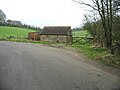
 Junction to the E, off Pett Bottom Road - geograph.org.uk - 330876.jpg 640 × 480; 315 KB
-
 Keeping the verges tidy - geograph.org.uk - 5431336.jpg 3.264 × 2.448; 3,76 MB
-
 Kissing gates in Stelling Minnis Common - geograph.org.uk - 1969625.jpg 3.072 × 2.304; 2,34 MB
-
 Lane in Fryarne Park Wood - geograph.org.uk - 1969835.jpg 3.072 × 2.304; 2,66 MB
-
 Lane junction near Atchester Wood - geograph.org.uk - 1969885.jpg 3.072 × 2.304; 1,33 MB
-
 Lane junction near Fryarne Park Wood - geograph.org.uk - 1969826.jpg 3.072 × 2.235; 1,01 MB
-
 Lane junction near South Park Farm - geograph.org.uk - 1969855.jpg 3.072 × 2.304; 2,5 MB
-
 Lane through Fryarne Park Wood - geograph.org.uk - 1968579.jpg 1.024 × 768; 351 KB
-
 Lime Kiln Lane - geograph.org.uk - 5016042.jpg 640 × 428; 134 KB
-
 Lime Kiln Lane - geograph.org.uk - 5016045.jpg 640 × 428; 129 KB
-
 Llamas of Stone Hall - geograph.org.uk - 1927714.jpg 3.072 × 2.304; 1,58 MB
-
 Looking S along Pett Bottom Road - geograph.org.uk - 330878.jpg 640 × 480; 324 KB
-

-
 Looking west from a country lane - geograph.org.uk - 4119269.jpg 946 × 709; 243 KB
-
 Lords Cottages on Church Lane - geograph.org.uk - 1244558.jpg 640 × 480; 162 KB
-
 Mead Farm - geograph.org.uk - 1969452.jpg 3.072 × 2.304; 1,45 MB
-
 Misling Lane junction on Stone Street - geograph.org.uk - 1927693.jpg 3.072 × 2.304; 1,44 MB
-
 Mobile Phone Mast and tent - geograph.org.uk - 1969778.jpg 3.072 × 2.304; 1,76 MB
-
 On Stelling Minnis Common - geograph.org.uk - 4428557.jpg 1.632 × 1.232; 421 KB
-
 Orchard Nurseries - geograph.org.uk - 1930710.jpg 3.072 × 2.304; 2,02 MB
-
 Pond by the junction - geograph.org.uk - 4776141.jpg 640 × 480; 194 KB
-
 Pond in a field - geograph.org.uk - 1927748.jpg 3.072 × 2.304; 1,7 MB
-
 Road junctions in Stelling Minnis - geograph.org.uk - 1927863.jpg 3.072 × 2.304; 1,66 MB
-
 Road through Fryarne Park Wood - geograph.org.uk - 330884.jpg 640 × 480; 331 KB
-
 Skylark Cottage - geograph.org.uk - 1930627.jpg 3.072 × 2.304; 1,74 MB
-
 Stelling Church Cottages, Church Lane - geograph.org.uk - 1244563.jpg 640 × 480; 168 KB
-
 Stelling Lodge Farm outbuildings - geograph.org.uk - 1244824.jpg 640 × 480; 128 KB
-
 Stelling Minnis chapel - geograph.org.uk - 340484.jpg 480 × 640; 282 KB
-

-
 Stelling Minnis Common - geograph.org.uk - 1969446.jpg 3.072 × 2.304; 1,46 MB
-
 Stelling Minnis Common Information Board - geograph.org.uk - 1969641.jpg 3.072 × 2.304; 1,56 MB
-
 Stelling Minnis Windmill in Kent - geograph.org.uk - 6055268.jpg 3.031 × 4.140; 3,44 MB
-
 Stelling Minnis Windmill in Kent - geograph.org.uk - 6055272.jpg 3.086 × 4.258; 3,77 MB
-
 Stelling Minnis Windmill Information Board - geograph.org.uk - 6055279.jpg 3.521 × 2.560; 2,88 MB
-
 Stelling, St. Mary's Church - geograph.org.uk - 5370508.jpg 3.678 × 2.455; 6,02 MB
-
 Stelling, St. Mary's Church - geograph.org.uk - 5370512.jpg 3.678 × 2.455; 5,86 MB
-
 Stelling, St. Mary's Church - geograph.org.uk - 5370515.jpg 3.680 × 3.648; 7,42 MB
-
 Stelling, St. Mary's Church - geograph.org.uk - 5370516.jpg 4.429 × 2.883; 6,71 MB
-
 Stelling, St. Mary's Church, Rustic Georgian interior 2 - geograph.org.uk - 5370525.jpg 5.520 × 3.680; 7,08 MB
-

-

-
 Stelling, St. Mary's Church, Rustic Georgian interior 5 - geograph.org.uk - 5370539.jpg 3.874 × 2.455; 3,55 MB
-
 Stelling, St. Mary's Church, Rustic Georgian interior 6 - geograph.org.uk - 5370549.jpg 5.520 × 3.680; 6,84 MB
-
 Stelling, St. Mary's Church, Rustic Georgian interior 7 - geograph.org.uk - 5370555.jpg 5.520 × 3.680; 6,56 MB
-
 Stelling, St. Mary's Church, The font - geograph.org.uk - 5370544.jpg 1.847 × 3.395; 2,47 MB
-
 Stone Street - geograph.org.uk - 1927687.jpg 3.072 × 2.304; 1,57 MB
-
 Stone Street near Thorn Lane - geograph.org.uk - 1927945.jpg 3.072 × 2.304; 1,52 MB
-
 Stone Street to Canterbury - geograph.org.uk - 1969606.jpg 3.072 × 2.304; 1,68 MB
-
 Stone Street to Hythe - geograph.org.uk - 1969501.jpg 3.072 × 2.304; 1,38 MB
-
 Stone Street, near Curtis Lane Junction - geograph.org.uk - 1927935.jpg 3.072 × 2.304; 1,61 MB
-
 Stonegate Business Park, Stone Street - geograph.org.uk - 5732536.jpg 3.264 × 2.448; 3,66 MB
-
 Stonegate Business Park, Stone Street - geograph.org.uk - 5732550.jpg 3.264 × 2.448; 3,88 MB
-
 Stonegate Business Park, Stone Street - geograph.org.uk - 5958152.jpg 3.264 × 2.448; 2,2 MB
-
 Stoneleigh House Lane - geograph.org.uk - 1930691.jpg 3.072 × 2.304; 1,52 MB
-
 Sunnyside, Wheelbarrow Town - geograph.org.uk - 5243966.jpg 3.264 × 2.448; 3,9 MB
-
 Terraced Housing at Stelling Minnis - geograph.org.uk - 1385468.jpg 640 × 480; 88 KB
-
-
 The George Inn, Stelling Minnis - geograph.org.uk - 1927655.jpg 3.072 × 2.304; 1,39 MB
-
 The Grange, Bossingham Road - geograph.org.uk - 4120392.jpg 1.077 × 807; 199 KB
-
 The Rose and Crown, Stelling Minnis - geograph.org.uk - 340395.jpg 640 × 480; 235 KB
-
 Track to The Laurels - geograph.org.uk - 4119286.jpg 979 × 734; 213 KB
-
 Tree and Crop Field - geograph.org.uk - 1956151.jpg 1.024 × 768; 260 KB
-
 Valley beside Elhampark Wood - geograph.org.uk - 1974121.jpg 3.072 × 1.728; 842 KB
-
 Valley near Atchester Wood - geograph.org.uk - 1969791.jpg 3.072 × 1.728; 882 KB
-
 Valley near Fryarne Park Wood - geograph.org.uk - 1969799.jpg 3.072 × 1.728; 1.010 KB
-
 View along Bossingham Road - geograph.org.uk - 340793.jpg 640 × 480; 149 KB
-

-
 View along Church Lane, Stelling MInnis - geograph.org.uk - 1244549.jpg 640 × 480; 175 KB
-

-
 View from Dean Hill - geograph.org.uk - 1245370.jpg 640 × 480; 113 KB
-
 View from Stelling Church - geograph.org.uk - 231491.jpg 640 × 425; 92 KB
-
 View SE along minor road - geograph.org.uk - 645279.jpg 640 × 480; 182 KB
-
 Yew Tree Cottage, Split Lane - geograph.org.uk - 4120397.jpg 979 × 734; 221 KB
-
 A view of the minnis, Stelling Minnis - geograph.org.uk - 340802.jpg 640 × 480; 150 KB
-

-

-
 House on Stelling Minnis - geograph.org.uk - 340487.jpg 640 × 480; 255 KB
-
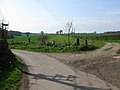
 Junction near Wheelbarrow Town - geograph.org.uk - 330421.jpg 640 × 480; 190 KB
-

-
 Junction of Curtis Lane and Stone Street - geograph.org.uk - 340810.jpg 640 × 480; 149 KB
-

-
 Looking S towards Wheelbarrow Town - geograph.org.uk - 330765.jpg 640 × 480; 234 KB
-
 Looking S towards Wheelbarrow Town - geograph.org.uk - 330775.jpg 640 × 480; 234 KB
-
 Minnis Lane off Bossingham Road - geograph.org.uk - 340389.jpg 640 × 480; 290 KB
-
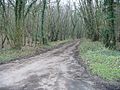
 Passing through Lodge Wood - geograph.org.uk - 330834.jpg 640 × 480; 321 KB
-

-
 Ponycart Lane, Stelling Minnis - geograph.org.uk - 340805.jpg 640 × 480; 197 KB
-
 Pylon on the road^ - geograph.org.uk - 330853.jpg 640 × 480; 241 KB
-
 Road running through Wheelbarrow Town - geograph.org.uk - 330428.jpg 640 × 480; 226 KB
-
 Stelling Minnis stores - geograph.org.uk - 340807.jpg 640 × 480; 145 KB
-

-
 Track through the woods, Wheelbarrow Town - geograph.org.uk - 330435.jpg 640 × 480; 349 KB


