Category:Stewkley
Zur Navigation springen
Zur Suche springen
English: Stewkley is a village and a civil parish within the Aylesbury Vale district of Buckinghamshire, England. It is located 5 miles (8 km) East of Winslow and 4 miles (6 km) West of Leighton Buzzard.
Gemeinde in der englischen Grafschaft Buckinghamshire  | |||||
| Medium hochladen | |||||
| Ist ein(e) | |||||
|---|---|---|---|---|---|
| Ort | Buckinghamshire, Südostengland, England | ||||
| Einwohnerzahl |
| ||||
| offizielle Website | |||||
 | |||||
Unterkategorien
Es werden 3 von insgesamt 3 Unterkategorien in dieser Kategorie angezeigt:
In Klammern die Anzahl der enthaltenen Kategorien (K), Seiten (S), Dateien (D)
Medien in der Kategorie „Stewkley“
Folgende 200 Dateien sind in dieser Kategorie, von 249 insgesamt.
(vorherige Seite) (nächste Seite)-

-
 A Decorated Farm Building - geograph.org.uk - 6604242.jpg 1.024 × 576; 169 KB
-
 A roller coaster ride - geograph.org.uk - 6354102.jpg 1.920 × 1.280; 1,76 MB
-
 Abandoned Trailer - geograph.org.uk - 395297.jpg 640 × 480; 171 KB
-
 Access road to Dean Tithe Farm - geograph.org.uk - 4351407.jpg 640 × 480; 71 KB
-
 Across the Fields - geograph.org.uk - 395131.jpg 640 × 480; 176 KB
-
 An autumnal High Street North - geograph.org.uk - 2594647.jpg 640 × 480; 81 KB
-
 Approach to Littlecote, Stewkley - geograph.org.uk - 4384708.jpg 640 × 480; 183 KB
-
 Baanaanaa^ - geograph.org.uk - 395228.jpg 640 × 496; 148 KB
-
 Barn and housing on the circular walk - geograph.org.uk - 3202651.jpg 1.600 × 1.067; 782 KB
-
 Benchmark on The Swan - geograph.org.uk - 5306157.jpg 634 × 1.024; 315 KB
-
 Benchmark on ^50 Dove Street - geograph.org.uk - 5306214.jpg 638 × 1.024; 197 KB
-
 Bletchley Road near Clack Farm - geograph.org.uk - 4998788.jpg 800 × 598; 160 KB
-

-
 Bowles Farm North End, Stewkley - geograph.org.uk - 350230.jpg 640 × 428; 136 KB
-
 Bridge over an un-named stream - geograph.org.uk - 395326.jpg 480 × 640; 194 KB
-
 Chapel Square - geograph.org.uk - 395009.jpg 640 × 480; 129 KB
-
 Chilly Scene, Stewkley Road - geograph.org.uk - 296469.jpg 640 × 489; 77 KB
-
 Coming in to Stewkley on the Circular Walk - geograph.org.uk - 3202654.jpg 1.200 × 1.600; 926 KB
-
 Countryside Footpath - geograph.org.uk - 891004.jpg 640 × 480; 156 KB
-
 Cross Bucks Way - geograph.org.uk - 2746083.jpg 640 × 480; 73 KB
-
 Cross Bucks Way - geograph.org.uk - 2746858.jpg 640 × 480; 95 KB
-
 Cross Bucks Way - geograph.org.uk - 2746859.jpg 640 × 480; 62 KB
-
 Cublington Spinney - geograph.org.uk - 3436945.jpg 1.600 × 1.071; 842 KB
-
 Cublington Spinney memorial - geograph.org.uk - 3436951.jpg 1.600 × 1.069; 755 KB
-
 Culvert for ditch under Soulbury Road - geograph.org.uk - 5306302.jpg 1.024 × 683; 373 KB
-
 Dean Farm - geograph.org.uk - 395188.jpg 640 × 480; 115 KB
-
 Dean Road - geograph.org.uk - 395174.jpg 640 × 480; 145 KB
-
 Dean Road - geograph.org.uk - 4351399.jpg 640 × 480; 77 KB
-
 Dean Road - geograph.org.uk - 4351412.jpg 640 × 480; 70 KB
-

-
 Dunton Road towards Stewkley - geograph.org.uk - 4995279.jpg 800 × 696; 177 KB
-
 Dunton Road, Littlecote - geograph.org.uk - 5672403.jpg 2.008 × 1.482; 973 KB
-
 Dunton Road, Stewkley - geograph.org.uk - 812826.jpg 480 × 640; 94 KB
-
 Dunton Road, Stewkley - geograph.org.uk - 890981.jpg 640 × 480; 60 KB
-
 Entering Littlecote on Dunton Road - geograph.org.uk - 5672399.jpg 2.014 × 1.490; 1,43 MB
-
 Entrance to Walducks Farm - geograph.org.uk - 890692.jpg 640 × 480; 56 KB
-
 Farm building and rubble - geograph.org.uk - 3184235.jpg 1.600 × 1.068; 514 KB
-
 Farmhouse and field - geograph.org.uk - 3184226.jpg 1.600 × 1.069; 390 KB
-
 Farming stuff at the edge of the field - geograph.org.uk - 3185315.jpg 1.600 × 1.068; 704 KB
-
 Farmland, Cublington - geograph.org.uk - 4383409.jpg 640 × 480; 210 KB
-
 Farmland, Stewkley - geograph.org.uk - 4383488.jpg 640 × 480; 230 KB
-
 Fence-lined minor road approaching Littlecote Farm - geograph.org.uk - 6292958.jpg 4.000 × 3.000; 2,78 MB
-
 Footbridge and stile on the path to Ash Farm - geograph.org.uk - 3436889.jpg 1.600 × 1.068; 814 KB
-
 Footbridge over stream - geograph.org.uk - 1636269.jpg 640 × 480; 110 KB
-
 Footpath along the field edge - geograph.org.uk - 3436881.jpg 1.600 × 1.067; 691 KB
-
 Footpath Bridge - geograph.org.uk - 890133.jpg 480 × 640; 123 KB
-
 Footpath from Warren Farm - geograph.org.uk - 3436856.jpg 1.600 × 1.067; 469 KB
-
 Footpath into Stewkley - geograph.org.uk - 3202664.jpg 1.200 × 1.600; 747 KB
-
 Footpath near Kingsbridge picnic area. - geograph.org.uk - 5619.jpg 640 × 426; 106 KB
-
 Footpath nearing Stewkley - geograph.org.uk - 2747066.jpg 640 × 480; 67 KB
-
 Footpath through the woods - geograph.org.uk - 3436864.jpg 1.600 × 1.068; 828 KB
-
 Footpath to Cublington - geograph.org.uk - 6572301.jpg 1.600 × 1.066; 443 KB
-
 Footpath to Stewkley - geograph.org.uk - 3436854.jpg 1.600 × 1.068; 492 KB
-
 Footpath to Stewkley - geograph.org.uk - 3436861.jpg 1.600 × 1.069; 823 KB
-
 Footpath towards Ash Farm - geograph.org.uk - 3436879.jpg 1.200 × 1.600; 924 KB
-
 Footpath towards Cublington - geograph.org.uk - 6572310.jpg 1.600 × 1.066; 407 KB
-
 Footpath up the lane past Grange Farm to Drayton Parslow - geograph.org.uk - 3202633.jpg 1.600 × 1.067; 716 KB
-

-
 Free Range Chickens - geograph.org.uk - 395034.jpg 640 × 480; 176 KB
-
 Gate on the path to Littlecote - geograph.org.uk - 3202659.jpg 1.200 × 1.600; 976 KB
-
 Grazing Sheep, Stewkley - geograph.org.uk - 399766.jpg 640 × 480; 151 KB
-
 Grubbs Close, Stewkley - geograph.org.uk - 6354066.jpg 1.920 × 1.280; 1,6 MB
-
 Hawthorn Hedge - geograph.org.uk - 399674.jpg 640 × 480; 205 KB
-
 Headstones, Stewkley churchyard - geograph.org.uk - 5696754.jpg 748 × 1.024; 339 KB
-
 High Street North in Stewkley - geograph.org.uk - 4998587.jpg 800 × 505; 117 KB
-
 High Street North in Stewkley - geograph.org.uk - 4998599.jpg 800 × 582; 124 KB
-
 High Street North, Stewkley - geograph.org.uk - 6354065.jpg 1.920 × 1.280; 1,2 MB
-
 High Street North, Stewkley - geograph.org.uk - 6362051.jpg 1.890 × 1.232; 1,62 MB
-
 High Street, North End, Stewkley - geograph.org.uk - 890686.jpg 480 × 640; 69 KB
-
 High Street, Stewkley - geograph.org.uk - 6354056.jpg 1.920 × 1.280; 924 KB
-
 High Street, Stewkley - geograph.org.uk - 6354058.jpg 1.920 × 1.280; 1.005 KB
-
 Hollingdon Junction - geograph.org.uk - 211850.jpg 640 × 480; 162 KB
-
 Hollingdon Road by Clack Farm - geograph.org.uk - 3184227.jpg 1.600 × 1.068; 414 KB
-
 Inside the Hedge - geograph.org.uk - 397948.jpg 480 × 640; 224 KB
-
 Junction on Dunton Road, Littlecote - geograph.org.uk - 5672410.jpg 2.048 × 1.536; 1,42 MB
-
 Junction with Dunton Road - geograph.org.uk - 2747073.jpg 640 × 480; 97 KB
-
 Kingsbridge Picnic Site - geograph.org.uk - 2747077.jpg 640 × 480; 107 KB
-
 Kingsbridge Picnic Site - geograph.org.uk - 890988.jpg 640 × 480; 98 KB
-
 Lane crossing a stream - geograph.org.uk - 6572312.jpg 1.600 × 1.066; 560 KB
-
 Line of Pylons - geograph.org.uk - 812824.jpg 480 × 640; 53 KB
-
 Loader and Bales - geograph.org.uk - 395065.jpg 640 × 480; 157 KB
-
 Lower Dean Farm - geograph.org.uk - 395236.jpg 640 × 480; 128 KB
-
 Lower Dean Farm - geograph.org.uk - 395248.jpg 640 × 480; 150 KB
-
 Medieval moat by the Circular Walk - geograph.org.uk - 3202656.jpg 1.600 × 1.067; 800 KB
-
 Merrymead junction - geograph.org.uk - 2776005.jpg 1.024 × 768; 216 KB
-
 Methodist Church in South End, Stewkley - geograph.org.uk - 4995312.jpg 800 × 560; 104 KB
-
 Mobile Phone Mast - geograph.org.uk - 890680.jpg 480 × 640; 68 KB
-
 Mursley Road, Drayton Parslow - geograph.org.uk - 6353510.jpg 1.920 × 1.280; 1,88 MB
-
 New barn in the paddock by the path - geograph.org.uk - 3202674.jpg 1.600 × 1.068; 522 KB
-
 New beginnings - geograph.org.uk - 397835.jpg 640 × 480; 137 KB
-
 New Crossing - geograph.org.uk - 397604.jpg 640 × 480; 143 KB
-
 New Field Boundary - geograph.org.uk - 399702.jpg 640 × 480; 123 KB
-
 North Farm - geograph.org.uk - 395307.jpg 640 × 480; 178 KB
-
 Nos. 50 and 52 Dove Street - geograph.org.uk - 5306223.jpg 1.024 × 683; 210 KB
-
 Old Gates and Tree - geograph.org.uk - 399647.jpg 640 × 480; 82 KB
-
 Out of its element - geograph.org.uk - 399724.jpg 640 × 480; 151 KB
-
 Part of the Cublington Spinney circular walk - geograph.org.uk - 3436958.jpg 1.600 × 1.067; 618 KB
-
 Path across the field to Richmond Hill Farm - geograph.org.uk - 3130686.jpg 1.600 × 1.068; 578 KB
-
 Path and sheep by Blackland Covert - geograph.org.uk - 3185312.jpg 1.600 × 1.068; 462 KB
-
 Path heading to Grange Farm - geograph.org.uk - 6604182.jpg 1.024 × 576; 199 KB
-
 Path heading to South Lane - geograph.org.uk - 5978967.jpg 640 × 480; 104 KB
-
 Path near to Walducks farm - geograph.org.uk - 475182.jpg 640 × 425; 83 KB
-
 Path nearing North Farm - geograph.org.uk - 5963565.jpg 640 × 480; 108 KB
-
 Path to Ashdean Farm - geograph.org.uk - 3185289.jpg 1.600 × 1.069; 734 KB
-
 Path to Blackland Farm - geograph.org.uk - 3185306.jpg 1.600 × 1.066; 407 KB
-
 Path to Drayton Parslow - geograph.org.uk - 3202591.jpg 1.200 × 1.600; 707 KB
-
 Path to Drayton Parslow - geograph.org.uk - 6604226.jpg 1.024 × 576; 165 KB
-
 Path to Drayton Parslow slips through the hedge - geograph.org.uk - 3130687.jpg 1.200 × 1.600; 673 KB
-
 Path to Dunton - geograph.org.uk - 6029014.jpg 640 × 480; 119 KB
-
 Path to Dunton - geograph.org.uk - 6029026.jpg 640 × 480; 81 KB
-
 Path to Lower Dean Farm - geograph.org.uk - 3202588.jpg 1.600 × 1.069; 595 KB
-
 Path to Merrymead - geograph.org.uk - 3185295.jpg 1.600 × 1.067; 652 KB
-
 Path to the Spinney - geograph.org.uk - 3436961.jpg 1.200 × 1.600; 935 KB
-
 Path toward Dean Tithe Farm - geograph.org.uk - 3185310.jpg 1.600 × 1.067; 553 KB
-
 Path towards Stewkley Lane - geograph.org.uk - 3202584.jpg 1.600 × 1.067; 437 KB
-
 Picnic area. - geograph.org.uk - 5617.jpg 640 × 426; 63 KB
-
 Plaque on the Cublington Spinney memorial - geograph.org.uk - 3436955.jpg 1.600 × 1.068; 584 KB
-
 Pond near Bury Farm - geograph.org.uk - 395096.jpg 640 × 480; 176 KB
-
 Public Footpath - geograph.org.uk - 812840.jpg 480 × 640; 120 KB
-
 Pylons and Bales - geograph.org.uk - 397917.jpg 480 × 640; 101 KB
-
 Reduce, Reuse, Recycle - geograph.org.uk - 395212.jpg 480 × 640; 147 KB
-
 Redundant Stile - geograph.org.uk - 395074.jpg 640 × 480; 131 KB
-
 Returning to Stewkley - geograph.org.uk - 399756.jpg 640 × 480; 193 KB
-
 Road by Littlecote Farm - geograph.org.uk - 2747093.jpg 640 × 480; 83 KB
-
 Road by the weir - geograph.org.uk - 2747090.jpg 640 × 480; 120 KB
-
 Road Junction and Spinney. - geograph.org.uk - 4302.jpg 640 × 426; 57 KB
-
 Road junction, Littlecote - geograph.org.uk - 4013658.jpg 640 × 428; 90 KB
-
 Road liable to flooding - geograph.org.uk - 4013851.jpg 640 × 480; 173 KB
-
 Road to Dean Tithe Farm - geograph.org.uk - 395152.jpg 640 × 480; 84 KB
-
 Soulbury Road, Stewkley - geograph.org.uk - 6354037.jpg 1.920 × 1.280; 1,33 MB
-
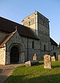
 St Michael and All Angels church, Stewkley - geograph.org.uk - 3619212.jpg 4.320 × 3.240; 4 MB
-
 St Michael and All Saints' Church - geograph.org.uk - 5306050.jpg 1.024 × 653; 176 KB
-
 St Michael and All Saints' Church - geograph.org.uk - 5306084.jpg 1.024 × 683; 170 KB
-
 St Michael ^ All Angels church, Stewkley - geograph.org.uk - 4997822.jpg 510 × 800; 123 KB
-
 St Michael ^ All Angels church, Stewkley - geograph.org.uk - 4997826.jpg 800 × 589; 204 KB
-
 St Michael ^ All Angels, Stewkley - Chancel - geograph.org.uk - 2611020.jpg 1.000 × 690; 151 KB
-
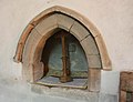
 St Michael ^ All Angels, Stewkley - Doorway - geograph.org.uk - 2611062.jpg 750 × 1.000; 182 KB
-
 St Michael ^ All Angels, Stewkley - Font - geograph.org.uk - 2611024.jpg 733 × 1.000; 151 KB
-
 St Michael ^ All Angels, Stewkley - Gallery - geograph.org.uk - 2611037.jpg 1.000 × 661; 141 KB
-
 St Michael ^ All Angels, Stewkley - geograph.org.uk - 2611007.jpg 1.000 × 673; 173 KB
-
 St Michael ^ All Angels, Stewkley - geograph.org.uk - 2611051.jpg 1.000 × 655; 180 KB
-
 St Michael ^ All Angels, Stewkley - geograph.org.uk - 2611059.jpg 1.000 × 635; 160 KB
-
 St Michael ^ All Angels, Stewkley - geograph.org.uk - 2611065.jpg 772 × 1.000; 194 KB
-
 St Michael ^ All Angels, Stewkley - Gravestones - geograph.org.uk - 2611047.jpg 1.000 × 667; 210 KB
-
 St Michael ^ All Angels, Stewkley - Piscina - geograph.org.uk - 2611033.jpg 1.000 × 766; 124 KB
-
 St Michael ^ All Angels, Stewkley - Porch - geograph.org.uk - 2611011.jpg 666 × 1.000; 227 KB
-
 St Michael ^ All Angels, Stewkley - Porch - geograph.org.uk - 2611044.jpg 1.000 × 667; 180 KB
-
 St Michael ^ All Angels, Stewkley - Pulpit - geograph.org.uk - 2611032.jpg 1.000 × 667; 125 KB
-
 St Michael ^ All Angels, Stewkley - Sanctuary - geograph.org.uk - 2611013.jpg 1.000 × 694; 144 KB
-
 St Michael ^ All Angels, Stewkley - Sanctuary - geograph.org.uk - 2611016.jpg 1.000 × 666; 135 KB
-
 St Michael ^ All Angels, Stewkley - War Memorial - geograph.org.uk - 2611029.jpg 1.000 × 735; 173 KB
-
 St Michael ^ All Angels, Stewkley - West doorway - geograph.org.uk - 2611064.jpg 1.000 × 626; 229 KB
-

-

-

-

-

-

-

-

-

-

-
 Staring cows near Dunton - geograph.org.uk - 4628913.jpg 4.320 × 3.240; 4,47 MB
-
 Stewkley - St Michael - Chancel groin rib intersection - geograph.org.uk - 4311525.jpg 1.000 × 1.035; 1,14 MB
-
 Stewkley - St Michael - Chancel groin roof - geograph.org.uk - 4311519.jpg 1.333 × 1.000; 1,13 MB
-
 Stewkley - St Michael - Norman arches - geograph.org.uk - 4311507.jpg 1.000 × 1.276; 908 KB
-
 Stewkley - St Michael - Tympanum over West door - geograph.org.uk - 4311502.jpg 1.333 × 1.000; 1.016 KB
-
 Stewkley - St Michael - West front - geograph.org.uk - 4311498.jpg 1.000 × 1.223; 936 KB
-
 Stewkley - St Michael from the north - geograph.org.uk - 4311479.jpg 1.333 × 1.000; 1,04 MB
-
 Stewkley - St Michael from the south - geograph.org.uk - 4311363.jpg 1.399 × 1.000; 1,05 MB
-
 Stewkley church - geograph.org.uk - 3994717.jpg 640 × 480; 124 KB
-
 Stewkley Church - geograph.org.uk - 6354041.jpg 1.920 × 1.280; 1,34 MB
-
 Stewkley church, Norman window - geograph.org.uk - 5698265.jpg 705 × 1.024; 227 KB
-
-
 Stewkley church, the Norman west door - geograph.org.uk - 3551805.jpg 764 × 1.024; 285 KB
-
 Stewkley church, the north door - geograph.org.uk - 5696713.jpg 752 × 1.024; 237 KB
-
 Stewkley church, the tower, from the north - geograph.org.uk - 5696705.jpg 747 × 1.024; 202 KB
-
 Stewkley church, the tower, from the north-west - geograph.org.uk - 5696988.jpg 768 × 1.024; 280 KB
-
 Stewkley church, west front - geograph.org.uk - 3551783.jpg 761 × 1.024; 181 KB
-
 Stewkley churchyard on a July evening - geograph.org.uk - 5698232.jpg 1.024 × 777; 230 KB
-
 Stewkley Circular Walk Signpost - geograph.org.uk - 395164.jpg 640 × 480; 126 KB
-

-
 Stewkley Methodist Church (1) - geograph.org.uk - 6145949.jpg 2.592 × 1.944; 1,38 MB
-
 Stewkley Methodist Church (2) - geograph.org.uk - 6145972.jpg 2.592 × 1.944; 1,35 MB
-
 Stewkley Methodist Church - geograph.org.uk - 2594661.jpg 640 × 480; 63 KB
-
 Stewkley Methodist Church - geograph.org.uk - 3994711.jpg 640 × 480; 121 KB
-
 Stewkley Northend Crossroads - geograph.org.uk - 211846.jpg 640 × 480; 165 KB
-
 Stewkley Recreation ground and clubhouse - geograph.org.uk - 3178727.jpg 1.600 × 1.070; 321 KB
-
 Stewkley Telephone Exchange - geograph.org.uk - 399975.jpg 640 × 480; 118 KB
-
 Stewkley village stores - geograph.org.uk - 4351370.jpg 640 × 480; 97 KB
-
 Stewkley, St. Michael's Church - geograph.org.uk - 5468651.jpg 4.214 × 2.810; 3,49 MB
-

-

-

-

-
-

-

-

_vol._1-6._L.P%27_(11000583484).jpg)


_-_geograph.org.uk_-_6145949.jpg)
_-_geograph.org.uk_-_6145972.jpg)


