Category:Stoke Mandeville
ナビゲーションに移動
検索に移動
English: Stoke Mandeville is a village and also a civil parish within Aylesbury Vale district to the south-east of Aylesbury in the county of Buckinghamshire, England. It has a large amount of arable land within its borders. Stoke Mandeville Hospital, although named after the village, is located on the parish's border with Aylesbury and provides the largest spinal injuries ward in Europe.
Français : Stoke Mandeville est un village au sud d'Aylesbury, dans le comté de Buckinghamshire, Angleterre. C'est une commune très prospère, comportant beaucoup de terres arables. L'Hôpital de Stoke Mandeville, quoique nommé d'après le village, est situé sur la limite avec Aylesbury et abrite le plus grand centre de traitement des blessés médullaires d'Europe.
Nederlands: Stoke Mandeville is een dorp en tevens een civil parish in het Verenigd Koninkrijk. Het dorp ligt binnen het Aylesbury Vale district, 4,8 kilometer ten zuidoosten van Aylesbury in de county Buckinghamshire.
village and civil parish in Buckinghamshire, UK  | |||||
| メディアをアップロード | |||||
| 分類 | |||||
|---|---|---|---|---|---|
| 場所 | バッキンガムシャー, 南東イングランド, イングランド | ||||
| 人口 |
| ||||
 | |||||
カテゴリ「Stoke Mandeville」にあるメディア
このカテゴリに属する 83 個のファイルのうち、 83 個を表示しています。
-
 A413 approaching Bedgrove Roundabout - geograph.org.uk - 2862206.jpg 640 × 470;66キロバイト
-
 A413 at Quilters Way - geograph.org.uk - 2834501.jpg 640 × 481;49キロバイト
-
 A413 towards Aylesbury - geograph.org.uk - 6178887.jpg 1,024 × 684;211キロバイト
-
 A413 Wendover Road - geograph.org.uk - 6178903.jpg 1,024 × 684;315キロバイト
-
 A413 Wendover Road - geograph.org.uk - 6178908.jpg 1,024 × 684;293キロバイト
-
 B4443 - geograph.org.uk - 135437.jpg 640 × 480;106キロバイト
-
 Booker Park School, Stoke Mandeville, main entrance - geograph.org.uk - 4730723.jpg 1,592 × 824;204キロバイト
-
 Bridleway off Wendover Road - geograph.org.uk - 1145056.jpg 640 × 480;94キロバイト
-
 Bucks Goat Centre - geograph.org.uk - 160796.jpg 640 × 480;83キロバイト
-
 Bus stop on Wendover Road - geograph.org.uk - 4484378.jpg 2,560 × 1,918;1.49メガバイト
-
 Bus stop on Wendover Road, Stoke Mandeville - geograph.org.uk - 4484390.jpg 2,560 × 1,920;2.04メガバイト
-
 Business Park, Stoke Mandeville - geograph.org.uk - 170113.jpg 640 × 480;102キロバイト
-

-
 Construction Site, Risborough Road - geograph.org.uk - 3543756.jpg 2,288 × 1,712;814キロバイト
-
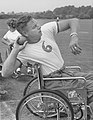 Dick Thompson.jpg 650 × 841;72キロバイト
-
 DIY Level Crossing ^ - geograph.org.uk - 162686.jpg 640 × 480;111キロバイト
-
 Entrance to Stoke Mandeville Hospital - geograph.org.uk - 1144973.jpg 640 × 480;71キロバイト
-
 Evans Close, Aylesbury - geograph.org.uk - 5198134.jpg 3,742 × 2,496;1.54メガバイト
-
 Farmland at Stoke Mandeville - geograph.org.uk - 5627078.jpg 3,888 × 2,592;3.24メガバイト
-
 Farmland, Stoke Mandeville - geograph.org.uk - 4382245.jpg 640 × 480;181キロバイト
-
 Farmland, Stoke Mandeville - geograph.org.uk - 4383165.jpg 640 × 480;199キロバイト
-
 Footpath crossing the tracks - geograph.org.uk - 5117611.jpg 1,600 × 1,200;745キロバイト
-
 Footpath nearing Apsley Manor Farm - geograph.org.uk - 1229293.jpg 640 × 480;87キロバイト
-
 Footpath off Lower Road - geograph.org.uk - 1144993.jpg 640 × 480;81キロバイト
-

-
 Former KX300 Telephone Kiosk, Stoke Mandeville - geograph.org.uk - 5237617.jpg 1,944 × 2,592;976キロバイト
-
 Former Stoke Mandeville Methodist Church - geograph.org.uk - 4033931.jpg 3,072 × 2,304;1.77メガバイト
-
 Hampden Hall Roundabout - geograph.org.uk - 2834522.jpg 640 × 480;44キロバイト
-

-
 Houses on Aylesbury Road, Stoke Mandeville - geograph.org.uk - 4484249.jpg 2,544 × 1,898;1.09メガバイト
-
 Houses on Station Road, Stoke Mandeville - geograph.org.uk - 5678302.jpg 2,304 × 1,728;820キロバイト
-
 Irvine Drive, Stoke Mandeville - geograph.org.uk - 5117749.jpg 1,600 × 1,200;418キロバイト
-
 Last of the Snow - geograph.org.uk - 5627081.jpg 3,888 × 2,592;2.79メガバイト
-
 Lion and Unicycle - geograph.org.uk - 189206.jpg 480 × 640;202キロバイト
-
 Looking across the fields to Moat Farm - geograph.org.uk - 88205.jpg 640 × 480;105キロバイト
-
 Marsh Crossing - geograph.org.uk - 1155842.jpg 640 × 480;69キロバイト
-
 Marsh Crossing - geograph.org.uk - 160663.jpg 640 × 480;61キロバイト
-
 Marsh Lane, Stoke Mandeville - geograph.org.uk - 5627086.jpg 3,888 × 2,592;3.5メガバイト
-
 Nash Close, Aylesbury - geograph.org.uk - 5198129.jpg 1,600 × 1,200;404キロバイト
-
 New housing by B4443 - geograph.org.uk - 4225757.jpg 1,024 × 683;229キロバイト
-
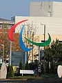 Paralympic sign, Stoke Mandeville Hospital - geograph.org.uk - 4225754.jpg 768 × 1,024;178キロバイト
-
 Path towards Mill House Farm - geograph.org.uk - 1223862.jpg 640 × 480;85キロバイト
-
 Patrick Way, Aylesbury - geograph.org.uk - 5198136.jpg 3,814 × 2,557;1.82メガバイト
-
 Railway station, Stoke Mandeville - geograph.org.uk - 4300001.jpg 4,320 × 3,240;5.53メガバイト
-
 Risborough Road, Stoke Mandeville - geograph.org.uk - 5678297.jpg 2,304 × 1,728;856キロバイト
-
 Roundabout on A413 - geograph.org.uk - 6178899.jpg 1,024 × 684;238キロバイト
-
 St Mary the Virgin, Stoke Mandeville - geograph.org.uk - 4300011.jpg 4,320 × 3,240;4.71メガバイト
-
 Station Road - geograph.org.uk - 1145021.jpg 640 × 480;70キロバイト
-
 Stoke Mandeville Combined School - geograph.org.uk - 1919064.jpg 3,072 × 2,304;1.82メガバイト
-
 Stoke Mandeville gold postbox - geograph.org.uk - 4225762.jpg 683 × 1,024;238キロバイト
-
 Stoke Mandeville gold postbox - geograph.org.uk - 4225763.jpg 1,024 × 683;255キロバイト
-
 Stoke Mandeville railway station - geograph.org.uk - 3377950.jpg 1,024 × 768;198キロバイト
-
 Stoke Mandeville School balloons.JPG 1,600 × 1,200;366キロバイト
-
 Stoke Mandeville School.JPG 1,600 × 1,200;378キロバイト
-
 Stoke Mandeville Sign - geograph.org.uk - 5117747.jpg 3,567 × 2,827;2.62メガバイト
-
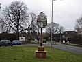
 Stoke Mandeville Village Sign - geograph.org.uk - 5117614.jpg 2,496 × 3,536;1.84メガバイト
-
 Telephone Exchange, Stoke Mandeville - geograph.org.uk - 921491.jpg 640 × 480;93キロバイト
-

-
 The Triangle Business Park - geograph.org.uk - 4710854.jpg 4,000 × 2,664;1.8メガバイト
-
 Towards Stoke Mandeville Station - geograph.org.uk - 5117612.jpg 1,600 × 1,200;615キロバイト
-
 Tree with a Message - geograph.org.uk - 5627087.jpg 2,592 × 3,888;4.68メガバイト
-
 Triangle Business Park - geograph.org.uk - 1223792.jpg 640 × 480;73キロバイト
-
 Triangle Business Park - geograph.org.uk - 169334.jpg 640 × 480;80キロバイト
-
 Weetabix at Moat Farm - geograph.org.uk - 5627063.jpg 3,603 × 2,144;1.86メガバイト
-
 Wendover Road - geograph.org.uk - 1145038.jpg 640 × 480;69キロバイト
-
 Wendover Road in Stoke Mandeville - geograph.org.uk - 3847867.jpg 1,500 × 999;114キロバイト
-
 Wendover Road into Aylesbury - geograph.org.uk - 3847871.jpg 1,500 × 985;141キロバイト
-
 Wendover Road to Aylesbury - geograph.org.uk - 3847868.jpg 1,500 × 912;95キロバイト
-
 Wendover Road to Aylesbury - geograph.org.uk - 3847869.jpg 1,500 × 981;94キロバイト
-
 Wendover Road to Aylesbury - geograph.org.uk - 3847870.jpg 1,500 × 962;89キロバイト
-
 Wendover Road, Stoke Mandeville - geograph.org.uk - 3377957.jpg 1,024 × 768;156キロバイト
-
 Wendover Road, Stoke Mandeville - geograph.org.uk - 4483440.jpg 2,560 × 1,920;2.01メガバイト
-
 Wendover Road, Stoke Mandeville - geograph.org.uk - 5117613.jpg 1,600 × 1,200;363キロバイト
-
 Wendover Road-Marroway roundabout - geograph.org.uk - 2834518.jpg 640 × 480;36キロバイト
-
 Winterton Drive, Stoke Mandeville - geograph.org.uk - 4383455.jpg 640 × 480;168キロバイト
-
 Yarn Bombed Tree beside Risborough Road - geograph.org.uk - 5627094.jpg 2,525 × 3,353;4.08メガバイト
-
 Bridleway, beside the worked field. - geograph.org.uk - 269821.jpg 640 × 480;353キロバイト
-

-
 Flints in Aylesbury plain - geograph.org.uk - 232366.jpg 640 × 480;168キロバイト
-
 Hampden Hall - New Build - geograph.org.uk - 169336.jpg 640 × 480;104キロバイト
-
 Harrowed stubble, North Lee - geograph.org.uk - 229657.jpg 640 × 480;112キロバイト
-
 National Spinal Injuries Centre (NSIC) - geograph.org.uk - 262472.jpg 640 × 480;289キロバイト
-
 Sheep in a field near Hall End Farm - geograph.org.uk - 88207.jpg 640 × 480;77キロバイト


_-_geograph.org.uk_-_262472.jpg)
