Category:Stoney Middleton
Vai alla navigazione
Vai alla ricerca
village and civil parish in Derbyshire Dales district, Derbyshire, England  | |||||
| Carica un file multimediale | |||||
| Istanza di | |||||
|---|---|---|---|---|---|
| Luogo | Derbyshire Dales, Derbyshire, Midlands Orientali, Inghilterra | ||||
| Considerato essere uguale a | Stoney Middleton (parish) | ||||
 | |||||
Sottocategorie
Questa categoria contiene le 4 sottocategorie indicate di seguito, su un totale di 4.
File nella categoria "Stoney Middleton"
Questa categoria contiene 200 file, indicati di seguito, su un totale di 289.
(pagina precedente) (pagina successiva)-
 2015 Stoney Middleton Well Dressing (a) - geograph.org.uk - 4625075.jpg 640 × 480; 110 KB
-
 2015 Stoney Middleton Well Dressing (b) - geograph.org.uk - 4625076.jpg 640 × 480; 117 KB
-
 2015 Stoney Middleton Well Dressing (c) - geograph.org.uk - 4625077.jpg 640 × 480; 114 KB
-
 A house beneath The Cliff - geograph.org.uk - 2373173.jpg 640 × 424; 106 KB
-
 A623 towards Baslow - geograph.org.uk - 3999252.jpg 640 × 480; 76 KB
-
 A623, Middleton Dale - geograph.org.uk - 3999254.jpg 640 × 480; 109 KB
-
 Above Coombs Dale - geograph.org.uk - 1365773.jpg 640 × 480; 147 KB
-
 Above Coombs Dale - geograph.org.uk - 2624295.jpg 3 296 × 2 472; 1,14 MB
-
-
 All Saints, Curbar, late July 2015 - geograph.org.uk - 4592054.jpg 640 × 480; 86 KB
-
 Approaching High Fields - geograph.org.uk - 988035.jpg 640 × 480; 121 KB
-
 Bath Gardens - geograph.org.uk - 4625080.jpg 640 × 480; 140 KB
-
 Bath House well dressing in Stoney Middleton 2019 - geograph.org.uk - 6218900.jpg 3 363 × 4 576; 4,8 MB
-
 Bath House well dressing, Stoney Middleton - geograph.org.uk - 5854988.jpg 3 640 × 4 769; 5,15 MB
-
 Black Harry gate - geograph.org.uk - 6387502.jpg 1 024 × 683; 132 KB
-
 Black Harry Lane - geograph.org.uk - 3452340.jpg 2 048 × 1 536; 632 KB
-
 Black Harry Lane - geograph.org.uk - 580380.jpg 640 × 428; 160 KB
-

-
 Black Harry Lane towards Black Harry Gate - geograph.org.uk - 3452341.jpg 2 048 × 1 536; 559 KB
-
 Bottom Cliff, Stoney Middleton - geograph.org.uk - 2806934.jpg 1 024 × 717; 359 KB
-
 Bottom Cliff, Stoney Middleton - geograph.org.uk - 2806940.jpg 813 × 1 024; 381 KB
-
 Boundary stone - geograph.org.uk - 3673620.jpg 4 000 × 2 248; 5,49 MB
-
 Bridleway and stream through Coombs Dale - geograph.org.uk - 1603308.jpg 640 × 480; 130 KB
-
 Burnt Heath - cattle turning to charge at photographer - geograph.org.uk - 3016274.jpg 4 338 × 2 892; 2,57 MB
-
 Carlswark Cottage - geograph.org.uk - 2189917.jpg 2 000 × 1 232; 2,45 MB
-
-
 Cattle resting above a limestone quarry - geograph.org.uk - 3016293.jpg 2 933 × 4 106; 2,53 MB
-
 Cavendish Mill - geograph.org.uk - 2527415.jpg 640 × 427; 276 KB
-
 Cavendish Mill - geograph.org.uk - 2527420.jpg 427 × 640; 262 KB
-
 Cavendish Mill - geograph.org.uk - 2527422.jpg 640 × 427; 263 KB
-
 Cavendish Mill Fluorspar Plant - geograph.org.uk - 3016282.jpg 4 425 × 2 950; 2,74 MB
-
 Cemetery at Stoney Middleton - geograph.org.uk - 5689653.jpg 640 × 427; 98 KB
-
 Chippings on Moisty Knowl - geograph.org.uk - 580314.jpg 640 × 428; 129 KB
-
 Cliffs above the A623 at Stoney Middleton - geograph.org.uk - 4311683.jpg 1 024 × 768; 287 KB
-
 Closed road - geograph.org.uk - 5099502.jpg 640 × 427; 111 KB
-
 Clump of trees on The Cliff, Stoney Middleton - geograph.org.uk - 5560525.jpg 1 600 × 1 200; 814 KB
-
 Coombs Dale - geograph.org.uk - 4192823.jpg 800 × 600; 150 KB
-
 Coombs Dale beside Sallett Hole Mine - geograph.org.uk - 3679357.jpg 4 000 × 2 248; 5,02 MB
-
 Coombs Dale, Derbyshire - geograph.org.uk - 1925805.jpg 1 024 × 683; 235 KB
-
 Curry Cottage - geograph.org.uk - 4758290.jpg 640 × 426; 78 KB
-
 Cut Mark High Street Stoney Middleton - geograph.org.uk - 4585922.jpg 640 × 480; 113 KB
-

-
 Cut Mark School Stoney Middleton - geograph.org.uk - 4585930.jpg 640 × 480; 104 KB
-

-
 Dale Brook - geograph.org.uk - 2373224.jpg 640 × 428; 107 KB
-
 Darlton Quarry - geograph.org.uk - 2897615.jpg 1 024 × 470; 136 KB
-
 Darlton Quarry - geograph.org.uk - 2897623.jpg 1 024 × 768; 226 KB
-
 Derbyshire UK parish map highlighting Stoney Middleton.svg 888 × 1 308; 2,34 MB
-
 Derelict farm building at Lane Head - geograph.org.uk - 3015931.jpg 3 072 × 4 608; 3,12 MB
-
 Derelict farm building on Middleton Lane - geograph.org.uk - 3015932.jpg 3 072 × 4 608; 2,94 MB
-
 Derwent Valley at Stoney Middleton, Derbyshire - geograph.org.uk - 6356213.jpg 2 000 × 1 333; 1,2 MB
-

-

-
 Descent into Stoney Middleton - geograph.org.uk - 2527461.jpg 427 × 640; 280 KB
-
 Dew pond on Middleton Moor - geograph.org.uk - 2897610.jpg 1 024 × 768; 219 KB
-
 Dew Pond, Middleton Lane - geograph.org.uk - 2527444.jpg 640 × 427; 282 KB
-
 Earth shifter at Black Harry Gate - geograph.org.uk - 1210817.jpg 640 × 480; 76 KB
-
 Entering Stoney Middleton from the east - geograph.org.uk - 2806973.jpg 1 024 × 768; 405 KB
-
 Farm shop in Stoney Middleton - geograph.org.uk - 4192819.jpg 800 × 600; 94 KB
-
 Farm shop, Stoney Middleton - geograph.org.uk - 3999266.jpg 640 × 480; 56 KB
-
 Fields across Coombs Dale - geograph.org.uk - 2851068.jpg 1 500 × 1 211; 1,32 MB
-
 Fish and chip shop, Stoney Middleton - geograph.org.uk - 2133546.jpg 1 024 × 768; 172 KB
-
 Flags flying above the "Roman Baths" - geograph.org.uk - 4625082.jpg 640 × 480; 108 KB
-
 Flags in The Nook - geograph.org.uk - 4625074.jpg 640 × 480; 79 KB
-
 Footpath across fields to Stoney Middleton - geograph.org.uk - 5560465.jpg 1 600 × 1 200; 853 KB
-
 Footpath by Stoke Brook - geograph.org.uk - 3037527.jpg 3 282 × 2 454; 1,49 MB
-
 Footpath near Darlton Quarry - geograph.org.uk - 2399487.jpg 640 × 480; 177 KB
-
 Footpath off New Road - geograph.org.uk - 2687571.jpg 640 × 427; 261 KB
-
 Footpath on The Cliff, west of Stoney Middleton - geograph.org.uk - 5560524.jpg 1 200 × 1 600; 742 KB
-
 Footpath towards Housley - geograph.org.uk - 2399484.jpg 640 × 480; 146 KB
-
 Footpath towards Stoney Middleton - geograph.org.uk - 2399491.jpg 640 × 480; 148 KB
-
 Former Toll House, Stoney Middleton.jpg 640 × 427; 382 KB
-
 Gate to the churchyard, Stoney Middleton - geograph.org.uk - 5560484.jpg 1 200 × 1 600; 782 KB
-

-
 Glebe Mines at Cavendish Mill - geograph.org.uk - 2897597.jpg 1 024 × 768; 174 KB
-
 Glebe Mines plant at Cavendish Mill - geograph.org.uk - 3452331.jpg 2 048 × 1 536; 554 KB
-
 Goddards Quarry - geograph.org.uk - 4311664.jpg 1 024 × 606; 179 KB
-
 Goddards Quarry - geograph.org.uk - 4311666.jpg 1 024 × 768; 268 KB
-
 Goddards Quarry - geograph.org.uk - 4311669.jpg 1 024 × 735; 247 KB
-
 Goddards Quarry - geograph.org.uk - 4311671.jpg 1 024 × 432; 160 KB
-
 Goddards Quarry - geograph.org.uk - 4311676.jpg 1 024 × 541; 163 KB
-
 Grassland above Stoney Middleton - geograph.org.uk - 580295.jpg 640 × 388; 75 KB
-
 Grassy slope north of Lane Head - geograph.org.uk - 5691708.jpg 1 500 × 878; 1,04 MB
-
 Heading towards Middleton Moor - geograph.org.uk - 986260.jpg 640 × 480; 110 KB
-
 High Fields - Black Harry Lane - geograph.org.uk - 986228.jpg 640 × 480; 87 KB
-
 High Fields - Black Harry Lane - geograph.org.uk - 986237.jpg 640 × 480; 94 KB
-
 High Fields - Black Harry Lane - geograph.org.uk - 988069.jpg 640 × 480; 97 KB
-

-
 High Fields - Lane Junction - geograph.org.uk - 988047.jpg 640 × 480; 113 KB
-
 High Fields above Stoney Middleton - geograph.org.uk - 580392.jpg 640 × 428; 149 KB
-
 Home improvements, Stoney Middleton - geograph.org.uk - 1443919.jpg 640 × 480; 73 KB
-
 Horses near Highfields Farm - geograph.org.uk - 580278.jpg 640 × 412; 101 KB
-
 House in the Nook - geograph.org.uk - 4067817.jpg 640 × 427; 335 KB
-
 House in the Nook - geograph.org.uk - 4067843.jpg 640 × 427; 435 KB
-
 House sign and bell in Stoney Middleton - geograph.org.uk - 5704863.jpg 4 901 × 3 725; 5,56 MB
-
 Houses near Stoney Middleton - geograph.org.uk - 2806982.jpg 1 024 × 738; 365 KB
-
 In High Fields in the mist - geograph.org.uk - 1603417.jpg 640 × 480; 67 KB
-
 Indian restaurant, Stoney Middleton - geograph.org.uk - 3999261.jpg 640 × 480; 84 KB
-
 Industrial structures at Cavendish Mill - geograph.org.uk - 3016286.jpg 4 128 × 2 949; 2,44 MB
-

-

-

-

-

-

-

-

-

-

-

-

-

-

-

-

-

-

-

-

-

-
 Lake in former mining area on Longstone Moor - geograph.org.uk - 2807265.jpg 1 024 × 768; 349 KB
-
 Lane connecting Stoney Middleton with Eyam - geograph.org.uk - 4860297.jpg 1 500 × 1 179; 1,42 MB
-
 Limestone Cliff, Middleton Dale - geograph.org.uk - 4758292.jpg 640 × 508; 109 KB
-
 Limestone outcrops in Coombs Dale - geograph.org.uk - 2807215.jpg 1 024 × 743; 400 KB
-
 Long grass in field by Stoke Brook - geograph.org.uk - 5560473.jpg 1 600 × 1 200; 802 KB
-
 Looking down Coombs Dale - geograph.org.uk - 3679365.jpg 4 000 × 2 248; 5,97 MB
-

-
 Looking down the upper sections of Coombs Dale - geograph.org.uk - 2807244.jpg 1 024 × 768; 364 KB
-
 Looking East down Coombs dale. - geograph.org.uk - 6387494.jpg 1 024 × 683; 159 KB
-
 Looking north from Moisty Knowl - geograph.org.uk - 580335.jpg 640 × 428; 120 KB
-
 Looking over Stoney Middleton - geograph.org.uk - 2132087.jpg 1 024 × 768; 242 KB
-
 Lover's Leap Garage, Middleton Dale - geograph.org.uk - 3999253.jpg 640 × 593; 89 KB
-
 Lover's Leap, Stoney Middleton - geograph.org.uk - 1713605.jpg 1 920 × 2 560; 1,53 MB
-
 Lovers Leap, Stoney Middleton - geograph.org.uk - 2373192.jpg 427 × 640; 130 KB
-
 Lovers Leap, Stoney Middleton - geograph.org.uk - 2373220.jpg 427 × 640; 120 KB
-
 Lych Gate and Lane at Stoney Middleton, Derbyshire - geograph.org.uk - 5243915.jpg 1 632 × 2 464; 3,22 MB
-
 Main well dressing in Stoney Middleton 2018 - geograph.org.uk - 5854998.jpg 3 274 × 4 429; 4,25 MB
-
 Main well dressing in Stoney Middleton 2019 - geograph.org.uk - 6218893.jpg 3 539 × 4 601; 5,01 MB
-
 Meadow by Stoke Brook - geograph.org.uk - 1443936.jpg 640 × 480; 66 KB
-
 Meadow Close - geograph.org.uk - 4758283.jpg 640 × 426; 78 KB
-
 Meadow Close - geograph.org.uk - 4758284.jpg 640 × 426; 68 KB
-
 Mere near Middleton Lane - geograph.org.uk - 2624312.jpg 3 296 × 2 472; 1,09 MB
-
 Middleton Dale - geograph.org.uk - 2373288.jpg 427 × 640; 111 KB
-

-

-

-

-

-

-

-

-
 Middleton Moor Murmuration - geograph.org.uk - 3843146.jpg 4 912 × 3 264; 5 MB
-
 Middleton Moor Murmuration - geograph.org.uk - 3843151.jpg 3 841 × 2 516; 2,42 MB
-
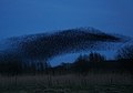 Middleton Moor Murmuration - geograph.org.uk - 3843154.jpg 4 186 × 2 933; 2,72 MB
-
 MiddletonDale.jpg 3 456 × 2 304; 3,91 MB
-
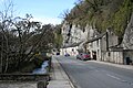
 Mill Street and The Bank, Stoney Middleton - geograph.org.uk - 2806953.jpg 1 024 × 793; 368 KB
-
 Mine road in Coombs Dale - geograph.org.uk - 2851049.jpg 1 500 × 1 125; 1,97 MB
-
 Mirror at bridleway crossing - geograph.org.uk - 2897628.jpg 768 × 1 024; 297 KB
-
 Moisty Lane - Approaching Lane Head - geograph.org.uk - 988626.jpg 640 × 480; 96 KB
-

-
 My master is nearby, just busy - geograph.org.uk - 4625088.jpg 640 × 480; 113 KB
-
 Oarystones - geograph.org.uk - 2527436.jpg 427 × 640; 295 KB
-

-
 On Black Harry Lane - geograph.org.uk - 3015934.jpg 4 608 × 3 072; 3,43 MB
-
 Open window and empty hanging basket - geograph.org.uk - 2524840.jpg 640 × 422; 58 KB
-
 Over the fields towards Eyam - geograph.org.uk - 592576.jpg 640 × 430; 166 KB
-
 Overlooking Darlton Quarry - geograph.org.uk - 2897619.jpg 1 024 × 768; 223 KB
-
 Path above Stoney Middleton - geograph.org.uk - 5704378.jpg 5 035 × 3 742; 4,75 MB
-
 Path by rough ground to Stoney Middleton - geograph.org.uk - 5558997.jpg 1 600 × 1 200; 815 KB
-
 Path down to Stoney Middleton - geograph.org.uk - 2806920.jpg 1 024 × 768; 373 KB
-
 Perils of the Peak - geograph.org.uk - 1210812.jpg 640 × 480; 114 KB
-
 Plaque opposite the parish church - geograph.org.uk - 4625073.jpg 640 × 480; 93 KB
-

-
 Public Footpath Entrance, Stoney Middleton - geograph.org.uk - 1743719.jpg 3 296 × 2 472; 1,06 MB
-
 Pump and water trough, Stoney Middleton - geograph.org.uk - 5560483.jpg 1 600 × 1 200; 820 KB
-
 Rivet Base Cross Stoney Middleton - geograph.org.uk - 4585938.jpg 640 × 480; 118 KB
-
 Road Passing Through Cavendish Mill - geograph.org.uk - 2624329.jpg 3 296 × 2 472; 1,07 MB
-
 Road signs at the bottom of High Street - geograph.org.uk - 4192821.jpg 600 × 800; 102 KB
-
 Rock Climb Alcasan (E2 5c) at Stoney Middleton.jpg 2 976 × 3 968; 4,68 MB
-
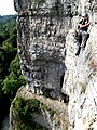
 Rock climbing at Stoney Middleton - geograph.org.uk - 689126.jpg 480 × 640; 107 KB
-
 Rock Cottage, The Dale, Stoney Middleton - geograph.org.uk - 2856579.jpg 3 072 × 4 608; 3,29 MB
-
 Ruined barn on Middleton Moor - geograph.org.uk - 2897611.jpg 1 024 × 768; 151 KB
-
 Ruined Barn, Middleton Lane - geograph.org.uk - 2527442.jpg 640 × 427; 271 KB
-
 Ruined Wall near the Oarystones - geograph.org.uk - 2527439.jpg 427 × 640; 252 KB
-
 Satellite dishes on Lovers Leap - geograph.org.uk - 2373246.jpg 427 × 640; 126 KB
-
 Shadows in The Nook - geograph.org.uk - 4625085.jpg 640 × 480; 110 KB
-
 Sheep, cattle and Cavendish Mill - geograph.org.uk - 1210805.jpg 640 × 480; 49 KB
-
 Sign at the "Roman Baths" - geograph.org.uk - 4625078.jpg 640 × 480; 89 KB
-
 Slurry pond by Black Harry Gate, Coombs Dale - geograph.org.uk - 3679370.jpg 3 954 × 2 164; 5,01 MB
-
 SM well dressing 2005 33980339 7282da25d1 o.jpg 600 × 800; 158 KB
-

-
 Snowdrops in Stoney Middleton graveyard - geograph.org.uk - 5704372.jpg 4 661 × 3 382; 3,87 MB
-
 St Martin's Church, Stoney Middleton - geograph.org.uk - 5350857.jpg 1 600 × 1 200; 609 KB
-
 St Martin's Church, Stoney Middleton - geograph.org.uk - 5704350.jpg 5 066 × 3 577; 5,23 MB
-

-

-

-

-

-

_-_geograph.org.uk_-_4625075.jpg)
_-_geograph.org.uk_-_4625076.jpg)
_-_geograph.org.uk_-_4625077.jpg)


_-_geograph.org.uk_-_4625126.jpg)
_-_geograph.org.uk_-_4625128.jpg)
_-_geograph.org.uk_-_4625129.jpg)
_-_geograph.org.uk_-_4625131.jpg)
_-_geograph.org.uk_-_4625139.jpg)
_-_geograph.org.uk_-_4625132.jpg)
_-_geograph.org.uk_-_4625134.jpg)
_-_geograph.org.uk_-_4625135.jpg)
_-_geograph.org.uk_-_4625138.jpg)
_-_geograph.org.uk_-_4625140.jpg)
_-_geograph.org.uk_-_4625150.jpg)
_-_geograph.org.uk_-_4625151.jpg)
_-_geograph.org.uk_-_4625152.jpg)
_-_geograph.org.uk_-_4625155.jpg)
_-_geograph.org.uk_-_4625174.jpg)
_-_geograph.org.uk_-_4625157.jpg)
_-_geograph.org.uk_-_4625158.jpg)
_-_geograph.org.uk_-_4625172.jpg)
_-_geograph.org.uk_-_4625173.jpg)
_-_geograph.org.uk_-_4625175.jpg)


_at_Stoney_Middleton.jpg)


_-_geograph.org.uk_-_4625100.jpg)
_-_geograph.org.uk_-_4625110.jpg)
_-_geograph.org.uk_-_4625111.jpg)
_-_geograph.org.uk_-_4625113.jpg)

