Category:Stretton, East Staffordshire
Aller à la navigation
Aller à la recherche
localité britannique du comté anglais de Staffordshire  | |||||
| Téléverser des médias | |||||
| Nature de l’élément | |||||
|---|---|---|---|---|---|
| Lieu | East Staffordshire, Staffordshire, Midlands de l'Ouest, Angleterre | ||||
 | |||||
Sous-catégories
Cette catégorie comprend 9 sous-catégories, dont les 9 ci-dessous.
Média dans la catégorie « Stretton, East Staffordshire »
Cette catégorie comprend 125 fichiers, dont les 125 ci-dessous.
-
 66752 Clay Mills Junction 7th September 2016.jpg 4 608 × 3 456 ; 4,51 Mio
-
 A38 about to cross Princess Way - geograph.org.uk - 4566348.jpg 640 × 402 ; 119 kio
-
 A38 approaching A5121 junction - geograph.org.uk - 4323766.jpg 640 × 377 ; 58 kio
-
 A38 near Horninglow - geograph.org.uk - 4566399.jpg 640 × 356 ; 54 kio
-
 A38, Branston - geograph.org.uk - 2396159.jpg 640 × 418 ; 40 kio
-
 A38, Clay Mills, Burton on Trent - geograph.org.uk - 2396139.jpg 640 × 454 ; 41 kio
-
 A5121 junction from A38 - geograph.org.uk - 4564737.jpg 640 × 349 ; 44 kio
-

-
 Approaching lay by on A38 near Horninglow - geograph.org.uk - 4323770.jpg 640 × 374 ; 64 kio
-

-

-
 Bales in flood - geograph.org.uk - 954980.jpg 640 × 426 ; 119 kio
-
 Bench mark, Monk's Bridge, Egginton - geograph.org.uk - 3872736.jpg 1 280 × 934 ; 686 kio
-
 Bitham Lane - geograph.org.uk - 5737792.jpg 2 000 × 1 333 ; 2,31 Mio
-
 Bitham Lane heading east - geograph.org.uk - 3423233.jpg 640 × 480 ; 74 kio
-
-
 Bridge 31, Trent and Mersey Canal - geograph.org.uk - 3222983.jpg 3 438 × 2 748 ; 2,15 Mio
-
 Bridge Farmhouse, Stretton - geograph.org.uk - 3863816.jpg 1 280 × 916 ; 237 kio
-
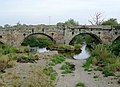
 Bridge over the River Dove, near Burton-on-Trent - geograph.org.uk - 1655727.jpg 640 × 482 ; 149 kio
-
 Bridge over the River Dove, near Burton-on-Trent - geograph.org.uk - 1656504.jpg 640 × 431 ; 133 kio
-
 Bridge Street, Stretton - geograph.org.uk - 3423237.jpg 640 × 480 ; 79 kio
-
 Bullocks - Across the River Penk - geograph.org.uk - 1444438.jpg 640 × 480 ; 302 kio
-
 Canal north-east of Stretton, Staffordshire - geograph.org.uk - 5595712.jpg 960 × 1 280 ; 1,33 Mio
-
 Canal north-east of Stretton, Staffordshire - geograph.org.uk - 5595724.jpg 1 280 × 960 ; 1,66 Mio
-
 Canalside beer garden at the Mill House - geograph.org.uk - 3572554.jpg 1 600 × 1 200 ; 408 kio
-
 Canalside factory units near Stretton, Staffordshire - geograph.org.uk - 6006803.jpg 960 × 1 280 ; 1,38 Mio
-
 Canalside marketing suite - geograph.org.uk - 6004118.jpg 1 280 × 960 ; 397 kio
-
 Changing Rooms - geograph.org.uk - 3572571.jpg 1 600 × 1 200 ; 499 kio
-
 Churchyard cross base, Stretton - geograph.org.uk - 3863829.jpg 1 280 × 960 ; 416 kio
-
 Clay Mills junction from A38 - geograph.org.uk - 4566338.jpg 640 × 296 ; 43 kio
-
 Claymills - geograph.org.uk - 2855395.jpg 424 × 640 ; 164 kio
-
 Claymills - the new and the old - geograph.org.uk - 1957501.jpg 640 × 480 ; 59 kio
-
 Claymills level crossing - geograph.org.uk - 4211582.jpg 640 × 480 ; 59 kio
-
 Claymills Pumping Station - geograph.org.uk - 2149986.jpg 800 × 531 ; 81 kio
-
 Claymills Victorian Pumping Station - geograph.org.uk - 1861560.jpg 640 × 477 ; 67 kio
-
 Claymills Victorian Pumping Station - geograph.org.uk - 2931733.jpg 426 × 640 ; 49 kio
-
 Claymills Victorian Pumping Station - geograph.org.uk - 5114873.jpg 800 × 600 ; 85 kio
-
 Claymills Victorian Pumping Station - geograph.org.uk - 5394305.jpg 640 × 480 ; 404 kio
-

-
 Claymills Victorian Sewage Pumping Station - geograph.org.uk - 5394914.jpg 640 × 481 ; 424 kio
-
 Crop field and hedgerow - geograph.org.uk - 4539294.jpg 640 × 407 ; 60 kio
-
 Derby Road (A5121), Stretton - geograph.org.uk - 5394949.jpg 640 × 480 ; 360 kio
-
 Dove House Hotel - geograph.org.uk - 5737760.jpg 2 000 × 1 333 ; 1,67 Mio
-
 Dovecliff Crescent - geograph.org.uk - 3568875.jpg 640 × 480 ; 89 kio
-
 Dovecliff Road - geograph.org.uk - 3568880.jpg 640 × 480 ; 110 kio
-
 Express Train at Claymills Junction - geograph.org.uk - 5394916.jpg 640 × 481 ; 406 kio
-
 Farmland, Meadow Lane Farm - geograph.org.uk - 3200833.jpg 640 × 409 ; 41 kio
-
 Fence in the floods - geograph.org.uk - 954984.jpg 640 × 426 ; 68 kio
-
 Fence in the floods - geograph.org.uk - 954987.jpg 640 × 426 ; 59 kio
-
 Fence in the floods - geograph.org.uk - 954989.jpg 640 × 426 ; 86 kio
-
 Fingerpost at Claymills - geograph.org.uk - 3987134.jpg 929 × 1 280 ; 542 kio
-
 From the A38 - geograph.org.uk - 5713527.jpg 2 000 × 1 333 ; 1,66 Mio
-
 Goods train at Claymills - geograph.org.uk - 4449804.jpg 640 × 480 ; 94 kio
-
 Hillfield Lane overbridge from A38 north - geograph.org.uk - 3002895.jpg 640 × 485 ; 78 kio
-
 Houses on Bitham Lane - geograph.org.uk - 3423232.jpg 640 × 480 ; 56 kio
-
 Jinny Nature Trail - geograph.org.uk - 3863822.jpg 1 280 × 960 ; 474 kio
-
 Long goods train at Clay Mills - geograph.org.uk - 4449818.jpg 640 × 480 ; 83 kio
-
 Longbow Close in Stretton - geograph.org.uk - 6327304.jpg 1 024 × 768 ; 139 kio
-
 Looking towards the Trent Mersey Canal - geograph.org.uk - 5737587.jpg 2 000 × 1 333 ; 3,11 Mio
-
 Manton Close Play Area - geograph.org.uk - 6004135.jpg 1 280 × 960 ; 580 kio
-
 McDonald's on Derby Road - geograph.org.uk - 3653262.jpg 1 500 × 999 ; 199 kio
-
 Meadow Lane Level Crossing (Claymills Junction) - geograph.org.uk - 5394917.jpg 640 × 481 ; 340 kio
-
 Mile Post - geograph.org.uk - 706470.jpg 427 × 640 ; 115 kio
-
 Mill House - geograph.org.uk - 5394968.jpg 640 × 481 ; 455 kio
-
 Mill Stream near Dovecliff Hall - geograph.org.uk - 2923426.jpg 3 236 × 2 390 ; 2,25 Mio
-

-
 Narrowboat near Beech Lane Bridge No 30 - geograph.org.uk - 4620968.jpg 800 × 567 ; 191 kio
-
 Nature trail heading north, Stretton - geograph.org.uk - 3423263.jpg 640 × 480 ; 125 kio
-

-

-
-
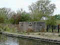
 Pill box near Rolleston - geograph.org.uk - 954986.jpg 640 × 426 ; 125 kio
-
 Pill Box, Dove Aqueduct - geograph.org.uk - 2397967.jpg 640 × 418 ; 84 kio
-
 Pillbox by the River Dove - geograph.org.uk - 2446547.jpg 1 200 × 900 ; 157 kio
-
 Pillbox by the Stretton Aqueduct in Staffordshire - geograph.org.uk - 6006634.jpg 1 440 × 960 ; 1,29 Mio
-
 Playing field on Hillfield Lane - geograph.org.uk - 3572564.jpg 1 600 × 1 200 ; 212 kio
-
 Pond on the nature trail - geograph.org.uk - 3423260.jpg 640 × 480 ; 122 kio
-
 Princess Way crossing the Trent ^ Mersey Canal - geograph.org.uk - 4621125.jpg 787 × 800 ; 168 kio
-
 Railway Line - geograph.org.uk - 2149979.jpg 800 × 531 ; 113 kio
-
 Replica Fokker triplane - geograph.org.uk - 4449892.jpg 615 × 640 ; 41 kio
-
 River Dove crossing from A38 - geograph.org.uk - 4564738.jpg 640 × 334 ; 48 kio
-
 River Dove in flood - geograph.org.uk - 664131.jpg 640 × 479 ; 57 kio
-
 River Dove near Rolleston - geograph.org.uk - 955081.jpg 640 × 480 ; 116 kio
-
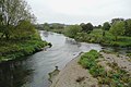 River Dove near Stretton, Staffordshire - geograph.org.uk - 1653475.jpg 800 × 531 ; 324 kio
-
 River Dove near Stretton, Staffordshire - geograph.org.uk - 1654285.jpg 640 × 469 ; 132 kio
-
 River Dove near Stretton, Staffordshire - geograph.org.uk - 1654294.jpg 640 × 480 ; 153 kio
-
 River Dove upstream of A38 bridge - geograph.org.uk - 3395249.jpg 1 600 × 1 200 ; 386 kio
-
 Rumenco - animal feed works - geograph.org.uk - 2650970.jpg 640 × 480 ; 88 kio
-
 Sewage Works Near Burton on Trent - geograph.org.uk - 3189300.jpg 640 × 480 ; 51 kio
-
 Shrewsbury Road Stretton - geograph.org.uk - 5737753.jpg 2 000 × 1 333 ; 1,62 Mio
-
 Site of former canal bridge near Clay Mills, Staffordshire - geograph.org.uk - 5595728.jpg 960 × 1 280 ; 1,35 Mio
-
 Stretton Bowls Club - geograph.org.uk - 6004141.jpg 1 280 × 960 ; 356 kio
-
 Stretton War Memorial - geograph.org.uk - 6004125.jpg 1 280 × 960 ; 467 kio
-
 Sun breaking through the fog - geograph.org.uk - 4304225.jpg 1 280 × 960 ; 70 kio
-
 Sun breaking through the fog - geograph.org.uk - 4304233.jpg 1 280 × 888 ; 56 kio
-
 The Beech - geograph.org.uk - 5713529.jpg 2 000 × 1 333 ; 1,85 Mio
-
 The Clay Mills mill stream - geograph.org.uk - 4182682.jpg 1 200 × 900 ; 352 kio
-
 The flood plain of the River Dove - geograph.org.uk - 4620882.jpg 600 × 800 ; 198 kio
-
 The Great Britain XII at Clay Mills - geograph.org.uk - 6141763.jpg 640 × 486 ; 83 kio
-
 The railway from Clay Mills level crossing - geograph.org.uk - 1957493.jpg 640 × 480 ; 83 kio
-
 The River Dove - geograph.org.uk - 5114888.jpg 800 × 600 ; 146 kio
-
 The Trent and Mersey Canal near Clay Mills - geograph.org.uk - 3745005.jpg 4 000 × 3 000 ; 3,54 Mio
-
 Train coming - geograph.org.uk - 3182017.jpg 3 264 × 2 448 ; 3,45 Mio
-
 Train for Derby - geograph.org.uk - 3182019.jpg 3 264 × 2 448 ; 4,1 Mio
-
 Tree in field, Stretton - geograph.org.uk - 2982749.jpg 640 × 307 ; 32 kio
-
 Trent and Mersey Canal (looking south) - geograph.org.uk - 5394953.jpg 640 × 480 ; 448 kio
-

-

-
 Trent and Mersey Canal at Stretton - geograph.org.uk - 5394956.jpg 640 × 480 ; 453 kio
-

-
 Trent and Mersey Canal Bridge No 30 at Stretton - geograph.org.uk - 3960364.jpg 1 600 × 1 200 ; 576 kio
-
 Trent and Mersey Canal near Clay Mills - geograph.org.uk - 2397975.jpg 640 × 480 ; 88 kio
-
 Trent and Mersey Canal near Stretton, Staffordshire - geograph.org.uk - 6006799.jpg 1 440 × 960 ; 1,53 Mio
-

-

-

-
 Trent ^ Mersey Canal in Burton upon Trent - geograph.org.uk - 4621011.jpg 800 × 512 ; 121 kio
-
 Trent ^ Mersey Canal Milepost near Stretton - geograph.org.uk - 4620936.jpg 800 × 608 ; 185 kio
-
 Trent ^ Mersey Canal Milepost next to bridge 31 - geograph.org.uk - 4621112.jpg 800 × 585 ; 149 kio
-
 Turnstiles to the nPower Family Stand - geograph.org.uk - 3653267.jpg 1 500 × 999 ; 200 kio
-
 View towards Stretton - geograph.org.uk - 2148167.jpg 800 × 531 ; 114 kio
-
 View upstream from Monk's Bridge - geograph.org.uk - 3872738.jpg 1 280 × 960 ; 369 kio
-
 War Graves Commission gravestone in Stretton churchyard - geograph.org.uk - 3863854.jpg 960 × 1 280 ; 349 kio
-
 Watling Street at Stretton, Staffordshire - geograph.org.uk - 1333910.jpg 640 × 464 ; 139 kio
-
 Works, Stretton - geograph.org.uk - 3200840.jpg 640 × 432 ; 75 kio


_over_the_River_Dove,_near_Burton-on-Trent_-_geograph.org.uk_-_1656509.jpg)


,_Stretton_-_geograph.org.uk_-_5394949.jpg)


_-_geograph.org.uk_-_5394917.jpg)


_-_geograph.org.uk_-_5394953.jpg)


