Category:Stroud, Gloucestershire
Vai alla navigazione
Vai alla ricerca
Deutsch: Stroud ist eine Stadt mit 12.690 Einwohnern (2001) in der englischen Grafschaft Gloucestershire. Sie ist das Zentrum des gleichnamigen Regierungsbezirkes und des Wahlkreises Stroud.
English: Stroud is a town and civil parish in the county of Gloucestershire, England. It is the main town in Stroud District.
Français : Stroud est une petite ville et une paroisse civile située dans le Gloucestershire, en Angleterre. C'est la principale ville du district de Stroud.
Nederlands: Stroud is een plaats in het bestuurlijke gebied Stroud, in het Engelse graafschap Gloucestershire. De plaats telt 12.690 inwoners.
Polski: Stroud – miasto w Wielkiej Brytanii (Anglia) w hrabstwie Gloucestershire. Około 12 tys. mieszkańców (2001).
Română: Stroud este un oraş şi un district nemetropolitan în comitatul Gloucestershire, regiunea South West, Anglia. Districtul are o populaţie de 110.300 locuitori, din care 12.960 locuiesc în oraşul propriu zis Stroud.
market town inglese  | |||||
| Carica un file multimediale | |||||
| Istanza di | |||||
|---|---|---|---|---|---|
| Luogo | Stroud, Gloucestershire, Sud Ovest dell'Inghilterra, Inghilterra | ||||
| Distinto da | |||||
| sito web ufficiale | |||||
 | |||||
Sottocategorie
Questa categoria contiene le 10 sottocategorie indicate di seguito, su un totale di 10.
Pagine nella categoria "Stroud, Gloucestershire"
Questa categoria contiene un'unica pagina, indicata di seguito.
S
File nella categoria "Stroud, Gloucestershire"
Questa categoria contiene 200 file, indicati di seguito, su un totale di 253.
(pagina precedente) (pagina successiva)-
 Convolvulus bindweed morning glory Stroud, Gloucestershire.jpg 6 240 × 4 160; 15,64 MB
-
 Evening primrose Oenothera Stroud Gloucestershire.jpg 4 808 × 3 847; 8,31 MB
-
 Stroud Subscription Rooms portico view 01a.jpg 5 372 × 3 582; 10,05 MB
-
 Stroud Thames & Severn Canal towpath book repository railway viaduct Gloucestershire.jpg 3 561 × 5 342; 20,01 MB
-
 Stroud railway viaduct graffiti Thames & Severn Canal towpath Gloucestershire 01.jpg 5 830 × 3 279; 19,75 MB
-
 Stroud railway viaduct graffiti Thames & Severn Canal towpath Gloucestershire 02.jpg 3 777 × 5 036; 16,7 MB
-
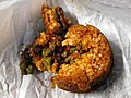 Arancini ragù stuffing Stroud Gloucestershire stodgy and dry 01.jpg 6 614 × 4 961; 18,72 MB
-
 Arancini ragù stuffing Stroud Gloucestershire stodgy and dry 02.jpg 6 614 × 4 961; 22,71 MB
-
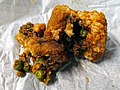 Arancini ragù stuffing Stroud Gloucestershire stodgy and dry 03.jpg 6 614 × 4 961; 21,74 MB
-
 Fish and chips box Stroud Gloucestershire greasy and stale.jpg 6 614 × 3 307; 11,35 MB
-
 John Canton Stroud Gloucestershire blue plaque.jpg 6 614 × 6 614; 21,52 MB
-
 John Wesley Stroud Gloucestershire plaque.jpg 4 961 × 6 614; 21,36 MB
-
 Pain au chocolat Stroud Gloucestershire 01.jpg 6 614 × 4 408; 17,04 MB
-
 Pain au chocolat Stroud Gloucestershire 02.jpg 6 614 × 4 409; 16,52 MB
-
 Stroud George Street open sash window Gloucestershire.jpg 6 614 × 4 409; 15,25 MB
-
 George Street Stroud, Groucestershire cafe bistro.jpg 6 150 × 4 100; 23,75 MB
-
 Flat white coffee Five Valleys Shopping Centre market Stroud Gloucestershire.jpg 2 041 × 2 108; 4,11 MB
-
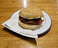 Bacon roll Five Valleys Shopping Centre market Stroud Gloucestershire 01.jpg 3 321 × 2 746; 7,32 MB
-
 Bacon roll Five Valleys Shopping Centre market Stroud Gloucestershire 02.jpg 3 465 × 2 772; 8,02 MB
-
 Fish and chips Five Valleys Shopping Centre market Stroud Gloucestershire 01.jpg 3 832 × 2 155; 7,09 MB
-
 Fish and chips Five Valleys Shopping Centre market Stroud Gloucestershire 02.jpg 3 721 × 2 093; 6,29 MB
-
 A circular spill weir - geograph.org.uk - 4816069.jpg 1 024 × 680; 319 KB
-
 A Golden Watery Grave - geograph.org.uk - 1038426.jpg 640 × 426; 119 KB
-
 A prime advertising opportunity - geograph.org.uk - 3759564.jpg 1 704 × 2 304; 1,8 MB
-
 Bank Gardens Gateway - geograph.org.uk - 5229488.jpg 2 592 × 4 608; 4,79 MB
-
 Bank Gardens, Stroud - geograph.org.uk - 4633341.jpg 900 × 551; 420 KB
-
 Benchmark at the bottom of Union Street - geograph.org.uk - 3763661.jpg 2 304 × 1 704; 1,61 MB
-
 Bisley Old Road Allotments, Stroud - geograph.org.uk - 217560.jpg 640 × 480; 115 KB
-
 Boundary fence - geograph.org.uk - 321708.jpg 640 × 480; 111 KB
-
 Bowcott Knoll Wood - geograph.org.uk - 1479912.jpg 426 × 640; 118 KB
-
 Bridleway in Folly Wood - geograph.org.uk - 1479928.jpg 426 × 640; 121 KB
-
 Bywash alongside Foundry or Upper Lock - geograph.org.uk - 4894930.jpg 1 024 × 768; 201 KB
-
 Calor gas cylinders and pump, Stroud - geograph.org.uk - 4648388.jpg 800 × 471; 100 KB
-
 Capel's Mill, Stroud, from behind a wildlife pond above the canal.jpg 4 000 × 3 000; 4,36 MB
-
 Capel's Mill, Stroud.jpg 4 000 × 3 000; 4,09 MB
-
 Chairs in Bowbridge Lock - geograph.org.uk - 4816066.jpg 800 × 531; 127 KB
-

-
 Confluence with Painswick Stream - geograph.org.uk - 1052890.jpg 640 × 480; 97 KB
-
 Coronation gates, Stratford Park, Stroud - geograph.org.uk - 3902643.jpg 800 × 757; 225 KB
-
 Culvert under A46, Stroud Park - geograph.org.uk - 1816639.jpg 1 200 × 800; 868 KB
-

-
 Dandelion clock, Owlpen - geograph.org.uk - 428122.jpg 640 × 480; 85 KB
-
 Deep ditch near Highcross Farm - geograph.org.uk - 683409.jpg 480 × 640; 126 KB
-

-
 Disused Railway Bridge - geograph.org.uk - 1539200.jpg 640 × 563; 97 KB
-
 Don't kill me^ - geograph.org.uk - 3759561.jpg 2 304 × 1 704; 1,68 MB
-
 Double postbox with two apertures, one for stamped, and the other for franked, mail.jpg 1 536 × 2 048; 1,45 MB
-

-
 Dudbridge ... the price of petrol today. - Flickr - BazzaDaRambler.jpg 3 588 × 2 594; 1,01 MB
-
 Entrance to Park Gardens, Stroud - geograph.org.uk - 3303827.jpg 640 × 475; 89 KB
-
 Entrance to Park Gardens, Stroud - geograph.org.uk - 5472171.jpg 2 000 × 1 464; 900 KB
-
 Field beside Slad Lane - geograph.org.uk - 592244.jpg 640 × 480; 100 KB
-
 Field margin - geograph.org.uk - 320879.jpg 618 × 465; 135 KB
-
 Fit only for ducks - geograph.org.uk - 3759542.jpg 2 304 × 1 704; 1,65 MB
-
 Food miles - geograph.org.uk - 339222.jpg 640 × 480; 85 KB
-
 Footbridge, Stratford Park, Stroud - geograph.org.uk - 1816630.jpg 1 200 × 799; 750 KB
-
 Footpath from Painswick Old Road to Folly Lane - geograph.org.uk - 5472192.jpg 1 500 × 2 000; 1,05 MB
-
 Footpath from Painswick Old Road to Folly Lane - geograph.org.uk - 5472196.jpg 1 500 × 2 000; 1,34 MB
-
 Footpath past Hawkwood College at Painswick Old Road - geograph.org.uk - 5472185.jpg 2 000 × 1 399; 865 KB
-
 Ford car sales - geograph.org.uk - 4816077.jpg 531 × 800; 124 KB
-

-

-

-
 Grafitti wall.jpg 2 048 × 1 536; 1,28 MB
-
 Grass bank, Stroud police station - geograph.org.uk - 591645.jpg 640 × 480; 164 KB
-
 Gypsy site - geograph.org.uk - 343589.jpg 640 × 480; 73 KB
-

-
 I can't make sense of you - geograph.org.uk - 3759579.jpg 2 304 × 1 704; 1,61 MB
-
 In Transit by Sam Freeman, Stroud.jpg 4 000 × 3 000; 4,98 MB
-
 John canton.jpg 1 332 × 1 372; 777 KB
-
 John Stayte Services Stroud with laundrette and EVSEs.jpg 4 000 × 2 248; 2,27 MB
-
 Lebanon cedar at Stouts Hill - geograph.org.uk - 316736.jpg 480 × 640; 144 KB
-
 Lock gates in Stroud - geograph.org.uk - 6015659.jpg 1 200 × 1 600; 514 KB
-
 Lodgemore Swing Bridge - geograph.org.uk - 1052889.jpg 640 × 480; 90 KB
-

-

-
 Merrywalks footbridge, Stroud - geograph.org.uk - 3303092.jpg 640 × 444; 84 KB
-
 Milestone in Stroud on side of old canal (between Walbridge and Inglesham).jpg 4 000 × 3 000; 6,02 MB
-
 Modern sculpture of an owl, Stroud - geograph.org.uk - 5641372.jpg 1 600 × 1 200; 796 KB
-
 No heading east - geograph.org.uk - 3759555.jpg 2 304 × 1 704; 1,64 MB
-
 Ordnance Survey Cut Mark - geograph.org.uk - 5116582.jpg 405 × 640; 109 KB
-
 Ordnance Survey Cut Mark - geograph.org.uk - 5116583.jpg 385 × 640; 87 KB
-
 Ordnance Survey Cut Mark - geograph.org.uk - 5116584.jpg 640 × 547; 103 KB
-
 Ordnance Survey One-Inch Sheet 103 Stroud & Chepstow, Published 1919.jpg 11 874 × 8 910; 11,76 MB
-
 Ordnance Survey One-Inch Sheet 156 Bristol & Stroud, Published 1946.jpg 10 939 × 12 823; 18,14 MB
-
 Ordnance Survey One-Inch Sheet 156 Bristol & Stroud, Published 1953.jpg 8 245 × 9 924; 10,47 MB
-
 Ordnance Survey One-Inch Sheet 156 Bristol & Stroud, Published 1972.jpg 11 086 × 13 175; 48,11 MB
-
 Ordnance Survey One-Inch Tourist Map of the Wye Valley & Lower Severn, published 1961.jpg 13 124 × 16 665; 27,94 MB
-
 OS Bench Mark - Church Street - geograph.org.uk - 5231046.jpg 3 392 × 2 592; 3,9 MB
-
 OS Bench Mark - Market Tavern - geograph.org.uk - 5231039.jpg 4 608 × 2 592; 6,01 MB
-
 OS Bench Mark - Old Police Station - geograph.org.uk - 5231049.jpg 4 608 × 2 592; 5,64 MB
-
 OS Bench Mark Union Street - geograph.org.uk - 5231044.jpg 1 228 × 1 527; 956 KB
-
 OutcastBand1.jpg 1 024 × 683; 61 KB
-
 Paganhill bus stop Stroud (2787695108).jpg 960 × 1 280; 107 KB
-

-
 Paganhill, Stroud ... Maypole. - Flickr - BazzaDaRambler.jpg 3 260 × 4 340; 1,61 MB
-

-
 Painswick Stream, Stroud - geograph.org.uk - 3902659.jpg 800 × 600; 240 KB
-
 Painted underpass - geograph.org.uk - 3759573.jpg 2 304 × 1 704; 1,73 MB
-
 Park Gardens War Memorial, Stroud - geograph.org.uk - 3303830.jpg 640 × 480; 105 KB
-

-
 Parks park (Gardens) Stroud - geograph.org.uk - 1076302.jpg 640 × 536; 88 KB
-
 Parliament Close, Stroud - geograph.org.uk - 4292983.jpg 800 × 532; 80 KB
-

-

-
 Picturesque Gloucestershire. Stroud (NBY 442806).jpg 3 600 × 2 362; 1,95 MB
-
 Pipiza species, possibly P. noctiluca - Flickr - gailhampshire.jpg 2 191 × 2 020; 527 KB
-
 Plaque on Stroud Brewery Bridge - geograph.org.uk - 4817677.jpg 800 × 531; 178 KB
-
 Plaque, site of Dudbridge Station, Stroud - geograph.org.uk - 932036.jpg 640 × 480; 140 KB
-
 Police staff car park, Stroud - geograph.org.uk - 4298759.jpg 800 × 564; 124 KB
-

-
 Public footpath to Callowell - geograph.org.uk - 3905534.jpg 800 × 611; 204 KB
-
 Puff Ball near Appleridge Farm - geograph.org.uk - 250321.jpg 640 × 480; 142 KB
-
 Railway arches, Merrywalks, Stroud - geograph.org.uk - 2085183.jpg 979 × 1 000; 313 KB
-
 Railway arches, Stroud - geograph.org.uk - 1752522.jpg 784 × 1 000; 171 KB
-
 Railway Viaduct, Dr Newton's Way, Stroud - geograph.org.uk - 2812844.jpg 1 000 × 664; 213 KB
-
 Railway viaduct, Stroud - geograph.org.uk - 4649932.jpg 800 × 500; 158 KB
-

-
 Roundabout on the A38, A419 junction - geograph.org.uk - 632159.jpg 640 × 433; 90 KB
-
 Rowcroft railway bridge, Stroud - geograph.org.uk - 2914859.jpg 640 × 480; 94 KB
-
 Ruscombe Brook - geograph.org.uk - 719347.jpg 480 × 640; 137 KB
-
 Rusty milepost, Slad Road, Stroud - geograph.org.uk - 3305110.jpg 549 × 640; 105 KB
-
 Shady sheep - geograph.org.uk - 574950.jpg 640 × 431; 112 KB
-
 Silted canal - geograph.org.uk - 4815727.jpg 800 × 531; 188 KB
-
 Silted canal near Stanton's Bridge - geograph.org.uk - 4815725.jpg 800 × 531; 163 KB
-
 Silted Thames and Severn Canal - geograph.org.uk - 4815723.jpg 800 × 531; 191 KB
-
 Silted Thames and Severn Canal - geograph.org.uk - 4817557.jpg 1 024 × 680; 408 KB
-

-
 Stanton's Bridge - geograph.org.uk - 4815726.jpg 800 × 531; 189 KB
-
 Statue of George Holloway - geograph.org.uk - 4817620.jpg 531 × 800; 77 KB
-
 Stile to a public footpath to Callowell - geograph.org.uk - 3986736.jpg 800 × 732; 294 KB
-
 Stone Stile - geograph.org.uk - 376798.jpg 480 × 640; 136 KB
-

-
 Stratford lake.jpg 2 048 × 1 536; 2,18 MB
-
 Stratford Park - geograph.org.uk - 3126016.jpg 640 × 480; 529 KB
-
 Stratford Park bandstand in Autumn - geograph.org.uk - 3191295.jpg 900 × 625; 172 KB
-
 Stratford Park, Stroud - geograph.org.uk - 3126011.jpg 640 × 480; 549 KB
-

-
 Stroud - geograph.org.uk - 4203537.jpg 800 × 531; 191 KB
-

-
 Stroud ... a little calm near Tricorn House roundabout. - Flickr - BazzaDaRambler.jpg 4 340 × 3 260; 3,48 MB
-
 Stroud ... brickwork. - Flickr - BazzaDaRambler.jpg 4 340 × 3 260; 4,47 MB
-

-
 Stroud ... crossing the cut. - Flickr - BazzaDaRambler.jpg 4 340 × 3 260; 2,57 MB
-
 Stroud ... I can't be here AGAIN - Flickr - BazzaDaRambler.jpg 2 900 × 3 093; 1,44 MB
-
 Stroud ... London train passes. (3442058328).jpg 1 280 × 407; 133 KB
-
 Stroud ... must be autumn. - Flickr - BazzaDaRambler.jpg 3 894 × 3 214; 3 MB
-
 Stroud ... red and gold at Waitrose. - Flickr - BazzaDaRambler.jpg 4 340 × 3 260; 1,85 MB
-
 Stroud ... Stratford Park entrance. - Flickr - BazzaDaRambler.jpg 3 260 × 4 340; 3,2 MB
-
 Stroud ... television. - Flickr - BazzaDaRambler.jpg 4 340 × 3 260; 4,13 MB
-
 Stroud ... towpath. - Flickr - BazzaDaRambler.jpg 4 340 × 3 260; 4,68 MB
-
 Stroud ... windows in a viaduct. - Flickr - BazzaDaRambler.jpg 2 659 × 3 258; 2,01 MB
-
 Stroud bus stop sign (3442054366).jpg 2 408 × 2 261; 2,73 MB
-
 Stroud Canal Bridge Flush Bracket - geograph.org.uk - 5229537.jpg 2 592 × 4 608; 5,23 MB
-
 Stroud Fire Station - geograph.org.uk - 5862353.jpg 1 960 × 1 410; 1,3 MB
-
 Stroud London Road bus depot. (2688580453).jpg 1 280 × 960; 200 KB
-
 Stroud Valley Cycle Path - geograph.org.uk - 463103.jpg 480 × 640; 124 KB
-
 Stroudwater ... the old boat house - upside down reality. - Flickr - BazzaDaRambler.jpg 1 879 × 3 044; 1,71 MB
-
 Stroudwater Navigation - geograph.org.uk - 6015652.jpg 1 600 × 1 198; 489 KB
-
 Subway under Dr Newton's Way, Stroud - geograph.org.uk - 4292302.jpg 800 × 590; 121 KB
-
 The Beatles and a horse failed here in George Square - geograph.org.uk - 6015623.jpg 1 600 × 1 200; 468 KB
-
 The Ebley bypass and cycle track ... once a railway route. - Flickr - BazzaDaRambler.jpg 3 260 × 4 340; 4,23 MB
-
 The new canal channel - geograph.org.uk - 3434213.jpg 3 407 × 2 217; 2 MB
-
 The Pond at the Lawns - geograph.org.uk - 719233.jpg 640 × 480; 104 KB
-
 The River Frome near Bowbridge Lock - geograph.org.uk - 4891972.jpg 1 024 × 768; 278 KB
-
 The start of the 2010 Stroud Half-Marathon - geograph.org.uk - 2133340.jpg 3 008 × 2 000; 1,54 MB
-
 The Subscription Rooms, George Square, Stroud - geograph.org.uk - 6015621.jpg 1 600 × 1 200; 437 KB
-
 The top of High Street, Stroud - geograph.org.uk - 4081378.jpg 900 × 675; 295 KB
-
 The town clock, George Square, Stroud - geograph.org.uk - 6015670.jpg 1 600 × 1 200; 394 KB
-
 Timber stockpile above Wallbridge upper lock - geograph.org.uk - 4891727.jpg 1 024 × 768; 146 KB
-
 Too cloudy to tell - geograph.org.uk - 3764076.jpg 1 704 × 2 304; 912 KB
-
 Top of High Street, Stroud - geograph.org.uk - 4637273.jpg 900 × 561; 434 KB
-
 Toppled pillars - geograph.org.uk - 3761426.jpg 2 304 × 1 704; 1,58 MB
-

-

-
 Tubular pedestrian subway (1) (1).jpg 3 359 × 3 182; 2,98 MB
-
 Tubular pedestrian subway (1).jpg 4 340 × 3 260; 2,23 MB
-
 Uley Bury - geograph.org.uk - 316726.jpg 640 × 480; 89 KB
-
 Under his thumb - geograph.org.uk - 3759485.jpg 1 704 × 2 304; 952 KB
-
 Under Stanton's Bridge - geograph.org.uk - 4816060.jpg 800 × 531; 156 KB
-

-
 Under the road - geograph.org.uk - 3759628.jpg 1 704 × 2 304; 1,47 MB
-

-
 Uplands, Stroud - geograph.org.uk - 591699.jpg 640 × 341; 74 KB
-
 Vetch on Spoonbed Hill - geograph.org.uk - 876480.jpg 426 × 640; 52 KB
-
 Victorian postbox - geograph.org.uk - 4817595.jpg 531 × 800; 119 KB
-
 View from Belle Vue Road, Stroud - geograph.org.uk - 4298744.jpg 639 × 800; 134 KB
-
 View of Butterrow Hill, from Stroud Market - geograph.org.uk - 1830764.jpg 1 000 × 728; 78 KB
-
 Wallbox at Lansdown, Stroud, Gloucestershire.jpg 1 399 × 2 045; 2,87 MB
-
 Washed up after the floods - geograph.org.uk - 683125.jpg 640 × 480; 204 KB
-
 Westrip Lane, Stroud ... Stagecoach STROUD VALLEYS. - Flickr - BazzaDaRambler.jpg 3 600 × 3 258; 1,37 MB
-

-
 What's this? - geograph.org.uk - 3757215.jpg 1 704 × 2 304; 1,89 MB
-
 Wild flower bed, Brewery Bridge, Stroud - geograph.org.uk - 3056228.jpg 610 × 900; 161 KB
-
 Woodland footpath - geograph.org.uk - 2844457.jpg 680 × 1 024; 385 KB
-
 Yew berries and beech leaves - geograph.org.uk - 591399.jpg 480 × 640; 182 KB
-
 Apples in an small orchard - geograph.org.uk - 425277.jpg 640 × 480; 65 KB
-
 Approaching Walk Bridge - geograph.org.uk - 1179234.jpg 640 × 480; 62 KB
-
 Bare trees and mistletoe - geograph.org.uk - 339032.jpg 640 × 480; 119 KB
-


.jpg)


.jpg)
_postbox._-_GL5_134_-_Flickr_-_BazzaDaRambler.jpg)


_Stroud_-_geograph.org.uk_-_1076302.jpg)


.jpg)


.jpg)


.jpg)


_(1).jpg)
.jpg)


.jpg)