Category:Stuartfield
Aller à la navigation
Aller à la recherche
village  | |||||
| Téléverser des médias | |||||
| Nature de l’élément | |||||
|---|---|---|---|---|---|
| Lieu |
| ||||
| Population |
| ||||
 | |||||
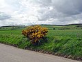
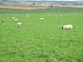
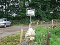
English: Stuartfield is a small inland village in the Buchan area of Aberdeenshire, Scotland, situated south of Old Deer. Formerly known as Crichie, a name still in use among locals.
Sous-catégories
Cette catégorie comprend seulement la sous-catégorie ci-dessous.
W
Média dans la catégorie « Stuartfield »
Cette catégorie comprend 38 fichiers, dont les 38 ci-dessous.
-
 Bull's enclosure at Shannas Farm - geograph.org.uk - 432754.jpg 640 × 480 ; 107 kio
-
 Ardallie Bog - geograph.org.uk - 465276.jpg 640 × 480 ; 87 kio
-
 Brae of Biffie - geograph.org.uk - 443125.jpg 589 × 442 ; 58 kio
-
 Bridgestone - geograph.org.uk - 441847.jpg 640 × 480 ; 99 kio
-
 Caravan Sales Yard at Lammerbogs - geograph.org.uk - 465277.jpg 640 × 480 ; 77 kio
-
 Cattle grid at Knock - geograph.org.uk - 473200.jpg 640 × 480 ; 93 kio
-
 Crichie Inn, Stuartfield. - geograph.org.uk - 164109.jpg 640 × 437 ; 90 kio
-
 Dens of Crichie - geograph.org.uk - 433029.jpg 640 × 480 ; 141 kio
-
 Firebreak in the Forest - geograph.org.uk - 464199.jpg 640 × 480 ; 66 kio
-
 Free-range Poultry Enclosure at West Burnend - geograph.org.uk - 470231.jpg 640 × 480 ; 108 kio
-
 From the B9030 - geograph.org.uk - 433022.jpg 640 × 480 ; 87 kio
-
 Gas Pipeline Facility at Coynach - geograph.org.uk - 470239.jpg 640 × 480 ; 85 kio
-
 Gas Pipeline Facility at Coynach - geograph.org.uk - 470241.jpg 640 × 480 ; 136 kio
-
 Kinknockie FArm - geograph.org.uk - 465279.jpg 640 × 480 ; 52 kio
-
 Kinnadie Farm - geograph.org.uk - 394110.jpg 640 × 480 ; 72 kio
-
 Lush Grazing at Bridgestone Farm - geograph.org.uk - 539794.jpg 640 × 480 ; 65 kio
-
 Marnabogs Farm - geograph.org.uk - 499432.jpg 640 × 480 ; 62 kio
-
 Milton of Clola - geograph.org.uk - 441849.jpg 640 × 480 ; 65 kio
-
 Mountpleasant Farm - geograph.org.uk - 465278.jpg 640 × 480 ; 66 kio
-
 North Craighead - geograph.org.uk - 464189.jpg 640 × 480 ; 75 kio
-
 North Howe Farm - geograph.org.uk - 432760.jpg 640 × 480 ; 55 kio
-
 Power line going past North Auchtylair - geograph.org.uk - 470237.jpg 640 × 480 ; 53 kio
-
 Shannas Cottages, Colpy - geograph.org.uk - 540417.jpg 640 × 480 ; 82 kio
-
 Sheep grazing on Kinknockie Hill - geograph.org.uk - 540428.jpg 640 × 480 ; 85 kio
-
 Signpost a West Crichie - geograph.org.uk - 470223.jpg 640 × 480 ; 141 kio
-
 Skelmuir Hill Trig Point - geograph.org.uk - 465270.jpg 640 × 480 ; 61 kio
-
 Track to Dens of Crichie - geograph.org.uk - 433024.jpg 640 × 480 ; 126 kio
-
 Tree Plantation at Mosstown of Dudwick - geograph.org.uk - 464194.jpg 640 × 480 ; 77 kio
-
 View from Shannas Farm - geograph.org.uk - 432756.jpg 640 × 480 ; 51 kio
-
 View from Skelmuir Trig - geograph.org.uk - 465272.jpg 640 × 480 ; 54 kio
-
 View towards East Backhill - geograph.org.uk - 464182.jpg 640 × 480 ; 68 kio
-
 View towards Parkhouse Hill - geograph.org.uk - 443129.jpg 589 × 442 ; 67 kio
-
 View towards Wind Hill - geograph.org.uk - 443131.jpg 589 × 442 ; 102 kio
-
 View towards Woodside Croft - geograph.org.uk - 390545.jpg 640 × 480 ; 73 kio
-
 West Bruntbrae Farm - geograph.org.uk - 460129.jpg 640 × 480 ; 84 kio
-
 West Crichie Farmhouse - geograph.org.uk - 470218.jpg 640 × 480 ; 77 kio
-
 Windfold Farm - geograph.org.uk - 465275.jpg 640 × 480 ; 67 kio
-
 Woodside Croft - geograph.org.uk - 390563.jpg 640 × 480 ; 98 kio


