Category:Stuttgart-Süd
Vai alla navigazione
Vai alla ricerca

human settlement in Germany  | |||||
| Carica un file multimediale | |||||
| Istanza di | |||||
|---|---|---|---|---|---|
| Luogo | Stoccarda, Distretto governativo di Stoccarda, Baden-Württemberg, Germania | ||||
| sito web ufficiale | |||||
 | |||||
Stuttgart-Süd, a district (de:Stadtbezirk) in Stuttgart
Sottocategorie
Questa categoria contiene le 24 sottocategorie indicate di seguito, su un totale di 24.
.
F
- Fangelsbachfriedhof (1 P, 70 F)
G
H
K
- Karls-Gymnasium Stuttgart (7 F)
M
P
- Paulinenbrunnen (Stuttgart) (5 F)
S
- Standseilbahn Stuttgart (37 F)
- Stolpersteine in Stuttgart-Süd (50 F)
T
- Theater Rampe (Stuttgart) (3 F)
W
File nella categoria "Stuttgart-Süd"
Questa categoria contiene 44 file, indicati di seguito, su un totale di 44.
-
 20180429 Stuttgart - Haigstaffel.jpg 3 680 × 5 293; 11,71 MB
-
 20190818 Stuttgart-Süd - Lehen.jpg 6 014 × 4 010; 15,85 MB
-
 Ausblick Richtung Stuttgart Kaltental vom Teehaus - panoramio.jpg 4 562 × 3 394; 5,71 MB
-
 Blick nach Stuttgart - panoramio (1).jpg 3 264 × 2 448; 4,04 MB
-
 Blick über Heslach zum Fernsehturm Stuttgart - panoramio.jpg 4 510 × 3 322; 4,59 MB
-
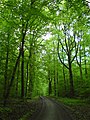
 Deep In The Woods (107392991).jpeg 2 048 × 1 365; 1,25 MB
-
 Heslach und Karlshöhe.jpg 2 496 × 1 664; 2,51 MB
-
 Immenhoferschule Stuttgart.JPG 2 496 × 1 664; 3,77 MB
-
 Karlsvorstadt und Haltepunkt Heslach 1893.jpg 1 000 × 698; 378 KB
-
 Klingelschild.jpg 1 632 × 1 200; 238 KB
-
 Landappbw 233520 1824 Schillereiche Stuttgart-Süd.jpg 720 × 1 280; 237 KB
-
 Landappbw 342296 1817 Blick auf die Neue Weinsteige Stuttgart-Süd.jpg 1 280 × 720; 169 KB
-
 Landappbw 342299 1821 Wohnhaus in der Liststraße Stuttgart-Süd.jpg 720 × 1 280; 134 KB
-
 Landappbw 526718 1817 Blick auf die Neue Weinsteige Stuttgart-Süd.jpg 1 920 × 1 440; 690 KB
-
 Landappbw 526724 1823 Treppe Staffel als Teil der Römerstraße Stuttgart-Süd.jpg 1 440 × 1 920; 1,29 MB
-
 Landappbw 526739 1817 Römerstraße Stuttgart-Süd.jpg 1 440 × 1 920; 749 KB
-
 Landappbw 526746 1817 Blick von der Karlshöhe nach Süden Stuttgart-Süd.jpg 1 440 × 1 920; 926 KB
-
 Landappbw 533495 4871 Blick vom Weißenburg-Park über Stuttgart-Süd Stuttgart-Mitte.jpg 1 920 × 1 440; 1,15 MB
-
 Landappbw 933715 1817 Bopserbrünnele - -anlage Stuttgart.jpg 1 799 × 935; 354 KB
-
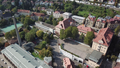 Luftbild Campus SGS.png 3 840 × 2 160; 10,96 MB
-
 Karte s sued.png 115 × 109; 4 KB
-
 LkStuttgart Sued.svg 850 × 780; 42 KB
-
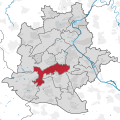 Stuttgart Bezirk Süd.svg 760 × 760; 1,71 MB
-
 MarienhospHeslach08.JPG 1 818 × 1 228; 1 003 KB
-
 MarienhospVInnen.JPG 1 818 × 1 228; 967 KB
-
 Marienkirche Stuttgart.jpg 2 471 × 1 613; 3,31 MB
-
 Markuskirche Stuttgart.jpg 1 612 × 2 470; 3,49 MB
-
 Mauer im Wernhaldenpark - geo.hlipp.de - 7648.jpg 640 × 480; 91 KB
-
 Park Liegewiese.JPG 2 568 × 1 536; 3,25 MB
-
 Photo Flug Heslach Hasenberg.JPG 1 001 × 704; 814 KB
-
 SakristeiMöh.jpg 1 764 × 1 323; 516 KB
-
 Statistisches Landsamt Baden-Württemberg.jpg 3 146 × 2 214; 5,32 MB
-
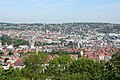 Stuttgart Süd und Mitte.JPG 2 496 × 1 664; 2,61 MB
-
 Stuttgart Weinberg Hasenberg.jpg 1 588 × 1 248; 1,01 MB
-
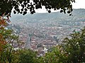
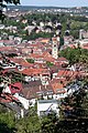
 Stuttgart-Süd.jpg 2 445 × 1 646; 3,8 MB
-
 Stuttgart-Süd2.JPG 1 664 × 2 496; 2,72 MB
-
 Stuttgart-Süd3.JPG 2 496 × 1 664; 2,79 MB
-
 Stuttgart-Süd4.JPG 1 664 × 2 496; 3,3 MB
-
 Stuttgart-Süd5.JPG 2 496 × 1 664; 3 MB
-
 Trinkwasser-"Brunnen" am Bopser - panoramio.jpg 4 596 × 2 860; 7,03 MB
-
 Waldweg bei Vaihingen - geo.hlipp.de - 10356.jpg 480 × 640; 135 KB
-
 Wasserhochbehaelter Hasenberg.jpg 1 024 × 684; 194 KB
-
 Weitmanns Waldhaus.jpg 5 312 × 2 988; 6,8 MB
-
 Wielandshöhe.jpg 1 310 × 903; 195 KB


.jpg)

.jpeg)


