Category:Suffield, Norfolk
Aller à la navigation
Aller à la recherche
English: Suffield is a village and a civil parish in the English county of Norfolk. The village is north of London. The village lies east of the A140 between Cromer and Norwich. The nearest railway station is at Gunton for the Bittern Line which runs between Sheringham, Cromer and Norwich. The nearest airport is Norwich International Airport.
localité britannique du comté anglais de Norfolk  | |||||
| Téléverser des médias | |||||
| Nature de l’élément | |||||
|---|---|---|---|---|---|
| Lieu | North Norfolk, Norfolk, Angleterre de l'Est, Angleterre | ||||
| Superficie |
| ||||
 | |||||
Sous-catégories
Cette catégorie comprend 10 sous-catégories, dont les 10 ci-dessous.
Média dans la catégorie « Suffield, Norfolk »
Cette catégorie comprend 28 fichiers, dont les 28 ci-dessous.
-
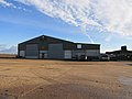
 -2018-12-08 Hall farm, Suffield (1).JPG 5 152 × 3 864 ; 6,7 Mio
-
 -2018-12-08 Hall farm, Suffield (2).JPG 5 152 × 3 864 ; 5,28 Mio
-
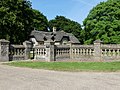
 -2018-12-08 South Entance and gate lodge to Gunton Hall and Park, Suffield (1).JPG 5 152 × 3 864 ; 6,13 Mio
-
 -2018-12-08 South Entance and gate lodge to Gunton Hall and Park, Suffield (2).JPG 5 152 × 3 864 ; 8,7 Mio
-
 -2021-06-15 South entrance next to Suffield Lodge, Suffield, Norfolk.jpg 1 024 × 768 ; 304 kio
-
 -2021-06-15 Suffield Lodge, Suffield, Norfolk.jpg 1 024 × 768 ; 315 kio
-
 Brick Kiln Lane by Boundary Farm - geograph.org.uk - 6120550.jpg 3 456 × 2 592 ; 1,66 Mio
-
 Brick Kiln Lane. Felmingham - geograph.org.uk - 6120547.jpg 3 339 × 2 508 ; 3,23 Mio
-
 By Brick Yard Farm, Brick Kiln Lane, Felmingham - geograph.org.uk - 6120548.jpg 3 456 × 2 592 ; 2,18 Mio
-
 Cottage at the junction with Rectory Road - geograph.org.uk - 6120537.jpg 3 456 × 2 592 ; 3,94 Mio
-
 Down the lane to Boundary Farm, - geograph.org.uk - 6120549.jpg 3 456 × 2 592 ; 3,88 Mio
-
 Drain traversing sheep pasture - geograph.org.uk - 1166521.jpg 640 × 480 ; 122 kio
-
 Gate in corner of pasture - geograph.org.uk - 1166544.jpg 640 × 480 ; 186 kio
-
 Gated entrance at Gunton - geograph.org.uk - 6120531.jpg 3 456 × 2 592 ; 3,98 Mio
-
 Museum of Straw Work - geograph.org.uk - 515302.jpg 480 × 640 ; 90 kio
-
 Preparing to land - geograph.org.uk - 1166529.jpg 640 × 548 ; 113 kio
-
 Rectory Road, Felmingham - geograph.org.uk - 6120541.jpg 3 456 × 2 592 ; 2,45 Mio
-
 Road junction, Suffield - geograph.org.uk - 3681287.jpg 640 × 480 ; 144 kio
-
 Rylock fence surrounding sheep pasture - geograph.org.uk - 1166546.jpg 480 × 640 ; 181 kio
-
 South Lodge - geograph.org.uk - 1984576.jpg 640 × 480 ; 67 kio
-
 Suffield Lodge and gate - geograph.org.uk - 3681268.jpg 640 × 480 ; 142 kio
-
 Suffield village sign - geograph.org.uk - 4602704.jpg 480 × 640 ; 266 kio
-
 Suffield village street - geograph.org.uk - 509978.jpg 640 × 480 ; 84 kio
-
 Suffield War Memorial - geograph.org.uk - 4604724.jpg 3 456 × 2 592 ; 3,86 Mio
-
 Track through woodland, Gunton - geograph.org.uk - 6120533.jpg 3 456 × 2 592 ; 3,99 Mio
-
 Vernon Wood - geograph.org.uk - 1166552.jpg 640 × 480 ; 193 kio
-
 View across farmland - geograph.org.uk - 529027.jpg 640 × 480 ; 76 kio
-
 You are being watched - geograph.org.uk - 1166503.jpg 640 × 527 ; 124 kio
.JPG)
.JPG)
.JPG)
.JPG)


