Category:Sullom Voe
Zur Navigation springen
Zur Suche springen
| Objektposition | | Karte mit allen Koordinaten: OpenStreetMap |
|---|
inlet between North Mainland and Northmavine on Shetland in Scotland  | |||||
| Medium hochladen | |||||
| Ist ein(e) | |||||
|---|---|---|---|---|---|
| Ort | Shetlandinseln, Schottland | ||||
 | |||||
Unterkategorien
Es werden 3 von insgesamt 3 Unterkategorien in dieser Kategorie angezeigt:
In Klammern die Anzahl der enthaltenen Kategorien (K), Seiten (S), Dateien (D)
Medien in der Kategorie „Sullom Voe“
Folgende 18 Dateien sind in dieser Kategorie, von 18 insgesamt.
-
 Admiralty Chart No 611 Sullom Voe, Published 1924.jpg 6.624 × 10.129; 30,09 MB
-

-
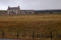
 Garth - geograph.org.uk - 181227.jpg 640 × 226; 30 KB
-
 Garth House, Sullom Voe - geograph.org.uk - 1065304.jpg 640 × 426; 79 KB
-
 Garths Voe, Sullom Voe - geograph.org.uk - 1463950.jpg 640 × 426; 62 KB
-
 Head of Sullom Voe - geograph.org.uk - 3481200.jpg 640 × 480; 70 KB
-
 Head of Sullom Voe - geograph.org.uk - 3481203.jpg 640 × 480; 62 KB
-
 Herons on the point at Sellaness - geograph.org.uk - 1739434.jpg 1.140 × 760; 311 KB
-
 Hill of Garth at Sullom Voe - geograph.org.uk - 2466866.jpg 800 × 534; 118 KB
-
 IWM-MH6666-Short-S23.jpg 702 × 428; 158 KB
-

-
 Mavis Grind, Shetland - geograph.org.uk - 152347.jpg 640 × 480; 50 KB
-
 Navigation aid in Sullom Voe - geograph.org.uk - 5167467.jpg 1.024 × 681; 158 KB
-
 Navigation aid on Ungam in Sullom Voe - geograph.org.uk - 5167493.jpg 1.024 × 681; 34 KB
-
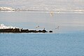
 Pilot boats at Sella Ness - geograph.org.uk - 1065309.jpg 640 × 426; 67 KB
-
 Shoreline of Sullom Voe at Scatsta - geograph.org.uk - 5167448.jpg 1.024 × 681; 184 KB
-
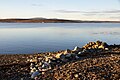
 The head of Sullom Voe - geograph.org.uk - 4997124.jpg 2.592 × 1.944; 1,43 MB
-


