Category:Sunk Island
Aller à la navigation
Aller à la recherche
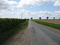
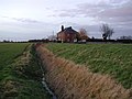
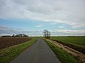
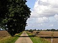
English: Sunk Island is a Crown Estate village and civil parish in the East Riding of Yorkshire, England. It lies 3.5 miles (5.6 km) south of Ottringham and 1 mile (1.6 km) to the north of the Humber Estuary.
village britannique  | |||||
| Téléverser des médias | |||||
| Nature de l’élément | |||||
|---|---|---|---|---|---|
| Lieu | East Riding of Yorkshire, Yorkshire de l'Est, Yorkshire-et-Humber, Angleterre | ||||
 | |||||
Sous-catégories
Cette catégorie comprend 4 sous-catégories, dont les 4 ci-dessous.
F
S
- Stone Creek Farm (4 F)
Média dans la catégorie « Sunk Island »
Cette catégorie comprend 537 fichiers, dont les 200 ci-dessous.
(page précédente) (page suivante)-
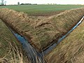
 A bridge over a drain - geograph.org.uk - 2217861.jpg 800 × 600 ; 301 kio
-
 A bridge over North Channel, Sunk Island Road - geograph.org.uk - 2052501.jpg 800 × 600 ; 348 kio
-
 A caterpillars nest - geograph.org.uk - 2218134.jpg 600 × 800 ; 224 kio
-
 A drain enters Winestead Drain, Sunk Island - geograph.org.uk - 2235633.jpg 800 × 600 ; 216 kio
-
 A farm - geograph.org.uk - 13052.jpg 640 × 480 ; 110 kio
-
 A farm - geograph.org.uk - 13128.jpg 640 × 480 ; 81 kio
-
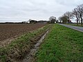
 A farm track off Old Hall Road, Sunk Island - geograph.org.uk - 2052621.jpg 800 × 600 ; 237 kio
-
 A farm track off Village Road, Sunk Island - geograph.org.uk - 2052653.jpg 800 × 600 ; 249 kio
-
 A house on Channel Road, Sunk Island - geograph.org.uk - 2110794.jpg 800 × 600 ; 188 kio
-
 A junction of drains on Sunk Island - geograph.org.uk - 2218475.jpg 800 × 600 ; 308 kio
-
 A pillbox hidden by the trees - geograph.org.uk - 2218507.jpg 800 × 600 ; 321 kio
-
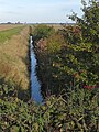
 A Sunk Island Drain, South Holderness - geograph.org.uk - 2217825.jpg 800 × 600 ; 265 kio
-
 A sunlight Stone Creek at low tide - geograph.org.uk - 4141069.jpg 4 608 × 3 456 ; 4,75 Mio
-
 Abandoned bridge near Stone Creek - geograph.org.uk - 5870523.jpg 1 024 × 768 ; 353 kio
-
 Approaching Stone Creek - geograph.org.uk - 4306757.jpg 1 024 × 768 ; 203 kio
-
 Area to become salt flats - geograph.org.uk - 2506675.jpg 640 × 480 ; 53 kio
-
 Assorted remains by the Humber - geograph.org.uk - 5871526.jpg 1 024 × 768 ; 277 kio
-
 Bale stack off Newlands Lane - geograph.org.uk - 1472820.jpg 640 × 480 ; 48 kio
-
 Bales along Newlands Road (geograph 5565417).jpg 800 × 476 ; 100 kio
-
 Bend on the Humber Bank - geograph.org.uk - 5870202.jpg 1 024 × 768 ; 227 kio
-
 Bend on West Bank - geograph.org.uk - 5870547.jpg 1 024 × 768 ; 238 kio
-
 Bird Box ^1302 on the banks of the River Humber - geograph.org.uk - 2218064.jpg 800 × 600 ; 213 kio
-

-
 Bleak House Farm Cottages, Sunk Island - geograph.org.uk - 326579.jpg 640 × 479 ; 98 kio
-
 Bleak House Farm entrance, Sunk Island - geograph.org.uk - 4709950.jpg 640 × 480 ; 363 kio
-
 Boats moored at Stone Creek - geograph.org.uk - 5536074.jpg 800 × 490 ; 101 kio
-
 Boats moored at Stone Creek - geograph.org.uk - 5536098.jpg 800 × 450 ; 72 kio
-
 Brick Road - geograph.org.uk - 5740756.jpg 640 × 480 ; 58 kio
-
 Brick Road Sunk Island - geograph.org.uk - 2063299.jpg 2 560 × 1 920 ; 2,12 Mio
-
 Brick Road towards Patrington - geograph.org.uk - 2407862.jpg 1 600 × 1 200 ; 490 kio
-
 Brick Road, Sunk Island - geograph.org.uk - 326578.jpg 640 × 480 ; 84 kio
-
 Brick Road, Sunk Island - geograph.org.uk - 5784263.jpg 2 592 × 1 944 ; 1,19 Mio
-
 Brick Road, Sunk Island - geograph.org.uk - 5784269.jpg 2 592 × 1 944 ; 1,37 Mio
-
 Brick Road, Sunk Island - geograph.org.uk - 6379129.jpg 640 × 480 ; 54 kio
-
 Bridge at New Clough (geograph 5562469).jpg 800 × 600 ; 148 kio
-
 Bridge over Winestead Drain - geograph.org.uk - 1472798.jpg 640 × 480 ; 50 kio
-
 Bridleway beside drain, Sunk Island - geograph.org.uk - 6379275.jpg 800 × 600 ; 126 kio
-
 Bridleway towards Channel Farm - geograph.org.uk - 2407824.jpg 1 600 × 1 200 ; 567 kio
-
 Buildings at East Bank Farm - geograph.org.uk - 5300904.jpg 1 024 × 768 ; 136 kio
-
 Bush in a drain - geograph.org.uk - 5300928.jpg 1 024 × 768 ; 145 kio
-
 Channel Farm and Stray Road - geograph.org.uk - 5609966.jpg 1 024 × 768 ; 310 kio
-
 Channel Farm Cottages - geograph.org.uk - 323860.jpg 478 × 640 ; 102 kio
-
 Channel Farm, Sunk Island - geograph.org.uk - 2249725.jpg 2 412 × 1 801 ; 1,83 Mio
-
 Channel Farm, Sunk Island - geograph.org.uk - 323859.jpg 640 × 478 ; 87 kio
-
 Channel Farm, Sunk Island - geograph.org.uk - 6379290.jpg 640 × 391 ; 48 kio
-
 Channel Farmhouse, Sunk Island - geograph.org.uk - 4710326.jpg 640 × 462 ; 538 kio
-
 Channel Road - geograph.org.uk - 5740750.jpg 640 × 480 ; 79 kio
-
 Channel Road, Sunk Island - geograph.org.uk - 2110790.jpg 800 × 600 ; 185 kio
-
 Channel Road, Sunk Island - geograph.org.uk - 2269682.jpg 800 × 600 ; 156 kio
-
 Channel Road, Sunk Island - geograph.org.uk - 323865.jpg 640 × 474 ; 83 kio
-
 Channel Road, Sunk Island - geograph.org.uk - 6379304.jpg 640 × 480 ; 46 kio
-
 Chemical works near Immingham - geograph.org.uk - 5406153.jpg 800 × 573 ; 88 kio
-
 Church Farm - geograph.org.uk - 2407840.jpg 1 600 × 1 200 ; 487 kio
-
 Church Farm Cottages, Sunk Island - geograph.org.uk - 6379137.jpg 640 × 480 ; 60 kio
-
 Church Farm, Sunk Island - geograph.org.uk - 4710362.jpg 640 × 480 ; 552 kio
-
 Church Farm, Sunk Island - geograph.org.uk - 6379135.jpg 800 × 600 ; 101 kio
-
 Church Farm, Sunk Island - geograph.org.uk - 6379139.jpg 800 × 600 ; 88 kio
-
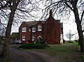
 Church Farm, Sunk Island.jpg 640 × 479 ; 125 kio
-
 Cottage on Channel Road, Sunk Island - geograph.org.uk - 1472859.jpg 640 × 478 ; 43 kio
-
 Cottages on Channel Road - geograph.org.uk - 2407819.jpg 1 600 × 1 200 ; 437 kio
-
 Cottages on Newlands Road - geograph.org.uk - 2407800.jpg 1 600 × 1 200 ; 461 kio
-
 Crop on the Turn - geograph.org.uk - 5845295.jpg 4 608 × 3 456 ; 7,52 Mio
-
 Cross Drain off Stray Road - geograph.org.uk - 1472835.jpg 640 × 480 ; 50 kio
-
 Cross Drain, Sunk Island - geograph.org.uk - 323854.jpg 477 × 640 ; 102 kio
-
 Cross Roads Sunk Island - geograph.org.uk - 2061601.jpg 2 560 × 1 920 ; 2,16 Mio
-
 Crown Estate Cottages, Sunk Island - geograph.org.uk - 323861.jpg 640 × 480 ; 59 kio
-
 Crown Estate Cottages, Sunk Island - geograph.org.uk - 323864.jpg 445 × 640 ; 98 kio
-
 Crown Estate Monument, Sunk Island - geograph.org.uk - 276041.jpg 477 × 640 ; 120 kio
-
 Crown Farm - geograph.org.uk - 5740774.jpg 640 × 480 ; 75 kio
-
 Crown Farm at Sunk Island - geograph.org.uk - 5549135.jpg 800 × 513 ; 110 kio
-
 Crown Farm, Sunk Island - geograph.org.uk - 312185.jpg 640 × 478 ; 86 kio
-
 Crown Farm, Sunk Island - geograph.org.uk - 4710359.jpg 640 × 480 ; 428 kio
-
 Crown Farm, Sunk Island - geograph.org.uk - 5862651.jpg 5 376 × 3 024 ; 4,29 Mio
-
 Crown Farm, Sunk Island - geograph.org.uk - 5862654.jpg 3 429 × 2 304 ; 1,52 Mio
-
 Deer in a harvested field - geograph.org.uk - 5870196.jpg 1 024 × 768 ; 141 kio
-
 Delve Bridge on the Sunk Island Road - geograph.org.uk - 2061630.jpg 2 560 × 1 920 ; 1,89 Mio
-
 Disused buildings behind Coastguard Cottages - geograph.org.uk - 297418.jpg 640 × 428 ; 87 kio
-
 Disused estate house near Old Hall Farm, Sunk Island - geograph.org.uk - 2249697.jpg 2 499 × 1 867 ; 1,56 Mio
-
 Ditches meeting on Sunk Island farmland - geograph.org.uk - 2249691.jpg 2 608 × 1 952 ; 1,74 Mio
-
 Does the Queen own Shrubbery Farm^ - geograph.org.uk - 2052524.jpg 800 × 600 ; 286 kio
-
 Drain alongside Patrington Road - geograph.org.uk - 5609970.jpg 1 024 × 768 ; 150 kio
-
 Drain behind the flood defences - geograph.org.uk - 5546598.jpg 800 × 773 ; 149 kio
-
 Drain beside Brick Road, Sunk Island - geograph.org.uk - 6379116.jpg 800 × 600 ; 124 kio
-
 Drain beside Brick Road, Sunk Island - geograph.org.uk - 6379130.jpg 800 × 600 ; 127 kio
-
 Drain beside East Bank Road, Sunk Island - geograph.org.uk - 6379278.jpg 800 × 600 ; 106 kio
-
 Drain beside East Bank Road, Sunk Island - geograph.org.uk - 6379282.jpg 640 × 480 ; 73 kio
-
 Drain beside Patrington Road, Sunk Island - geograph.org.uk - 6379110.jpg 800 × 600 ; 92 kio
-
 Drain beside Sunk Island Road, Sunk Island - geograph.org.uk - 6379136.jpg 800 × 600 ; 131 kio
-
 Drain beside track to Patrington Farm - geograph.org.uk - 6379119.jpg 800 × 600 ; 120 kio
-
 Drain near Corner House - geograph.org.uk - 5740765.jpg 640 × 480 ; 111 kio
-
 Drain near Middle Farm, Sunk Island - geograph.org.uk - 4710354.jpg 480 × 640 ; 523 kio
-
 Drain near Middle Farm, Sunk Island - geograph.org.uk - 6379270.jpg 800 × 600 ; 92 kio
-
 Drain off Stray Road - geograph.org.uk - 1472845.jpg 640 × 480 ; 42 kio
-
 Drain off Stray Road - geograph.org.uk - 5740740.jpg 640 × 480 ; 78 kio
-
 Drain on Sunk Island - geograph.org.uk - 5300895.jpg 1 024 × 768 ; 186 kio
-
 Drain on Sunk Island - geograph.org.uk - 5870180.jpg 1 024 × 768 ; 180 kio
-
 Drainage ditch on Sunk Island - geograph.org.uk - 5784931.jpg 2 592 × 1 944 ; 1,68 Mio
-
 Drive to Patrington Farm, Sunk Island - geograph.org.uk - 4709944.jpg 480 × 640 ; 477 kio
-
 Drive to Shrubbery Farm, Sunk Island - geograph.org.uk - 4710364.jpg 640 × 480 ; 547 kio
-
 Dry drainage ditch beside Brick Road - geograph.org.uk - 2407851.jpg 1 600 × 1 200 ; 609 kio
-
 East along Brick Lane, Sunk Island - geograph.org.uk - 2110780.jpg 800 × 600 ; 203 kio
-
 East Bank Farm - geograph.org.uk - 2407820.jpg 1 600 × 1 200 ; 458 kio
-
 East Bank Farm Cottages - geograph.org.uk - 1472863.jpg 640 × 480 ; 47 kio
-
 East Bank Farm cottages, Sunk Island - geograph.org.uk - 4710345.jpg 640 × 480 ; 489 kio
-
 East Bank Farm, Sunk Island - geograph.org.uk - 2269663.jpg 800 × 600 ; 217 kio
-
 East Bank Farm, Sunk Island - geograph.org.uk - 276035.jpg 640 × 421 ; 105 kio
-
 East Bank Farm, Sunk Island - geograph.org.uk - 323866.jpg 640 × 477 ; 144 kio
-
 East Bank Farm, Sunk Island - geograph.org.uk - 6379285.jpg 800 × 600 ; 106 kio
-
 East Bank Farmhouse - geograph.org.uk - 2249721.jpg 2 459 × 1 838 ; 1,6 Mio
-
 East Bank Road and Middle Farm - geograph.org.uk - 5300886.jpg 1 024 × 768 ; 145 kio
-
 East Bank Road and parallel drain - geograph.org.uk - 5312940.jpg 1 024 × 768 ; 181 kio
-
 East Bank Road and parallel drain - geograph.org.uk - 5312943.jpg 1 024 × 768 ; 146 kio
-
 East Bank Road and Wood Farm Cottages - geograph.org.uk - 5312949.jpg 1 024 × 768 ; 170 kio
-
 East Bank Road at Middle Farm - geograph.org.uk - 5406168.jpg 800 × 654 ; 164 kio
-
 East Bank Road at Sunk Island - geograph.org.uk - 5547880.jpg 800 × 585 ; 102 kio
-
 East Bank Road at Sunk Island - geograph.org.uk - 5549133.jpg 800 × 600 ; 120 kio
-
 East Bank Road, Sunk Island - geograph.org.uk - 2052563.jpg 800 × 600 ; 321 kio
-
 East Bank Road, Sunk Island - geograph.org.uk - 323868.jpg 640 × 480 ; 81 kio
-
 East Bank Road, Sunk Island - geograph.org.uk - 326572.jpg 640 × 474 ; 140 kio
-
 East Bank Road, Sunk Island - geograph.org.uk - 4709444.jpg 640 × 480 ; 445 kio
-
 East Bank Road, Sunk Island - geograph.org.uk - 4709838.jpg 640 × 480 ; 361 kio
-
 East Bank Road, Sunk Island - geograph.org.uk - 5861164.jpg 5 209 × 2 929 ; 3,49 Mio
-
 East Bank Road, Sunk Island - geograph.org.uk - 6379274.jpg 800 × 600 ; 85 kio
-
 East Bank Road, Sunk Island - geograph.org.uk - 6379277.jpg 800 × 600 ; 87 kio
-
 East Bank Road, Sunk Island - geograph.org.uk - 6379281.jpg 640 × 480 ; 58 kio
-
-
 East of Coastguard Cottages - geograph.org.uk - 312201.jpg 464 × 640 ; 107 kio
-
 East of Old Island - geograph.org.uk - 312232.jpg 640 × 479 ; 94 kio
-
 East of Sunk Island - geograph.org.uk - 323858.jpg 640 × 386 ; 67 kio
-

-

-
 Entering Sunk Island - geograph.org.uk - 2052510.jpg 800 × 600 ; 264 kio
-
 Entering Sunk Island - geograph.org.uk - 6379108.jpg 800 × 600 ; 77 kio
-
 Entrance to Outstray Farm (geograph 5562474).jpg 800 × 478 ; 175 kio
-
 Entrance to Winestead Farm - geograph.org.uk - 5740759.jpg 640 × 480 ; 56 kio
-
 Farm buildings, Crown Farm - geograph.org.uk - 2418623.jpg 1 600 × 1 200 ; 368 kio
-
 Farm buildings, Patrington Road - geograph.org.uk - 2407870.jpg 1 600 × 1 200 ; 331 kio
-
 Farm cottages on East Bank Road, Sunk Island - geograph.org.uk - 6379283.jpg 800 × 579 ; 122 kio
-
 Farm Road - geograph.org.uk - 57373.jpg 640 × 480 ; 127 kio
-
 Farm Track - geograph.org.uk - 54000.jpg 640 × 480 ; 115 kio
-
 Farm Track - geograph.org.uk - 54018.jpg 640 × 480 ; 81 kio
-
 Farm Track - geograph.org.uk - 54021.jpg 640 × 480 ; 83 kio
-
 Farm track and drain, Sunk Island - geograph.org.uk - 6379109.jpg 800 × 600 ; 81 kio
-
 Farm track and drainage ditch off Patrington Road - geograph.org.uk - 2407872.jpg 1 600 × 1 200 ; 534 kio
-
 Farm track leading to Stone Creek Farm - geograph.org.uk - 5536145.jpg 800 × 518 ; 116 kio
-
 Farm track off Newlands Road - geograph.org.uk - 2407808.jpg 1 600 × 1 200 ; 505 kio
-
 Farm Track off Stone Creek - geograph.org.uk - 2418621.jpg 1 600 × 1 200 ; 411 kio
-
 Farm track to East Bank Farm - geograph.org.uk - 5547849.jpg 800 × 579 ; 116 kio
-
 Farm track to Humberdale Farm - geograph.org.uk - 5870489.jpg 1 024 × 768 ; 179 kio
-
 Farm track, Sunk Island - geograph.org.uk - 5300758.jpg 1 024 × 768 ; 173 kio
-
 Farmland along the Humber estuary - geograph.org.uk - 5547840.jpg 800 × 513 ; 141 kio
-
 Farmland near Channel Farm - geograph.org.uk - 2407815.jpg 1 600 × 1 200 ; 574 kio
-
 Farmland near East Bank Farm - geograph.org.uk - 2407822.jpg 1 600 × 1 200 ; 261 kio
-
 Farmland near Patrington Farm - geograph.org.uk - 2407867.jpg 640 × 480 ; 74 kio
-
 Farmland near Stone Creek farm - geograph.org.uk - 2418612.jpg 1 600 × 1 200 ; 389 kio
-
 Farmland near West Farm - geograph.org.uk - 2418630.jpg 1 600 × 1 200 ; 392 kio
-
 Farmland near Winestead Farm - geograph.org.uk - 2407856.jpg 1 600 × 1 200 ; 389 kio
-
 Farmland off Old Hall Road - geograph.org.uk - 2407835.jpg 1 600 × 1 200 ; 372 kio
-
 Farmland off Ottringham Road - geograph.org.uk - 2407847.jpg 1 600 × 1 200 ; 756 kio
-
 Farmland off Stray Road - geograph.org.uk - 2407811.jpg 1 600 × 1 200 ; 393 kio
-
 Farmland on Sunk Island - geograph.org.uk - 5784298.jpg 2 592 × 1 944 ; 1,45 Mio
-
 Fields on Sunk Island - geograph.org.uk - 1472881.jpg 640 × 480 ; 31 kio
-
 Fisherman's Channel - geograph.org.uk - 5740745.jpg 640 × 480 ; 79 kio
-
 Fisherman's Channel at Sunk Island - geograph.org.uk - 5565477.jpg 800 × 571 ; 148 kio
-
 Fisherman's Channel, Sunk Island - geograph.org.uk - 2249728.jpg 2 608 × 1 952 ; 1,42 Mio
-
 Fisherman's Channel, Sunk Island - geograph.org.uk - 4709959.jpg 640 × 480 ; 535 kio
-
 Fisherman's Channel, Sunk Island - geograph.org.uk - 6379293.jpg 800 × 600 ; 102 kio
-
 Flat farmland at Sunk Island - geograph.org.uk - 5565428.jpg 800 × 587 ; 153 kio
-
 Flat farmland at Sunk Island - geograph.org.uk - 5565490.jpg 800 × 530 ; 126 kio
-
 Flat farmland, Sunk Island - geograph.org.uk - 6379113.jpg 800 × 600 ; 83 kio
-
 Flat field near Patrington Farm, Sunk Island - geograph.org.uk - 6379120.jpg 800 × 600 ; 113 kio
-
 Flat field near Winestead Farm, Sunk Island - geograph.org.uk - 6379123.jpg 800 × 600 ; 89 kio
-
 Flat field off East Bank Road, Sunk Island - geograph.org.uk - 6379276.jpg 800 × 600 ; 146 kio
-
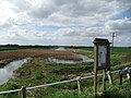
 Flood defences along the Humber estuary - geograph.org.uk - 5546578.jpg 800 × 600 ; 120 kio
-
 Flood defences along the Humber estuary - geograph.org.uk - 5546584.jpg 800 × 600 ; 150 kio
-

-
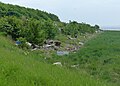
 Flotsam and jetsam on the banks of the Humber - geograph.org.uk - 2218170.jpg 800 × 600 ; 282 kio
-
 Flotsam on the flood defences at Sunk Island - geograph.org.uk - 5536211.jpg 800 × 572 ; 121 kio
-
 Footpath on the Humber Bank - geograph.org.uk - 5871477.jpg 1 024 × 768 ; 258 kio
-
 Gate and drain, Sunk Island - geograph.org.uk - 4710360.jpg 484 × 640 ; 409 kio
-
 Gate behind the former church, Sunk Island - geograph.org.uk - 5304470.jpg 1 024 × 768 ; 211 kio
-
 Gate on the bank of the Humber - geograph.org.uk - 5547153.jpg 800 × 510 ; 109 kio
-
 Gate on the Humber Bank - geograph.org.uk - 5870171.jpg 1 024 × 768 ; 175 kio
-
 Gate on the Humber Bank - geograph.org.uk - 5871536.jpg 1 024 × 768 ; 171 kio
-
 Gate on the Humber flood defences - geograph.org.uk - 5546616.jpg 800 × 538 ; 100 kio
-
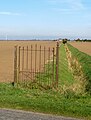
 Gate on the sea defences - geograph.org.uk - 5545265.jpg 800 × 557 ; 137 kio
-
 Gate to nowhere - geograph.org.uk - 5847959.jpg 1 024 × 768 ; 154 kio
-
 Gateway to West Farm - geograph.org.uk - 1472920.jpg 640 × 480 ; 54 kio
-

-
 Grain in, turning over the land - geograph.org.uk - 5861355.jpg 5 261 × 2 497 ; 3,05 Mio
-
 Grimsby Docks from the air - geograph.org.uk - 3845838.jpg 640 × 480 ; 100 kio
-
 Hafnia Seaways passing Grimsby - geograph.org.uk - 5547817.jpg 800 × 523 ; 94 kio
-
 Harvested field and Stone Creek Farm Cottages - geograph.org.uk - 5847967.jpg 1 024 × 768 ; 173 kio
-
 Harvested Sunk Island fields - geograph.org.uk - 5871464.jpg 1 024 × 774 ; 199 kio
-
 Hawkin's Point - geograph.org.uk - 276033.jpg 480 × 640 ; 130 kio
-
 Hawkin's Point - geograph.org.uk - 5740678.jpg 640 × 480 ; 62 kio
-
 Hawkin's Point on the River Humber - geograph.org.uk - 2218106.jpg 800 × 600 ; 213 kio
-
 Heading northwest along Winestead Drain - geograph.org.uk - 2217771.jpg 800 × 600 ; 218 kio
-
 Heading west along the River Humber - geograph.org.uk - 2217867.jpg 800 × 600 ; 235 kio
-
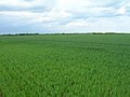
 Holderness flat agricultural land - geograph.org.uk - 38755.jpg 640 × 480 ; 141 kio


.jpg)


.jpg)


.jpg)


